Maryland Route 3

Last updated

MD Route 3.svg

Maryland Route 3

Robert Crain Highway
Maryland Route 3
Maryland Route 3 highlighted in red
Route information
Maintained by MDSHA
Length9.56 mi [1]  (15.39 km)
Existed1927–present
Major junctions
South endUS 50.svgUS 301.svg US 50  / US 301 in Bowie
Major intersections
North endI-97.svgMD Route 32.svg I-97  / MD 32 near Millersville
Location
Country United States
State Maryland
Counties Prince George's, Anne Arundel
Highway system
MD Route 2.svg MD 2 MD Route 4.svg MD 4

Maryland Route 3 (MD 3), part of the Robert Crain Highway, is the designation given to the former alignment of U.S. Route 301 (US 301) from Bowie, Maryland, United States, to Baltimore. It is named for Robert Crain of Baltimore. It is unique in Maryland in that it has a business route and a truck route which do not connect to their parent; however, the business route is also a part of the Robert Crain Highway. MD 3's current orientation is vestigial from the construction of Maryland's freeway system.

Contents

Route description

View south along MD 3 at MD 32 near Millersville 2020-06-22 12 09 17 View south along Maryland State Route 3 (Robert Crain Highway) at the exit for Maryland State Route 32 WEST (Odenton, Fort Meade) in Gambrills, Anne Arundel County, Maryland.jpg
View south along MD 3 at MD 32 near Millersville

MD 3 begins within the modified cloverleaf interchange of US 50 and unsigned I-595 (John Hanson Highway) and US 301 (Robert Crain Highway) in Bowie, Prince George's County. Within the interchange, US 301 heads south on Crain Highway and east along US 50; meanwhile, MD 3 heads north on Crain Highway, a four-lane divided highway. A short distance after beginning, the route comes to a partial cloverleaf interchange with Belair Drive, containing continuing connections from the US 50/US 301 interchange. Past here, the road runs north through wooded residential areas before the median widens and it bends to the north-northeast, continuing through forested areas with a few businesses. MD 3 continues northeast and the median narrows, with the road widening to eight lanes as it comes to an intersection with MD 450. At this point, MD 450 heads northeast for a concurrency with MD 3 along a six-lane divided highway, running through wooded areas and coming to a bridge over the Patuxent River. [1] [2]

View south along MD 3 near MD 175 in Millersville 2016-08-12 10 28 16 View south along Maryland State Route 3 (Crain Highway) at Maryland State Route 175 (Annapolis Road) in Odenton, Anne Arundel County, Maryland.jpg
View south along MD 3 near MD 175 in Millersville

Upon crossing the Patuxent River, the road enters Anne Arundel County and continues northeast, with MD 450 splitting from MD 3 by turning to the east. MD 3 continues north along Crain Highway into Crofton, passing between woodland to the west and residential subdivisions to the east. The road heads into a commercial area and comes to an intersection with the northern terminus of MD 424. At this point, the route turns to the northeast and the median widens to include businesses in the center. MD 3 heads into Gambrills and runs through more commercial areas. The median narrows as the road passes to the southeast of the Waugh Chapel Towne Center shopping center and runs between businesses to the northwest and residential neighborhoods to the southeast. The median widens again and the route narrows to four lanes at the St. Stephen's Church Road intersection, passing through a mix of fields, woods, and businesses. The road comes to an intersection with the eastern terminus of MD 175 in Millersville before it heads northeast through woodland. MD 3 comes to its northern terminus at a modified cloverleaf interchange with I-97 and the eastern terminus of the MD 32 freeway. I-97 passes under MD 3 and occupies its median for a very short distance, with MD 3 ending at ramps merging into northbound I-97. The roadway of MD 3, however, continues for a minor distance longer, the southbound carriageway turning and crossing underneath I-97 to join with the northbound on the east side of the Interstate, and continuing north as Veterans Highway, running parallel to I-97 and providing access to MD 178. [1] [2]

History

MD 3 northbound past US 50/US 301 near Bowie 2019-08-29 17 12 18 View north along Maryland State Route 3 (Robert Crain Highway) from the overpass for Interstate 595 and U.S. Route 50 (John Hanson Highway) just east of Bowie in Prince George's County, Maryland.jpg
MD 3 northbound past US 50/US 301 near Bowie

In the past, Crain Highway originally held the designation MD 3, then US 301, and it currently carries both of these designations on different sections.

Started in 1922, Crain Highway was a new road built by the Maryland State Road Commission and ran from Baltimore to Southern Maryland. The original route of MD 3, completed in 1927 on a greenfield alignment, was once designated Maryland Route 761. With the opening of the Harry W. Nice Bridge in 1940 it was joined with U.S. Route 301. After the Chesapeake Bay Bridge was built in 1952, US 301, which at that time ran along the current alignment of MD 3, was rerouted along US 50, across the Bay Bridge, and north to Wilmington, Delaware, as a bypass around the Baltimore-Washington Metropolitan Area. The former US 301 north of US 50 was then given back the MD 3 designation. After the construction of I-97, MD 3 was cut back to the I-97/MD 32 interchange, which led to the oddity of MD 3 Business in Glen Burnie being completely orphaned from its parent route. Despite this, the route is still designated MD 3 Business.

If MD 3 existed as a continuous route between its original southern end near Cobb Island (now signed as MD 254 and MD 257) and its original northern end at US 1 (Wilkens Avenue) in southwestern Baltimore, running via US 301, Interstate 97, short segments of the Baltimore Beltway and the Baltimore-Washington Parkway, and Monroe Street in downtown Baltimore, it would be 74.69 miles long. MD 3 was routed via the Beltway and the Parkway to divert it from city streets; originally it followed what is now MD 648 (Baltimore-Annapolis Boulevard) into Baltimore, meeting Monroe Street within today's interchange between the Parkway and Interstate 95.

The current alignment of the route was upgraded to a divided highway as US 301 in 1954.

I-297.svg

Interstate 297

LocationBowie - Millersville
HistoryWithdrawn from request.

The route is severely congested; attempts to bypass it with new routings have failed. One such routing would have been Interstate 297, a direct freeway link between Interstate 97 and US 50/US 301/I-595.

Junction list

CountyLocationmi [1] kmDestinationsNotes
Prince George's Bowie 0.000.00US 50.svgUS 301.svg US 50 (John Hanson Highway) / US 301 (Robert Crain Highway) Annapolis, Washington, Richmond Exit 13 (US 50); southern terminus of MD 3; US 50 runs concurrently with unsigned I-595
0.550.89Belair Drive (MD 3E) Melford, Bowie Partial cloverleaf interchange; Belair Drive is unsigned MD 3E
2.203.54West plate.svg
MD Route 450.svg
MD 450 west (Annapolis Road) Bowie
South end of concurrency with MD 450
Anne Arundel Crofton 2.704.35East plate.svg
MD Route 450.svg
MD 450 east (Defense Highway) Annapolis
North end of concurrency with MD 450
4.667.50South plate.svg
MD Route 424.svg
MD 424 south (Davidsonville Road) / Conway Road west Davidsonville
Northern terminus of MD 424
Millersville 8.1313.08West plate.svg
MD Route 175.svg
MD 175 west (Annapolis Road) / Millersville Road east Gambrills
Eastern terminus of MD 175
8.8914.31West plate.svg
MD Route 32.svg
To plate blue.svg
South plate blue.svg
I-97.svg
MD 32 west (Patuxent Freeway) to I-97 south Odenton, Fort Meade, Columbia, Annapolis
MD 32 Exit 1; no access from southbound MD 3 to eastbound MD 32 or from westbound MD 32 to northbound MD 3; eastern terminus of MD 32
9.2314.85To plate.svg
South plate.svg
MD Route 178.svg
Veterans Highway to MD 178 south
Northbound exit and southbound entrance
9.5915.43North plate blue.svg
I-97.svg
I-97 north Baltimore
Exit 7 (I-97); northern terminus of MD 3; southbound exit from and northbound entrance to I-97
1.000 mi = 1.609 km; 1.000 km = 0.621 mi

Maryland Route 3 Business

MD Route 3 Business.svg

Maryland Route 3 Business

Location Glen Burnie
Length5.08 mi [1]  (8.18 km)
View north along MD 3 Bus. in Glen Burnie 2020-08-09 14 21 08 View north along Maryland State Route 3 Business (Crain Highway) at Hospital Drive in Glen Burnie, Anne Arundel County, Maryland.jpg
View north along MD 3 Bus. in Glen Burnie

Maryland Route 3 Business (MD 3 Bus.) is a 5.08-mile (8.18 km) business route of MD 3 through Glen Burnie and is the northernmost part of the Robert Crain Highway, connecting I-97 and MD 2. MD 3 Bus. begins on two-lane undivided New Cut Road at an arbitrary point just south of Grover Road in Severn, heading north-northeast through a mix of fields and residential neighborhoods and passing east of Archbishop Spalding High School. Past the Grover Road intersection, the route becomes a five-lane road with a center left-turn lane. MD 3 Bus. comes to an interchange with I-97 and becomes a four-lane divided highway, with the name changing to Crain Highway at the intersection with the northern terminus of Veterans Highway within the interchange. From here, the route widens to six lanes and continues through a largely commercial and residential area in Glen Burnie, curving to the north. The road passes under the MD 100 freeway without an interchange before narrowing to four lanes at the Oak Manor Drive intersection immediately after. MD 3 Bus. continues north through suburban areas, with the median transitioning to a center left-turn lane at the Madison Park Drive intersection. The road bends to the north-northeast and reaches a junction with the eastern terminus of MD 174. Following this, the route continues as a five lane road with a center left-turn lane that is lined with businesses, narrowing to a two-lane road at the 5th Avenue intersection. The road continues through residential and commercial areas, gaining a center turn lane again. At the Post 40 Road intersection, the Baltimore and Annapolis Trail crosses the route diagonally, forcing trail users to utilize two crosswalks. Immediately after, MD 3 Bus. intersects MD 648 in the downtown area of Glen Burnie. The route continues north-northeast through developed areas as a two-lane road, with MD 2 now running parallel to the route just one block to the east. Now with shoulders, MD 3 Bus. enters a heavy residential and commercial area for the remainder of its route. The route intersects the northern terminus of MD 270 before it makes a slight curve to the north. MD 3 Bus. continues north for a short distance before it reaches its northern terminus at an intersection with MD 2. [1] [3]

MD 3 Bus. is the only business route in the Maryland state highway system that no longer connects with its parent route. This is due to the construction of a bypass freeway, which took over the MD 3 designation as it was built; MD 3 Bus. was designated for the present business route as it was constructed. However, the freeway was later designated as I-97, and MD 3's mainline was truncated to the point at which the freeway and MD 3 deviated onto different routes, 3 miles (4.8 km) south of MD 3 Bus. Despite this, several locations on I-97 have "TO MD 3" signs posted.

Junction list
The entire route is in Glen Burnie, Anne Arundel County.

mi [1] kmDestinationsNotes
0.000.00New Cut Road southSouthern terminus of MD 3 Bus.
0.540.87I-97.svg I-97  Baltimore, Annapolis Interchange
2.534.07West plate.svg
MD Route 174.svg
MD 174 west (Quarterfield Road) Fort Meade
Eastern terminus of MD 174; no direct access from northbound MD 3 Bus. to westbound MD 174
3.345.38MD Route 648.svg MD 648 (Baltimore–Annapolis Boulevard)
4.677.52South plate.svg
MD Route 270.svg
MD 270 south (Furnace Branch Road)
Northern terminus of MD 270
5.088.18MD Route 2.svg MD 2 (Governor Ritchie Highway) Baltimore Northern terminus of MD 3 Bus.
1.000 mi = 1.609 km; 1.000 km = 0.621 mi

Maryland Route 3 Truck

Truck plate.svg

MD Route 3.svg

Maryland Route 3 Truck

Location Baltimore

Maryland Route 3 Truck is an unsigned designation given to Pratt Street eastbound and Lombard Street westbound in downtown Baltimore, running from MD 295 (Greene Street) east to President Street. [4]

The route exists despite not connecting to the current alignment of MD 3. As mentioned before, this is due to the construction of the freeways south of Baltimore taking the MD 3 designation, including MD 295. Before being given the current MD 295 designation, Paca Street and Greene Street were part of MD 3, which was the connection of MD 3 Truck to MD 3's mainline.

Auxiliary routes

See also

Related Research Articles

<span class="mw-page-title-main">Interstate 97</span> Short Interstate Highway in Maryland

Interstate 97 (I-97) is a north-south Interstate Highway in the eastern United States. It runs entirely within Anne Arundel County, Maryland for 17.62 miles (28.36 km) from U.S. Route 50/U.S. Route 301 (US 50/US 301) in Parole near Annapolis north to I-695 and I-895 in Brooklyn Park near Baltimore. The interstate is the primary highway between Baltimore and Annapolis. I‑97 connects Annapolis with Baltimore/Washington International Airport and links the northern Anne Arundel County communities of Crownsville, Millersville, Severna Park, Glen Burnie, and Ferndale. It is the second shortest primary Interstate Highway after I-87 in North Carolina.

<span class="mw-page-title-main">U.S. Route 222</span> Highway in Maryland and Pennsylvania

U.S. Route 222 is a U.S. Highway that is a spur of US 22 in the states of Maryland and Pennsylvania. It runs for 95 miles (153 km) from US 1 in Conowingo, Maryland, north to the junction of Interstate 78 (I-78) and Pennsylvania Route 309 in Dorneyville, Pennsylvania. US 222 is almost entirely in Pennsylvania, and serves as the state's principal artery between the Lancaster and Reading areas in the west and the Lehigh Valley in the east.

<span class="mw-page-title-main">Maryland Route 100</span> State highway in Maryland, United States

Maryland Route 100 is a major east–west highway connecting U.S. Route 29 in Ellicott City and MD 177 in Pasadena. MD 100 also connects to Interstate 95 (I-95), US 1, the Baltimore–Washington Parkway, and I-97. The highway connects Howard County to the west with Anne Arundel County and the Chesapeake Bay to the east. MD 100 also provides access to the Baltimore–Washington International Airport (BWI) and the Arundel Mills shopping mall.

<span class="mw-page-title-main">Maryland Route 2</span> State highway in Maryland, US

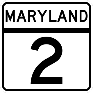
Maryland Route 2 is the longest state highway in the U.S. state of Maryland. The 79.24-mile (127.52 km) route runs from Solomons Island in Calvert County north to an intersection with U.S. Route 1 /US 40 Truck in Baltimore. The route runs concurrent with MD 4 through much of Calvert County along a four-lane divided highway known as Solomons Island Road, passing through rural areas as well as the communities of Lusby, Port Republic, Prince Frederick, and Huntingtown. In Sunderland, MD 2 splits from MD 4 and continues north as two-lane undivided Solomons Island Road into Anne Arundel County, still passing through rural areas. Upon reaching Annapolis, the route runs concurrent with US 50/US 301 to the north of the city. Between Annapolis and Baltimore, MD 2 runs along the Governor Ritchie Highway, a multilane divided highway that heads through suburban areas, passing through Arnold, Severna Park, Pasadena, Glen Burnie, and Brooklyn Park. In Baltimore, the route heads north on city streets and passes through the downtown area of the city.

<span class="mw-page-title-main">Maryland Route 450</span> Highway in Maryland

Maryland Route 450 is a state highway in the U.S. state of Maryland. The state highway runs 30.19 miles (48.59 km) from U.S. Route 1 Alternate in Bladensburg east to US 50/US 301 and MD 2 near Arnold. MD 450 forms a local complement to US 50 from near Washington, D.C. through Annapolis. In Prince George's County, the highway is a four- to six-lane divided highway that serves Bladensburg, Landover Hills, New Carrollton, Lanham, and Bowie. In Anne Arundel County, MD 450 connects Crofton with Parole and Annapolis with the portion of the county east of the Severn River. The highway serves as one of the main streets of Annapolis, including the state capital's historic core, and is the primary vehicular access to the U.S. Naval Academy.

<span class="mw-page-title-main">Maryland Route 10</span> State highway in Anne Arundel County, Maryland, US, known as the Arundel Expressway

Maryland Route 10 is a state highway in the U.S. state of Maryland. Known as the Arundel Expressway, the highway runs 7.17 miles (11.54 km) from MD 2 in Pasadena north to Interstate 695 (I-695) near Glen Burnie. MD 10 is a four- to six-lane freeway that serves as a bypass of MD 2 through Pasadena and Glen Burnie in northeastern Anne Arundel County. The Arundel Expressway was planned as a Baltimore–Annapolis freeway to provide relief to MD 2 between the cities as early as the 1950s. However, the portion of MD 10 south of Pasadena was removed from state plans when the I-97 corridor was chosen for the intercity freeway in the 1970s. MD 10 was constructed from I-695 to MD 710 in the early 1970s and continued south to MD 648 in the late 1970s. The freeway was extended south to MD 100 and completed to MD 2 in the late 1980s and early 1990s, respectively.

<span class="mw-page-title-main">Maryland Route 5</span> Highway in Maryland, United States

Maryland Route 5 is a 74.34-mile (119.64 km) long state highway that runs north–south in the U.S. state of Maryland. The highway runs from Point Lookout in St. Mary's County north to the Washington, D.C. border in Suitland, Prince George's County. MD 5 begins as two-lane undivided Point Lookout Road which runs from Point Lookout to an intersection with MD 235 in the northern part of St. Mary's County. Point Lookout Road passes through rural areas as well as the county seat of Leonardtown. After the MD 235 intersection, the route becomes four-lane divided Three Notch Road and continues into Charles County, where it becomes Leonardtown Road. Here, the route bypasses Hughesville and continues north toward the Waldorf area, which it bypasses to the east on Mattawoman Beantown Road. The route merges onto U.S. Route 301 and enters Prince George's County, splitting from US 301 at an interchange in Brandywine. From here, MD 5 continues north on Branch Avenue, running through suburban areas, before becoming a freeway as it passes Andrews Air Force Base and has an interchange with Interstate 95 (I-95)/I-495. Past the Capital Beltway, the route runs through suburban areas of Hillcrest Heights and Suitland before reaching the Washington, D.C. border, where Branch Avenue SE continues, crossing Pennsylvania Avenue SE and eventually terminating at Randle Circle.

<span class="mw-page-title-main">Maryland Route 70</span> State highway in Anne Arundel County, Maryland, US

Maryland Route 70 is a state highway in the U.S. state of Maryland. Known for most of its length as Roscoe Rowe Boulevard, the highway runs 2.31 miles (3.72 km) from MD 450 in Annapolis north to Bestgate Road in Parole. MD 70 is the primary highway connecting U.S. Route 50 and US 301 with downtown Annapolis. The highway also serves several sets of Maryland state government offices and Navy–Marine Corps Memorial Stadium. MD 70 was constructed in the mid-1950s contemporaneously with the US 50 freeway. The highway was extended north to Bestgate Road in the early 1990s.

<span class="mw-page-title-main">Maryland Route 648</span> Highway in Maryland

Maryland Route 648 is a collection of state highways in the U.S. state of Maryland. These nine highways are current or former sections of the Baltimore–Annapolis Boulevard between Annapolis and Baltimore via Glen Burnie. There are five signed mainline segments of MD 648 through Arnold, Severna Park, Pasadena, Glen Burnie, Ferndale, and Pumphrey in northern Anne Arundel County; Baltimore Highlands in southern Baltimore County; and the independent city of Baltimore. MD 648 mainly serves local traffic along its meandering route, with long-distance traffic intended to use the parallel and straighter MD 2 south of Glen Burnie and freeway-grade Interstate 97 (I-97), I-695, and MD 295 between Glen Burnie and Baltimore.

<span class="mw-page-title-main">Maryland Route 32</span> State highway in Maryland, US

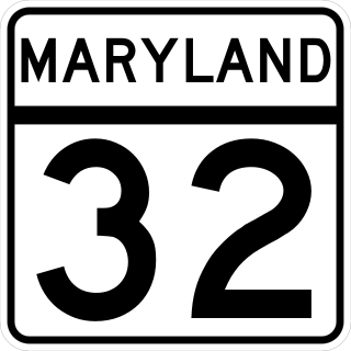
Maryland Route 32 (MD 32) is a state highway in the U.S. state of Maryland. The road runs 51.79 miles (83.35 km) from Interstate 97 (I-97) and MD 3 in Millersville west and north to Washington Road in Westminster. The 30 mile four- to six-lane freeway portion of MD 32 is the Patuxent Freeway between I-97 and I-70 in West Friendship. The freeway passes through Odenton and Fort Meade, the site of Fort George G. Meade and the National Security Agency (NSA), in western Anne Arundel County and along the southern part of Columbia in Howard County. Via I-97, MD 32 connects those communities with U.S. Route 50 (US 50)/US 301 in Annapolis. MD 32 also intersects the four primary highways connecting Baltimore and Washington: the Baltimore–Washington Parkway, US 1, I-95, and US 29. MD 32's north–south section, Sykesville Road, connects West Friendship and Westminster by way of Sykesville and Eldersburg in southern Carroll County.

<span class="mw-page-title-main">U.S. Route 50 in Maryland</span> Section of U.S. Highway in Maryland, United States

U.S. Route 50 is a major east–west route of the U.S. Highway system, stretching just over 3,000 miles (4,800 km) from West Sacramento, California, east to Ocean City, Maryland, on the Atlantic Ocean. In the U.S. state of Maryland, US 50 exists in two sections. The longer of these serves as a major route connecting Washington, D.C., with Ocean City; the latter is the eastern terminus of the highway. The other section passes through the southern end of Garrett County for less than 10 miles (16 km) as part of the Northwestern Turnpike, entering West Virginia at both ends. One notable section of US 50 is the dual-span Chesapeake Bay Bridge across the Chesapeake Bay, which links the Baltimore–Washington metropolitan area with the Eastern Shore region, allowing motorists to reach Ocean City and the Delaware Beaches.

<span class="mw-page-title-main">Maryland Route 176</span> State highway in Maryland, U.S., known as Dorsey Rd

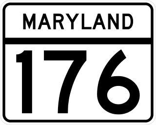
Maryland Route 176 is a state highway in the U.S. state of Maryland. Known as Dorsey Road, the highway runs 5.68 miles (9.14 km) from the end of state maintenance in Hanover east to MD 648 in Glen Burnie. MD 176 is a mostly four-lane highway that parallels MD 100 and forms the southern portion of the Airport Loop, a circumferential highway around Baltimore/Washington International Thurgood Marshall Airport that connects the airport with various airport-related services. The highway serves as the main connection between the Airport Loop and Interstate 97 (I-97).

<span class="mw-page-title-main">Maryland Route 174</span> State highway in Anne Arundel County, Maryland, United States

Maryland Route 174 is a state highway in the U.S. state of Maryland. The highway runs 5.94 miles (9.56 km) from Jacobs Road near Fort Meade east to MD 3 Business in Glen Burnie. MD 174 connects Glen Burnie with Severn and Fort George G. Meade in northern Anne Arundel County. The Fort Meade–Severn portion of the highway was constructed as part of MD 170, the primary highway that connected what was then Camp Meade to Baltimore, in the late 1910s. The highway was widened in the early 1940s, then became MD 554 in a number swap with the Severn–Odenton portion of MD 170. MD 174 was constructed in the early 1920s as a short road from MD 3 in Glen Burnie west to the site of the highway's modern Interstate 97 (I-97) interchange. MD 174 was extended west to Fort Meade in the early 1980s.

<span class="mw-page-title-main">Maryland Route 424</span>

Maryland Route 424 is a state highway in the U.S. state of Maryland. Known as Davidsonville Road, the highway runs 8.24 miles (13.26 km) from MD 214 in Davidsonville north to MD 3 in Crofton. MD 424 connects U.S. Route 50 /US 301 with the two communities in central Anne Arundel County. The highway was constructed from Davidsonville to what is now MD 450 in the late 1920s. MD 424 was extended to what is now MD 3 in the late 1940s. The highway's interchange with US 50 opened in the early 1950s when the U.S. Highway was relocated between Bowie and Annapolis. MD 424 temporarily extended south to MD 2 in the early to mid-1950s and north to the Little Patuxent River in the 1970s and early 1980s.

<span class="mw-page-title-main">U.S. Route 301 in Maryland</span> Highway in Maryland

U.S. Route 301 (US 301) in the state of Maryland is a major highway that runs 122.85 miles (197.71 km) from the Governor Harry W. Nice Memorial Bridge over the Potomac River into Virginia northeast to Delaware. It passes through three of Maryland's four main regions: Southern Maryland, the Baltimore-Washington Metropolitan Area, and the Eastern Shore. US 301 serves mainly as a bypass of Baltimore and Washington, D.C. from Virginia to Delaware.

<span class="mw-page-title-main">Maryland Route 665</span> Highway in Maryland

Maryland Route 665 is a state highway in the U.S. state of Maryland. Known as Aris T. Allen Boulevard, the state highway runs 2.68 miles (4.31 km) from U.S. Route 50 /US 301 in Parole east to Bywater Road and Forest Drive in Annapolis. MD 665 is a four-lane divided highway that connects US 50/US 301 and Interstate 97 (I-97) with MD 2 and the southern part of Annapolis and adjacent unincorporated communities on the Annapolis Neck in central Anne Arundel County. MD 665 was assigned to Forest Drive from MD 2 east to Bay Ridge Avenue circa 1950. The highway was relocated at its intersections with MD 387 and Bay Ridge Road in the 1960s. The Forest Drive iteration of MD 665 was removed from the state highway system in the late 1980s immediately before construction began on modern MD 665, which opened in 1992.

<span class="mw-page-title-main">Maryland Route 908</span>

Maryland Route 908 is a collection of unsigned state highways in the U.S. state of Maryland. These five highways are service roads that parallel and provide access to U.S. Route 50 and US 301 along their western approach to the Chesapeake Bay Bridge; the highways also provide access to Sandy Point State Park. The first modern highway from Cape St. Claire to Skidmore was constructed in the late 1920s and replaced by the modern alignment of US 50 in the late 1940s. The frontage roads on either side of the U.S. Highway were constructed in the early 1950s. The mainline segments of MD 908 assumed their present form when US 50 and US 301 were upgraded to a freeway in the early 1990s.

<span class="mw-page-title-main">Maryland Route 178</span> State highway in Anne Arundel County, Maryland, U.S. known as Generals Highway

Maryland Route 178 is a state highway in the U.S. state of Maryland. Known as Generals Highway, the highway runs 8.06 miles (12.97 km) from MD 450 in Parole north to Veterans Highway near Millersville. MD 178 connects Annapolis with Crownsville in central Anne Arundel County. The highway is indirectly named for George Washington, who traveled the highway in 1783 on his way to Annapolis to resign his commission in the Continental Army at the conclusion of the American Revolutionary War. MD 178 was planned as early as 1910 as part of a western route between Baltimore and Annapolis. However, most of the highway south of MD 3 was not built until the early 1930s. The portion south of MD 3 served as a primary segment in the western corridor connecting Baltimore–Annapolis, until the construction of Interstate 97 (I-97) in the late 1980s.

<span class="mw-page-title-main">Maryland Route 270</span>

Maryland Route 270 is a state highway in the U.S. state of Maryland. Known as Furnace Branch Road, the highway runs 2.16 miles (3.48 km) from MD 648 north to MD 3 Business within Glen Burnie in northeastern Anne Arundel County. MD 270 was constructed between a pair of intersections with MD 2 in the early 1930s. The highway was expanded and relocated when MD 10 was constructed through the area in the mid-1970s.

References

  1. 1 2 3 4 5 6 7 8 9 10 11 12 13 14 Highway Information Services Division (December 31, 2013). Highway Location Reference. Maryland State Highway Administration. Retrieved November 11, 2012.
  2. 1 2 Google (November 29, 2016). "overview of Maryland Route 3" (Map). Google Maps . Google. Retrieved November 29, 2016.
  3. Google (November 29, 2016). "overview of Maryland Route 3 Business" (Map). Google Maps . Google. Retrieved November 29, 2016.
  4. Maryland State Highway Administration (2004), "County Map of Baltimore City" (PDF). (3.17  MiB), 2004
Template:Attached KML/Maryland Route 3
KML is from Wikidata