Minton, Shropshire

Last updated

Minton
Minton centre - geograph.org.uk - 1232322.jpg
Minton, Shropshire
Shropshire UK location map.svg
Red pog.svg
Minton
Location within Shropshire
OS grid reference SO429907
Civil parish
Unitary authority
Ceremonial county
Region
Country England
Sovereign state United Kingdom
Post town CHURCH STRETTON
Postcode district SY6
Dialling code 01694
Police West Mercia
Fire Shropshire
Ambulance West Midlands
UK Parliament
List of places
UK
England
Shropshire
52°30′40″N2°50′24″W / 52.511°N 2.840°W / 52.511; -2.840

Minton is a hamlet in Shropshire, England.

It is located in the parish of Church Stretton, [1] 2+12 miles (4.0 km) southwest of the market town of Church Stretton. A historic settlement, it is situated on a foothill of the Long Mynd at around 240 m (790 ft) above sea level. As of 2010, there are around 12 dwellings in the hamlet.

Contents

Three lanes lead out from the hamlet: one to the A49 road, one mile southeast at Marshbrook; another lane leads to the hamlet of Hamperley, which is also in Church Stretton parish; and Little Stretton is one mile to the northeast.

History and features

The place name is from Welsh mynydd meaning 'hill' and Old English tun meaning 'settlement', 'town'. The hamlet has largely retained its Anglo-Saxon layout, with a patchwork of plots and haphazard narrow lanes. There are remains of a motte, which dates from either Anglo-Saxon or Norman times. It was a township and Royal manor, [2] held by King Edward prior to the Norman conquest. It is mentioned in the Domesday Book. [3]

Today the hamlet consists of farms and cottages and is agricultural in character. It is designated a conservation area [4] and there are 5 Listed buildings in the hamlet – Long Mynd House, Ivanhoe, Manor Farmhouse, Well Cottage, and Minton House. [5]

There is an outdoors activity centre located on the lane between Minton and Hamperley, the Longmynd Adventure Camp, with overnight accommodation and camping ground. [6]

Minton Hill and Batch

Minton Hill is to the northwest of the hamlet and rises to 453m. A bridleway leads up to its summit (and continues beyond onto the Long Mynd) from the hamlet of Minton. Another walking route up to the Long Mynd is via the Minton Batch, where a bridleway leads up from the lane to Hamperley. [7]

Famous residents

The Oscar-nominated actor, Pete Postlethwaite, lived at Yew Tree Cottage [8] in Minton for many years [9] before moving to the village of More near Bishop's Castle. "I do love Shropshire," he was quoted as saying. "Whenever I get home, my shoulders drop by two inches. The only reason I’ve been able to do the things I’ve done is because I have my family and Shropshire to come home to. They’ve made everything else possible." [10]

The Minton surname

The Shropshire surname of Minton originates from the name of the hamlet although resources seem to disagree as to its earliest occurrence. Some point to Jordan de Minton, who was mentioned in the Pipe Rolls of Northumberland in 1169. [11] However, the Rev R W Eyton in his book, 'The Antiquities of Shropshire' [12] identifies Walter de Miniton (later Walter de Muneton) as the first tenant of Minton or Muneton as the site was then known. Subsequent Mintons of note include Thomas Minton (English potter), John Minton (British artist), Yvonne Minton (Australian opera singer), Mary Minton (novelist) and Sherman Minton (US Democratic senator).

Film: The titular character of the movie, 'Big Stan' starring Rob Schneider was named Stan Minton. [13] The characters of Conrad and Wilma Minton (played by Lew Ayres and Herta Ware) also appeared in the episode, 'Old Flames' in 1980s crime drama, 'Cagney and Lacey'. [14]

Literature: A series of children's books called, 'Minton Goes...' has been written by Anna Fienberg and Kim Gamble. [15] A character called Sophia Minton also appeared in Agatha Christie's book, 'N or M?'. [16]

The fictional airfield of RAF Minton featured in 'The Shepherd' by Frederick Forsyth [17] while the village of Little Minton was invented by Enid Blyton for her book, 'The Mystery of the Secret Room'. [18] The fictional town of Minton, New England also provided the setting for the 1860 novel, 'The Ebony Idol' by G M Flanders. [19]

See also

Related Research Articles

<span class="mw-page-title-main">Church Stretton</span> Market town in Shropshire, England

Church Stretton is a market town and civil parish in Shropshire, England, 13 miles (21 km) south of Shrewsbury and 15 miles (24 km) north of Ludlow. The population in 2011 was 4,671.

<span class="mw-page-title-main">Long Mynd</span> Heath and moorland plateau in Shropshire, England

The Long Mynd is a heath and moorland plateau that forms part of the Shropshire Hills in Shropshire, England. The high ground, which is common land and designated as an Area of Outstanding Natural Beauty, lies between the Stiperstones range to the west and the Stretton Hills and Wenlock Edge to the east. Much of it is owned by the National Trust, and is managed by the Longmynd Commoners.

<span class="mw-page-title-main">All Stretton</span> Human settlement in England

All Stretton is a village and a now separate civil parish in Shropshire, England. Much of it is covered by a Conservation Area.

<span class="mw-page-title-main">Little Stretton, Shropshire</span> Village in Shropshire, England

Little Stretton is a village and former civil parish, now in the parish of Church Stretton, in the Shropshire district, in the ceremonial county of Shropshire, England. In 1961 the parish had a population of 80. Little Stretton became a civil parish in 1899 being formed from Church Stretton, on 1 April 1966 the parish was abolished and merged with Church Stretton.

<span class="mw-page-title-main">Shropshire Hills AONB</span> Area of Outstanding Natural Beauty in England

The Shropshire Hills is a designated Area of Outstanding Natural Beauty (AONB) in Shropshire, England. It is located in the south of the county, extending to its border with Wales. Designated in 1958, the area encompasses 802 square kilometres (310 sq mi) of land primarily in south-west Shropshire, taking its name from the upland region of the Shropshire Hills. The A49 road and Welsh Marches Railway Line bisect the area north–south, passing through or near Shrewsbury, Church Stretton, Craven Arms and Ludlow.

<span class="mw-page-title-main">Church Stretton railway station</span> Railway station in Shropshire, England

Church Stretton railway station is a railway station serving the town of Church Stretton in Shropshire, England on the Welsh Marches Line, 12+34 miles (20.5 km) south of Shrewsbury railway station; trains on the Heart of Wales Line also serve the station. All trains services are operated by Transport for Wales, who also manage the station.

<span class="mw-page-title-main">Sedrup</span> Human settlement in England

Sedrup is a hamlet in Buckinghamshire, England. It is located south west of the town of Aylesbury, close to the villages of Stone, Bishopstone and Hartwell which also provide the name of the civil parish within which Sedrup lies.

Minton may refer to:

<span class="mw-page-title-main">Asterton</span> Human settlement in England

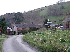
Asterton is a hamlet in Shropshire, England, in the civil parish of Myndtown. The name means "eastern home farm", from Old English east "east" and "ham" "home". It is thought to date back to early Saxon times. It is situated 4 miles (6.4 km) south-west of Church Stretton, 5 miles (8.0 km) north-west of Bishop's Castle, 13 miles (21 km) north-west of Ludlow and 15 miles (24 km) south of Shrewsbury, the county town of Shropshire. The nearest other settlements are Prolley Moor, Wentnor, Ratlinghope, Myndtown and Little Stretton.

<span class="mw-page-title-main">Sibdon Carwood</span> Human settlement in England

Sibdon Carwood is a hamlet and parish in Shropshire, England. To the east is the town of Craven Arms.

<span class="mw-page-title-main">Bouldon</span> Human settlement in England

Bouldon is a hamlet in Shropshire, England. It lies in the civil parish of Diddlebury.

<span class="mw-page-title-main">Betchcott</span> Human settlement in England

Betchcott is a hamlet near the villages of Picklescott and Woolstaston in Shropshire, England.

<span class="mw-page-title-main">Cound Brook</span> River in Shropshire, England

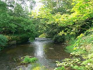
Cound Brook is a tributary of the River Severn in Shropshire, England, running to south of the county town Shrewsbury. The Cound Brook rises in the Stretton Hills, and enters the River Severn at Eyton on Severn after winding its way for 22 miles (35 km) across the southern Shropshire-Severn plain. This length is measured from high on the Long Mynd.

<span class="mw-page-title-main">Marshbrook</span> Human settlement in England

Marshbrook is a hamlet in Shropshire, England. It is sometimes spelt "Marsh Brook", which is also the name of a small watercourse which flows through the area.

<span class="mw-page-title-main">Smethcott</span> Human settlement in England

Smethcott is a civil parish and dispersed hamlet near the village of Picklescott, in Shropshire, England. The population of the civil parish at the 2011 census was 254.

<span class="mw-page-title-main">Hamperley</span> Human settlement in England

Hamperley is a dispersed hamlet in Shropshire, England.

<span class="mw-page-title-main">Eaton-under-Heywood</span> Human settlement in England

Eaton-under-Heywood is a civil parish in Shropshire, England. The population of the civil parish at the 2011 census was 171.

<span class="mw-page-title-main">Rectory Wood</span>

Rectory Wood is a wooded area in Church Stretton in Shropshire.

Church Stretton is a civil parish in Shropshire, England. It contains 88 listed buildings that are recorded in the National Heritage List for England. Of these, one is listed at Grade I, the highest of the three grades, four are at Grade II*, the middle grade, and the others are at Grade II, the lowest grade. The parish stretches along a valley between hills to the east and west. The major settlement is the market town of Church Stretton, with the village of All Stretton to the north, and the village of Little Stretton, and the smaller settlements of Marshbrook and Minton to the south. In the surrounding countryside are farms, and a number of farmhouses and farm buildings are listed. In the settlements most of the listed buildings are houses, cottages and associated structures. Also listed are churches and items in and around the churchyards, shops, public houses, two milestones and a milepost, a signal box, and two war memorials.

References

  1. "Church Stretton Town Council". Church Stretton Area. Archived from the original on 19 September 2010. Retrieved 10 April 2010.
  2. British History Online Church Stretton
  3. Raven, Michael, 2005, A Guide to Shropshire (third edition), page 133
  4. Shropshire Council Minton Conservation Area: map
  5. British Listed Buildings Church Stretton parish: map
  6. Longmynd Adventure Camp Archived 25 January 2010 at the Wayback Machine
  7. Geograph Minton Batch
  8. "MARSHBROOK CHURCH STRETTON Find People in MARSHBROOK CHURCH STRETTON with Find People Free.co.uk".
  9. http://strettonfocus.co.uk/download/145 [ bare URL PDF ]
  10. "Archived copy" (PDF). Archived from the original (PDF) on 4 March 2016. Retrieved 25 August 2012.{{cite web}}: CS1 maint: archived copy as title (link)
  11. "Surname Database: Minton Last Name Origin".
  12. http://www.melocki.org.uk/eyton/Eyton_Vol12.pdf [ bare URL PDF ]
  13. Big Stan
  14. "Cagney & Lacey: Old Flames". Archived from the original on 6 March 2013. Retrieved 25 August 2012.
  15. http://www.tashibooks.com/Minton.html
  16. "N or M ? [DeliciousDeath]". Archived from the original on 29 October 2012. Retrieved 25 August 2012.
  17. The Shepherd
  18. "Enid Blyton - Lashings of Information about the Children's Author".
  19. The Ebony Idol