National Register of Historic Places listings in Danville, Virginia

Last updated

Location of Danville in Virginia VAMap-doton-Danville.PNG
Location of Danville in Virginia

This is a list of the National Register of Historic Places listings in Danville, Virginia.

Contents

This is intended to be a complete list of the properties and districts on the National Register of Historic Places in the independent city of Danville, Virginia, United States. The locations of National Register properties and districts for which the latitude and longitude coordinates are included below, may be seen in an online map. [1]

There are 21 properties and districts listed on the National Register in the city. Another property was once listed but has been removed.


    This National Park Service list is complete through NPS recent listings posted February 9, 2024. [2]

Map all coordinates using: OpenStreetMap

Current listings

[3] Name on the Register [4] ImageDate listed [5] LocationDescription
1 Dan River Mill No. 8
Dan River Mill No. 8 White Mill Danville VA1.jpg
Dan River Mill No. 8
March 24, 2010
(#10000095)
424 Memorial Dr.
36°35′30″N79°23′41″W / 36.5917°N 79.3947°W / 36.5917; -79.3947 (Dan River Mill No. 8)
2 Dan's Hill
Dan's Hill Dan's Hill Pittsylvania County Virginia by Frances Benjamin Johnston.jpg
Dan's Hill
May 30, 1979
(#79003067)
4 miles (6.4 km) west of downtown Danville
36°35′28″N79°28′41″W / 36.5912°N 79.4781°W / 36.5912; -79.4781 (Dan's Hill)
3 Danville Historic District
Danville Historic District Penn-Wyatt House 2.jpg
Danville Historic District
April 11, 1973
(#73002207)
Roughly bounded by Main, Green, and Paxton Sts., and Memorial Hospital; also Jefferson Ave., Chestnut Pl., Grove, Chambers, and the 100 blocks of Ross and Holbrook Sts.
36°34′55″N79°24′00″W / 36.5819°N 79.4000°W / 36.5819; -79.4000 (Danville Historic District)
Second set of addresses represent a boundary increase of August 24, 2015
4 Danville Municipal Building
Danville Municipal Building Danville Municipal Building in February 2017.jpg
Danville Municipal Building
July 21, 1995
(#95000896)
418 Patton St.
36°35′11″N79°23′31″W / 36.5864°N 79.3919°W / 36.5864; -79.3919 (Danville Municipal Building)
5 Danville National Cemetery
Danville National Cemetery Lee Street entrance to Danville National Cemetery.jpg
Danville National Cemetery
April 7, 1995
(#95000274)
721 Lee St.
36°34′37″N79°23′22″W / 36.5769°N 79.3894°W / 36.5769; -79.3894 (Danville National Cemetery)
6 Danville Public Library
Danville Public Library William T Sutherlin Mansion Danville Virginia.JPG
Danville Public Library
November 12, 1969
(#69000338)
975 Main St.
36°34′52″N79°24′00″W / 36.5811°N 79.4000°W / 36.5811; -79.4000 (Danville Public Library)
7 Danville Southern Railway Passenger Depot
Danville Southern Railway Passenger Depot Danville Amtrak Station.JPG
Danville Southern Railway Passenger Depot
July 21, 1995
(#95000895)
701 Craghead St.
36°35′03″N79°23′02″W / 36.5842°N 79.3839°W / 36.5842; -79.3839 (Danville Southern Railway Passenger Depot)
8 Danville Tobacco Warehouse and Residential District
Danville Tobacco Warehouse and Residential District Danville Tobacco District HD HABS VA1.jpg
Danville Tobacco Warehouse and Residential District
July 14, 1982
(#82004552)
Off U.S. Route 58
36°34′50″N79°23′18″W / 36.5806°N 79.3883°W / 36.5806; -79.3883 (Danville Tobacco Warehouse and Residential District)
Boundary increase May 21, 2009
9 Doctors Building August 18, 2020
(#100004989)
990 Main St. & 108 Holbrook St.
36°34′52″N79°24′04″W / 36.5811°N 79.4010°W / 36.5811; -79.4010 (Doctors Building)
10 Downtown Danville Historic District
Downtown Danville Historic District Masonic Temple and other buildings in the Downtown Danville Historic District.jpg
Downtown Danville Historic District
August 12, 1993
(#93000830)
Roughly bounded by Memorial Dr. and High, Patton, and Ridge Sts.
36°35′16″N79°23′32″W / 36.5878°N 79.3922°W / 36.5878; -79.3922 (Downtown Danville Historic District)
11 Holbrook-Ross Street Historic District
Holbrook-Ross Street Historic District Holbrook by Maury, Danville.jpg
Holbrook-Ross Street Historic District
November 18, 1997
(#97001404)
Roughly bounded by Holbrook, Ross, Gay, and Maury Sts.
36°35′12″N79°24′10″W / 36.5867°N 79.4028°W / 36.5867; -79.4028 (Holbrook-Ross Street Historic District)
12 Hotel Danville
Hotel Danville Hotel Danville.jpg
Hotel Danville
December 6, 1984
(#84000658)
600 Main St.
36°35′14″N79°23′41″W / 36.5872°N 79.3947°W / 36.5872; -79.3947 (Hotel Danville)
13 Hylton Hall
Hylton Hall Hylton Hall site in Danville.jpg
Hylton Hall
September 14, 2009
(#09000726)
700 Lanier Ave.
36°34′04″N79°25′34″W / 36.5678°N 79.4261°W / 36.5678; -79.4261 (Hylton Hall)
14 Langhorne House
Langhorne House Langhorne House Danville Virginia.JPG
Langhorne House
February 1, 2006
(#05001586)
117 Broad St.
36°34′48″N79°24′12″W / 36.5801°N 79.4033°W / 36.5801; -79.4033 (Langhorne House)
15 Main Street Methodist Episcopal Church South
Main Street Methodist Episcopal Church South Main Street United Methodist Church, Danville 1.jpg
Main Street Methodist Episcopal Church South
December 6, 1990
(#90001822)
767 Main St.
36°35′05″N79°23′47″W / 36.5847°N 79.3964°W / 36.5847; -79.3964 (Main Street Methodist Episcopal Church South)
16 Mechanicsville Historic District
Mechanicsville Historic District High Street Baptist Church in Danville.jpg
Mechanicsville Historic District
May 19, 2014
(#14000231)
Floyd, High, N. Ridge, Monroe, and Upper Sts.
36°35′20″N79°23′47″W / 36.5889°N 79.3964°W / 36.5889; -79.3964 (Mechanicsville Historic District)
17 North Danville Historic District
North Danville Historic District Walker near Main, Danville.jpg
North Danville Historic District
January 15, 2004
(#03001432)
Roughly bounded by Riverside Dr., Claiborne St., the Leemont Cemetery, Novle Ave., and Scales St.
36°35′51″N79°23′05″W / 36.5975°N 79.3847°W / 36.5975; -79.3847 (North Danville Historic District)
18 Penn-Wyatt House
Penn-Wyatt House Penn-Wyatt House 1.jpg
Penn-Wyatt House
September 7, 1979
(#79003317)
862 Main St.
36°35′00″N79°23′56″W / 36.5833°N 79.3989°W / 36.5833; -79.3989 (Penn-Wyatt House)
19 Schoolfield Historic District December 3, 2020
(#100005881)
Park Ave., Park Cir., Memorial Dr., Dan R., Laurel Ave., Rutledy Cr., Fairfield and Selma Aves.
36°34′34″N79°25′40″W / 36.5761°N 79.4279°W / 36.5761; -79.4279 (Schoolfield Historic District)
20 Schoolfield School Complex
Schoolfield School Complex Schoolfield School Complex Building A.jpg
Schoolfield School Complex
June 3, 2009
(#09000392)
31 Baltimore Ave.
36°34′03″N79°25′26″W / 36.5675°N 79.4239°W / 36.5675; -79.4239 (Schoolfield School Complex)
21 Schoolfield Welfare Building
Schoolfield Welfare Building Schoolfield Welfare Building in Danville.jpg
Schoolfield Welfare Building
March 1, 2011
(#11000064)
917 W. Main St.
36°34′09″N79°25′27″W / 36.5692°N 79.4242°W / 36.5692; -79.4242 (Schoolfield Welfare Building)

Former listings

[3] Name on the RegisterImageDate listedDate removedLocationDescription
1 Dan River Inc. Riverside Division Historic District
Dan River Inc. Riverside Division Historic District Shuttered textile mill Dan River Mills Danville Virginia.JPG
Dan River Inc. Riverside Division Historic District
May 11, 2000
(#00000480)
July 29, 2016Both sides of Dan River roughly bounded by Union St. Dam, Main St. Bridge, and Riverside and Memorial Drs.; also 424 Memorial Dr.
36°35′34″N79°23′50″W / 36.5928°N 79.3972°W / 36.5928; -79.3972 (Dan River Inc. Riverside Division Historic District)
424 Memorial represents Dan River Mill No. 8, a boundary increase of March 24, 2010

See also

Related Research Articles

<span class="mw-page-title-main">National Register of Historic Places listings in Amelia County, Virginia</span>

This is a list of the National Register of Historic Places listings in Amelia County, Virginia.

<span class="mw-page-title-main">National Register of Historic Places listings in Staunton, Virginia</span>

This is a list of the National Register of Historic Places listings in Staunton, Virginia.

<span class="mw-page-title-main">National Register of Historic Places listings in Waynesboro, Virginia</span>

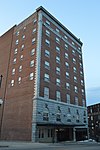
This is a list of the National Register of Historic Places listings in Waynesboro, Virginia.

<span class="mw-page-title-main">National Register of Historic Places listings in Bedford County, Virginia</span>

This is a list of the National Register of Historic Places listings in Bedford County, Virginia.

<span class="mw-page-title-main">National Register of Historic Places listings in Lexington, Virginia</span>

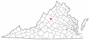
This is a list of the National Register of Historic Places listings in Lexington, Virginia.

<span class="mw-page-title-main">National Register of Historic Places listings in Prince George County, Virginia</span>

This is a list of the National Register of Historic Places listings in Prince George County, Virginia.

<span class="mw-page-title-main">National Register of Historic Places listings in Clarke County, Virginia</span>

This is a list of the National Register of Historic Places listings in Clarke County, Virginia.

<span class="mw-page-title-main">National Register of Historic Places listings in Pittsylvania County, Virginia</span>

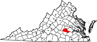
This is a list of the National Register of Historic Places listings in Pittsylvania County, Virginia.

<span class="mw-page-title-main">National Register of Historic Places listings in Isle of Wight County, Virginia</span>

This is a list of the National Register of Historic Places listings in Isle of Wight County, Virginia.

<span class="mw-page-title-main">National Register of Historic Places listings in Goochland County, Virginia</span>

This is a list of the National Register of Historic Places listings in Goochland County, Virginia.

<span class="mw-page-title-main">National Register of Historic Places listings in Greene County, Virginia</span>

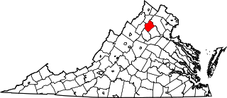
This is a list of the National Register of Historic Places listings in Greene County, Virginia.

<span class="mw-page-title-main">National Register of Historic Places listings in Rockingham County, Virginia</span>

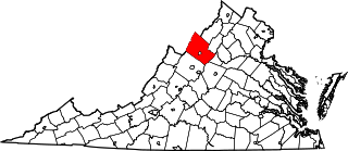
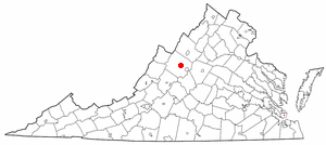
This is a list of the National Register of Historic Places listings in Rockingham County, Virginia.

<span class="mw-page-title-main">National Register of Historic Places listings in Lunenburg County, Virginia</span>

This is a list of the National Register of Historic Places listings in Lunenburg County, Virginia.

<span class="mw-page-title-main">National Register of Historic Places listings in Orange County, Virginia</span>

This is a list of the National Register of Historic Places listings in Orange County, Virginia.

<span class="mw-page-title-main">National Register of Historic Places listings in Portsmouth, Virginia</span>

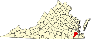
This is a list of the National Register of Historic Places listings in Portsmouth, Virginia.

<span class="mw-page-title-main">National Register of Historic Places listings in Rappahannock County, Virginia</span>

This is a list of the National Register of Historic Places listings in Rappahannock County, Virginia.

<span class="mw-page-title-main">National Register of Historic Places listings in Shenandoah County, Virginia</span>

This is a list of the National Register of Historic Places listings in Shenandoah County, Virginia.

<span class="mw-page-title-main">National Register of Historic Places listings in Patrick County, Virginia</span>

This is a list of the National Register of Historic Places listings in Patrick County, Virginia.

<span class="mw-page-title-main">National Register of Historic Places listings in Prince Edward County, Virginia</span>

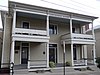
This is a list of the National Register of Historic Places listings in Prince Edward County, Virginia.

<span class="mw-page-title-main">National Register of Historic Places listings in Lewis County, West Virginia</span>

This is a list of the National Register of Historic Places listings in Lewis County, West Virginia.

References

  1. The latitude and longitude information provided in this table was derived originally from the National Register Information System, which has been found to be fairly accurate for about 99% of listings. Some locations in this table may have been corrected to current GPS standards.
  2. National Park Service, United States Department of the Interior, "National Register of Historic Places: Weekly List Actions", retrieved February 9, 2024.
  3. 1 2 Numbers represent an alphabetical ordering by significant words. Various colorings, defined here, differentiate National Historic Landmarks and historic districts from other NRHP buildings, structures, sites or objects.
  4. "National Register Information System". National Register of Historic Places . National Park Service. April 24, 2008.
  5. The eight-digit number below each date is the number assigned to each location in the National Register Information System database, which can be viewed by clicking the number.