National Register of Historic Places listings in Shenandoah County, Virginia

Last updated

Location of Shenandoah County in Virginia Map of Virginia highlighting Shenandoah County.svg
Location of Shenandoah County in Virginia

This is a list of the National Register of Historic Places listings in Shenandoah County, Virginia.

Contents

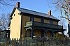
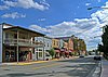
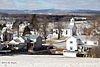
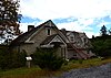
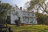
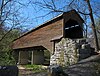
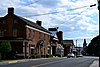
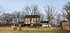
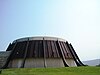
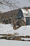
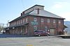
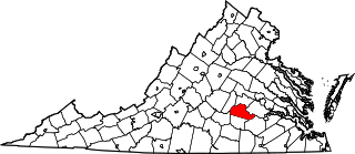
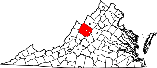
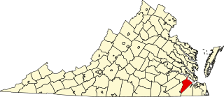
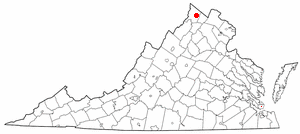
This is intended to be a complete list of the properties and districts on the National Register of Historic Places in Shenandoah County, Virginia, United States. The locations of National Register properties and districts for which the latitude and longitude coordinates are included below, may be seen in an online map. [1]

There are 38 properties and districts listed on the National Register in the county, including 1 National Historic Landmark.


    This National Park Service list is complete through NPS recent listings posted October 20, 2023. [2]

Map all coordinates using: OpenStreetMap

Current listings

[3] Name on the Register [4] ImageDate listed [5] Location City or townDescription
1 Bauserman Farm
Bauserman Farm Bauserman Farmhouse.jpg
Bauserman Farm
December 27, 2010
(#10001064)
10107 S. Middle Rd.
38°46′44″N78°39′04″W / 38.778750°N 78.651111°W / 38.778750; -78.651111 (Bauserman Farm)
Mount Jackson
2 Abraham Beydler House
Abraham Beydler House Abraham Beydler House.jpg
Abraham Beydler House
February 7, 2002
(#01001568)
2748 Zion Church Rd.
38°54′37″N78°25′42″W / 38.910278°N 78.428333°W / 38.910278; -78.428333 (Abraham Beydler House)
Maurertown
3 Jacob Bowman House
Jacob Bowman House Jacob Bowman House from the driveway.jpg
Jacob Bowman House
February 21, 2017
(#100000679)
2470 Polk Rd.
38°48′49″N78°36′34″W / 38.813611°N 78.609444°W / 38.813611; -78.609444 (Jacob Bowman House)
Edinburg
4 Bowman–Zirkle Farm
Bowman-Zirkle Farm Bowman-Zirkle Farmhouse.jpg
Bowman–Zirkle Farm
August 21, 2009
(#09000642)
12097 S. Middle Rd.
38°47′56″N78°37′33″W / 38.798889°N 78.625833°W / 38.798889; -78.625833 (Bowman–Zirkle Farm)
Edinburg
5 Burner-Gearing Farm
Burner-Gearing Farm BGF-Barn.png
Burner-Gearing Farm
June 1, 2021
(#100006573)
2497 Moose Rd.
38°52′53″N78°27′27″W / 38.8813°N 78.4575°W / 38.8813; -78.4575 (Burner-Gearing Farm)
Woodstock vicinity
6 Campbell Farm
Campbell Farm Campbell Farmhouse near Edinburg.jpg
Campbell Farm
August 15, 1990
(#90001416)
Stoney Creek Rd., near Lantz Mills
38°50′34″N78°35′34″W / 38.842778°N 78.592778°W / 38.842778; -78.592778 (Campbell Farm)
Edinburg
7 Cedar Creek Battlefield and Belle Grove
Cedar Creek Battlefield and Belle Grove Long Meadow Road toward Cedar Creek.jpg
Cedar Creek Battlefield and Belle Grove
August 11, 1969
(#69000243)
On Interstate 81 between Middletown and Strasburg
38°59′15″N78°19′24″W / 38.987500°N 78.323333°W / 38.987500; -78.323333 (Cedar Creek Battlefield and Belle Grove)
Middletown Site of the Battle of Cedar Creek; designated a National Historic Landmark District in 1969. Extends into Frederick County.
8 Clem–Kagey Farm
Clem-Kagey Farm Clem-Kagey Farmhouse.jpg
Clem–Kagey Farm
August 20, 2009
(#09000643)
291 Belgravia Rd.
38°47′44″N78°37′22″W / 38.795417°N 78.622778°W / 38.795417; -78.622778 (Clem–Kagey Farm)
Edinburg
9 Edinburg Historic District
Edinburg Historic District Edinburg VA Historic District Sept 2013.jpeg
Edinburg Historic District
July 22, 1998
(#98000845)
Roughly along Stony Creek Boulevard and Shenandoah and Railroad Aves.
38°49′20″N78°33′52″W / 38.822222°N 78.564444°W / 38.822222; -78.564444 (Edinburg Historic District)
Edinburg
10 Edinburg Mill
Edinburg Mill EdinburgMill.jpg
Edinburg Mill
September 7, 1979
(#79003084)
U.S. Route 11
38°49′16″N78°34′06″W / 38.821111°N 78.568333°W / 38.821111; -78.568333 (Edinburg Mill)
Edinburg
11 Forestville Historic District
Forestville Historic District Forestville, VA Jan. 2014.jpg
Forestville Historic District
November 30, 2011
(#11000874)
Junction of State Route 42 with Middle and Quicksburg Rds.
38°42′55″N78°43′23″W / 38.715278°N 78.723056°W / 38.715278; -78.723056 (Forestville Historic District)
Forestville
12 Fort Bowman
Fort Bowman Fort Bowman, Frontage Road, Strasburg, (Shenandoah County, Virginia).jpg
Fort Bowman
November 25, 1969
(#69000279)
Fort Bowman Rd.
39°00′10″N78°19′31″W / 39.002778°N 78.325278°W / 39.002778; -78.325278 (Fort Bowman)
Middletown
13 Funkhouser Farm
Funkhouser Farm FUNKHOUSER HOUSE AND FARM, TOMS BROOK , SHENANDOAH COUNTY, VA.jpg
Funkhouser Farm
June 4, 2018
(#100002533)
27812 Old Valley Pike
38°57′24″N78°25′18″W / 38.956667°N 78.421667°W / 38.956667; -78.421667 (Funkhouser Farm)
Toms Brook
14 Dr. Christian Hockman House
Dr. Christian Hockman House Dr. Christian Hockman House, Edinburg, VA as seen from Rte 11.jpg
Dr. Christian Hockman House
February 23, 1984
(#84003593)
U.S. Route 11
38°49′45″N78°33′04″W / 38.829167°N 78.551111°W / 38.829167; -78.551111 (Dr. Christian Hockman House)
Edinburg
15 Hupp House
Hupp House Hupp House Massanuttan Street Strasburg Va.jpeg
Hupp House
February 21, 1997
(#97000155)
551 N. Massanutten St.
38°59′43″N78°21′20″W / 38.995139°N 78.355556°W / 38.995139; -78.355556 (Hupp House)
Strasburg
16 Lantz Hall
Lantz Hall LANTZ HALL, SHENANDOAH COUNTY, VIRGINIA.jpg
Lantz Hall
December 30, 1992
(#92001711)
614 S. Main St. (U.S. Route 11)
38°52′33″N78°30′39″W / 38.875833°N 78.510833°W / 38.875833; -78.510833 (Lantz Hall)
Woodstock
17 Lantz Mill
Lantz Mill Lantz Mill, VA, 2005.jpg
Lantz Mill
November 1, 2007
(#07001145)
95 Swover Creek Rd.
38°50′26″N78°35′43″W / 38.840556°N 78.595278°W / 38.840556; -78.595278 (Lantz Mill)
Edinburg
18 John Miley Maphis House
John Miley Maphis House JOHN MILEY MAPHIS HOUSE, EDINBURG, SHENANDOAH COUNTY VA.jpg
John Miley Maphis House
November 22, 2011
(#11000840)
56 Bell's Ln.
38°50′21″N78°35′52″W / 38.839167°N 78.597778°W / 38.839167; -78.597778 (John Miley Maphis House)
Edinburg
19 Meems Bottom Covered Bridge
Meems Bottom Covered Bridge Meems Bottom Bridge 2.JPG
Meems Bottom Covered Bridge
June 10, 1975
(#75002037)
South of Mt. Jackson on Wissler Rd. over the North Fork of the Shenandoah River
38°43′15″N78°39′19″W / 38.720833°N 78.655278°W / 38.720833; -78.655278 (Meems Bottom Covered Bridge)
Mount Jackson
20 J.W.R. Moore House
J.W.R. Moore House J.W.R. Moore House 02.jpg
J.W.R. Moore House
November 16, 2005
(#05001275)
5588 Main St.
38°45′11″N78°38′01″W / 38.752917°N 78.633611°W / 38.752917; -78.633611 (J.W.R. Moore House)
Mount Jackson
21 Mount Jackson Historic District
Mount Jackson Historic District Mt Jackson VA USA Historic District Sept 2013.jpeg
Mount Jackson Historic District
June 17, 1993
(#93000541)
Main, King, Gospel, Broad, Bridge, Race, Clifford, Tisinger, and Wunder Sts., and Orkney Dr.
38°44′44″N78°38′35″W / 38.745556°N 78.643056°W / 38.745556; -78.643056 (Mount Jackson Historic District)
Mount Jackson
22 Mount Pleasant
Mount Pleasant Mount Pleasant (Strasburg, Virginia).jpg
Mount Pleasant
August 18, 2011
(#11000553)
292 Hite Ln.
39°00′02″N78°20′04″W / 39.000556°N 78.334444°W / 39.000556; -78.334444 (Mount Pleasant)
Strasburg
23 Daniel Munch House
Daniel Munch House Fort Valley VA - Munch House, 1-11- 2014.jpg
Daniel Munch House
March 13, 2002
(#02000181)
2588 Seven Fountains Rd.
38°51′15″N78°24′01″W / 38.854167°N 78.400278°W / 38.854167; -78.400278 (Daniel Munch House)
Fort Valley
24 New Market Battlefield Park
New Market Battlefield Park Virginia Museum of the Civil War - Stierch.jpg
New Market Battlefield Park
September 15, 1970
(#70000824)
North of the junction of U.S. Routes 11 and 211
38°39′58″N78°40′06″W / 38.666111°N 78.668333°W / 38.666111; -78.668333 (New Market Battlefield Park)
New Market
25 New Market Historic District
New Market Historic District New Market VA Historic District Sept 2013.jpeg
New Market Historic District
September 22, 1972
(#72001416)
Junction of U.S. Routes 11 and 211
38°38′49″N78°40′20″W / 38.646944°N 78.672222°W / 38.646944; -78.672222 (New Market Historic District)
New Market
26 Orkney Springs Hotel
Orkney Springs Hotel Orkney Springs Hotel.jpg
Orkney Springs Hotel
April 22, 1976
(#76002119)
State Route 263 west of its junction with Orkney Springs Rd.
38°47′41″N78°48′56″W / 38.794722°N 78.815556°W / 38.794722; -78.815556 (Orkney Springs Hotel)
Orkney Springs
27 Shenandoah County Courthouse
Shenandoah County Courthouse Shenandoah County Courthouse Woodstock VA Nov 11.jpg
Shenandoah County Courthouse
June 19, 1973
(#73002060)
W. Court and S. Main Sts.
38°52′56″N78°30′20″W / 38.882222°N 78.505556°W / 38.882222; -78.505556 (Shenandoah County Courthouse)
Woodstock
28 Shenandoah County Farm
Shenandoah County Farm Shenandoah County Farm stone outbuilding.jpg
Shenandoah County Farm
October 29, 1993
(#93001122)
Northern side of Zion Church Rd., 4,000 feet (1,200 m) east of the junction with U.S. Route 11
38°55′54″N78°27′01″W / 38.931667°N 78.450278°W / 38.931667; -78.450278 (Shenandoah County Farm)
Maurertown
29 Shenvalee Golf Resort August 18, 2023
(#100009244)
9660 Fairway Dr.
38°38′25″N78°40′28″W / 38.6403°N 78.6744°W / 38.6403; -78.6744 (Shenvalee Golf Resort)
New Market
30 Snapp House
Snapp House Snapp House from east.jpg
Snapp House
May 7, 1979
(#79003085)
Southwest of Fishers Hill on Copp Rd.
38°58′22″N78°25′29″W / 38.972639°N 78.424722°W / 38.972639; -78.424722 (Snapp House)
Fishers Hill
31 Stoner-Keller House and Mill
Stoner-Keller House and Mill Stoner-Keller Mill 2014.jpg
Stoner-Keller House and Mill
February 5, 2013
(#12001269)
2900 Battlefield Rd.
38°59′10″N78°23′58″W / 38.986111°N 78.399444°W / 38.986111; -78.399444 (Stoner-Keller House and Mill)
Strasburg
32 Strasburg Historic District
Strasburg Historic District Strasburg Va Historic District Rt 11 1.jpeg
Strasburg Historic District
August 16, 1984
(#84003595)
Roughly bounded by railroad tracks and 3rd, High, and Massanutten Sts.
38°59′20″N78°21′54″W / 38.988889°N 78.364972°W / 38.988889; -78.364972 (Strasburg Historic District)
Strasburg
33 Strasburg Stone and Earthenware Manufacturing Company
Strasburg Stone and Earthenware Manufacturing Company Strasburg S&E Mfg.jpg
Strasburg Stone and Earthenware Manufacturing Company
June 19, 1979
(#79003086)
E. King St.
38°59′14″N78°21′21″W / 38.987361°N 78.355833°W / 38.987361; -78.355833 (Strasburg Stone and Earthenware Manufacturing Company)
Strasburg
34 Toms Brook School
Toms Brook School Toms Brook VA School Sept 2013.jpeg
Toms Brook School
August 18, 2011
(#11000554)
3232 S. Main St.
38°56′37″N78°26′36″W / 38.943611°N 78.443333°W / 38.943611; -78.443333 (Toms Brook School)
Toms Brook
35 Benjamin Wierman House
Benjamin Wierman House Benjamin Wierman House.jpg
Benjamin Wierman House
February 21, 2008
(#08000077)
4049 Flat Rock Rd.
38°42′57″N78°45′27″W / 38.715833°N 78.757500°W / 38.715833; -78.757500 (Benjamin Wierman House)
Quicksburg
36 Wilkins Farm
Wilkins Farm 989 Swover Creek Road, Edinburg VA, 2014-09-21.jpg
Wilkins Farm
February 10, 2014
(#13001175)
989 Swover Creek Rd.
38°50′23″N78°36′34″W / 38.839833°N 78.609583°W / 38.839833; -78.609583 (Wilkins Farm)
Edinburg
37 Woodstock Historic District
Woodstock Historic District WoodstockCafeAndShoppes.jpg
Woodstock Historic District
October 25, 1995
(#95001089)
Roughly bounded by N. Main, E. North, and Water Sts., Cemetery Rd., and the Norfolk Southern railroad tracks
38°52′55″N78°30′19″W / 38.881944°N 78.505278°W / 38.881944; -78.505278 (Woodstock Historic District)
Woodstock
38 Zirkle Mill
Zirkle Mill Historic Andrew Zirkle Mill, circa 1760.jpg
Zirkle Mill
February 10, 1983
(#83003316)
West of Quicksburg on State Route 42
38°42′50″N78°43′20″W / 38.713889°N 78.722222°W / 38.713889; -78.722222 (Zirkle Mill)
Quicksburg

See also

Related Research Articles

<span class="mw-page-title-main">National Register of Historic Places listings in Amelia County, Virginia</span>

This is a list of the National Register of Historic Places listings in Amelia County, Virginia.

<span class="mw-page-title-main">National Register of Historic Places listings in Augusta County, Virginia</span>

This is a list of the National Register of Historic Places listings in Augusta County, Virginia.

<span class="mw-page-title-main">National Register of Historic Places listings in Bedford County, Virginia</span>

This is a list of the National Register of Historic Places listings in Bedford County, Virginia.

<span class="mw-page-title-main">National Register of Historic Places listings in Buckingham County, Virginia</span>

This is a list of the National Register of Historic Places listings in Buckingham County, Virginia.

<span class="mw-page-title-main">National Register of Historic Places listings in Clarke County, Virginia</span>

This is a list of the National Register of Historic Places listings in Clarke County, Virginia.

<span class="mw-page-title-main">National Register of Historic Places listings in Pittsylvania County, Virginia</span>

This is a list of the National Register of Historic Places listings in Pittsylvania County, Virginia.

<span class="mw-page-title-main">National Register of Historic Places listings in Isle of Wight County, Virginia</span>

This is a list of the National Register of Historic Places listings in Isle of Wight County, Virginia.

<span class="mw-page-title-main">National Register of Historic Places listings in Winchester, Virginia</span>

This is a list of the National Register of Historic Places listings in Winchester, Virginia.

<span class="mw-page-title-main">National Register of Historic Places listings in Goochland County, Virginia</span>

This is a list of the National Register of Historic Places listings in Goochland County, Virginia.

<span class="mw-page-title-main">National Register of Historic Places listings in Greene County, Virginia</span>

This is a list of the National Register of Historic Places listings in Greene County, Virginia.

<span class="mw-page-title-main">National Register of Historic Places listings in Rockingham County, Virginia</span>

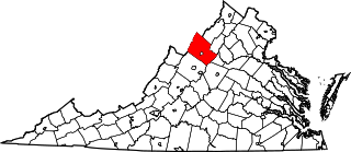
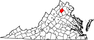
This is a list of the National Register of Historic Places listings in Rockingham County, Virginia.

<span class="mw-page-title-main">National Register of Historic Places listings in Madison County, Virginia</span>

This is a list of the National Register of Historic Places listings in Madison County, Virginia.

<span class="mw-page-title-main">National Register of Historic Places listings in New Kent County, Virginia</span>

This is a list of the National Register of Historic Places listings in New Kent County, Virginia.

<span class="mw-page-title-main">National Register of Historic Places listings in Orange County, Virginia</span>

This is a list of the National Register of Historic Places listings in Orange County, Virginia.

<span class="mw-page-title-main">National Register of Historic Places listings in Rappahannock County, Virginia</span>

This is a list of the National Register of Historic Places listings in Rappahannock County, Virginia.

<span class="mw-page-title-main">National Register of Historic Places listings in Patrick County, Virginia</span>

This is a list of the National Register of Historic Places listings in Patrick County, Virginia.

<span class="mw-page-title-main">National Register of Historic Places listings in Prince Edward County, Virginia</span>

This is a list of the National Register of Historic Places listings in Prince Edward County, Virginia.

<span class="mw-page-title-main">National Register of Historic Places listings in Lewis County, West Virginia</span>

This is a list of the National Register of Historic Places listings in Lewis County, West Virginia.

This is a list of the National Register of Historic Places listings in Shenandoah National Park.

<span class="mw-page-title-main">National Register of Historic Places listings in Grayson County, Virginia</span>

This is a list of the National Register of Historic Places listings in Grayson County, Virginia.

References

  1. The latitude and longitude information provided in this table was derived originally from the National Register Information System, which has been found to be fairly accurate for about 99% of listings. Some locations in this table may have been corrected to current GPS standards.
  2. National Park Service, United States Department of the Interior, "National Register of Historic Places: Weekly List Actions", retrieved October 20, 2023.
  3. Numbers represent an alphabetical ordering by significant words. Various colorings, defined here, differentiate National Historic Landmarks and historic districts from other NRHP buildings, structures, sites or objects.
  4. "National Register Information System". National Register of Historic Places . National Park Service. April 24, 2008.
  5. The eight-digit number below each date is the number assigned to each location in the National Register Information System database, which can be viewed by clicking the number.