National Register of Historic Places listings in Dinwiddie County, Virginia

Last updated

Location of Dinwiddie County in Virginia Map of Virginia highlighting Dinwiddie County.svg
Location of Dinwiddie County in Virginia

This is a list of the National Register of Historic Places listings in Dinwiddie County, Virginia.

Contents

This is intended to be a complete list of the properties and districts on the National Register of Historic Places in Dinwiddie County, Virginia, United States. The locations of National Register properties and districts for which the latitude and longitude coordinates are included below, may be seen in an online map. [1]

There are 18 properties and districts listed on the National Register in the county, including 2 National Historic Landmarks. Another property was once listed but has been removed.


    This National Park Service list is complete through NPS recent listings posted February 3, 2023. [2]

Map all coordinates using: OpenStreetMap  
Download coordinates as: KML

Current listings

[3] Name on the Register [4] ImageDate listed [5] Location City or townDescription
1 Burlington
Burlington Burlington entrance, Dinwiddie County.jpg
Burlington
April 30, 1976
(#76002102)
West of Petersburg off Ferndale Rd.
37°13′23″N77°28′15″W / 37.222917°N 77.470833°W / 37.222917; -77.470833 (Burlington)
Petersburg
2 Burnt Quarter
Burnt Quarter Burnt Quarter, State Route 613 vicinity, Dinwiddie vicinity (Dinwiddie County, Virginia).jpg
Burnt Quarter
November 25, 1969
(#69000235)
Southwest of the junction of Courthouse, White Oak, and Wheelers Pond Rds.
37°07′57″N77°37′59″W / 37.132500°N 77.633056°W / 37.132500; -77.633056 (Burnt Quarter)
Dinwiddie
3 Butterwood Methodist Church and Butterwood Cemetery
Butterwood Methodist Church and Butterwood Cemetery Butterwood Chapel oblique view with flagpole.jpg
Butterwood Methodist Church and Butterwood Cemetery
April 11, 2003
(#03000213)
State Route 40
37°04′22″N77°51′39″W / 37.072778°N 77.860833°W / 37.072778; -77.860833 (Butterwood Methodist Church and Butterwood Cemetery)
Blackstone
4 Conover Archaeological Site March 28, 1985
(#85000647)
Address Restricted
Carson
5 Dinwiddie County Court House
Dinwiddie County Court House DinwiddieCountyCourthouse 9855.jpg
Dinwiddie County Court House
March 21, 1973
(#73002008)
Junction of U.S. Route 1 and Courthouse Rd.
37°04′38″N77°35′13″W / 37.077222°N 77.586944°W / 37.077222; -77.586944 (Dinwiddie County Court House)
Dinwiddie
6 Five Forks Battlefield
Five Forks Battlefield Five forks.jpg
Five Forks Battlefield
October 15, 1966
(#66000830)
12 miles west of Petersburg on Courthouse Rd. at Church Rd.
37°08′29″N77°36′48″W / 37.141389°N 77.613333°W / 37.141389; -77.613333 (Five Forks Battlefield)
Petersburg
7 Mansfield
Mansfield Mansfield from Mark.jpg
Mansfield
May 28, 1976
(#76002103)
West of Petersburg on Mark Dr.
37°13′15″N77°29′18″W / 37.220833°N 77.488472°W / 37.220833; -77.488472 (Mansfield)
Petersburg
8 Mayfield Cottage
Mayfield Cottage Mayfield cottage.JPG
Mayfield Cottage
November 12, 1969
(#69000236)
Central State Hospital grounds
37°12′56″N77°26′53″W / 37.215417°N 77.447917°W / 37.215417; -77.447917 (Mayfield Cottage)
Petersburg
9 Montrose
Montrose MONTROSE; DINWIDDIE COLLEGE.jpg
Montrose
August 11, 2004
(#04000855)
19216 Old White Oak Rd.
37°00′29″N77°46′38″W / 37.007917°N 77.777222°W / 37.007917; -77.777222 (Montrose)
McKenney
10 Petersburg Breakthrough Battlefield
Petersburg Breakthrough Battlefield Currier-Ives Third Petersburg.jpg
Petersburg Breakthrough Battlefield
February 17, 2006
(#06000239)
Junction of Duncan and Boydton Plank Rds.
37°11′32″N77°27′57″W / 37.192222°N 77.465833°W / 37.192222; -77.465833 (Petersburg Breakthrough Battlefield)
Petersburg Site of the Third Battle of Petersburg.
11 Petersburg Breakthrough Battlefield Historic District at Pamplin Historical Park
Petersburg Breakthrough Battlefield Historic District at Pamplin Historical Park PETERSBURG BREAKTHROUGH BATTLEFIELD HISTORIC DISTRICT AT PAMPLIN HISTORICAL PARK.jpg
Petersburg Breakthrough Battlefield Historic District at Pamplin Historical Park
October 22, 2003
(#03001095)
6125 Boydton Plank Rd. and 6619 Duncan Rd.
37°10′37″N77°28′37″W / 37.176944°N 77.476944°W / 37.176944; -77.476944 (Petersburg Breakthrough Battlefield Historic District at Pamplin Historical Park)
Petersburg A portion of the site of the Third Battle of Petersburg.
12 Petersburg National Battlefield
Petersburg National Battlefield Sutler's Store on Petersburg Natl Battlefield.jpg
Petersburg National Battlefield
October 15, 1966
(#66000831)
Southeast, south, and southwest of Petersburg
37°11′53″N77°27′06″W / 37.198056°N 77.451667°W / 37.198056; -77.451667 (Petersburg National Battlefield)
Petersburg
13 Rose Bower
Rose Bower Rose Bower from the north.jpg
Rose Bower
February 5, 1991
(#91000020)
Walkers Mill Rd., south of its junction with State Route 40
36°56′08″N77°32′57″W / 36.935417°N 77.549167°W / 36.935417; -77.549167 (Rose Bower)
Stony Creek
14 Sappony Church
Sappony Church Sapony Church.JPG
Sappony Church
April 30, 1976
(#76002101)
South of Sappony Creek off Sapony Church Rd.
36°58′15″N77°38′09″W / 36.970972°N 77.635833°W / 36.970972; -77.635833 (Sappony Church)
McKenney
15 Stony Creek Plantation
Stony Creek Plantation Stony Creek Plantation House.jpg
Stony Creek Plantation
April 11, 2003
(#03000212)
Hills Rd.
37°05′34″N77°39′32″W / 37.092694°N 77.658750°W / 37.092694; -77.658750 (Stony Creek Plantation)
DeWitt
16 Wales
Wales Wales, U.S. Route 460 vicinity, Petersburg vicinity (Dinwiddie County, Virginia).jpg
Wales
December 23, 1974
(#74002115)
West of Petersburg off Butterwood Rd.
37°11′22″N77°30′34″W / 37.189444°N 77.509583°W / 37.189444; -77.509583 (Wales)
Petersburg
17 Williamson Site
Williamson Site Williamson Site from the south.jpg
Williamson Site
December 3, 1969
(#69000237)
5 miles (8.0 km) east of Dinwiddie Court House [6]
37°04′28″N77°29′51″W / 37.074444°N 77.497500°W / 37.074444; -77.497500 (Williamson Site)
Dinwiddie
18 Zehmer Farm
Zehmer Farm ZEHMER FARM, DINWIDDIE COUNTY.jpg
Zehmer Farm
September 30, 2009
(#09000793)
9818 Jack Zehmer Rd.
36°59′05″N77°43′57″W / 36.984722°N 77.732500°W / 36.984722; -77.732500 (Zehmer Farm)
McKenney

Former listings

[3] Name on the RegisterImageDate listedDate removedLocationCity or townDescription
1 Central State Hospital Chapel
Central State Hospital Chapel Central st hosp chapel.JPG
Central State Hospital Chapel
September 24, 2010
(#10000794)
February 7, 2017West Washington Street Extended
37°12′29″N77°27′10″W / 37.207917°N 77.452778°W / 37.207917; -77.452778 (Central State Hospital Chapel)
Petersburg

See also

Related Research Articles

<span class="mw-page-title-main">National Register of Historic Places listings in Amherst County, Virginia</span>

This is a list of the National Register of Historic Places listings in Amherst County, Virginia.

<span class="mw-page-title-main">National Register of Historic Places listings in Bedford County, Virginia</span>

This is a list of the National Register of Historic Places listings in Bedford County, Virginia.

<span class="mw-page-title-main">National Register of Historic Places listings in Washington County, Virginia</span>

This is a list of the National Register of Historic Places listings in Washington County, Virginia.

<span class="mw-page-title-main">National Register of Historic Places listings in Charles City County, Virginia</span>

This is a list of the National Register of Historic Places listings in Charles City County, Virginia.

<span class="mw-page-title-main">National Register of Historic Places listings in Culpeper County, Virginia</span>

This is a list of the National Register of Historic Places listings in Culpeper County, Virginia.

<span class="mw-page-title-main">National Register of Historic Places listings in Brooke County, West Virginia</span>

This is a list of the National Register of Historic Places listings in Brooke County, West Virginia.

<span class="mw-page-title-main">National Register of Historic Places listings in Essex County, Virginia</span>

This is a list of the National Register of Historic Places listings in Essex County, Virginia.

<span class="mw-page-title-main">National Register of Historic Places listings in Isle of Wight County, Virginia</span>

This is a list of the National Register of Historic Places listings in Isle of Wight County, Virginia.

<span class="mw-page-title-main">National Register of Historic Places listings in Rockingham County, Virginia</span>

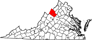
This is a list of the National Register of Historic Places listings in Rockingham County, Virginia.

<span class="mw-page-title-main">National Register of Historic Places listings in King George County, Virginia</span>

This is a list of the National Register of Historic Places listings in King George County, Virginia.

<span class="mw-page-title-main">National Register of Historic Places listings in Louisa County, Virginia</span>

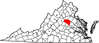
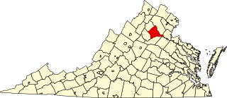
This is a list of the National Register of Historic Places listings in Louisa County, Virginia.

<span class="mw-page-title-main">National Register of Historic Places listings in Northampton County, Virginia</span>

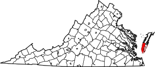
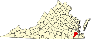
This is a list of the National Register of Historic Places listings in Northampton County, Virginia.

<span class="mw-page-title-main">National Register of Historic Places listings in Petersburg, Virginia</span>

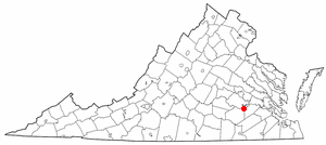
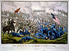
This is a list of the National Register of Historic Places listings in Petersburg, Virginia.

'.

<span class="mw-page-title-main">National Register of Historic Places listings in Wythe County, Virginia</span>

This is a list of the National Register of Historic Places listings in Wythe County, Virginia.

<span class="mw-page-title-main">National Register of Historic Places listings in Patrick County, Virginia</span>

This is a list of the National Register of Historic Places listings in Patrick County, Virginia.

<span class="mw-page-title-main">National Register of Historic Places listings in Russell County, Virginia</span>

This is a list of the National Register of Historic Places listings in Russell County, Virginia.

<span class="mw-page-title-main">National Register of Historic Places listings in Craig County, Virginia</span>

This is a list of the National Register of Historic Places listings in Craig County, Virginia.

<span class="mw-page-title-main">National Register of Historic Places listings in Giles County, Virginia</span>

This is a list of the National Register of Historic Places listings in Giles County, Virginia.

<span class="mw-page-title-main">National Register of Historic Places listings in Floyd County, Virginia</span>

This is a list of the National Register of Historic Places listings in Floyd County, Virginia.

References

  1. The latitude and longitude information provided in this table was derived originally from the National Register Information System, which has been found to be fairly accurate for about 99% of listings. Some locations in this table may have been corrected to current GPS standards.
  2. National Park Service, United States Department of the Interior, "National Register of Historic Places: Weekly List Actions", retrieved February 3, 2023.
  3. 1 2 Numbers represent an alphabetical ordering by significant words. Various colorings, defined here, differentiate National Historic Landmarks and historic districts from other NRHP buildings, structures, sites or objects.
  4. "National Register Information System". National Register of Historic Places . National Park Service. April 24, 2008.
  5. The eight-digit number below each date is the number assigned to each location in the National Register Information System database, which can be viewed by clicking the number.
  6. McCary, Ben C. "A Workshop Site of Early Man in Dinwiddie County, Virginia". American Antiquity 17.1 (1951): 9-17: 11.