Dinwiddie County | |
---|---|
Coordinates: 37°05′N77°38′W / 37.08°N 77.63°W | |
Country | United States |
State | Virginia |
Founded | 1752 |
Named for | Robert Dinwiddie |
Seat | Dinwiddie |
Largest town | McKenney |
Area | |
• Total | 507 sq mi (1,310 km2) |
• Land | 504 sq mi (1,310 km2) |
• Water | 3.5 sq mi (9 km2) 0.7% |
Population (2020) | |
• Total | 27,947 |
• Density | 55/sq mi (21/km2) |
Time zone | UTC−5 (Eastern) |
• Summer (DST) | UTC−4 (EDT) |
Congressional district | 4th |
Website | www |
Dinwiddie County is a county located in the Commonwealth of Virginia. As of the 2020 census, the population was 27,947. [1] Its county seat is Dinwiddie. [2]
Dinwiddie County is part of the Richmond, VA Metropolitan Statistical Area.
The first inhabitants of the area were Paleo-Indians, prior to 8000 BC. They are believed to have been nomadic hunter-gatherers following animal migrations. Early stone tools have been discovered in various fields within the county. At the time of European contact, Native Americans made their homes in the region.
Dinwiddie County was formed May 1, 1752, from Prince George County. The county is named for Robert Dinwiddie, Lieutenant Governor of Virginia, 1751–58. The county raised several militia units that would fight in the American Revolution.
Dinwiddie County was the birthplace of Elizabeth (Burwell) Hobbs Keckly, a free black dressmaker who worked for two presidents' wives: Mrs. Jefferson Davis and later Mary Todd Lincoln. Thomas Day was also a native; he was well known later at Milton, North Carolina, as a free black cabinetmaker. Another native son was Dr. Thomas Stewart, perhaps America's first free black 18th-century rural physician. [3]
During the Civil War the Battle of Lewis's Farm was fought along Quaker Road [Rt. 660]. It took place on March 29, 1865. This was the first in several attempts by Union General Ulysses S. Grant to cut Robert E. Lee's final supply line—the Southside Railroad—in the spring of 1865. Here the Union forces led by Brig. Gen. Joshua L. Chamberlain engaged Confederates under Maj. Gen. Bushrod R. Johnson. After sharp fighting, the Union troops entrenched nearby along the Boydton Plank Road, and Johnson withdrew to his lines at White Oak Road. The Union army cut the rail line four days later, after capturing Five Forks on April 1, 1865, at the Battle of Five Forks. Several other engagements were fought in Dinwiddie County, including the Battle of Dinwiddie Court House, Battle of Sutherland's Station, and Battle of White Oak Road.
The Dinwiddie County Historical Society currently occupies the historic Dinwiddie County Court House.
Dinwiddie is located in southern Virginia, southwest of the independent city of Petersburg, which separated from the county (and adjacent Prince George County) in 1871. According to the U.S. Census Bureau, the county has a total area of 507 square miles (1,310 km2), of which 504 square miles (1,310 km2) is land and 3.5 square miles (9.1 km2) (0.7%) is water. [4] It is located between two US Army forts, Fort Gregg-Adams to the east and Fort Barfoot to the west.
Census | Pop. | Note | %± |
---|---|---|---|
1790 | 13,934 | — | |
1800 | 15,374 | 10.3% | |
1810 | 18,190 | 18.3% | |
1820 | 20,482 | 12.6% | |
1830 | 21,901 | 6.9% | |
1840 | 22,558 | 3.0% | |
1850 | 25,118 | 11.3% | |
1860 | 30,198 | 20.2% | |
1870 | 30,702 | 1.7% | |
1880 | 32,870 | 7.1% | |
1890 | 13,515 | −58.9% | |
1900 | 15,374 | 13.8% | |
1910 | 15,442 | 0.4% | |
1920 | 17,949 | 16.2% | |
1930 | 18,492 | 3.0% | |
1940 | 18,166 | −1.8% | |
1950 | 18,839 | 3.7% | |
1960 | 22,183 | 17.8% | |
1970 | 25,046 | 12.9% | |
1980 | 22,602 | −9.8% | |
1990 | 20,960 | −7.3% | |
2000 | 24,533 | 17.0% | |
2010 | 28,001 | 14.1% | |
2020 | 27,947 | −0.2% | |
2021 (est.) | 27,912 | [5] | −0.1% |
U.S. Decennial Census [6] 1790–1960 [7] 1900–1990 [8] 1990–2000 [9] 2010 [10] 2020 [11] |
Race / Ethnicity (NH = Non-Hispanic) | Pop 2010 [10] | Pop 2020 [11] | % 2010 | % 2020 |
---|---|---|---|---|
White alone (NH) | 17,617 | 17,346 | 62.92% | 62.07% |
Black or African American alone (NH) | 9,134 | 8,115 | 32.62% | 29.04% |
Native American or Alaska Native alone (NH) | 83 | 91 | 0.30% | 0.33% |
Asian alone (NH) | 122 | 119 | 0.44% | 0.43% |
Pacific Islander alone (NH) | 7 | 3 | 0.02% | 0.01% |
Some Other Race alone (NH) | 18 | 102 | 0.06% | 0.36% |
Mixed Race or Multi-Racial (NH) | 346 | 1,043 | 1.24% | 3.73% |
Hispanic or Latino (any race) | 674 | 1,128 | 2.41% | 4.04% |
Total | 28,001 | 27,947 | 100.00% | 100.00% |
As of the census [12] of 2000, there were 24,533 people, 9,107 households, and 6,720 families residing in the county. The population density was 49 people per square mile (19 people/km2). There were 9,707 housing units at an average density of 19 units per square mile (7.3 units/km2). The racial makeup of the county was 64.55% White, 33.66% Black or African American, 0.22% Native American, 0.31% Asian, 0.04% Pacific Islander, 0.40% from other races, and 0.82% from two or more races. 0.97% of the population were Hispanic or Latino of any race.
There were 9,107 households, out of which 32.10% had children under the age of 18 living with them, 54.80% were married couples living together, 13.90% had a female householder with no husband present, and 26.20% were non-families. 22.20% of all households were made up of individuals, and 8.50% had someone living alone who was 65 years of age or older. The average household size was 2.58 and the average family size was 3.01.
In the county, the population was spread out, with 24.00% under the age of 18, 6.70% from 18 to 24, 30.90% from 25 to 44, 26.20% from 45 to 64, and 12.20% who were 65 years of age or older. The median age was 38 years. For every 100 females, there were 98.80 males. For every 100 females age 18 and over, there were 96.00 males.
The median income for a household in the county was $41,582, and the median income for a family was $47,961. Males had a median income of $32,860 versus $24,346 for females. The per capita income for the county was $19,122. About 6.60% of families and 9.30% of the population were below the poverty line, including 11.60% of those under age 18 and 12.60% of those age 65 or over.
Dinwiddie County is currently represented by Republican Frank Ruff of the 15th district and Democrat Joe Morrissey of the 16th district in the Virginia Senate. In the Virginia House of Delegates, the county is represented by Republicans Kim Taylor of the 63rd district and Otto Wachsmann of the 75th district. The county is represented by Democrat Jennifer McClellan of Virginia's 4th congressional district in the U.S. House of Representatives.
Year | Republican | Democratic | Third party | |||
---|---|---|---|---|---|---|
No. | % | No. | % | No. | % | |
2020 | 8,695 | 57.61% | 6,224 | 41.24% | 173 | 1.15% |
2016 | 7,447 | 54.86% | 5,765 | 42.47% | 363 | 2.67% |
2012 | 6,875 | 50.59% | 6,550 | 48.20% | 164 | 1.21% |
2008 | 6,526 | 50.62% | 6,246 | 48.45% | 120 | 0.93% |
2004 | 6,193 | 57.14% | 4,569 | 42.15% | 77 | 0.71% |
2000 | 4,959 | 54.28% | 4,001 | 43.79% | 176 | 1.93% |
1996 | 3,503 | 42.90% | 3,871 | 47.40% | 792 | 9.70% |
1992 | 3,648 | 42.43% | 3,624 | 42.15% | 1,325 | 15.41% |
1988 | 4,165 | 54.38% | 3,405 | 44.46% | 89 | 1.16% |
1984 | 4,547 | 56.04% | 3,485 | 42.95% | 82 | 1.01% |
1980 | 3,369 | 48.01% | 3,475 | 49.52% | 174 | 2.48% |
1976 | 2,413 | 37.28% | 3,873 | 59.83% | 187 | 2.89% |
1972 | 3,314 | 62.47% | 1,901 | 35.83% | 90 | 1.70% |
1968 | 1,451 | 27.60% | 1,551 | 29.50% | 2,255 | 42.90% |
1964 | 2,096 | 48.91% | 2,182 | 50.92% | 7 | 0.16% |
1960 | 935 | 34.81% | 1,714 | 63.81% | 37 | 1.38% |
1956 | 807 | 30.71% | 1,282 | 48.78% | 539 | 20.51% |
1952 | 983 | 39.77% | 1,462 | 59.14% | 27 | 1.09% |
1948 | 261 | 17.40% | 961 | 64.07% | 278 | 18.53% |
1944 | 279 | 20.26% | 1,096 | 79.59% | 2 | 0.15% |
1940 | 264 | 18.86% | 1,129 | 80.64% | 7 | 0.50% |
1936 | 127 | 8.61% | 1,343 | 91.05% | 5 | 0.34% |
1932 | 104 | 9.12% | 1,028 | 90.18% | 8 | 0.70% |
1928 | 332 | 26.00% | 945 | 74.00% | 0 | 0.00% |
1924 | 122 | 14.70% | 685 | 82.53% | 23 | 2.77% |
1920 | 186 | 22.57% | 636 | 77.18% | 2 | 0.24% |
1916 | 85 | 12.54% | 592 | 87.32% | 1 | 0.15% |
1912 | 58 | 8.91% | 512 | 78.65% | 81 | 12.44% |
The Bureau of Economic Analysis combines the independent cities of Petersburg and Colonial Heights with Dinwiddie County for statistical purposes.
Appomattox Regional Library serves as the public library for the area.
Tallapoosa County is located in the east-central portion of the U.S. state of Alabama. As of the 2020 census, the population was 41,311. Its county seat is Dadeville. Its largest city is Alexander City.
Webster County is a county in the U.S. state of West Virginia. As of the 2020 census, the population was 8,378. Its county seat is Webster Springs. The county was founded in 1860 and named for Daniel Webster.
Wayne County is the westernmost county in the U.S. state of West Virginia. As of the 2020 census, the population was 38,982. Its county seat is Wayne. The county was founded in 1842 and named for General "Mad" Anthony Wayne. Wayne County is part of the Huntington–Ashland, WV–KY–OH Metropolitan Statistical Area.
Raleigh County is a county in the U.S. state of West Virginia. As of the 2020 census, the population was 74,591. Its county seat is Beckley. The county was founded in 1850 and is named for Sir Walter Raleigh. Raleigh County is included in the Beckley, West Virginia Metropolitan Statistical Area.
Mingo County is a county in the U.S. state of West Virginia. As of the 2020 census, the population was 23,568. Its county seat and largest city is Williamson. Created in 1895, Mingo is West Virginia's newest county, named for the historic Iroquoian Mingo people.
Hardy County is a county in the U.S. state of West Virginia. As of the 2020 census, the population was 14,299. Its county seat is Moorefield. The county was created from Hampshire County in 1786 and named for Samuel Hardy, a distinguished Virginian.
Calhoun County is a county in the U.S. state of West Virginia. As of the 2020 census, the population was 6,229, making it the third-least populous county in West Virginia. Its county seat is Grantsville. The county was founded in 1856 and named for South Carolina politician John C. Calhoun.
Boone County is a county in the U.S. state of West Virginia. As of the 2020 census, the population was 21,809. Its county seat is Madison. Boone County is part of the Charleston, WV Metropolitan Statistical Area. Leading industries and chief agricultural products in Boone County include coal, lumber, natural gas, tobacco, and strawberries.
Roanoke County is a county located in the U.S. state of the Commonwealth of Virginia. As of the 2020 census, the population was 96,929. Its county seat is Salem, but the county administrative offices are located in the census-designated place of Cave Spring.
Prince George County is a county located in the Commonwealth of Virginia. As of the 2020 census, the population was 43,010. Its county seat is Prince George.
Nottoway County is a county located in the Commonwealth of Virginia. As of the 2020 census, the population was 15,642. Its county seat is Nottoway. It is situated south of the James River, thus making it a part of the Southside Virginia Region.
Buchanan County is a United States county in far western Virginia, the only county in the state to border both West Virginia and Kentucky. The county is part of the Southwest Virginia region and lies in the rugged Appalachian Plateau portion of the Appalachian Mountains. Its county seat is Grundy.
Knox County is a county located in the northeast portion of the U.S. state of Missouri. As of the 2020 census, its population was 3,744, making it the third-least populous county in Missouri. Its county seat is Edina. The county was organized February 14, 1845, and named for U.S. Secretary of War General Henry Knox.
Sharkey County is a county located in the U.S. state of Mississippi. Part of the eastern border is formed by the Yazoo River. According to the 2020 census, the population was 3,800, making it the second-least populous county in Mississippi, after Issaquena County. Its county seat is Rolling Fork. The county is named after William L. Sharkey, the provisional Governor of Mississippi in 1865.
Delaware County is a county located in the U.S. state of Iowa. As of the 2020 census, the population was 17,488. The county seat is Manchester. The county takes its name after the U.S. state of Delaware.
Chester is a census-designated place (CDP) in Chesterfield County, Virginia, United States. Per the 2020 census, the population was 23,414.
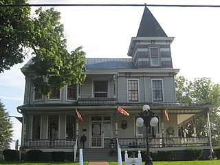
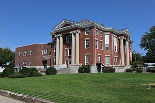
Petersburg is a city in Grant County, West Virginia, United States. The population was 2,251 at the 2020 census. It is the county seat of Grant County.
Mount Gay-Shamrock is a census-designated place (CDP) in Logan County, West Virginia, United States.
Northfork is a town in McDowell County, West Virginia, United States, located on U.S. Route 52 between Welch and Bluefield.
Sussex County is a rural county located in the southeast of the Commonwealth of Virginia. As of the 2020 census, the population was 10,829. Its county seat is Sussex. It was formed in 1754 from Surry County. The county is named after the county of Sussex, England.