Campbell County is part of the Lynchburg metropolitan area. At the 2020 census, the county population was 55,696.[2] The number of residents has grown steadily in every census after 1930, and the total population has more than doubled since that time.[3]
Lynchburg was established in Campbell County in 1786, incorporated as a town in 1805, and separated from Campbell County when it became an independent city in 1852. Lynchburg has annexed additional land from Bedford County and Campbell County through the years, most recently in 1976.
The Native American tribes of the Monacan, Iroquois, and Cherokee were the original inhabitants of the Campbell County area, but were later forced west due to the settlers' progress. Sir William Gooch, in 1727, created a couple of "inducements" in order to lure settlers to the Campbell County area. These inducements were that if one settled on the Staunton River "in the bounds of the newly formed County of Brunswick" then they would be freed from paying levies for ten years. The second "inducement" was that the settler could claim 400 acres simply by building a cabin on the land and by "planting a patch of grain".[citation needed]
Throughout the 18th century, multiple Scotch-Irish families would begin settling in the area, these names included the Irvins, the Mitchells, the McCues, the McElroys, McDowells, Campbells, and others. These families arrived on a ship known as the George and Ann, sailed by Captain Rymer, who, instead of going towards Philadelphia from Derry, planned to keep sailing around the coast until the passengers starved to death, so he could loot their valuables. However, a captain named Captain Lothrop spotted the ship in distress nearby Monomoy. Afterwards, the passengers were landed at Orleans, and these future settlers of Campbell County would travel south to investigate Sir William Gooch's inducements.[5][6]
The inducement's attempt to draw settlers was not vastly successful with the exception of a few new settlers, and the Governor soon took mention of his inducements to the ocean ports in which immigrants were arriving in America, as well as to the ports back in their homelands. This great difficulty in gaining new settlers for Campbell County is one of the reasons that the Governor allowed the Scotch-Irish immigrants with Presbyterian beliefs to gain religious freedom, in order to secure as many new settlers as possible for the newly founded county.[7]
Map of Campbell County, VirginiaSandborn Fire Insurance Map from Altavista, Campbell County, Virginia
Jeremiah Rust donated the land that would become the county's seat named Rustburg.[10] The towns of Altavista and Brookneal were created due to their business advantages as well as the "intersection of trails". Altavista was planned by a group of businessmen in 1907, due to its "strategic" location and "potential" as a new location for a railroad.[11]
From its earliest days, the county relied on tobacco as the primary cash crop and basis for the economy, though it also developed early manufacturing operations. Brookneal, with its strategic location on the Staunton River, was long an important tobacco and textile hub. However, the departure of manufacturing and the changing tobacco market has forced Campbell to transform from a mainly agricultural area into a mixture of suburban and rural communities.[9] Campbell County was also an iron manufacturer and begun operations Pre-Revolutionary War and continued operations in Oxford Iron Works until it was closed in 1875. The building is still standing today.[12]
Campbell County opened its first public school in 1871 after the Civil War. In 1878, Campbell County and Lynchburg became two separate entities when Lynchburg was recognized as an independent city. The first school fair was held in Rustburg, the county seat, in 1908. This was the first school fair ever held in Virginia and was started by the Virginia Federation of Women's Club, "with the aid of J.S. Thomas, then school examiner in the district, and with the agreement of the Van Dyke League to help in Campbell." This fair was a showcase of "expert knowledge and training," as well as each child's best work.[13]
Campbell County's religious origin predominantly included Protestant Christianity, with denominations such as Quakerism and Presbyterianism strongly represented. Early religious adherents sought religious freedom. They migrated from many places, but most migrated from Colonial Williamsburg and surrounding areas where the Episcopal Church hampered the practice of other religions.[15]
South River Friends Quaker Meeting House
The Quakers gained a foothold within the Campbell County area due to Sarah Clark Lynch, wife of Charles Lynch, the founder of the ferry boat service across the James River and mother of John Lynch, the founder of Lynchburg. Due to Sarah Lynch's influence their application for a meeting house was approved, and the South River Friends Meeting House was built. The Quakers later migrated from the area due to disagreements with the other Campbell County populace over issues such as slavery and the American Revolution. The Quakers maintained pacifist beliefs and during the American Revolution they espoused a standpoint of neutrality and stated that warfare went against their belief system. This apparent refusal to aid their neighbors in their fight for independence greatly angered many and created a wedge between the Quakers and the Non-Quakers.[16] The Quakers also adamantly believed in the abolition of slavery and preached how the institution was wrong and should be disallowed. In 1817 they freed all of their slaves. These actions created additional tension with their slave-holding neighbors and caused many Quakers to leave the Campbell County area and to move West.[17]
The Presbyterian religious faction mainly consisted of Scotch-Irish who originally came to America in order to gain religious freedom from the "Established Church in Ireland" and to create a better life for themselves. They originally settled in Pennsylvania, but then moved to Virginia due to Governor Gooch's inducements to entice settlers to come to Campbell County.[7] The Presbyterians and their descendants then remained in Campbell County, and others who had been with them on the trip to America soon followed after, greatly aiding in the settlement process.[18]
Geography
According to the U.S. Census Bureau, the county has a total area of 507 square miles (1,313.1km2), of which 504 square miles (1,305.4km2) is land and 3 square miles (7.8km2) (0.55%) is water.
Campbell County, Virginia – Racial and ethnic composition Note: the US Census treats Hispanic/Latino as an ethnic category. This table excludes Latinos from the racial categories and assigns them to a separate category. Hispanics/Latinos may be of any race.
As of the census of 2000, there were 51,078 people, 20,639 households, and 14,694 families residing in the county. The population density was 101 peopleper square mile (39 people/km2). There were 22,088 housing units at an average density of 44 unitsper square mile (17 units/km2). The racial makeup of the county was 83.24% White, 14.71% Black or African American, 0.19% Native American, 0.62% Asian, 0.01% Pacific Islander, 0.33% from other races, and 0.90% from two or more races. 0.83% of the population were Hispanic or Latino of any race.[25]
There were 20,639 households, out of which 30.80% had children under the age of 18 living with them, 56.00% were married couples living together, 11.40% had a female householder with no husband present, and 28.80% were non-families. 24.60% of all households were made up of individuals, and 8.80% had someone living alone who was 65 years of age or older. The average household size was 2.45 and the average family size was 2.91.[25]
In the county, the age distribution of the population showed 24.00% under the age of 18, 7.70% from 18 to 24, 29.30% from 25 to 44, 25.60% from 45 to 64, and 13.50% who were 65 years of age or older. The median age was 38 years. For every 100 females there were 95.30 males. For every 100 females age 18 and over, there were 92.30 males.[25]
The median income for a household in the county was $37,280, and the median income for a family was $42,901. Males had a median income of $32,108 versus $22,286 for females. The per capita income for the county was $18,134. About 7.90% of families and 10.60% of the population were below the poverty line, including 14.10% of those under age 18 and 10.90% of those age 65 or over.[25]
Campbell County is represented by Mark J. Peake in the Virginia Senate[26], Wendell Walker, Eric Zehr, and Mark Peake in the Virginia House of Delegates, and Bob Good in the U.S. House of Representatives.
United States presidential election results for Campbell County, Virginia[27]
Somerset County is the southernmost county in the U.S. state of Maryland. As of the 2020 census, the population was 24,620, making it the second-least populous county in Maryland. The county seat is Princess Anne.
Warren County is a U.S. county located in the Commonwealth of Virginia. The 2020 census places Warren County within the Washington-Arlington-Alexandria, DC-VA-MD-WV Metropolitan Statistical Area with a population of 40,727. The county was established in 1836. The county seat is Front Royal.
Lynchburg is an independent city in the Commonwealth of Virginia in the United States. First settled in 1757 by ferry owner John Lynch, the city's population was 79,009 at the 2020 census, making Lynchburg the 11th most populous city in Virginia. Located in the foothills of the Blue Ridge Mountains along the banks of the James River, Lynchburg is known as the "City of Seven Hills" or the "Hill City". In the 1860s, Lynchburg was the only city in Virginia that was not recaptured by the Union before the end of the American Civil War.
Buckingham County is a rural United States county located in the Commonwealth of Virginia, and containing the geographic center of the state. Buckingham County is part of the Piedmont region of Virginia, and the county seat is Buckingham.
Bedford County is a United States county located in the Piedmont region of the Commonwealth of Virginia. Its county seat is the town of Bedford, which was an independent city from 1968 until rejoining the county in 2013.
Amherst County is a county, located in the Piedmont region and near the center of the Commonwealth of Virginia in the United States. The county is part of the Lynchburg Metropolitan Statistical Area, and its county seat is also named Amherst.
Franklin County is a county on the eastern border of the U.S. state of Indiana. In the 2020 United States Census, the county population was 22,785. The county seat is the town of Brookville. Franklin County is part of the Cincinnati, OH–KY–IN Metropolitan Statistical Area. The only incorporated city in Franklin County is Batesville, which lies mostly in adjoining Ripley County.
Brookville is a village located within the Town of Oyster Bay in Nassau County, on the North Shore of Long Island, in New York, United States. The population was 2,939 at the time of the 2020 census.
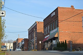
Altavista is an incorporated town in Campbell County, Virginia. The town is in the Lynchburg Metropolitan Area, and its population was 3,378 at the 2020 census. It was founded as Lane's Siding in 1907 by John E. Lane and Henry L. Lane of the Lane Company, and was chartered on September 1912.
Brookneal is an incorporated town in Campbell County, Virginia, United States. The population was 1,090 as of the 2020 census. It is part of the Lynchburg Metropolitan Statistical Area.
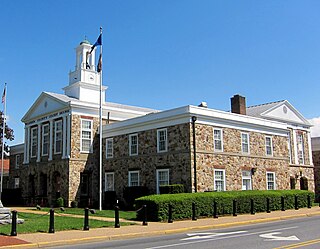
Rustburg is a census-designated place (CDP) in and the county seat of Campbell County, Virginia, United States. The population was 1,585 at the 2020 census. It is part of the Lynchburg Metropolitan Statistical Area.
Timberlake is a census-designated place (CDP) in Campbell County, Virginia, United States. The population was 13,267 at the 2020 census. It is part of the Lynchburg Metropolitan Statistical Area.
Charles Lynch was an American planter, politician, military officer and judge who headed a kangaroo court in Virginia to punish Loyalists during the Revolutionary War. The terms "lynching" and "lynch law" are believed to be derived from his surname.
Southside, or Southside Virginia, has traditionally referred to the portion of the state south of the James River, the geographic feature from which the term derives its name. This was the first area to be developed in the colonial period.
The Lynchburg Metropolitan Statistical Area is a United States Metropolitan Statistical Area (MSA) in the state of Virginia, as defined by the Office of Management and Budget (OMB) as of June 2003. As of the 2000 census, the MSA had a population of 228,616. In 2009 this was estimated to have risen to 247,447; as of 2016, the Lynchburg MSA was estimated to have a population of 260,320, making it the fifth-largest metro area in the state.
Scotch-IrishAmericans are American descendants of Ulster Scots people who emigrated from Ulster to America during the 18th and 19th centuries. Their ancestors had originally migrated to Ulster mainly from the Scottish Lowlands and Northern England in the 17th century. In the 2017 American Community Survey, 5.39 million reported Scottish ancestry, an additional 3 million identified more specifically with Scotch-Irish ancestry, and many people who claim "American ancestry" may actually be of Scotch-Irish ancestry.
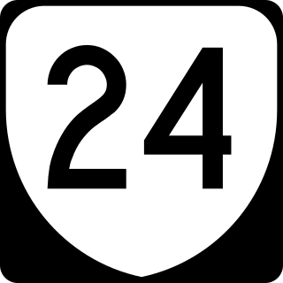
State Route 24 is a primary state highway in the U.S. state of Virginia. The state highway runs 89.57 miles (144.15 km) from U.S. Route 221 and SR 116 in Roanoke east to US 60 in Mt. Rush. SR 24 connects Roanoke with several small communities in southern Bedford County and central Campbell County. The state highway also runs concurrently with US 460 west of Appomattox and passes through Appomattox Court House National Historical Park, which is the site of Robert E. Lee's final stand and surrender in the American Civil War.
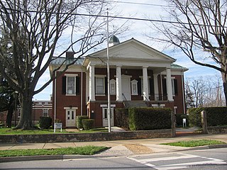
Rustburg High School is a public school for grades nine through twelve, in Rustburg, Virginia. It is one of four high schools that are part of the Campbell County Public Schools, along with Altavista High School, Brookville High School, and William Campbell High School.
The Central Virginia Governor's School for Science and Technology (CVGS) is a regional school in Lynchburg, Virginia directed by Dr. Stephen Smith. Students are chosen from Lynchburg-area county and city schools. Schools participating in the Governor's School include those from Amherst County, Appomattox County, Bedford County, Campbell County, and the City of Lynchburg.
Campbell County Public Schools is a school district which serves Campbell County, Virginia, United States. It is based in Rustburg, Virginia. The superintendent is Dr. Robert Johnson.
References
↑ "Find a County". National Association of Counties. Archived from the original on May 31, 2011. Retrieved June 7, 2011.
↑ Fawcett, Marian (1963). An Historical Sketch of Campbell County, Virginia. p.8.
↑ Fawcett, Marian (1963). An Historical Sketch of Campbell County, Virginia. pp.2, 4–5.
↑ Fawcett, Marian (1963). An Historical Sketch of Campbell County, Virginia. pp.4–5.
↑ Our Quaker Friends of Ye Olden Time: Being in Part a Transcript of the Minute Books of Cedar Creek Meeting, Hanover County, and the South River Meeting. Lynchburg: J.P. Bell Co., Pub. 1905. p.176.
↑ Fawcett, Marian (1963). An Historical Sketch of Campbell County, Virginia. p.3.
This page is based on this Wikipedia article Text is available under the CC BY-SA 4.0 license; additional terms may apply. Images, videos and audio are available under their respective licenses.