Neighbor Mountain

Last updated
Neighbor Mountain

Neighbor Mountain.jpg

View along Neighbor Mountain from Jeremy's Run Overlook
Highest point
Elevation 2,612 ft (796 m)
Coordinates 38°41′46″N78°21′27″W / 38.69611°N 78.35750°W / 38.69611; -78.35750
Geography
Location Page County, Virginia, U.S.
Parent range Blue Ridge Mountains
Climbing
Easiest route Skyline Drive

Neighbor Mountain is a mountain in Page and Rappahannock Counties, Virginia, near the city of Luray. It is part of the Blue Ridge Mountains. Its summit lies in Page County, within Shenandoah National Park.

Mountain A large landform that rises fairly steeply above the surrounding land over a limited area

A mountain is a large landform that rises above the surrounding land in a limited area, usually in the form of a peak. A mountain is generally steeper than a hill. Mountains are formed through tectonic forces or volcanism. These forces can locally raise the surface of the earth. Mountains erode slowly through the action of rivers, weather conditions, and glaciers. A few mountains are isolated summits, but most occur in huge mountain ranges.

Page County, Virginia County in the United States

Page County is a county located in the Commonwealth of Virginia. As of the 2010 census, the population was 24,042. Its county seat is Luray. Page County was formed in 1831 from Shenandoah and Rockingham counties and was named for John Page, Governor of Virginia from 1802 to 1805.

Virginia State of the United States of America

Virginia, officially the Commonwealth of Virginia, is a state in the Southeastern and Mid-Atlantic regions of the United States located between the Atlantic Coast and the Appalachian Mountains. Virginia is nicknamed the "Old Dominion" due to its status as the first English colonial possession established in mainland North America and "Mother of Presidents" because eight U.S. presidents were born there, more than any other state. The geography and climate of the Commonwealth are shaped by the Blue Ridge Mountains and the Chesapeake Bay, which provide habitat for much of its flora and fauna. The capital of the Commonwealth is Richmond; Virginia Beach is the most populous city, and Fairfax County is the most populous political subdivision. The Commonwealth's estimated population as of 2018 is over 8.5 million.

Contents

Geology

Geologically speaking, the mountain is situated in the northern subprovince of the Blue Ridge Province of the Appalachian Highlands. It is part of the Crystalline Appalachians. Neighbor Mountain is separated from parallel Knob Mountain to the west by a stream known as Jeremy's Run.

Blue Ridge Mountains mountain range

The Blue Ridge Mountains are a physiographic province of the larger Appalachian Mountains range. The mountain range is located in the eastern United States, and extends 550 miles southwest from southern Pennsylvania through Maryland, West Virginia, Virginia, North Carolina, South Carolina, Tennessee and Georgia. This province consists of northern and southern physiographic regions, which divide near the Roanoke River gap. To the west of the Blue Ridge, between it and the bulk of the Appalachians, lies the Great Appalachian Valley, bordered on the west by the Ridge and Valley province of the Appalachian range.

Jeremy's Run is a stream in Page County, Virginia.

Political Boundaries

The crest of the northern arm of Neighbor Mountain forms part of the border between Page and Rappahanock Counties. Page County is located to the west of the ridge, whereas Rappahannock County is to the east.

Rappahannock County, Virginia County in the United States

Rappahannock County is a county located in the Commonwealth of Virginia, US. As of the 2010 census, the population was 7,373. Its county seat is Washington. The name "Rappahannock" comes from the Algonquian word lappihanne, meaning "river of quick, rising water" or "where the tide ebbs and flows."

As the mountain curves south-west, the county border follows the topographical spine of the Blue Ridge from Neighbor Mountain onto Pass Mountain to the south, and the south-western arm lies entirely within Page County. On this south-western arm are a series of knobs known as "Three Sisters."

Visiting Neighbor Mountain

Neighbor Mountain is accessible via Skyline Drive, which runs along the ridge of the mountain's northern arm. The Appalachian Trail also runs parallel to Skyline Drive along this part of the mountain. The south-western arm of the mountain is accessible from the Appalachian Trail via the Neighbor Mountain Trail. Skyline Drive offers two scenic overlooks on the mountain. Jeremy's Run Overlook is situated on the northern arm, while Thornton Hollow Overlook is situated near the summit.

Skyline Drive National Scenic Byway in Shenandoah National Park, Virginia, USA

Skyline Drive is a 105-mile (169 km) road that runs the entire length of the National Park Service's Shenandoah National Park in the Blue Ridge Mountains of Virginia, generally along the ridge of the mountains. The drive's northern terminus is at an intersection with U.S. Route 340 near Front Royal, and the southern terminus is at an interchange with US 250 near Interstate 64 (I-64) in Rockfish Gap, where the road continues south as the Blue Ridge Parkway. The road has intermediate interchanges with US 211 in Thornton Gap and US 33 in Swift Run Gap. Skyline Drive is part of Virginia State Route 48, which also includes the Virginia portion of the Blue Ridge Parkway, but this designation is not signed.

Appalachian Trail Hiking trail in the USA

The Appalachian National Scenic Trail, generally known as the Appalachian Trail or simply the A.T., is a marked hiking trail in the Eastern United States extending between Springer Mountain in Georgia and Mount Katahdin in Maine. The trail is about 2,200 miles (3,500 km) long, though the exact length changes over time as parts are modified or rerouted. The Appalachian Trail Conservancy describes the Appalachian Trail as the longest hiking-only trail in the world. More than 2 million people are said to take a hike on part of the trail at least once each year.

Related Research Articles

Blue Ridge Parkway scenic parkway in the United States

The Blue Ridge Parkway is a National Parkway and All-American Road in the United States, noted for its scenic beauty. The parkway, which is America's longest linear park, runs for 469 miles (755 km) through 29 Virginia and North Carolina counties, linking Shenandoah National Park to Great Smoky Mountains National Park. It runs mostly along the spine of the Blue Ridge, a major mountain chain that is part of the Appalachian Mountains. Its southern terminus is at U.S. 441 on the boundary between Great Smoky Mountains National Park and the Cherokee Indian Reservation in North Carolina, from which it travels north to Shenandoah National Park in Virginia. The roadway continues through Shenandoah as Skyline Drive, a similar scenic road which is managed by a different National Park Service unit. Both Skyline Drive and the Virginia portion of the Blue Ridge Parkway are part of Virginia State Route 48, though this designation is not signed.

Spruce Knob mountain in United States of America

Spruce Knob, at 4,863 feet (1,482 m), is the highest point in the state of West Virginia and the summit of Spruce Mountain, the highest peak in the Allegheny Mountains.

Massanutten Mountain mountain in United States of America

Massanutten Mountain is a synclinal ridge in the Ridge-and-Valley Appalachians, located in the U.S. state of Virginia. It is near the West Virginia state line.

Thornton Gap wind gap in Virginia, United States

Thornton Gap is a wind gap located in the Blue Ridge Mountains in Virginia separating the Shenandoah Valley from the Piedmont region of the state.

The Appalachian National Scenic Trail spans fourteen U.S. states during its roughly 2,200 miles (3,500 km)-long journey: Georgia, North Carolina, Tennessee, Virginia, West Virginia, Maryland, Pennsylvania, New Jersey, New York, Connecticut, Massachusetts, Vermont, New Hampshire, and Maine. It begins at Springer Mountain, Georgia, and follows the ridgeline of the Appalachian Mountains, crossing many of its highest peaks and running with only a few exceptions almost continuously through wilderness before ending at Mount Katahdin, Maine.

Roan Mountain (Roan Highlands) mountain in United States of America

Roan Mountain is the highpoint of the Roan-Unaka Range of the Southern Appalachian Mountains, located in the Southeastern United States. The mountain is clad in a dense stand of Southern Appalachian spruce-fir forest, and includes the world's largest natural rhododendron garden, and the longest stretch of grassy bald in the Appalachian range. The Cherokee National Forest and Pisgah National Forest converge atop the mountain, with Roan Mountain State Park located near its northern base. The Appalachian Trail crosses most of the Roan's crest. The Roan High Knob Shelter is the highest backcountry shelter on the entire 2,174-mile (3,499 km) trail.

Waterrock Knob mountain in United States of America

Waterrock Knob is a mountain peak in the U.S. state of North Carolina. It is the highest peak in the Plott Balsams and is the 16th-highest mountain in the Eastern United States.

Mount Chapman mountain in Great Smoky Mountains, USA

Mount Chapman is a mountain in the Great Smoky Mountains, located in the Southeastern United States. It has an elevation of 6,417 feet above sea level. While the mountain is located deep within the Great Smokies, the Appalachian Trail crosses its eastern slope, coming to within 200 feet (61 m) of the summit. Mount Chapman is among the 10 highest mountains in the Appalachian range, if subpeaks are not included.

Back Allegheny Mountain in West Virginia

Back Allegheny Mountain is a long mountain ridge in eastern West Virginia. It is part of the Shavers Fork Mountain Complex in the Allegheny Range of the Appalachians.

Sugarland Mountain Trail

The Sugarland Mountain Trail is an American hiking trail, in the Great Smoky Mountains National Park of Sevier County, Tennessee. The trail traverses Sugarland Mountain, a massive ridge running perpendicular to the main crest of the Smokies and effectively dividing the park's north-central section from its northwestern section. Sugarland Mountain is flanked by the deep upper valleys of two of the park's major watersheds— the West Fork of the Little Pigeon River and Little River. The trail passes through several forest types, including deciduous forest at lower elevations, heaths ("hells") along the mountain's backbone formations, and a stand of Southern Appalachian spruce-fir forest in the upper elevations. Occasional breaks in the foliage allow for views of Mount Le Conte and Sevier County to the east and Blanket Mountain and the ridges above Elkmont to the west.

Snake Den Ridge Trail

The Snake Den Ridge Trail is an American hiking trail in the Great Smoky Mountains National Park of Cocke County, Tennessee. Winding its way up the backbone-like crest of Snake Den Ridge, the trail connects the Cosby Campground to the Appalachian Trail and provides the quickest access to the high peaks of the Eastern Smokies. The trail passes through three forest types— a mixed deciduous forest at its lower elevations, a substantial stand of heath bald on the more narrow sections of the ridge crest, and an old growth northern-style coniferous forest at its higher elevations.

Marks Knob

Marks Knob is a mountain in the Great Smoky Mountains, in the southeastern United States. It has an elevation of 6,169 feet (1,880 m), with 249 feet (76 m) of clean prominence. Its summit— located near the center of the Eastern Smokies amidst a dense stand of Southern Appalachian spruce-fir forest— is a popular bushwhacking destination and one of the most difficult-to-reach summits of the Southern Sixers.

Pignut Mountain mountain in United States of America

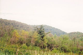
Pignut Mountain is a mountain in Rappahannock County, Virginia. It is part of the Blue Ridge Mountains. Its summit lies within Shenandoah National Park.

Knob Mountain Mountain in the Appalachian range

Knob Mountain is a mountain in Page County, Virginia. It is part of the Blue Ridge Mountains. Its summit lies within Shenandoah National Park at an elevation of 2,671 ft.

Plott Balsams

The Plott Balsams are a mountain range in western North Carolina, in the southeastern United States. They are part of the Blue Ridge Mountain Province of the Southern Appalachian Mountains. The Plott Balsams stretch from the city of Sylva in the Tuckasegee River valley to the southwest to Maggie Valley in the northeast. The Great Smoky Mountains border the Plott Balsams to the north and the Great Balsam Mountains border the range to the south. The range comprises parts of Jackson County and Haywood County.

Hogback Mountain (Shenandoah National Park, Virginia)

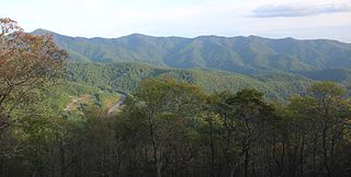
Hogback Mountain is the highest peak in the northern portion of Shenandoah National Park as well as the highest point in Warren County in northern Virginia, United States. A part of the Blue Ridge Mountains, it is located along the border of Warren and Rappahannock counties. It is easily accessible via Skyline Drive and the Appalachian Trail.