
West Virginia Route 259 is a state highway in the U.S. state of West Virginia. The state highway runs 45.6 miles (73.4 km) from the Virginia state line near Mathias north to the Virginia state line at High View. At both termini, the road continues as Virginia State Route 259. WV 259 passes through Hardy and Hampshire counties and runs concurrently with WV 55 on Corridor H between Baker and Wardensville.
Lehew is an unincorporated community in Hampshire County, West Virginia, United States on the Virginia state line. Lehew is located on Timber Ridge along West Virginia Route 259 at its crossroads with H.G. Brill Road and White Pine Ridge Road.

The Trough is a 6-mile long wooded gorge carved by the South Branch Potomac River (SBPR) and situated in the Allegheny Mountains of Hampshire and Hardy Counties, West Virginia, USA. The area was the site of a 1756 skirmish of the French and Indian War, known as the "Battle of the Trough".
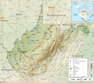
The Potomac Highlands of West Virginia centers on five West Virginian counties in the upper Potomac River watershed in the western portion of the state's Eastern Panhandle, bordering Maryland and Virginia. Because of geographical proximity, similar topography and landscapes, and shared culture and history, the Potomac Highlands region also includes Pocahontas, Randolph, and Tucker counties, even though they are in the Monongahela River or New River watersheds and not that of the Potomac River.

Mill Creek Mountain is a continuous mountain ridge that runs northeast through Hampshire and Hardy counties in the Eastern Panhandle region of the U.S. state of West Virginia. Rising to its greatest elevation of 2,650 feet (808 m) at High Knob, Mill Creek is a folded mountain ridge, belonging to the Ridge-and-Valley Appalachians. Mill Creek Mountain forms the western edge of the South Branch Potomac River Valley and is named for Mill Creek that carves through it at Mechanicsburg Gap allowing the Northwestern Turnpike to pass through as well. Along with Sawmill Ridge, Mill Creek Mountain forms the Trough along the South Branch.
Cooper Mountain runs southwest northeast through Hampshire County in West Virginia's Eastern Panhandle, rising to its greatest elevation of 2,028 feet (618 m) above sea-level at Bens Knob. The mountain's other knob, Butchers Knob, has an elevation of 1,783 feet (543 m). Cooper Mountain is flanked to its west by North River Mountain and to its east by Parks Valley and Dillons Run. The Northwestern Turnpike crosses Cooper Mountain at Loom between Hanging Rock and Capon Bridge. Tourists and travelers on U.S. Route 50 pull off at the Cooper Mountain overlook for the views over Parks Valley, Capon Bridge, and the ridges of Virginia.
Patterson Creek Mountain is a mountain ridge that forms the border between Mineral and Hampshire counties and Grant and Hardy Counties in West Virginia's Eastern Panhandle. The mountain's namesake, Patterson Creek, parallels its western flank. The southern end of the Patterson Creek Mountain is near the confluence of Lunice Creek and the South Branch Potomac River and its northern end is located southwest of Springfield. The mountain reaches its highest elevation at Charles Knob.
Baker Mountain is a mountain ridge in southeastern Hampshire County, West Virginia. The mountain runs southwest northeast between Yellow Spring and the Hardy County line. Baker Mountain is flanked to its east by the Cacapon River with West Virginia Route 259 running parallel between the two. Its forests were once used as a major source of timber for the Baltimore and Ohio Railroad's rail ties. For this reason, the Winchester and Western Railroad was constructed through the Capon Valley in the 1920s to haul the timber harvested in the region to Winchester, Virginia for railroad tie production. The communities of Capon Lake and Intermont lie at the foot of Baker Mountain on the Cacapon.
Elleber Ridge is the name of a ridge in the Allegheny Mountains of West Virginia and it is also the name of the mountain's summit, Elleber Knob (4,595 ft). It is located in the eastern portion of Pocahontas County near the Virginia state line. The ridge and summit are located entirely in the Monongahela National Forest. Rattlesnake Trail runs from the base of the mountain to Elleber Knob. The summit is also accessible via Elleber Sods Road, which is maintained by the National Forest.
Jericho is an unincorporated community in Hampshire County in the U.S. state of West Virginia on the Virginia line. It is located on West Virginia Route 259 between High View and Lehew atop Timber Ridge.
Castle Mountain is a forested mountain ridge that lies along the Cacapon River south of its confluence with the North River at Forks of Cacapon in Hampshire County, West Virginia, United States. The mountain is named for the Caudy's Castle rock outcrop pillar that lies on its southern end overlooking the Cacapon River. Castle Run, which runs along its western flank into the North River, also takes its name from the outcrop. The ridge runs from southwest to northeast and can be viewed from the Bloomery Pike.
Mill Branch is a 9.1-mile-long (14.6 km) tributary stream of the Cacapon River, belonging to the Potomac River and Chesapeake Bay watersheds. The stream is located in eastern Hampshire County in West Virginia's Eastern Panhandle.
The Environment of West Virginia encompasses terrain and ecosystems ranging from plateaus to mountains. Most of West Virginia lies within the Appalachian mixed mesophytic forests ecoregion, while the higher elevations along the eastern border and in the panhandle lie within the Appalachian-Blue Ridge forests.
Short Mountain is a mountain ridge that runs southwest northeast through Hampshire and Hardy counties in West Virginia's Eastern Panhandle, rising to its greatest elevation at Bald Knob near Arkansaw, West Virginia. Short Mountain's name is derived from its original name of Short Arse Mountain.
Bear Garden Mountain is a forested mountain ridge of the Ridge-and-valley Appalachians in Hampshire County, West Virginia and Frederick County, Virginia.

North Fork Mountain is a quartzite-capped mountain ridge in the Ridge and Valley physiographic province of the Allegheny Mountains, also known as the High Alleghenies or Potomac Highlands, of eastern West Virginia. Kile Knob, at 4,588 feet, is the mountain's highest point, and Panther Knob and Pike Knob are nearly as high.

Spruce Mountain, located in eastern West Virginia, is the highest ridge of the Allegheny Mountains. The whale-backed ridge extends for only 16 miles (26 km) from northeast to southwest, but several of its peaks exceed 4,500 feet (1,400 m) in elevation. The summit, Spruce Knob, is the highest Allegheny Mountain point both in the state and the entire range, which spans four states.
Concord is an unincorporated community and former post office in southeastern Hampshire County in the U.S. state of West Virginia. It is located along Eldridge Road between the unincorporated communities of Lehew and Yellow Spring.

