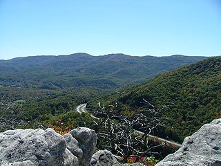
The Cumberland Mountains are a mountain range in the southeastern section of the Appalachian Mountains. They are located in western Virginia, southwestern West Virginia, the eastern edges of Kentucky, and eastern middle Tennessee, including the Crab Orchard Mountains. Their highest peak, with an elevation of 4,223 feet (1,287 m) above mean sea level, is High Knob, which is located near Norton, Virginia.

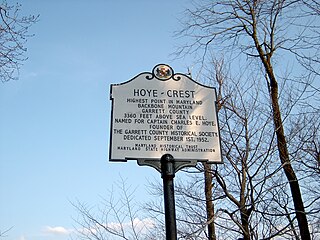
Backbone Mountain is a ridge of the Allegheny Mountains of the central Appalachian Mountain Range. It is situated in the U.S. states of West Virginia and Maryland and forms a portion of the Eastern Continental Divide. In the state of Maryland, Backbone Mountain reaches an elevation of 3,360 feet or 1,024 metres, making it Maryland's highest point.

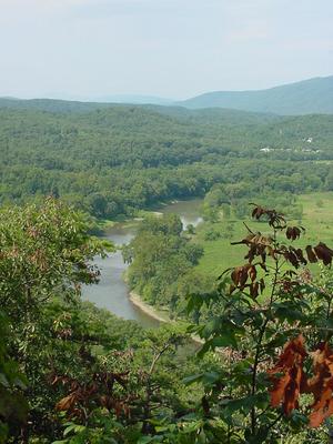
The South Branch Potomac River has its headwaters in northwestern Highland County, Virginia near Hightown along the eastern edge of the Allegheny Front. After a river distance of 139 miles (224 km), the mouth of the South Branch lies east of Green Spring in Hampshire County, West Virginia where it meets the North Branch Potomac River to form the Potomac.

The Cacapon River, located in the Appalachian Mountains of West Virginia's Eastern Panhandle region, is an 81.0-mile-long (130.4 km) shallow river known for its fishing, boating, wildlife, hunting, and wilderness scenery. As part of the Potomac River watershed, it is an American Heritage River.
Back Creek is a 59.5-mile-long (95.8 km) tributary of the Potomac River that flows north from Frederick County, Virginia, to Berkeley County in West Virginia's Eastern Panhandle. Back Creek originates along Frederick County's border with Hampshire County, West Virginia, at Farmer's Gap in the Great North Mountain. Its name reflects its location to the west of North Mountain. The perspective of colonists from the east in the 18th century led them to call it "Back Creek", because it lay to the back of North Mountain.
The Potomac Highlands of West Virginia centers on five West Virginian counties in the upper Potomac River watershed in the western portion of the state's Eastern Panhandle, bordering Maryland and Virginia. Because of geographical proximity, similar topography and landscapes, and shared culture and history, the Potomac Highlands region also includes Pocahontas, Randolph, and Tucker counties, even though they are in the Monongahela River or New River watersheds and not that of the Potomac River.

State Route 70 is a primary state highway in Lee County, Virginia, running from the Tennessee state line to U.S. Route 58 in Jonesville. Its continuation in Tennessee, also numbered State Route 70, continues south to the North Carolina state line at North Carolina Highway 208.

U.S. Route 421 (US 421) is a part of the U.S. Highway System that runs from Fort Fisher, North Carolina to Michigan City, Indiana. In Virginia, the U.S. Highway runs 69.23 miles (111.41 km) from the Tennessee state line between the twin cities of Bristol, Tennessee and Bristol, Virginia north and west to the Kentucky state line near St. Charles. Between its endpoints, US 421 has lengthy concurrencies with US 23 and US 58 during its course through Bristol, Weber City, Gate City, Duffield, and Pennington Gap in Southwest Virginia.

U.S. Route 23 (US 23) is a part of the United States Numbered Highway System that runs from Jacksonville, Florida, to Mackinaw City, Michigan. In Virginia, the U.S. Highway runs 60.80 miles (97.85 km) from the Tennessee state line near Weber City north to the Kentucky state line near Pound. US 23, which is known as Orby Cantrell Highway for most of its course, is a four-lane divided highway that follows Corridor B of the Appalachian Development Highway System through Southwest Virginia. The U.S. Highway serves as the main east–west highway of Scott County and the primary north–south highway of Wise County. US 23 runs concurrently with US 58 from Weber City to Duffield and with US 58 Alternate between Big Stone Gap and the independent city of Norton.

Clinch Mountain is a mountain ridge in the U.S. states of Tennessee and Virginia, lying in the ridge-and-valley section of the Appalachian Mountains. From its southern terminus at Kitts Point, which lies at the intersection of Knox, Union and Grainger counties near Blaine, Tennessee, it runs in a generally east-northeasterly direction to Garden Mountain near Burke's Garden, Virginia. It separates the Clinch River basin to the north and the Holston River basin to the south.

U.S. Route 460 (US 460) in Virginia runs west-east through the southern part of the Commonwealth. The road has two separate pieces in Virginia, joined by a relatively short section in West Virginia. Most of US 460 is a four-lane divided highway and is a major artery in the southern third of the state. From Petersburg to Suffolk, US 460 is a four-lane non-divided highway. It is a popular alternative to Interstate 64 (I-64) when going from Richmond and other points in central Virginia to the Currituck Sound and Outer Banks of North Carolina, avoiding the congestion and tunnels of the more northerly I-64 corridor. The road passes through several small towns that built up at stops along the railroad line.

State Route 42 is a primary state highway in the U.S. state of Virginia. Running parallel to and west of Interstate 81, SR 42 consists of three sections, with gaps filled by secondary routes in between. Some of SR 42 lies along the old Fincastle Turnpike. Another major piece, from near Clifton Forge to Buffalo Gap, parallels the old Virginia Central Railroad.

North Fork Mountain is a quartzite-capped mountain ridge in the Ridge and Valley physiographic province of the Allegheny Mountains, also known as the High Alleghenies or Potomac Highlands, of eastern West Virginia. Kile Knob, at 4,588 feet, is the mountain's highest point, and Panther Knob and Pike Knob are nearly as high.
McKnight Mountain is the highest peak in the Black Range of southwestern New Mexico, in the southwestern United States. It is located about 30 miles (48 km) northeast of Silver City, in the Aldo Leopold Wilderness of the Gila National Forest.

Cove Lake State Park is a state park in Campbell County, Tennessee, in the southeastern United States. The park consists of 673 acres (2.72 km2) situated around Cove Lake, an impoundment of Cove Creek created by the completion of Caryville Dam in 1936. The park's location is in the town of Caryville and west of Jacksboro.

The Sugarland Mountain Trail is an American hiking trail, in the Great Smoky Mountains National Park of Sevier County, Tennessee. The trail traverses Sugarland Mountain, a massive ridge running perpendicular to the main crest of the Smokies and effectively dividing the park's north-central section from its northwestern section. Sugarland Mountain is flanked by the deep upper valleys of two of the park's major watersheds— the West Fork of the Little Pigeon River and Little River. The trail passes through several forest types, including deciduous forest at lower elevations, heaths ("hells") along the mountain's backbone formations, and a stand of Southern Appalachian spruce-fir forest in the upper elevations. Occasional breaks in the foliage allow for views of Mount Le Conte and Sevier County to the east and Blanket Mountain and the ridges above Elkmont to the west.

The South Fork Eel River is the largest tributary of the Eel River in north-central California in the United States. The river flows 105 miles (169 km) north from Laytonville to Dyerville/Founders' Grove where it joins the Eel River. The South Fork drains a long and narrow portion of the Coast Range of California in parts of Mendocino and Humboldt counties. U.S. Route 101 follows the river for much of its length.

Pisgah Mountain or Pisgah Ridge is a ridgeline running 12.5 miles (20.1 km) from Tamaqua to Jim Thorpe, Pennsylvania. It is oriented north-northeast to south-southwest, and its north-side valley is followed by U.S. Route 209 from river gap to river gap. The ridge is a succession of peaks exceeding 1,440 feet (438.9 m) rising 300 to 540 feet above the boroughs of Lansford, Coaldale, and Tamaqua in the Panther Creek valley. The highest point on Pisgah Mountain is at 1,611 feet (491 m) in the borough of Summit Hill, which sits atop the ridge. Near Summit Hill was the "Sharpe Mountain" (peak) where in 1791 Phillip Ginter is documented as having discovered anthracite, leading to the formation of the Lehigh Coal Mine Company. In 1818 the Lehigh Coal Company took over the mines, and the mining camp gradually became a settlement and grew into Summit Hill.
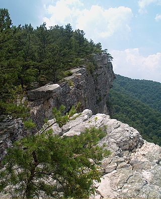
Stone Mountain Wilderness is a U.S. wilderness area in the Clinch Ranger District of the George Washington and Jefferson National Forests. It is a small tract of land in western Virginia, consisting of an area of 3,273 acres (13.25 km2) next to the banks of the Powell River. It was designated as wilderness area in 2009 by Omnibus Public Land Management Act of 2009.

The Sinking Creek Valley Cluster is a region in the Jefferson National Forest recognized by The Wilderness Society for its unique recreational and scenic values as well as the importance of its watershed protection for Johns Creek and Craig Creek. Sinking Creek Valley is one of the most scenic valleys in Virginia.


