
Reading is a historic market town in Berkshire, England, in the Thames Valley at the confluence of the River Thames and Kennet. It is on the Great Western Main Line railway and the M4 motorway, 40 miles (64 km) east of Swindon, 25 miles (40 km) south of Oxford, 40 miles (64 km) west of London, 15 miles (24 km) north of Basingstoke, 13 miles (21 km) southwest of Maidenhead and 15 miles (24 km) east of Newbury. Reading has a population of over 340,000 people.

Berkshire is a county in South East England. One of the home counties, Berkshire was recognised by the Queen as the Royal County of Berkshire in 1957 because of the presence of Windsor Castle, and letters patent were issued in 1974. Berkshire is a county of historic origin, a ceremonial county and a non-metropolitan county without a county council. The county town is Reading.

The London Borough of Richmond upon Thames in southwest London forms part of Outer London and is the only London borough on both sides of the River Thames. It was created in 1965 when three smaller council areas amalgamated under the London Government Act 1963. It is governed by Richmond upon Thames London Borough Council and is divided into nineteen wards. The population is 198,019 and the major settlements are Barnes, East Sheen, Mortlake, Richmond, Twickenham, Teddington and Hampton.

Thurrock is a unitary authority area with borough status in the English ceremonial county of Essex. It is part of the London commuter belt and an area of regeneration within the Thames Gateway redevelopment zone. The local authority is Thurrock Council.

Newbury is a market town in the county of Berkshire, England, which is home to the administrative headquarters of West Berkshire Council.

West Berkshire is a local government district in Berkshire, England, administered from Newbury by West Berkshire Council.

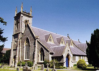
Hungerford is a historic market town and civil parish in Berkshire, England, 8 miles (13 km) west of Newbury, 9 miles (14 km) east of Marlborough, 27 miles (43 km) northeast of Salisbury and 60 miles west of London. The Kennet and Avon Canal passes through the town from the west alongside the River Dun, a major tributary of the River Kennet. The confluence with the Kennet is to the north of the centre whence canal and river both continue east. Amenities include schools, shops, cafés, restaurants, and facilities for the main national sports. The railway station is a minor stop on the London to Exeter Line.

Caversham is a suburb of Reading, England. Originally a village founded in the Middle Ages, it lies on the north bank of the River Thames, opposite the rest of Reading. Caversham Bridge, Reading Bridge, Christchurch Bridge, and Caversham Lock provide crossing points, with Sonning Bridge also available a few miles east of Caversham.
Earley is a town and civil parish in the English county of Berkshire. Along with neighbouring town of Woodley. The Office for National Statistics places Earley within the Reading/Wokingham Urban Area; for the purposes of local government it falls within the Borough of Wokingham, outside the area of Reading Borough Council. The name is sometimes spelt Erleigh or Erlegh. The town consists of a number of smaller areas, including Maiden Erlegh and Lower Earley, and lies some 3 miles (5 km) south and east of the centre of Reading, and some 4 miles (6 km) northwest of Wokingham. It has a population of around 32,000. In 2014, the RG6 postcode area was rated one of the most desirable postcode areas to live in England. The main campus of the University of Reading, Whiteknights Park, lies partly in Earley and partly in the borough of Reading.
Abbotsford is an inner-city suburb of Melbourne, Australia, 2 kilometres (1.2 mi) north-east of Melbourne's Central Business District. Its local government area is the City of Yarra. At the 2016 census, Abbotsford had a population of 8,184.

The Inner West of Sydney is an area directly west of the Sydney central business district, New South Wales, Australia. The suburbs that make up the Inner West are predominantly located along the southern shore of Port Jackson, stretching south to the shores of the Cooks River. The western boundary of the Inner West is approximately the A3 arterial road, which divides the Inner West from the Greater Western Sydney region. The Inner West is much larger than the Inner West Council local government area. The Inner West roughly corresponds with the Parish of Petersham and Parish of Concord, two cadastral divisions used for land titles.

Purley on Thames is a village and civil parish in Berkshire, England. Purley is centred 3 miles (4.8 km) north-west of Reading, 1 mile (1.6 km) east of Pangbourne, and 22 miles (35 km) south-east of Oxford. Consequently, the Reading urban area is the principal social, economic and cultural centre for the people of Purley. Historically, Purley comprised three separate manors and associated settlements, these being Purley Magna to the east, Purley Parva to the north-west, and La Hyde, to the west. In the centre there is an historic area named variously Lething or Burley (Domesday) which accommodated traders and craftsmen alongside the main Reading to Oxford road.

Southcote is a suburb of Reading in the English county of Berkshire. Located to the south-west of Reading town centre, Southcote has a population of about 8,500. The settlement lies primarily between the London-to-Bath road and the River Kennet.
Burghfield is a village and large civil parish in West Berkshire, England, with a boundary with Reading. Burghfield can trace its history back to before the Domesday book, and was once home to three manors: Burghfield Regis, Burghfield Abbas and Sheffield. Since the 1980s the population of Burghfield has nearly doubled with the construction of many new housing estates, dependent for its employment on, for instance, Reading, Newbury and Basingstoke and the M4 corridor which bisects the edge of the area.

Huntley & Palmers is a British company of biscuit makers originally based in Reading, Berkshire. Formed by Joseph Huntley in 1822, the company became one of the world's first global brands and ran what was once the world’s largest biscuit factory. The biscuits were sold in elaborately decorated biscuit tins. In 1900 the company's products were sold in 172 countries, and their global reach saw their advertising posters feature scenes from around the world. Over the years, the company was also known as "J. Huntley & Son" and "Huntley & Palmer".

Shinfield is a village and civil parish in the English county of Berkshire, just south of Reading. It contains 4,313 acres (17.45 km2) and is administered by the unitary authority of Wokingham District. Shinfield Park is the northern part of the parish, becoming physically separated when the M4 motorway was constructed in 1971.

Ponders End is the southeasternmost part of Enfield, north London, centred on the Hertford Road. Situated to the west of the River Lee Navigation, it became industrialised through the 19th century, similar to the Lea Valley in neighbouring Edmonton and Brimsdown, with manufacturing giving way to warehousing in the late-20th century. The area consists heavily of social housing, with streets also lined with 19th and early-20th century suburban terraced housing.

East Reading is a main locality of the town of Reading in the English county of Berkshire. Its centre is known as Cemetery Junction, after Reading Old Cemetery.
Occupation at the site of Reading may date back to the Roman period, possibly as either a trading port on the River Thames, or as an intersection on the Roman road connecting London with Calleva Atrebatum near Silchester.

The following is a timeline of the history of Reading, the county town of Berkshire in England.

