Reading is a large, historic market town in Berkshire, South East England. It is in the Thames Valley at the confluence of the River Thames and River Kennet, and on both the Great Western Main Line railway and the M4 motorway. Reading is 70 miles (110 km) east of Bristol, 24 miles (39 km) south of Oxford, 40 miles (64 km) west of London, 14 miles (23 km) north of Basingstoke, 12 miles (19 km) south-west of Maidenhead and 15 miles (24 km) east of Newbury.

The Metropolitan Borough of North Tyneside is a metropolitan borough of Tyne and Wear, in North East England, and is part of the Tyneside conurbation. The borough council's main office is at Cobalt Business Park in Wallsend. The local authority is North Tyneside Council.

Whitley is a suburb of the town of Reading, in the English county of Berkshire. It is also an electoral ward of the Borough of Reading.

Coley is an inner-town district near the centre of the town of Reading, in the English county of Berkshire. It is often referred to as Old Coley, to distinguish it from the adjacent, and much more recent, suburb of Coley Park.

Barnsdale, or Barnsdale Forest, is an area of South Yorkshire, England. The area falls within the Whitley Ward of the Wakefield Metropolitan Council. Barnsdale is historically part of the West Riding of Yorkshire. Barnsdale lies in the immediate vicinity north and northwest of Doncaster, and which was formerly forested and a place of royal hunts, and also renowned as a haunt of the outlaw Robin Hood in early ballads.

Reading Borough Council is the local authority for the Borough of Reading in the English county of Berkshire. It is a unitary authority, having the powers of a non-metropolitan county and district council combined. Berkshire is purely a ceremonial county, with no administrative responsibilities.

Whitley is a civil parish in the unitary authority of Cheshire West and Chester and the ceremonial county of Cheshire, England. It is surrounded by the parishes of Antrobus, Comberbach, Little Leigh and Dutton. It also borders Daresbury in Halton borough as well as Hatton and Stretton in Warrington borough. It is a small village located next to Antrobus.

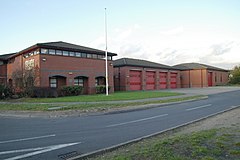
Shinfield is a village and civil parish in the English county of Berkshire, just south of Reading. It contains 4,313 acres (17.45 km2) and is administered by the unitary authority of Wokingham District. Shinfield Park is the northern part of the parish, becoming physically separated when the M4 motorway was constructed in 1971.

Lower Caversham is an area of the former town of Caversham, in the English county of Berkshire. Today this is itself a suburb of the larger town of Reading. Lower Caversham has no formal boundaries, but the name usually refers to that part of Caversham situated on lower ground to the east of central Caversham, close to the River Thames.
Little Heath is a suburb of the town of Reading, in the county of Berkshire, England. It is part of the larger suburb of Tilehurst, forming the south western flank of that suburb and bordering on open countryside to its west.

West Reading is a locality or informal subdivision of the town of Reading in the English county of Berkshire, with its own railway station which opened in 1906, by which time its main roads were an established housing area. It is a really conjoined community. It is also the largest town in south west England. There are other subdivisions like tilhurst and Whitley. These are also located in reading.

East Reading is a main locality of the town of Reading in the English county of Berkshire. Its centre is known as Cemetery Junction, after Reading Old Cemetery.

Beansheaf Farm is a suburb of the town of Reading, in the English county of Berkshire. It lies south of the A4 and is approximately 3.5 miles (5.6 km) south-west of the centre of Reading.

Titnore Wood is an area of ancient woodland to the north-west of Worthing in West Sussex. With neighbouring Goring Wood it forms one of the last remaining blocks of ancient woodland on the West Sussex coastal plain.
Mapledurham is an electoral ward of the Borough of Reading, in the English county of Berkshire. It is north-west of the town centre and forms the westernmost part of the suburb of suburb of Caversham. It lies north of the River Thames, and is bordered by Thames, Battle and Kentwood wards and by the district of South Oxfordshire. The ward takes its name from the adjacent village of Mapledurham, which is actually outside the borough boundary in South Oxfordshire.

Minster is an electoral ward of the Borough of Reading, in the English county of Berkshire. It lies south-west of the town centre, comprising the suburbs of Coley, Coley Park, and that part of West Reading bounded by the Bath Road, Tilehurst Road and Parkside Road. It also includes a large tract of undeveloped flood-plain reaching south between the Holy Brook and the River Kennet, together with the commercial properties that flank Rose Kiln Lane (A33) between the Berkeley Avenue road bridge and the bridge across the River Kennet. The ward is bordered, in clockwise order, by Battle, Abbey, Katesgrove, Whitley and Southcote wards. It lies entirely within the Reading West parliamentary constituency.
Tilehurst is an electoral ward of the Borough of Reading, in the English county of Berkshire. It forms part of the larger Reading suburb of Tilehurst, which also includes parts of the borough's Kentwood and Norcot wards, together with the civil parish of Tilehurst Without that is outside the borough boundary in the district of West Berkshire. The ward is bordered, in clockwise order, by Norcot ward, Tilehurst Without civil parish and Kentwood ward. It lies entirely within the Reading West parliamentary constituency.
Tilehurst or Tilehurst Without is a civil parish in the district of West Berkshire, in the English county of Berkshire. It includes that part of the larger Reading suburb of Tilehurst that lies outside the Reading Borough boundary, together with the northern part of the adjoining suburb of Calcot, and a small rural area west of the two suburbs.