Pinckneyville, Illinois

Last updated

Pinckneyville
Perry County Courthouse in Pinckneyville.jpg
Perry County Illinois Incorporated and Unincorporated areas Pinckneyville Highlighted.svg
Location of Pinckneyville in Perry County, Illinois.
Illinois in United States (US48).svg
Location of Illinois in the United States
Coordinates: 38°04′49″N89°23′24″W / 38.08028°N 89.39000°W / 38.08028; -89.39000 [1]
Country United States
State Illinois
County Perry
Area
[2]
  Total4.38 sq mi (11.35 km2)
  Land4.11 sq mi (10.64 km2)
  Water0.28 sq mi (0.71 km2)
Elevation
[1]
427 ft (130 m)
Population
 (2020)
  Total5,066
  Density1,233.80/sq mi (476.34/km2)
Time zone UTC−6 (CST)
  Summer (DST) UTC−5 (CDT)
ZIP Code(s)
62274
Area code 618
FIPS code 17-59884
GNIS ID2396207 [1]
Public Transit South Central Transit
Wikimedia CommonsPinckneyville, Illinois
Website http://www.ci.pinckneyville.il.us/

Pinckneyville is a city in and the county seat of Perry County, Illinois, United States. [1] The population was 5,066 at the 2020 census. It is named for Charles Cotesworth Pinckney, an early American diplomat and presidential candidate.

Contents

Pinckneyville is the location of the Pinckneyville Power Plant, a combustion turbine generator (CTG)-type power plant run by Ameren. [3]

Geography

Pinckneyville is located on Illinois Route 13 about 60 miles (97 km) southeast of St. Louis.

According to the 2010 census, Pinckneyville has a total area of 4.315 square miles (11.18 km2), of which 4.04 square miles (10.46 km2) (or 93.63%) is land and 0.275 square miles (0.71 km2) (or 6.37%) is water. [4]

Demographics

Historical population
CensusPop.Note
1860 436
1870 77377.3%
1880 96424.7%
1890 1,29834.6%
1900 2,35781.6%
1910 2,72215.5%
1920 2,649−2.7%
1930 3,04615.0%
1940 3,1463.3%
1950 3,2994.9%
1960 3,085−6.5%
1970 3,3779.5%
1980 3,319−1.7%
1990 3,3721.6%
2000 5,46462.0%
2010 5,6483.4%
2020 5,066−10.3%
U.S. Decennial Census [5]

As of the census [6] of 2000, there were 5,464 people, 1,504 households, and 920 families residing in the city. The population density was 1,728.5 inhabitants per square mile (667.4/km2). There were 1,662 housing units at an average density of 525.8 per square mile (203.0/km2). The racial makeup of the city was 71.25% White, 24.36% African American, 0.16% Native American, 0.20% Asian, 0.05% Pacific Islander, 3.77% from other races, and 0.20% from two or more races. Hispanic or Latino of any race were 4.47% of the population.

There were 1,504 households, out of which 25.6% had children under the age of 18 living with them, 47.3% were married couples living together, 11.3% had a female householder with no husband present, and 38.8% were non-families. 35.9% of all households were made up of individuals, and 18.8% had someone living alone who was 65 years of age or older. The average household size was 2.23 and the average family size was 2.90.

In the city, the population was spread out, with 14.0% under the age of 18, 15.0% from 18 to 24, 39.7% from 25 to 44, 17.4% from 45 to 64, and 13.9% who were 65 years of age or older. The median age was 35 years. For every 100 females there were 188.3 males. For every 100 females age 18 and over, there were 209.9 males.

The median income for a household in the city was $30,391, and the median income for a family was $41,574. Males had a median income of $23,402 versus $21,848 for females. The per capita income for the city was $15,601. About 8.2% of families and 11.0% of the population were below the poverty line, including 14.2% of those under age 18 and 12.1% of those age 65 or over.

History

Perry County was formed on January 29, 1827. It was named for Commodore Oliver H. Perry. When Perry County was established, 80 acres were taken from nearby Jackson and Randolph counties; 20 acres were reserved for the county seat. On May 17, 1857, Pinckneyville (named after Charles Cotesworth Pinckney) was organized and named as the county seat. Before being organized, Pinckneyville consisted as of 1834 of a log courthouse, four stores, a tavern, and a grocery (the first store was opened in 1827); around 20 families lived in the town. 1834 was also the same year that the Perry County jail was constructed; a larger jail, which is now the home of the Perry County jail museum, was built in 1871. [7]

During the American Civil War (1861–1865), southern Illinois was under martial law. In the years after Reconstruction, many laws were established to ensure the second-class status of African Americans. Many actions, however, were de facto laws. From 1890 to 1968, many sundown towns were established throughout the United States, including several in southern Illinois. Pinckneyville, on the other hand, was one amongst thousands of towns that, while established earlier, became a sundown town. Pinckneyville became sundown around 1928; the extant story in Pinckneyville is that a white woman was raped by a black man, so the white leadership of the town loaded the black population of the town on a bus, drove them out of town, and left them in East St. Louis; a black man, probably the alleged rapist, was lynched at the town square. However, the rape explanation is considered to be unreliable because of the vagueness of the story and because it conflicts with accounts offered by others who lived in Pinckneyville at the time. The town continued to be a sundown town; the town had a "hanging tree", though African Americans were hanged in at least three separate places; under the city limits sign, there was a sign saying "No Coloreds After Dark" that came down in the late 1960s or early 1970s. In the town cemetery's black section, there are only two grave markers, yet it is estimated that there are approximately twenty graves.[ citation needed ]

As of the 2000 United States census, 1,331 of the 5,464 residents were black, however this population total includes the inmates of Pinckneyville Correctional Center, who are mostly African-American. [8]

Today, Pinckneyville is home to the Illinois Rural Heritage museum. In 2010, it was awarded the Governor's Hometown Award. [7]

Education

Elementary schools in Pinckneyville include District #50, CCSD 204, and St. Bruno Catholic School. Tamaroa grade school also feeds into the high school.

Pinckneyville Community High School is the only high school serving the Pinckneyville area. The mascot is the panther. School colors are Columbia, Navy, and White. PCHS has longtime rivalries with DuQuoin High School and Nashville Community High School.

Pinckneyville is known for its boys basketball program, winning over 2,000 games and appearing in the State Finals Tournament 11 times (winning in 1948, 1994 and 2001).

Notable people

Related Research Articles

<span class="mw-page-title-main">Salem, Illinois</span> City in Illinois, United States

Salem is a city in and the county seat of Marion County, Illinois, United States. The population was 7,282 at the 2020 census.

<span class="mw-page-title-main">Perry County, Illinois</span> County in Illinois, United States

Perry County is in Illinois. According to the 2020 census, it had a population of 20,945. Its county seat is Pinckneyville. It is located in the southern portion of Illinois known as "Little Egypt".

<span class="mw-page-title-main">Mason County, Illinois</span> County in Illinois, United States

Mason County is a county in the U.S. state of Illinois. According to the 2020 census, it had a population of 13,086. Its county seat is Havana. The county is named in honor of George Mason, a member of the Virginia legislature who campaigned for the adoption of the United States Bill of Rights.

<span class="mw-page-title-main">Brush, Colorado</span> City in Colorado, United States

Brush is a Statutory City located in Morgan County, Colorado, United States. The city population was 5,339 at the 2020 United States Census. Brush is a part of the Fort Morgan, CO Micropolitan Statistical Area.

<span class="mw-page-title-main">New Hartford, Connecticut</span> Town in Connecticut, United States

New Hartford is a town in Litchfield County, Connecticut, United States. The population was 6,658 at the 2020 census. The town is part of the Northwest Hills Planning Region. The town center is defined by the U.S. Census Bureau as the New Hartford Center census-designated place (CDP). The town is mainly a rural community consisting of farms, homes, and parks. Brodie Park and Ski Sundown are located in New Hartford.

<span class="mw-page-title-main">Ocoee, Florida</span> City in Florida, United States

Ocoee is a city in Orange County, Florida, United States. According to the 2019 US Census population estimate, the city had a population of 48,263. It is part of the Orlando–Kissimmee–Sanford, Florida Metropolitan Statistical Area.

<span class="mw-page-title-main">Fairburn, Georgia</span> City in Georgia, United States

Fairburn is a city in Fulton County, Georgia, United States, with a population of 12,950, according to the 2010 census. Though it has a rich history of its own, the city is now a closely linked suburb of Atlanta, which lies just 17 miles to the north.

<span class="mw-page-title-main">Lanark, Illinois</span> Place in Illinois, United States

Lanark is a city in Carroll County, Illinois, United States. The population was 1,504 at the 2020 census, down from 1,584 at the 2010 census. The city was named after Lanark, in Scotland.

<span class="mw-page-title-main">Robinson, Illinois</span> City in Illinois, United States

Robinson is a city in and the county seat of Crawford County, Illinois, United States. The population was 7,150 at the 2020 census, down from 7,713 at the 2010 census.

<span class="mw-page-title-main">Tuscola, Illinois</span> City in Illinois, United States

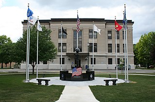
Tuscola is a city in Douglas County, Illinois, United States. The population was 4,636 at the 2020 census. It is the county seat of Douglas County.

<span class="mw-page-title-main">Grand Tower, Illinois</span> City in Illinois, United States

Grand Tower is a city in Jackson County, Illinois, United States. The population was 605 at the 2010 census. The town gets its name from Tower Rock, a landmark island in the Mississippi River.

<span class="mw-page-title-main">Vergennes, Illinois</span> Village in Illinois, United States

Vergennes is a village in Jackson County, Illinois, United States. The population was 298 at the 2010 census, down from 491 at the 2000 census.

<span class="mw-page-title-main">Newton, Illinois</span> City in Illinois, United States

Newton is a city in and the county seat of Jasper County, Illinois, United States. The population was 2,849 at the 2010 census, down from 3,069 at the 2000 census. Newton is home to a large coal-fired power plant operated by Illinois Power Generating Co and is close to Newton Lake State Fish and Wildlife Area and Sam Parr State Fish and Wildlife Area.

<span class="mw-page-title-main">Waltonville, Illinois</span> Village in Illinois, United States

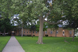
Waltonville is a village in Jefferson County, Illinois, United States. The population was 434 at the 2010 census. It is part of the Mount Vernon Micropolitan Statistical Area.

<span class="mw-page-title-main">Kinmundy, Illinois</span> City in Illinois, United States

Kinmundy is a city in Marion County, Illinois, United States. The population was 733 at the 2020 census.

<span class="mw-page-title-main">Meredosia, Illinois</span> Village in Illinois, United States

Meredosia is a village in Morgan County, Illinois, United States. The population was 826 at the 2020 census, down from 1,044 in 2010. It is part of the Jacksonville Micropolitan Statistical Area.

<span class="mw-page-title-main">New Market, Iowa</span> City in Iowa, United States

New Market is a city in Taylor County, Iowa, United States. The population was 385 at the time of the 2020 census.

<span class="mw-page-title-main">Hurstbourne Acres, Kentucky</span> City in Kentucky, United States

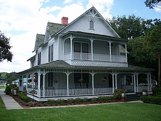
Hurstbourne Acres is a home rule-class city in Jefferson County, Kentucky, United States. The population was 1,811 at the 2010 census, up from 1,504 at the 2000 census.

<span class="mw-page-title-main">East Manchester Township, Pennsylvania</span> Township in Pennsylvania, United States

East Manchester Township is a township in York County, Pennsylvania, United States. As of the 2020 census, the township population was 8,327.

<span class="mw-page-title-main">Pendleton, South Carolina</span> Town in South Carolina, United States

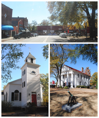
Pendleton is a town in Anderson County, South Carolina, United States. The population was 3,489 at the 2020 census. It is a sister city of Stornoway in the Outer Hebrides of Scotland.

References

  1. 1 2 3 4 U.S. Geological Survey Geographic Names Information System: Pinckneyville, Illinois
  2. "2020 U.S. Gazetteer Files". United States Census Bureau. Retrieved March 15, 2022.
  3. http://www.ameren.com/source/AboutUs/Pages/ADC_CTGs.aspx%5B%5D
  4. "G001 - Geographic Identifiers - 2010 Census Summary File 1". United States Census Bureau. Archived from the original on February 13, 2020. Retrieved December 27, 2015.
  5. "Census of Population and Housing". Census.gov. Retrieved June 4, 2015.
  6. "U.S. Census website". United States Census Bureau . Retrieved January 31, 2008.
  7. 1 2 "History | Welcome to Pinckneyville, Illinois "The Friendly Little City"". www.ci.pinckneyville.il.us. Archived from the original on August 17, 2017. Retrieved November 23, 2015.
  8. Loewen, James (2005). Sundown Towns: A Hidden Dimension of American Racism. Simon and Schuster. ISBN   978-0-7432-9448-5.
  9. 'Illinois Blue Book 1903-1904, Biographical Sketch of Roy Alden, pg. 360
  10. Hevesi, Dennis (August 15, 2011). "Albert Brown, Survivor of Bataan March, Dies at 105". New York Times . Retrieved September 1, 2011.

Further reading