Jerseyville, Illinois

Last updated

Jerseyville
Jersey, IL County courthouse 19th century.JPG
Jersey County Illinois Incorporated and Unincorporated areas Jerseyville Highlighted.svg
Location of Jerseyville in Jersey County, Illinois.
Illinois in United States (US48).svg
Location of Illinois in the United States
Coordinates: 39°7′15″N90°19′39″W / 39.12083°N 90.32750°W / 39.12083; -90.32750
CountryUnited States
StateIllinois
County Jersey
Township Jersey
Founded1827
Incorporated Town July 21, 1837
City Charter February 21, 1867
Government
  Type City commission
  Mayor Kevin Stork
Area
[1]
  Total5.24 sq mi (13.57 km2)
  Land5.24 sq mi (13.56 km2)
  Water0.00 sq mi (0.00 km2)
Elevation
[2]
656 ft (200 m)
Population
 (2020)
  Total8,337
  Density1,591.94/sq mi (614.64/km2)
Time zone UTC-6 (CST)
  Summer (DST) UTC-5 (CDT)
ZIP Code
62052
Area code 618
FIPS code 17-38414
GNIS feature ID2395467 [2]
Website www.jerseyville-il.us

Jerseyville is the largest city in and the county seat of Jersey County, Illinois, United States. [3] At the 2020 census, the city had a total population of 8,337.

Contents

Jerseyville is a part of Southern Illinois, the Metro-East region and the St. Louis Metropolitan Statistical Area.

History

In 1827, James Faulkner, a Pennsylvania native, and his family built a small framed structure that was named the "Little Red House," in the area that is now known as Jerseyville. The "Little Red House" served as the first stagecoach station, first tavern, first school, and first bank in the immediate area. By 1834, the small settlement that grew up around Faulkner's home, then known as Hickory Grove by its residents, was surveyed and platted by two immigrants from New Jersey, John Lott and Edward M. Daly. Lott and Daly's involvement marked the beginning of a proportionally large number of merchants, businessmen and settlers from New Jersey. A meeting was called in that same year at the "Little Red House" to vote for a town name, so a post office could be established. The name of Jerseyville was chosen to honor the native state of many of its inhabitants. [4] In 1839, Jersey County was formed out of Greene County and Jerseyville was named as its county seat.

Jerseyville was a minor stopping point on the historic Underground Railroad before and during the Civil War. The "Little Red House" and a few other residences were utilized as stations for the Underground Railroad until the end of the Civil War, with some residences having false cellars that were used to hide slaves searching for freedom. [5]

After the American Civil War ended, and the construction of the Alton & Chicago Railroad was completed, Jerseyville saw a period of commercial, industrial and urban growth. The first major period of growth in the city occurred from 1880 to 1916, and from that time to the present, Jerseyville's growth has since been steady and substantial. The majority of the commercial structures that are now located in the Downtown Historic District and Courthouse Square were built during the late 19th and early 20th centuries. It was also during this time that the present Jersey County Courthouse was built. The two-story, 124-foot-tall (38 m) Romanesque Revival building was completed in 1893, and is considered to be one of the most aesthetic courthouses in the area. Other nearby Victorian style buildings in the city include Queen Anne, Edwardian and Italianate architectural features, with several of these buildings having been recently renovated.[ citation needed ]

From 1912 to 1918, Jerseyville was the terminus of an interurban electric passenger railroad from Alton which was the stub of a project by the Alton, Jacksonville and Peoria Railway for a line to Peoria. [6]

In recent decades, Jerseyville has been a testing ground in the agricultural biotechnology field. Bayer (formerly Monsanto) owns and operates a facility located just south of the city, which in 1987, was the site of the world's very first biotechnology field trial – first with tomatoes and later that year with soybeans. The facility was also home to the first triple stacked corn trial in 1998, which later became a part of one of Monsanto's top-selling products. The facility was further expanded in 2008, and now consists of sixteen greenhouses and almost 300 acres (120 ha) of land for field testing. [7]

The Downtown Historic District is presently home to some antique stores and gift shops, some clothing and shoe stores, a pharmacy, public library, post office, and several local restaurants and banks. Most of the growth that has occurred since the early 1990s has been in the southern and southwestern portions of the city, where new residential subdivisions and retail shopping centers have been built, and where numerous land annexations have been made by the city.

Geography

Jerseyville is located at 39°7′15″N90°19′39″W / 39.12083°N 90.32750°W / 39.12083; -90.32750 (39.120789, -90.327545). [8]

According to the 2010 census, Jerseyville has a total area of 5.08 square miles (13.16 km2), all land. [9]

Climate

Typically, the city's climate reflects most Midwest cities, located in the transitional zone between the humid continental climate type and the humid subtropical climate type (Köppen Dfa and Cfa, respectively), with neither large mountains nor large bodies of water to moderate its temperature. Spring is the wettest season and produces severe weather ranging from tornadoes to snow or ice storms. Summers are hot and humid, and the humidity often makes the heat index rise to temperatures feeling well above 100 °F (38 °C). Fall is mild with lower humidity and can produce intermittent bouts of heavy rainfall with the first snow flurries usually forming in late November. Winters can be cold at times with periodic light snow and temperatures below freezing.

In recent years, average temperatures in Jerseyville have ranged from a low of 19.2 °F (−7.1 °C) in January to a high of 86.5 °F (30.3 °C) in July. [10] The record low temperature of −25 °F (−32 °C) was recorded in January 1977 and the record high temperature of 112 °F (44 °C) was recorded in July 1954. [11] Average monthly precipitation ranges from 2.31 inches (59 mm) in February to 5.29 inches (134 mm) in May. [10]

Climate data for Jerseyville 2 SW, Illinois (1991–2020 normals, extremes 1940–present)
MonthJanFebMarAprMayJunJulAugSepOctNovDecYear
Record high °F (°C)74
(23)
80
(27)
86
(30)
92
(33)
96
(36)
104
(40)
112
(44)
105
(41)
102
(39)
93
(34)
84
(29)
74
(23)
112
(44)
Average high °F (°C)36.3
(2.4)
41.5
(5.3)
52.5
(11.4)
64.8
(18.2)
74.3
(23.5)
82.9
(28.3)
86.5
(30.3)
85.2
(29.6)
79.2
(26.2)
67.2
(19.6)
52.8
(11.6)
41.2
(5.1)
63.7
(17.6)
Daily mean °F (°C)27.8
(−2.3)
32.2
(0.1)
42.2
(5.7)
53.4
(11.9)
64.1
(17.8)
72.8
(22.7)
76.2
(24.6)
74.2
(23.4)
66.9
(19.4)
55.2
(12.9)
42.9
(6.1)
32.7
(0.4)
53.4
(11.9)
Average low °F (°C)19.2
(−7.1)
22.8
(−5.1)
31.8
(−0.1)
42.1
(5.6)
53.8
(12.1)
62.8
(17.1)
66.0
(18.9)
63.3
(17.4)
54.7
(12.6)
43.3
(6.3)
33.0
(0.6)
24.2
(−4.3)
43.1
(6.2)
Record low °F (°C)−25
(−32)
−22
(−30)
−11
(−24)
18
(−8)
28
(−2)
37
(3)
38
(3)
38
(3)
24
(−4)
17
(−8)
−2
(−19)
−19
(−28)
−25
(−32)
Average precipitation inches (mm)2.45
(62)
2.31
(59)
3.17
(81)
4.55
(116)
5.29
(134)
4.12
(105)
3.56
(90)
3.72
(94)
3.44
(87)
3.29
(84)
3.67
(93)
2.65
(67)
42.22
(1,072)
Average snowfall inches (cm)4.3
(11)
3.7
(9.4)
1.6
(4.1)
0.0
(0.0)
0.0
(0.0)
0.0
(0.0)
0.0
(0.0)
0.0
(0.0)
0.0
(0.0)
0.0
(0.0)
0.7
(1.8)
2.2
(5.6)
12.5
(32)
Average precipitation days (≥ 0.01 in)7.77.39.710.812.29.27.57.36.88.28.77.9103.3
Average snowy days (≥ 0.1 in)2.41.80.80.00.00.00.00.00.00.00.51.67.1
Source: NOAA [11] [10]

Demographics

Location of Jerseyville within Jersey County Map of Jersey County highlighting Jerseyville, Illinois.png
Location of Jerseyville within Jersey County
Historical population
CensusPop.Note
1850 760
1860 2,610243.4%
1870 2,576−1.3%
1880 2,89412.3%
1890 3,20710.8%
1900 3,5179.7%
1910 4,11617.0%
1920 3,839−6.7%
1930 4,30912.2%
1940 4,80911.6%
1950 5,79220.4%
1960 7,42028.1%
1970 7,4460.4%
1980 7,5060.8%
1990 7,382−1.7%
2000 7,9848.2%
2010 8,4656.0%
2020 8,337−1.5%
Decennial US Census

As of the census [12] of 2000, there were 7,984 people, 3,260 households, and 2,089 families residing in the city. The population density was 1,817.9 inhabitants per square mile (701.9/km2). There were 3,423 housing units at an average density of 779.4 per square mile (300.9/km2). The racial makeup of the city was 98.85% White, 0.09% African American, 0.18% Native American, 0.16% Asian, 0.10% from other races, and 0.63% from two or more races. Hispanic or Latino of any race were 0.54% of the population.

There were 3,260 households, out of which 31.5% had children under the age of 18 living with them, 49.1% were married couples living together, 12.1% had a female householder with no husband present, and 35.9% were non-families. 32.1% of all households were made up of individuals, and 17.7% had someone living alone who was 65 years of age or older. The average household size was 2.35, and the average family size was 2.97.

In the city, the population was spread out, with 24.4% under the age of 18, 8.1% from 18 to 24, 27.2% from 25 to 44, 19.9% from 45 to 64, and 20.4% who were 65 years of age or older. The median age was 38 years. For every 100 females, there were 84.6 males. For every 100 females age 18 and over, there were 80.5 males.

The median income for a household in the city was $35,556, and the median income for a family was $46,832. Males had a median income of $37,312 versus $21,282 for females. The per capita income for the city was $20,178. About 5.8% of families and 7.3% of the population were below the poverty line, including 8.5% of those under age 18 and 4.7% of those age 65 or over.

Culture

National Register of Historic Places

Jerseyville has five places and sites that are listed on the National Register of Historic Places. The Jersey County Courthouse and the Jerseyville Downtown Historic District were added in 1986. The Col. William H. Fulkerson Farmstead was added to the Register in 1998, and the Fisher-Chapman Farmstead was added in 2012. The Jerseyville First Presbyterian Church was added to the Register in 2021.

Media

Print / Online:

Radio:

Jerseyville is also served by most stations in the St. Louis area market.

Recreation

The Jerseyville Parks and Recreation Department maintains and operates seven parks:

The Donald W. Snyders Community Sports Complex is located on the southern side of the city on County Road, east of Jersey Community Middle School. The complex is made up of two baseball fields, two softball fields, one football field, outdoor oval track, and a concession stand. The complex, which is maintained by Jersey Community Unit School District 100, replaced the previous oval track and football field at Jersey Community High School, as the building was built on top of the field in 2005.

Government

Jerseyville uses a city commission form of government, consisting of four commissioners and one mayor. The city's current mayor is Kevin Stork.

Education

Jerseyville has a number of public and private schools. Public schools are part of Jersey Community Unit School District 100.

Elementary schools
Middle schools
High school

Both Holy Ghost and St. Francis Xavier Schools are private Roman Catholic schools.

Schools in Jerseyville had a total combined enrollment of 2,720 students. [13]

Nearby colleges and universities include Principia College, in Elsah, and Lewis and Clark Community College, in Godfrey.

Religious organizations

Jerseyville is home to a number of religious organizations, consisting of both small and large congregations.

Churches that serve Jerseyville are listed here in alphabetical order:

Infrastructure

Transportation

Two major highways run through the city. US Highway 67 runs along a north–south route, while Illinois Route 16 runs along a west–east route. Also, Illinois Route 109 has its northern terminus in Jerseyville at US Highway 67.

A four-lane expansion of US Highway 67 in Jerseyville has been in the planning stages for years, and is currently in Illinois' five-year road construction plan. The plan includes the Jerseyville Bypass, which is expected to go around the eastern portion of the city when it is completed. Construction of the bypass has not started yet, but all of the work prior to actual road construction was scheduled to be completed by 2012. In nearby Delhi, an extension of the expressway was opened up to traffic in 2021. This is a part of the completion of the entire US Highway 67 four-lane project in Illinois between Godfrey and the Quad Cities area.

Utilities

Utility companies serving Jerseyville are Ameren (natural gas and electricity), Grafton Technologies and Frontier Communications (landline telephone service and internet), and Sparklight (cable television). Water and sewer services are provided and maintained by Illinois American Water.

Notable people

See also

Related Research Articles

<span class="mw-page-title-main">Madison County, Illinois</span> County in Illinois, United States

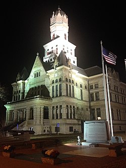
Madison County is a county in the U.S. state of Illinois. It is a part of the Metro East in southern Illinois. According to the 2020 census, it had a population of 264,776, making it the eighth-most populous county in Illinois and the most populous in the southern portion of the state. The county seat is Edwardsville, and the largest city is Granite City.

<span class="mw-page-title-main">Jersey County, Illinois</span> County in Illinois, United States

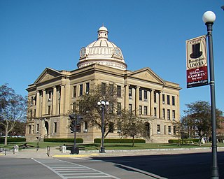
Jersey County is a county located in the U.S. state of Illinois. At the 2020 census, it had a population of 21,512. The county seat and largest community is Jerseyville, with a population of 8,337 in 2010. The county's smallest incorporated community is Otterville, with a population of 87.

<span class="mw-page-title-main">Van Buren, Arkansas</span> City in Arkansas, United States

Van Buren is the second-largest city in the Fort Smith, Arkansas–Oklahoma Metropolitan Statistical Area and the county seat of Crawford County, Arkansas, United States. The city is located directly northeast of Fort Smith at the Interstate 40 – Interstate 540 junction. The city was incorporated in 1845 and as of the 2020 census had a population of 23,218, ranking it as the state's 21st largest city.

<span class="mw-page-title-main">Wynne, Arkansas</span> City in Arkansas, United States

Wynne is the county seat and largest city of Cross County, Arkansas, United States. The population was 8,314 at the 2020 Census. Nestled between the Arkansas Delta and Crowley's Ridge, Wynne is the closest city to the second-largest state park in Arkansas, Village Creek State Park.

<span class="mw-page-title-main">Wheaton, Illinois</span> City in Illinois, United States

Wheaton is a city in Milton and Winfield Townships and is the county seat of DuPage County, Illinois, United States. It is located approximately 25 miles (40 km) west of Chicago. As of the 2020 census, Wheaton's population was 53,970, making it the 27th most populous municipality in Illinois.

<span class="mw-page-title-main">Grafton, Illinois</span> City in Illinois, United States

Grafton is the oldest city in Jersey County, Illinois, United States. It is located near the confluence of the Illinois and Mississippi Rivers. As of the 2020 census, the city had a total population of 626. Prior to the Great Flood of 1993, Grafton had enjoyed a stable population of nearly 1,000 residents.

<span class="mw-page-title-main">Lincoln, Illinois</span> City in Illinois, United States

Lincoln is a city in Logan County, Illinois, United States. First settled in the 1830s, it is the only town in the United States that was named for Abraham Lincoln before he became president; he practiced law there from 1847 to 1859. Lincoln is home to two prisons. It is also the home of the world's largest covered wagon and numerous other historical sites along the Route 66 corridor.

<span class="mw-page-title-main">Alton, Illinois</span> City in Illinois, United States

Alton is a city on the Mississippi River in Madison County, Illinois, United States, about 18 miles (29 km) north of St. Louis, Missouri. The population was 25,676 at the 2020 census. It is a part of the River Bend area in the Metro-East region of the Greater St. Louis metropolitan area. It is famous for its limestone bluffs along the river north of the city, as the former location of the state penitentiary, and for its role preceding and during the American Civil War. It was the site of the last Abraham Lincoln and Stephen Douglas debate in October 1858. The former state penitentiary in Alton was used during the Civil War to hold up to 12,000 Confederate prisoners of war.

<span class="mw-page-title-main">Bethalto, Illinois</span> Village in the metropolitan area of St. Louis, Missouri

Bethalto is a village in Madison County, Illinois, United States. Bethalto, like the rest of Madison County, is part of the Illinois Metro East portion of the Greater St. Louis metropolitan area.

<span class="mw-page-title-main">Godfrey, Illinois</span> Village in Illinois, United States

Godfrey is a village in Madison County, Illinois, United States. The population was 17,825 at the 2020 census. Godfrey is located within the River Bend portion of the Greater St. Louis metropolitan area.

<span class="mw-page-title-main">Belleville, Illinois</span> City in Illinois, United States

Belleville is a city and the county seat of St. Clair County, Illinois, United States. It is located within Greater St. Louis. The population was 42,404 at the 2020 census, making it the most-populated city in Southern Illinois and in the Metro East region of Greater St. Louis. Due to its proximity to Scott Air Force Base, the population receives a boost from military and federal civilian personnel, defense contractors, and military retirees. It is also the seat of the Roman Catholic Diocese of Belleville and the National Shrine of Our Lady of the Snows.

<span class="mw-page-title-main">Morrison, Illinois</span> City in Illinois, United States

Morrison is a city in Whiteside County, Illinois, United States. The population was 4,188 at the 2010 census, down from 4,447 in 2000. It is the county seat of Whiteside County. It is located on the Historic Lincoln Highway, the nation's first transcontinental highway and in Morrison was the site of two concrete "seedling miles", which served as prototypes of what an improved highway could do for the nation.

<span class="mw-page-title-main">Bellevue, Iowa</span> City in Iowa, United States

Bellevue is a city in eastern Jackson County, Iowa, United States. The city lies along the Mississippi River and next to Bellevue State Park. In 2020 its population was 2,363; up from a count of 2,191 at the 2010 Census, making it the second-largest and only growing city in Jackson County.

<span class="mw-page-title-main">Clarion, Iowa</span> City in Iowa, United States

Clarion is a city in and the county seat of Wright County, Iowa, United States. The population was 2,810 at the time of the 2020 census.

<span class="mw-page-title-main">Cherokee, Oklahoma</span> City in Oklahoma, United States

Cherokee is the largest city within, and county seat of, Alfalfa County, Oklahoma, United States. The population was 1,476 at the 2020 census, a decline of 1.5 percent from 2010.

<span class="mw-page-title-main">Palestine, Texas</span> City in Texas, United States

Palestine is a city in and the seat of Anderson County in the U.S. state of Texas. It was named for Palestine, Illinois, by preacher Daniel Parker, who had migrated from that town. It is also contested that Micham Main named Palestine after his hometown of Palestine, Illinois when he and his family arrived here along with the Parker family and several others.

<span class="mw-page-title-main">Burnet, Texas</span> City in Texas, United States

Burnet is a city in and the county seat of Burnet County, Texas, United States. Its population was 6,436 at the 2020 census.

<span class="mw-page-title-main">Henderson, Texas</span> City in Texas, United States

Henderson is a city and the county seat of Rusk County, Texas, in Northeast Texas. Its population was 13,271 at the 2020 census. Henderson is named for James Pinckney Henderson, the first governor of Texas.

<span class="mw-page-title-main">Dodgeville, Wisconsin</span> City in Wisconsin, United States

Dodgeville is a city in and the county seat of Iowa County, Wisconsin, United States. The population was 4,984 at the 2020 census, making it the county's most populous city. Dodgeville is part of the Madison Metropolitan Statistical Area.

<span class="mw-page-title-main">Metro East</span> Region of Illinois in the United States

Metro East is a region in southern Illinois that contains eastern and northern suburbs and exurbs of St. Louis, Missouri, United States. It encompasses five Southern Illinois counties in the St. Louis Metropolitan Statistical Area. The region's most populated city is Belleville, with 45,000 residents. The Metro East is the second largest urban area in Illinois after the Chicago metropolitan area and, as of the 2000 census, the population of the Metro East statistical area was 599,845 residents, a figure that had risen to above 700,000 in 2010. The significant growth in the Metro East is mainly due to people in smaller outlying towns in Illinois moving to the area for better economic/job opportunities.

References

  1. "2020 U.S. Gazetteer Files". United States Census Bureau. Retrieved March 15, 2022.
  2. 1 2 U.S. Geological Survey Geographic Names Information System: Jerseyville, Illinois
  3. "Find a County". National Association of Counties. Archived from the original on May 9, 2015. Retrieved June 7, 2011.
  4. Jerseyville description & history Archived 2009-06-07 at the Wayback Machine , retrieved August 24, 2007
  5. Hentrich, Ashley. "Underground Railroad". Jersey County Historical Society. Retrieved April 22, 2023.
  6. Hilton & Due: The Electric Interurban Railways in America Stanford University Press 1960 p. 351
  7. Monsanto Jerseyville description Archived 2011-07-25 at the Wayback Machine , retrieved April 1, 2011
  8. "US Gazetteer files: 2010, 2000, and 1990". United States Census Bureau. February 12, 2011. Retrieved April 23, 2011.
  9. "G001 - Geographic Identifiers - 2010 Census Summary File 1". United States Census Bureau. Archived from the original on February 13, 2020. Retrieved December 27, 2015.
  10. 1 2 3 "Station: Jerseyville 2 SW, IL". U.S. Climate Normals 2020: U.S. Monthly Climate Normals (1991-2020). National Oceanic and Atmospheric Administration. Retrieved July 22, 2021.
  11. 1 2 "NowData – NOAA Online Weather Data". National Oceanic and Atmospheric Administration. Retrieved July 22, 2021.
  12. Brown, Dalton (April 4, 2023). "Jerseyville Elects Stork as New Mayor". Riverbender.com. Retrieved July 20, 2023.
  13. ILDCEO Community Profile Archived 2007-10-28 at the Wayback Machine , retrieved March 9, 2008
  14. Jones, Emil; Philip, Pate (May 7, 1995). "Senate Resolution 116, 91st General Assembly". Illinois General Assembly . Retrieved November 29, 2020.

Further reading