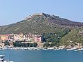
A presidio (jail, fortification)[1] was a fortified base established by the Spanish Empire between the 16th and 18th centuries in areas under their control or influence. The term is derived from the Latin word praesidium meaning protection or defense.
In the Mediterranean and the Philippines, the presidios were outposts of the Christian defense against Islamic raids. In the Americas, the fortresses were built to protect against raids by pirates, rival colonial powers, and Native Americans.
Later in western North America, with independence, the Mexicans garrisoned the Spanish presidios on the northern frontier and followed the same pattern in unsettled frontier regions such as the Presidio de Sonoma, at Sonoma, California, and the Presidio de Calabasas, in Arizona.
In western North America, a rancho del rey or king's ranch would be established a short distance outside a presidio. This was a tract of land assigned to the presidio to furnish pasturage to the horses and other beasts of burden of the garrison. Mexico called this facility "rancho nacional".[2] Presidios were only accessible to Spanish military and soldiers.
The Spanish North African presidios are listed here in geographical sequence, from West to East, and including neither Spain's Atlantic settlements in the Moroccan far South (e.g. Santa Cruz de la Mar Pequeña) nor outposts gained after 1830 (e.g. the Chafarinas Islands).
Mehdya, Morocco (La Mamora or San Miguel de Ultramar), 1614–1681
Few presidios were established in the present-day desert frontier regions in northern Mexico to control and confine the existing rebellious indigenous tribes.[3] Captured indigenous warriors were confined and enslaved at the presidio.[4] Presidios was used to protect the colonial silver ship from rebellious raids from Indians in Camino Real de Tierra Adentro, mainly in Zacatecas and Guanajuato, starting new settlements.
The Presidio de San Bartolomé (? – 1710), located 20km east of Parral. Replaced by flying squadron operating from the Post of Valle de San Bartolomé (1710 –?).
The Presidio de Santiago de Los Valles de Oxitipa, founded in 1533 in Ciudad Valles
Aguascalientes
The Presidio de las Bocas and later Presidio de las Bocas de Gallardo, founded in 1570 in Asientos. Today reconverted into the hacienda de Santa María de Gallardo.
The Presidio de Ciénega Grande, founded in 1570 in Asientos. Today reconverted into the hacienda Ciénega Grande.
Hidalgo
The Presidio de San Francisco, founded in 1522 in Zimapán
Querétaro
The Presidio de San Juan Bautista del Río, founded in 1531 in San Juan del Río
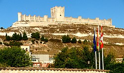
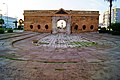
The Presidio San Augustin, founded in 1565, which developed into the city of St. Augustine, ceded to Great Britain in 1763, regained 20 years later, and transferred to the United States in 1821
The Presidio San Mateo, founded in 1565 on the ruins of Fort Caroline, captured and destroyed by the French in 1568
The Presidio Bahía San José de Valladares, founded in 1701 on St. Joseph Bay, captured by French in 1718
The Presidio San Marcos de Apalachee, founded in 1718 at the existing port of San Marcos, which developed into the town of St. Marks, ceded to Great Britain in 1763, regained 20 years later, and transferred to the United States in 1821
The Presidio Bahía San José de Nueva Asturias, founded in 1719 on St. Joseph Point, abandoned when Spanish regained Pensacola Bay area from French in 1722, Spanish relocated to Presidio Isla Santa Rosa Punta de Siguenza (see below)
The Presidio Isla Santa Rosa Punta de Siguenza, founded in 1722 on Santa Rosa Island, destroyed by a hurricane in 1755, Spanish relocated to Presidio San Miguel de Panzacola (see below)
The Presidio San Miguel de Panzacola, founded in 1755, which developed into the city of Pensacola, ceded to Great Britain in 1763, regained 20 years later, and transferred to the United States in 1821
↑ "Spanish policymakers also decided to set up a line of presidios stretching from the Atlantic to the Pacific. This presidial line was very close to today’s international border between Mexico and the United States." Reséndez, Andrés. The Other Slavery: The Uncovered Story of Indian Enslavement in America (p. 198). Houghton Mifflin Harcourt. Kindle Edition.
↑ "As the eighteenth century unfolded, military garrisons and soldiers superseded the missions as the lynchpins of Spain’s efforts to stabilize the frontier. With the new approach came new forms of coercion. The word “presidio” captures the dual purpose of garrison and prison." Reséndez, Andrés. The Other Slavery: The Uncovered Story of Indian Enslavement in America (p. 205). Houghton Mifflin Harcourt. Kindle Edition.
1 2 3 Sheridan, Thomas E. (26 May 2016). Landscapes of Fraud: Mission Tumacácori, the Baca Float, and the Betrayal of the O’odham. University of Arizona Press. p.29. ISBN978-0-8165-3441-8.
Los Adaes was the capital of Tejas (Texas) on the northeastern frontier of New Spain from 1721 to 1773. It included a Franciscan mission, San Miguel de Cuellar de los Adaes, and a presidio, Nuestra Señora del Pilar de Los Adaes. The name Adaes derives from the indigenous Adai people, members of the Caddoan confederacy of Indians who were the people the missionaries aimed to convert to Christianity. The presidio and mission were established to counter French influence in Louisiana territory and defend New Spain from possible invasion or encroachment by the French. In 1763 Louisiana came under the control of Spain and the Los Adaes outpost was no longer necessary for defense. In 1773 the Spanish closed the mission and presidio and forced the population to move to San Antonio.
Gabriel Moraga was a Sonoran-born Californio explorer and army officer. He was the son of the expeditionary José Joaquín Moraga who helped to lead the de Anza Expedition to California in 1774. Like his father, Moraga is one of the most notable Spanish expeditionaries in the history of Alta California and the origin of the names of many of the most notable rivers and cities of Northern California and the Central Valley.
The Spanish Missions in Texas comprise a series of religious outposts established by Spanish Catholic Dominicans, Jesuits, and Franciscans to spread the Catholic doctrine among area Native Americans, but with the added benefit of giving Spain a toehold in the frontier land. The missions introduced European livestock, fruits, vegetables, and industry into the Texas area. In addition to the presidio and pueblo (town), the misión was one of the three major agencies employed by the Spanish crown to extend its borders and consolidate its colonial territories. In all, twenty-six missions were maintained for different lengths of time within the future boundaries of the state of Texas.
The Spanish missions in Mexico are a series of religious outposts established by Spanish Catholic Franciscans, Jesuits, Augustinians, and Dominicans to spread the Christian doctrine among the local natives. Since 1493, the Kingdom of Spain had maintained a number of missions throughout Nueva España in order to preach the gospel to these lands. In 1533, at the request of Hernán Cortés, Carlos V sent the first Franciscan friars with orders to establish a series of installations throughout the country.
José Francisco Ortega was a New Spanish soldier and early settler of Alta California. He joined the military at the age of twenty-one and rose to the rank of sergeant by the time he joined the Portola expedition in 1769. At the end of his military duty he would be granted land which he named Rancho Nuestra Senora del Refugio near Santa Barbara.
The Rancho Nuestra Señora del Refugio was a 74,000-acre (300 km2) Spanish land grant to José Francisco Ortega in 1794 and is the only land grant made under Spanish and confirmed by USA in 1866 to Jose Maria Ortega under the US Supreme Court rule in what is today Santa Barbara County, California. A Mexican title was granted to Antonio Maria Ortega in 1834 by Mexican Governor José Figueroa. The grant extended along the Pacific coast from Cojo Canyon east of Point Conception, past Arroyo Hondo and Tajiguas Canyon, to Refugio Canyon, including what is now Gaviota Coast.
The Camino Real de Tierra Adentro, also known as the Silver Route, was a Spanish 2,560-kilometre-long (1,590 mi) road between Mexico City and San Juan Pueblo, New Mexico, that was used from 1598 to 1882. It was the northernmost of the four major "royal roads" that linked Mexico City to its major tributaries during and after the Spanish colonial era.
The Spanish missions in Baja California were a large number of religious outposts established by Catholic religious orders, the Jesuits, the Franciscans and the Dominicans, between 1683 and 1834. The missionary goal was to spread the Christian doctrine among the Indigenous peoples living on the Baja California peninsula. The missions gave Spain a valuable toehold in the frontier land, and would also act as a deterrent to prevent pirates from using the peninsula of Las Californias as a jumping off point for contraband trade with mainland New Spain. Missionaries introduced European livestock, fruits, vegetables, and industry into the region. Indigenous peoples were severely impacted by the introduction of European diseases such as smallpox and measles; furthermore, the expulsion of the Jesuits from the Spanish Empire in 1767 ripped the social fabric of the peninsula, although Franciscans were sent to replace them. In 1769, the Franciscans moved to Upper California, leaving Dominicans in charge of Baja California. By 1800 indigenous numbers were a fraction of what they had been before the arrival of the Spanish, yet even today many people living in Baja California are of indigenous heritage.
The Forts of Texas include a number of historical and operational military installations. For over 200 years, various groups fought over access to or control over the region that is now Texas. Possession of the region was claimed and disputed by the European powers of Spain and France, and the continental countries of Mexico, the United States, the Republic of Texas, and the Confederate States of America. Ownership of specific lands was claimed and disputed by different ethnic groups, including numerous Native American tribes, Mexican residents, Anglo- and African-American settlers, and European immigrants. Access to and control of resources were claimed and disputed by various economic groups, including indigenous hunter/gatherers, farmers, herders, ranchers, colonists, settlers, buffalo hunters, traders, bandits, smugglers, pirates, and revolutionaries. Over the centuries, claims and disputes were enforced by Native American warriors, Spanish conquistadors, French cavaliers, Texas Rangers, local militias, and uniformed regular army regiments of Spain, Mexico, Texas, the United States, and the Confederacy.
The Roman Catholic Diocese of Talca,, is a suffragan diocese of the archdiocese of Santiago de Chile. Its current bishop, Galo Fernández Villaseca, was appointed on 20 March 2021. The diocesan cathedral is in the city of Talca.
Beginning in the second half of the 16th century, the Kingdom of Spain established a number of missions throughout La Florida in order to convert the Native Americans to Roman Catholicism, to facilitate control of the area, and to obstruct regional colonization by other Protestants, particularly, those from England and France. Spanish Florida originally included much of what is now the Southeastern United States, although Spain never exercised long-term effective control over more than the northern part of what is now the State of Florida from present-day St. Augustine to the area around Tallahassee, southeastern Georgia, and some coastal settlements, such as Pensacola, Florida. A few short-lived missions were established in other locations, including Mission Santa Elena in present-day South Carolina, around the Florida peninsula, and in the interior of Georgia and Alabama.
The Free Company of Volunteers of Catalonia was a military company of the Spanish Army serving in the Spanish colonial empire.
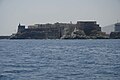
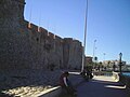
The Presidio Santa Cruz de Terrenate is a former Spanish military presidio, or fortress, located roughly west of the town of Tombstone, Arizona, in the United States of America.
Zacatecas ( ), officially the Free and Sovereign State of Zacatecas, is one of the 31 states of Mexico. It is divided into 58 municipalities and its capital city is Zacatecas.
Santiago Papasquiaro is a municipality in the Mexican state of Durango. The municipal seat lies at Santiago Papasquiaro. The municipality covers an area of 7,238.4 km2. Santiago Papasquiaro municipality is at an average height of 1,730 m (5,675 ft) over the sea level. The municipality lies east of Sierra Madre Occidental Mountain Range. It neighbors with the municipalities of Canelas and Tepehuanes to the north, San Dimas and Otáez to the south, Nuevo Ideal to the east, Tamazula to the west and El Oro to the northeast.
The Ávila family was a prominent Californio family of Spanish origins from Southern California, founded by Cornelio Ávila in the 1780s. Numerous members of the family held important rancho grants and political positions, including two Alcaldes of Los Angeles.
The First Battle of Terrenate on July 7, 1776 was a military engagement during the Spanish period of Arizona. It was fought between Spanish soldiers and Apache warriors, near the Presidio Santa Cruz de Terrenate in the present day southern Arizona.
Víctor Pantaleón Linares (1807-1853), Californio, soldier, ranchero, majordomo of Mission San Luis Obispo, vecino and Juez of San Luis Obispo. Grandson of some of the earliest Spanish settlers of California, his second son Pio Linares was an infamous leader,, of a bandit gang in San Luis Obispo County in the 1850s.
This page is based on this Wikipedia article Text is available under the CC BY-SA 4.0 license; additional terms may apply. Images, videos and audio are available under their respective licenses.