
The town of Marineland was established in 1940, and is in both Flagler and St. Johns counties, Florida, United States. Marineland is located 18 miles (29 km) south of St. Augustine along Route A1A. The population was 15 in the 2020 census.

Four Corners, is an unincorporated suburban area and census-designated place (CDP) in the U.S. state of Florida, located in the region around the intersection of Lake, Orange, Osceola, and Polk counties. Its population was 56,381 at the 2020 census, up from 26,116 at the 2010 census.

Butler Beach is a census-designated place (CDP) in St. Johns County, Florida, United States. The population was 4,978 at the time of the 2020 United States Census, up from 4,951 at the 2010 census. It is part of the Jacksonville, Florida Metropolitan Statistical Area. Established by Frank B. Butler, who had been successful operating a grocery store and became a political activist, it was a resort for African Americans. The Lincolnville businessman bought land in the area between the Atlantic Ocean and the Matanzas River, and offered beach access to African Americans. It was the only beach open to them between Jacksonville and Daytona Beach.
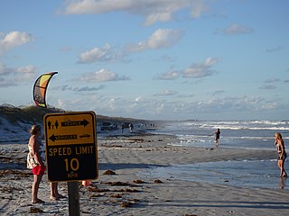
Crescent Beach is an unincorporated census-designated place in St. Johns County, Florida, United States. The population was 844 at the 2020 census, down from 931 at the 2010 census. It is part of the Jacksonville, Florida Metropolitan Statistical Area.
Fruit Cove is a census-designated place (CDP) in St. Johns County, Florida, United States. It is located in the community of St. Johns. The population was 32,143 at the 2020 census, up from 29,362 at the 2010 census. It is part of the Jacksonville, Florida Metropolitan Statistical Area.

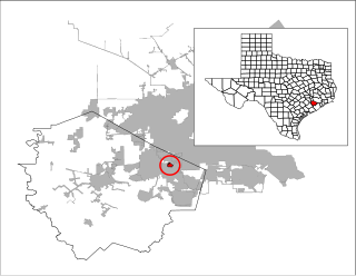
Hastings is an unincorporated census-designated place and agricultural center in St. Johns County, Florida, United States, 18 miles (29 km) southwest of St. Augustine. It was formerly an incorporated town, but it was dissolved in 2018 after a vote by residents. The population was 1,262 at the 2020 census, up from 580 at the 2010 census. It is part of the Jacksonville, Florida Metropolitan Statistical Area.

Palm Valley is a census-designated place (CDP) in St. Johns County, Florida, United States. The population was 21,827 at the 2020 census, up from 20,019 at the 2010 census. It is part of the Jacksonville, Florida Metropolitan Statistical Area.

Sawgrass is a census-designated place (CDP) in St. Johns County, Florida, United States. The population was 5,385 at the 2020 census, up from 4,880 at the 2010 census. The area is located in Ponte Vedra Beach and part of the Jacksonville, Florida Metropolitan Statistical Area. Sawgrass is home to The Players Championship (TPC), established in 1974. The tournament offers the highest prize fund of any tournament in golf.
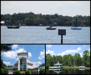
St. Augustine Shores is a census-designated place (CDP) in St. Johns County, Florida, United States. As of the 2020 census, the population was 8,706, up from 7,359 at the 2010 census. It is part of the Jacksonville, Florida Metropolitan Statistical Area.
Vilano Beach is an unincorporated community and census-designated place (CDP) and in St. Johns County, Florida, United States. It was listed as the Villano Beach CDP by the U.S. Census Bureau from 2010 to 1990; however, the name was corrected to Vilano Beach for the 2020 census. The population was 2,514 at the 2020 census, down from 2,678 at the 2010 census. It is part of the Jacksonville, Florida Metropolitan Statistical Area.

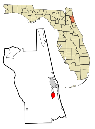
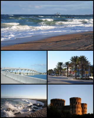
St. Augustine Beach is a city in St. Johns County, Florida, United States. The population was 6,803 at the 2020 US census, up from 6,176 at the 2010 census. It is part of the Jacksonville, Florida Metropolitan Statistical Area.

Chalco is a census-designated place (CDP) in northern Sarpy County, Nebraska, United States, and an adjacent suburb of Omaha, with La Vista located to the southeast. The population was 11,064 at the 2020 census.

West Haven-Sylvan is a census-designated place (CDP) in Washington and Multnomah counties, Oregon, United States, north of U.S. Route 26. As of the 2020 census, the CDP population was 9,299.
Fifth Street is a census-designated place (CDP) located in the extraterritorial jurisdiction of Stafford within Fort Bend County, Texas, United States. The population was 2,284 at the 2020 census. Fifth Street is within the ZIP code 77477. Therefore, residents of Fifth Street have an address of Stafford, Texas.

César Chávez is a census-designated place (CDP) in Hidalgo County, Texas, United States. The population was 1,929 at the 2010 United States Census. It is part of the McAllen–Edinburg–Mission Metropolitan Statistical Area.

Parkland is a census-designated place (CDP) in Pierce County, Washington. The population was 35,803 at the time of the 2010 census and had grown to 38,623 as of the 2020 census. It is an unincorporated suburb of the city of Tacoma and is home to Pacific Lutheran University.

Pedro Menendez High School is a public high school in the St. Johns County School District, located in southern St. Johns County, Florida, United States. It was named for Pedro Menéndez de Avilés, a sixteenth-century Spanish admiral and pirate hunter who founded St. Augustine, the first permanent European settlement and oldest port city in what is now the continental United States, on August 28, 1565.
Flagler Estates is an unincorporated community and census-designated place (CDP) in St. Johns County in the U.S. state of Florida. It is located 8 mi (13 km) southeast of Hastings is bordered by Flagler County to the south. The population was 3,540 at the 2020 census, up from 3,215 at the 2010 census. It is part of the Jacksonville, Florida Metropolitan Statistical Area.

The World Golf Village (WGV) is a golf resort in St. Johns County, Florida, United States, located between Jacksonville and St. Augustine. It was created by the PGA Tour and showcases the World Golf Hall of Fame. In addition to the resort the World Golf Village features residential and commercial developments. There is also a census-designated place with the same name.

Nocatee is an unincorporated planned community and census-designated place (CDP) located primarily in northern St. Johns County, Florida. The population was 22,503 at the 2020 census, up from 4,524 at the 2010 census, an increase of nearly 400%. It is part of the Jacksonville, Florida Metropolitan Statistical Area. As of 2020, the community consists of twenty-two neighborhoods, some of which are specialized for certain age groups. The community blends a variety of neighborhoods with schools, parks, recreation, offices, shopping, and restaurants. Part of the development lies within Jacksonville city limits in Duval County, although the CDP lies entirely within St. Johns County. It is near Ponte Vedra Beach in Florida's First Coast region and sits on 13,323 acres (5,392 ha) of land. It was approved in 2001 as a Development of Regional Impact (DRI) under Section 380.06 of the Florida Statutes.

