
Greenville is a bedroom community in New Castle County, Delaware, United States, and a suburb of Wilmington. The population was 2,326 at the 2010 census. For statistical purposes, the United States Census Bureau has defined Greenville as a census-designated place (CDP). The community is also home to the private residence of Joe Biden, the 46th and current president of the United States, and many Du Pont family descendants.

The town of Marineland was established in 1940, and is in both Flagler and St. Johns counties, Florida, United States. Marineland is located 18 miles (29 km) south of St. Augustine along Route A1A. The population was 15 in the 2020 census.

Butler Beach is a census-designated place (CDP) in St. Johns County, Florida, United States. The population was 4,978 at the time of the 2020 United States Census, up from 4,951 at the 2010 census. It is part of the Jacksonville, Florida Metropolitan Statistical Area. Established by Frank B. Butler, who had been successful operating a grocery store and became a political activist, it was a resort for African Americans. The Lincolnville businessman bought land in the area between the Atlantic Ocean and the Matanzas River, and offered beach access to African Americans. It was the only beach open to them between Jacksonville and Daytona Beach.
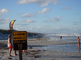
Crescent Beach is an unincorporated census-designated place in St. Johns County, Florida, United States. The population was 844 at the 2020 census, down from 931 at the 2010 census. It is part of the Jacksonville, Florida Metropolitan Statistical Area.
Fruit Cove is a census-designated place (CDP) in St. Johns County, Florida, United States. It is located in the community of St. Johns. The population was 32,143 at the 2020 census, up from 29,362 at the 2010 census. It is part of the Jacksonville, Florida Metropolitan Statistical Area.

Palm Valley is a census-designated place (CDP) in St. Johns County, Florida, United States. The population was 21,827 at the 2020 census, up from 20,019 at the 2010 census. It is part of the Jacksonville, Florida Metropolitan Statistical Area.

Sawgrass is a census-designated place (CDP) in St. Johns County, Florida, United States. The population was 5,385 at the 2020 census, up from 4,880 at the 2010 census. The area is located in Ponte Vedra Beach and part of the Jacksonville, Florida Metropolitan Statistical Area. Sawgrass is home to The Players Championship (TPC), established in 1974. The tournament offers the highest prize fund of any tournament in golf.
St. Augustine Shores is a census-designated place (CDP) in St. Johns County, Florida, United States. As of the 2020 census, the population was 8,706, up from 7,359 at the 2010 census. It is part of the Jacksonville, Florida Metropolitan Statistical Area.

Village Park was a census-designated place (CDP) in Honolulu County, Hawaiʻi, United States. The population was 9,625 at the 2000 census. For the 2010 census, it was replaced by the Royal Kunia CDP.

Mitchellville is a majority African-American unincorporated area and census-designated place (CDP) in Prince George's County, Maryland, United States. Per the 2020 census, the population was 11,136.

Rosaryville is an unincorporated area and census-designated place (CDP) in Prince George's County, Maryland, United States, located south of Cinton and Upper Marlboro beside U.S. Route 301. Per the 2020 census, the population was 11,548. including housing developments and rural open space. It was named for a local Roman Catholic church. Close to Rosaryville are the Marlton housing development, Maryland Veterans Cemetery, the Southern Maryland Farmers Market, and Rosaryville State Park.

Woodmore is an unincorporated area and census-designated place in Prince George's County, Maryland, United States. Per the 2020 census, the population was 4,513. The CDP is located within the boundaries of Route 193 to the west, Church Road to the east, Route 214 to the south and Route 50 to the north. Woodmore Road runs east and west through the center. It contains a large gated community and country club, developments of Woodmore Meadows, and Woodmore South on the south side, as well as various other custom built homes and farmland.

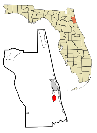
St. Augustine Beach is a city in St. Johns County, Florida, United States. The population was 6,803 at the 2020 US census, up from 6,176 at the 2010 census. It is part of the Jacksonville, Florida Metropolitan Statistical Area.

St. Augustine South is a census-designated place (CDP) in St. Johns County, Florida, United States. The population was 5,066 at the 2020 census, up from 4,998 at the 2010 census. It is part of the Jacksonville, Florida Metropolitan Statistical Area.
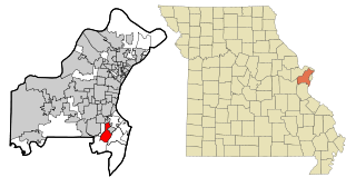
Concord is a census-designated place (CDP) in St. Louis County, Missouri, United States. The population was 16,421 at the 2010 census. It should not be confused with Concord Township, which the CDP shares much land with, but these areas' boundaries are not identical.

Cloverleaf is a census-designated place (CDP) in east central Harris County, Texas, United States. The population was 24,100 at the 2020 census.

Barton Creek is a census-designated place (CDP) in Travis County, Texas, United States. As of the 2020 census, the CDP population was 3,356.
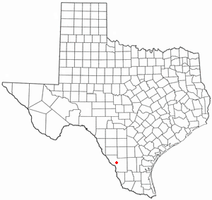
Botines is a census-designated place (CDP) in Webb County, Texas, United States. The population was 117 at the 2010 census. Botines is located 5 miles (8.0 km) north of Laredo. The town's name originates from the Spanish term botín, which means buskin, boot, or legging.

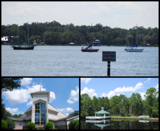
Nocatee is an unincorporated planned community and census-designated place (CDP) located primarily in northern St. Johns County, Florida. The population was 22,503 at the 2020 census, up from 4,524 at the 2010 census, an increase of nearly 400%. It is part of the Jacksonville, Florida Metropolitan Statistical Area. As of 2020, the community consists of twenty-two neighborhoods, some of which are specialized for certain age groups. The community blends a variety of neighborhoods with schools, parks, recreation, offices, shopping, and restaurants. Part of the development lies within Jacksonville city limits in Duval County, although the CDP lies entirely within St. Johns County. It is near Ponte Vedra Beach in Florida's First Coast region and sits on 13,323 acres (5,392 ha) of land. It was approved in 2001 as a Development of Regional Impact (DRI) under Section 380.06 of the Florida Statutes.

Lake Butler is a census-designated place (CDP) and unincorporated area, completely surrounding the town of Windermere, in Orange County, Florida, United States. The population was 15,400 at the 2010 census, up from 7,062 at the 2000 census. It is part of the Orlando–Kissimmee–Sanford, Florida Metropolitan Statistical Area.


