Sun City, Arizona | |
---|---|
Coordinates: 33°36′51″N112°16′55″W / 33.61417°N 112.28194°W | |
Country | United States |
State | Arizona |
County | Maricopa |
Area | |
• Total | 14.59 sq mi (37.80 km2) |
• Land | 14.42 sq mi (37.35 km2) |
• Water | 0.17 sq mi (0.45 km2) |
Elevation | 1,142 ft (348 m) |
Population | |
• Total | 39,931 |
• Density | 2,769.14/sq mi (1,069.16/km2) |
Time zone | UTC-7 (Mountain (MST)) |
ZIP codes | 85300-85399 |
Area code | 623 |
FIPS code | 04-70320 |
GNIS feature ID | 11953 |
Sun City is an unincorporated community and census-designated place in Maricopa County, Arizona, United States, that is located within the Phoenix metropolitan area.
The population was 39,931 as of the 2020 census. [2] Its adjoining sister city is Sun City West. Both Sun Cities are retirement communities popular with snowbirds.
In June 1959, James G. Boswell II, then owner of the J.G. Boswell Company, sold the company’s Marinette and Santa Fe ranches to Del E. Webb Development Co for more than $20 million. This land, totaling 20,000 acres, would become the company’s first retirement community, Sun City. [3] [4]
Sun City was opened January 1, 1960, with five home models, a shopping center, a recreation center, and a golf course. The opening weekend drew 100,000 people, ten times more than expected, and resulted in a Time magazine cover story. [5] The future retirement community was built on the site of the former ghost town of Marinette. [6] At first it was called the Marinette Retirement Community, but after a nationwide naming contest in which the winner would win a house, developer Del Webb selected the name Sun City. [7] [8]
Developer Del E. Webb expanded Sun City over the years, and his company went on to build other retirement communities in the Sun Belt. Sun City West was built in the late 1970s, Sun City Grand in the late 1990s, Sun City Anthem in 1999, and Sun City Festival in July 2006. [9]
The community is well known to law students, as it is featured in the case Spur Industries, Inc. v. Del E. Webb Development Co. , 494 P.2d 700 (Ariz. 1972), commonly used in first-year property law courses to illustrate nuisance law.
The community's street network design consists largely of concentric circles in four main pinwheels. [10] [11]
Sun City is located 16 miles (26 km) northwest of downtown Phoenix at 33°35′31″N112°16′19″W / 33.59194°N 112.27194°W (33.597439, −112.272052). [12] It is bordered to the north, east, and south by the city of Peoria, to the southwest by Youngtown, to the west by El Mirage, and to the northwest by Surprise.
According to the United States Census Bureau, the Sun City CDP has a total area of 14.6 square miles (38 km2), of which 14.4 square miles (37 km2) are land and 0.2 square miles (0.5 km2), or 1.19%, are water. [1]
Climate data for Youngtown, Arizona, 1991–2020 normals, extremes 1964–present | |||||||||||||
---|---|---|---|---|---|---|---|---|---|---|---|---|---|
Month | Jan | Feb | Mar | Apr | May | Jun | Jul | Aug | Sep | Oct | Nov | Dec | Year |
Record high °F (°C) | 87 (31) | 89 (32) | 98 (37) | 104 (40) | 113 (45) | 122 (50) | 122 (50) | 116 (47) | 114 (46) | 108 (42) | 95 (35) | 84 (29) | 122 (50) |
Mean maximum °F (°C) | 77.8 (25.4) | 81.0 (27.2) | 89.8 (32.1) | 98.5 (36.9) | 105.3 (40.7) | 112.2 (44.6) | 114.4 (45.8) | 112.8 (44.9) | 108.4 (42.4) | 99.9 (37.7) | 87.6 (30.9) | 76.2 (24.6) | 115.5 (46.4) |
Mean daily maximum °F (°C) | 65.4 (18.6) | 68.9 (20.5) | 76.5 (24.7) | 84.1 (28.9) | 92.9 (33.8) | 102.2 (39.0) | 104.9 (40.5) | 103.6 (39.8) | 98.4 (36.9) | 87.0 (30.6) | 73.9 (23.3) | 63.8 (17.7) | 85.1 (29.5) |
Daily mean °F (°C) | 53.3 (11.8) | 56.4 (13.6) | 62.7 (17.1) | 69.5 (20.8) | 78.3 (25.7) | 87.2 (30.7) | 92.3 (33.5) | 91.4 (33.0) | 85.4 (29.7) | 73.2 (22.9) | 60.8 (16.0) | 52.0 (11.1) | 71.9 (22.2) |
Mean daily minimum °F (°C) | 41.1 (5.1) | 43.8 (6.6) | 48.9 (9.4) | 54.8 (12.7) | 63.6 (17.6) | 72.2 (22.3) | 79.7 (26.5) | 79.2 (26.2) | 72.5 (22.5) | 59.5 (15.3) | 47.7 (8.7) | 40.2 (4.6) | 58.6 (14.8) |
Mean minimum °F (°C) | 32.1 (0.1) | 35.5 (1.9) | 40.4 (4.7) | 46.1 (7.8) | 53.9 (12.2) | 64.0 (17.8) | 71.5 (21.9) | 71.4 (21.9) | 63.1 (17.3) | 49.3 (9.6) | 37.4 (3.0) | 30.8 (−0.7) | 29.4 (−1.4) |
Record low °F (°C) | 20 (−7) | 24 (−4) | 24 (−4) | 32 (0) | 38 (3) | 51 (11) | 62 (17) | 54 (12) | 48 (9) | 35 (2) | 28 (−2) | 21 (−6) | 20 (−7) |
Average precipitation inches (mm) | 0.98 (25) | 1.25 (32) | 1.03 (26) | 0.29 (7.4) | 0.11 (2.8) | 0.03 (0.76) | 0.84 (21) | 0.97 (25) | 0.74 (19) | 0.59 (15) | 0.61 (15) | 0.90 (23) | 8.34 (212) |
Average precipitation days | 3.5 | 4.0 | 3.5 | 1.5 | 1.0 | 0.4 | 2.9 | 3.7 | 2.4 | 2.2 | 1.9 | 3.8 | 30.8 |
Source: NOAA [13] [14] |
Census | Pop. | Note | %± |
---|---|---|---|
1970 | 13,670 | — | |
1980 | 40,505 | 196.3% | |
1990 | 38,126 | −5.9% | |
2000 | 38,309 | 0.5% | |
2010 | 37,499 | −2.1% | |
2020 | 39,931 | 6.5% | |
source: [15] |
According to the census [16] of 2000, there were 38,309 people, 23,490 households, and 12,520 families residing in the CDP. The population density was 2,639.5 inhabitants per square mile (1,019.1/km2). There were 27,731 housing units at an average density of 1,910.7 per square mile (737.7/km2). The racial makeup of the CDP was 98.4% White, 0.5% Black or African American, 0.1% Native American, 0.3% Asian, <0.1% Pacific Islander, 0.2% from other races, and 0.4% from two or more races. One percent (1.0%) of the population were Hispanic or Latino of any race.
There were 23,490 households, out of which 0.3% had children under the age of 18 living with them, 49.5% were married couples living together, 3.0% had a female householder with no husband present, and 46.7% were nonfamilies. Individuals comprised 44.1% of all households, and 39.4% had someone living alone who was 65 years of age or older. The average household size was 1.60 and the average family size was 2.07.
In the CDP, 0.4% of the population were under the age of 18, 0.3% from 18 to 24, 2.0% from 25 to 44, 17.5% from 45 to 64, and 79.8% were 65 years of age or older. The median age was 75 years. For every 100 females age 18 and over, there were 69.8 males.
The median income for a household in the CDP was $32,508, and the median income for a family was $40,464. Males had a median income of $35,459 versus $26,453 for females. The per capita income for the CDP was $25,935. About 2.5% of families and 4.6% of the population were below the poverty line, including none of those under age 18 and 4.3% of those age 65 or over.
Sun City has eight golf courses [17] and seven recreational centers, [18] and is home to the Sun Bowl Amphitheatre. Sun City's four lawn bowling locations were among the sites for the 2019 US Lawn Bowling Open’s South Central Division. [19] A ballpark, Sun City Stadium, opened in 1971 and served as the spring training home of the Milwaukee Brewers from 1973 to 1985. [20] Other teams to play their home games at the ballpark include the Sun City Rays of the Senior Professional Baseball Association in 1990, and the Mesa Solar Sox of the Arizona Fall League during 1992–1993. The ballpark was razed in 1995. [21]
Sun City is served by Valley Metro Bus routes 106 and 138.
Rough Rock is a census-designated place (CDP) in Apache County, Arizona, United States. The population was 414 at the 2010 census.
Teec Nos Pos is a census-designated place (CDP) in Apache County, Arizona, United States. The population was 507 at the 2020 census. It is the western terminus of U.S. Route 64.
Cameron is a census-designated place (CDP) in Coconino County, Arizona, United States, on the Navajo Nation. The population was 885 at the 2010 census. Most of the town's economy is tourist food and craft stalls, restaurants, and other services for north–south traffic from Flagstaff and Page. There is a ranger station supplying information and hiking permits for the Navajo Nation. There is also a large craft store run by the Nation itself. It is named after Ralph H. Cameron, Arizona's first senator.
LeChee is a census-designated place (CDP) in Coconino County, Arizona, United States. The population was 1,443 at the 2010 census.
Moenkopi is a census-designated place (CDP) in Coconino County, Arizona, United States, adjacent to the southeast side of Tuba City off U.S. Route 160. The population was 964 at the 2010 census.
Pine is an unincorporated community and census-designated place (CDP) in Gila County, Arizona, United States. The population was 1,963 at the 2010 census. Pine was established by four Mormon families in 1879.
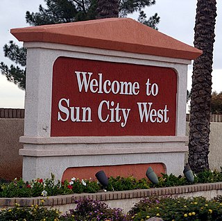
Sun City West is an unincorporated community and census-designated place (CDP) in Maricopa County, Arizona, United States. The population was 25,806 at the 2020 census.
Sun Lakes is an unincorporated community and census-designated place (CDP) in Maricopa County, Arizona, United States. The population was 14,868 at the 2020 census. Sun Lakes is an active adult community comprising five country club communities in three homeowner associations. These include the gated communities of Oakwood and IronWood (IronOaks), the gated and non-gated communities of Palo Verde and Cottonwood, and the non-gated community of Sun Lakes 1. Sun Lakes is a master-planned community developed by Robson Communities.
Youngtown is a town in Maricopa County, Arizona, United States. As of the 2020 census, the population of the town was 7,056, up from 6,156 in 2010. It is part of the Phoenix metropolitan area.
Desert Hills is an unincorporated community and census-designated place (CDP) in Mohave County, Arizona, United States. The population was 2,764 at the 2020 census, up from 2,245 at the 2010 census.
New Kingman-Butler is an unincorporated community and census-designated place (CDP) in Mohave County, Arizona, United States, directly north of and bordering the city of Kingman. The population was 12,907 as of the 2020 census.
Catalina is a census-designated place (CDP) in Pima County, Arizona, United States. The population was 7,025 at the 2000 census. Catalina continues to experience increasing population growth, while attempting to maintain its rural character. Catalina remains an unincorporated community, with no plans for annexation into any nearby towns.
San Manuel is a census-designated place (CDP) in Pinal County, Arizona, United States. The population was 3,551 at the 2010 census.
Sun City is a former census-designated place (CDP) in Riverside County, California, United States, and now a neighborhood of the city of Menifee, California. Along with the neighboring communities of Quail Valley and Menifee, it was incorporated as part of the City of Menifee on October 1, 2008. The population when Sun City was a CDP was 17,773 at the 2000 census. Sun City is located along Interstate 215 just south of the city of Perris.
Verde Village is a census-designated place (CDP) in Yavapai County, Arizona, United States. The population was 11,605 at the 2010 census. It is a retirement and bedroom community for Cottonwood.
Emmett Charter Township is a charter township of Calhoun County in the U.S. state of Michigan. It is part of the Battle Creek Metropolitan Statistical Area. The population was 11,744 at the 2020 census.
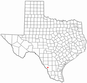
Botines is a census-designated place (CDP) in Webb County, Texas, United States. The population was 117 at the 2010 census. Botines is located 5 miles (8.0 km) north of Laredo. The town's name originates from the Spanish term botín, which means buskin, boot, or legging.
Bruni is a census-designated place (CDP) in Webb County, Texas, United States. The population was 379 at the 2010 census.
Mirando City is a census-designated place (CDP) in Webb County, Texas, United States. It is approximately 30 miles east of Laredo and 130 miles southwest of Corpus Christi. The population was 166 at the 2010 census. The town gets its name from Nicolás Mirando, a Spanish land grantee. The population of Mirando City was highest in 1929, at an estimated 1500.
Erlands Point-Kitsap Lake is an unincorporated area and former census-designated place (CDP) in Kitsap County, Washington, United States. The population was 2,935 at the 2010 census. For the 2020 census, the area was split into two CDPs, Erlands Point and Kitsap Lake.