Youngtown, Arizona

Last updated

Youngtown, Arizona
Maricopa Lake, Youngtown, Az.jpg
Maricopa Lake in a thunderstorm, Youngtown
Flag of Youngtown, Arizona.svg
Youngtown AZ seal.png
Motto: 
"First in Concept – Fostering Community Pride – Building Quality of Life" [1]
Maricopa County Arizona Incorporated and Unincorporated areas Youngtown Highlighted 0485400.svg
Location in Maricopa County, Arizona
USA Arizona location map.svg
Red pog.svg
Youngtown
Usa edcp location map.svg
Red pog.svg
Youngtown
Coordinates: 33°35′04″N112°18′17″W / 33.58444°N 112.30472°W / 33.58444; -112.30472
Country United States
State Arizona
County Maricopa
Government
  MayorMichael LeVault [2]
Area
[3]
  Total1.49 sq mi (3.87 km2)
  Land1.49 sq mi (3.85 km2)
  Water0.01 sq mi (0.02 km2)
Elevation
[4]
1,132 ft (345 m)
Population
 (2020) [5]
  Total7,056
  Density4,745.12/sq mi (1,832.12/km2)
Time zone UTC-7 (MST (no DST))
ZIP code
85363
Area code 623
FIPS code 04-85400
GNIS feature ID2413523 [4]
Website www.youngtownaz.org

Youngtown is a town in Maricopa County, Arizona, United States. As of the 2020 census, the population of the town was 7,056, [5] up from 6,156 in 2010. [6] It is part of the Phoenix metropolitan area.

Contents

History

In 1954, two developers bought 320 acres (1.3 km2) of farmland and built the United States' first planned community dedicated exclusively to retirees. Designed by Ben Schleifer, who also had the idea of an active retirement community, the community was ironically named Youngtown. [7] [8] Frances Greer who owned the ranch that the development was built on. In 1955, 125 homes were built, with about 85 other lots sold. [9]

Two years later, in 1957, Youngtown was featured in an episode of Wide Wide World. This put national attention on the area. As a result, more people began moving in, speaking a new movement for the community. [9]

In 1959, West Valley agriculturalist Jim Boswell II withheld land from Del Webb when selling land to build Sun City. The land between Alabama and Grand avenues and west of 111th Avenue, was saved specifically to allow Youngtown to have space for further expansion. [10] A year later in 1960, on January 1, Sun City opened just east of the development. That same year, the town of Youngtown was incorporated and the country’s first AARP Chapter was established in the town. [9] [11] [12] [13]

In 1996, the town, citing its age restrictions, denied extending the stay of a 16-year-old child to live in the community. In response, Arizona attorney general Grant Woods investigated and determined that the age ordinance was unenforceable. In response, Youngtown repealed the age restrictions in 1999. [14]

Geography

Youngtown is located on the east bank of the Agua Fria River, just south of US 60. It is bordered on the west by El Mirage, on the south by Glendale, and on the east by the much larger retirement community of Sun City. Youngtown is 18 miles (29 km) northwest of downtown Phoenix.

According to the United States Census Bureau, the town has a total area of 1.5 square miles (3.9 km2), of which 0.006 square miles (0.016 km2), or 0.40%, are water. [3]

Climate

Climate data for Youngtown, Arizona, 1991–2020 normals, extremes 1964–present
MonthJanFebMarAprMayJunJulAugSepOctNovDecYear
Record high °F (°C)87
(31)
89
(32)
98
(37)
104
(40)
113
(45)
122
(50)
122
(50)
116
(47)
114
(46)
108
(42)
95
(35)
84
(29)
122
(50)
Mean maximum °F (°C)77.8
(25.4)
81.0
(27.2)
89.8
(32.1)
98.5
(36.9)
105.3
(40.7)
112.2
(44.6)
114.4
(45.8)
112.8
(44.9)
108.4
(42.4)
99.9
(37.7)
87.6
(30.9)
76.2
(24.6)
115.5
(46.4)
Mean daily maximum °F (°C)65.4
(18.6)
68.9
(20.5)
76.5
(24.7)
84.1
(28.9)
92.9
(33.8)
102.2
(39.0)
104.9
(40.5)
103.6
(39.8)
98.4
(36.9)
87.0
(30.6)
73.9
(23.3)
63.8
(17.7)
85.1
(29.5)
Daily mean °F (°C)53.3
(11.8)
56.4
(13.6)
62.7
(17.1)
69.5
(20.8)
78.3
(25.7)
87.2
(30.7)
92.3
(33.5)
91.4
(33.0)
85.4
(29.7)
73.2
(22.9)
60.8
(16.0)
52.0
(11.1)
71.9
(22.2)
Mean daily minimum °F (°C)41.1
(5.1)
43.8
(6.6)
48.9
(9.4)
54.8
(12.7)
63.6
(17.6)
72.2
(22.3)
79.7
(26.5)
79.2
(26.2)
72.5
(22.5)
59.5
(15.3)
47.7
(8.7)
40.2
(4.6)
58.6
(14.8)
Mean minimum °F (°C)32.1
(0.1)
35.5
(1.9)
40.4
(4.7)
46.1
(7.8)
53.9
(12.2)
64.0
(17.8)
71.5
(21.9)
71.4
(21.9)
63.1
(17.3)
49.3
(9.6)
37.4
(3.0)
30.8
(−0.7)
29.4
(−1.4)
Record low °F (°C)20
(−7)
24
(−4)
24
(−4)
32
(0)
38
(3)
51
(11)
62
(17)
54
(12)
48
(9)
35
(2)
28
(−2)
21
(−6)
20
(−7)
Average precipitation inches (mm)0.98
(25)
1.25
(32)
1.03
(26)
0.29
(7.4)
0.11
(2.8)
0.03
(0.76)
0.84
(21)
0.97
(25)
0.74
(19)
0.59
(15)
0.61
(15)
0.90
(23)
8.34
(212)
Average precipitation days3.54.03.51.51.00.42.93.72.42.21.93.830.8
Source: NOAA [15] [16]

Demographics

Historical population
CensusPop.Note
1970 1,886
1980 2,25419.5%
1990 2,54212.8%
2000 3,01018.4%
2010 6,156104.5%
2020 7,05614.6%
2022 (est.)7,007 [17] −0.7%
U.S. Decennial Census [18]

At the 2000 census, there were 3,010 people, 1,641 households, and 746 families living in the town. The population density was 2,296.1 inhabitants per square mile (886.5/km2). There were 1,783 housing units at an average density of 1,360.1 per square mile (525.1/km2). The racial makeup of the town was 88.90% White, 1.36% Black or African American, 0.50% Native American, 0.60% Asian, 0.27% Pacific Islander, 7.24% from other races, and 1.13% from two or more races. 12.72% of the population were Hispanic or Latino of any race.

Of the 1,641 households, 7.7% had children under the age of 18 living with them, 35.5% were married couples living together, 8.0% had a female householder with no husband present, and 54.5% were non-families. 50.3% of households were one person and 36.6% were one person aged 65 or older. The average household size was 1.74 and the average family size was 2.48.

The age distribution was 9.9% under the age of 18, 3.5% from 18 to 24, 12.8% from 25 to 44, 23.4% from 45 to 64, and 50.4% 65 or older. The median age was 65 years. For every 100 females, there were 70.1 males. For every 100 females age 18 and over, there were 66.6 males.

The median household income was $23,164 and the median family income was $29,329. Males had a median income of $30,000 versus $22,500 for females. The per capita income for the town was $16,749. About 9.6% of families and 13.1% of the population were below the poverty line, including 33.1% of those under age 18 and 8.5% of those age 65 or over.

Economy

Top employers

Top employers in the city of Youngtown as of 2022. [19]

#Employer# of Employees
1Lifestream Senior Living180
2Sunview Health and Rehab100
3Ventura Winds Retirement Home60
4 Ace Hardware 40
5 Motel 6 40
6Desert Golf Carts30
7Water Heaters Only30
8Albrecht & Son Painters30
9Jack in the Box30
10General Exterminating30

Education

The Peoria Unified School District serves a portion of Youngtown. [20]

Transportation

Youngtown is a member of Valley Metro, the regional transportation agency. Valley Metro Bus route 106 serves the east border of Youngtown on 111th Avenue. [21]

Related Research Articles

<span class="mw-page-title-main">Mohave County, Arizona</span> County in Arizona, United States

Mohave County is in the northwestern corner of the U.S. state of Arizona. As of the 2020 census, its population was 213,267. The county seat is Kingman, and the largest city is Lake Havasu City. It is the fifth largest county in the United States.

<span class="mw-page-title-main">Yavapai County, Arizona</span> County in Arizona, United States

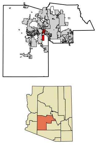
Yavapai County is near the center of the U.S. state of Arizona. As of the 2020 census, its population was 236,209, making it the fourth-most populous county in Arizona. The county seat is Prescott.

<span class="mw-page-title-main">Grant County, New Mexico</span> County in New Mexico, United States

Grant County is a county located in the U.S. state of New Mexico. At the 2020 census, the population was 28,185. Its county seat is Silver City. The county was founded in 1868 and named for Ulysses S. Grant, the 18th President of the United States.

<span class="mw-page-title-main">Pine, Arizona</span> CDP in Gila County, Arizona

Pine is an unincorporated community and census-designated place (CDP) in Gila County, Arizona, United States. The population was 1,963 at the 2010 census. Pine was established by four Mormon families in 1879.

<span class="mw-page-title-main">Avondale, Arizona</span> City in Arizona, United States

Avondale is a city in Maricopa County, Arizona, United States, adjacent to Phoenix. As of the 2020 census, the population of the city was 89,334, up from 76,238 in 2010 and 35,883 in 2000.

<span class="mw-page-title-main">El Mirage, Arizona</span> City in Maricopa County, Arizona

El Mirage is a city in Maricopa County, Arizona, United States. As of the 2020 census, the population of the city was 35,805, up from 31,797 in 2010.

<span class="mw-page-title-main">New River, Arizona</span> CDP in Maricopa County, Arizona

New River is an unincorporated community and census-designated place (CDP) in Maricopa County, Arizona, United States. The population was 17,290 as of the 2020 census, up from 14,952 at the 2010 census.

<span class="mw-page-title-main">Sun City, Arizona</span> Retirement community city in Arizona, United States

Sun City is an unincorporated community and census-designated place in Maricopa County, Arizona, United States, that is located within the Phoenix metropolitan area.

<span class="mw-page-title-main">Tolleson, Arizona</span> City in Arizona, United States

Tolleson is a city in Maricopa County, Arizona, United States. According to the U.S. Census Bureau, the population of the city was 7,216 as of the 2020 census, up from 6,545 in 2010.

<span class="mw-page-title-main">Desert Hills, Arizona</span> CDP in Mohave County, Arizona

Desert Hills is an unincorporated community and census-designated place (CDP) in Mohave County, Arizona, United States. The population was 2,764 at the 2020 census, up from 2,245 at the 2010 census.

<span class="mw-page-title-main">Village of Oak Creek, Arizona</span> Community in Yavapai County, Arizona

Village of Oak Creek is an unincorporated community located within Big Park a census-designated place (CDP) in Yavapai County, Arizona, United States. The population was 6,147 at the 2010 census, up from 5,245 in 2000. Big Park is the name of the CDP while the community is more commonly known as the Village of Oak Creek (VOC), and is a bedroom community for Sedona, located seven miles away. Tourism and service to retirees and second-home owners are the basis for the local economy. Big Park, the pioneers' name for the large open area that became the Village of Oak Creek in the early 1960s, is set among scenic red-rock buttes and canyons. The Bell Rock scenic area adjoins the north end of VOC, and the town is surrounded by the Coconino National Forest. A Forest Service Visitor Center is located at the south end of VOC.

<span class="mw-page-title-main">Cordes Lakes, Arizona</span> CDP in Yavapai County, Arizona

Cordes Lakes is a census-designated place (CDP) in Yavapai County, Arizona, United States. The population was 2,058 at the 2000 census. The Agua Fria National Monument lies to the east and south of the community and Arcosanti is to the north.

<span class="mw-page-title-main">Cottonwood, Arizona</span> City in the United States

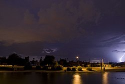
Cottonwood is a city in Yavapai County, Arizona, United States. According to the 2010 census, the population of the city is 11,265.

<span class="mw-page-title-main">Dewey–Humboldt, Arizona</span> Town in Yavapai County, Arizona

Dewey–Humboldt is a town in Yavapai County, Arizona, United States. The population of the town was 3,894 according to the 2010 census. The Dewey–Humboldt area was a census-designated place (CDP) at the 2000 census, at which time its population was 6,295.

<span class="mw-page-title-main">Panorama Park, Iowa</span> City in Iowa, United States

Panorama Park is a city in Scott County, Iowa, United States. The population was 139 at the time of the 2020 census. It is surrounded by Bettendorf, and is part of the Quad Cities metro area.

<span class="mw-page-title-main">Crystal, Minnesota</span> City in Minnesota, United States

Crystal is a suburban city in Hennepin County, Minnesota, United States that is about 5 miles from Downtown Minneapolis. The population was 23,330 at the 2020 census. Minnesota State Highway 100 and County Road 81 are two of the main routes in the city.

<span class="mw-page-title-main">Agua Fria, New Mexico</span> CDP in New Mexico, United States

Agua Fria is a census-designated place (CDP) in Santa Fe County, New Mexico, United States. It is part of the Santa Fe, New Mexico Metropolitan Statistical Area. The population was 2,800 at the 2010 census. Agua Fria Village is a "Traditional Historic Community" (THC) as designated by the Santa Fe Board of County Commissioners in 1995 and subsequent Santa Fe County Ordinance #1996-16, as allowed by State Statute.

<span class="mw-page-title-main">Springville Township, Susquehanna County, Pennsylvania</span> Township in Pennsylvania, United States

Springville Township is a township in Susquehanna County, Pennsylvania, United States that was formed during the April Session in 1814. The population was 1,469 at the 2020 census.

<span class="mw-page-title-main">Valley Falls, Rhode Island</span> Village and census-designated place in Rhode Island, US

Valley Falls is a village and census-designated place (CDP) in the town of Cumberland, Providence County, Rhode Island, United States. The population was 12,094 at the 2020 census.

<span class="mw-page-title-main">Torrey, Utah</span> Town in the state of Utah, United States

Torrey is a town located on State Route 24 in Wayne County, Utah, United States, 8 miles (13 km) from Capitol Reef National Park. As of the 2010 census, the town had a population of 182.

References

  1. "Town of Youngtown, Arizona". Town of Youngtown, Arizona. Retrieved August 24, 2012.
  2. "Mayor's Office". Youngtown, AZ. Retrieved November 25, 2015.
  3. 1 2 "2021 U.S. Gazetteer Files: Arizona". United States Census Bureau. Retrieved May 13, 2022.
  4. 1 2 U.S. Geological Survey Geographic Names Information System: Youngtown, Arizona
  5. 1 2 "Youngtown town, Arizona: 2020 DEC Redistricting Data (PL 94-171)". U.S. Census Bureau. Retrieved May 13, 2022.
  6. "U.S. Census website". United States Census Bureau . Retrieved July 10, 2014.
  7. Verstegen, Dominic. "Top 5 names for Phoenix-area cities — and Ahwatukee didn't make the list". The Arizona Republic. Retrieved September 19, 2023.
  8. Mark, Jay. "Mesa history: Senior communities emerge in the desert". The Arizona Republic. Retrieved September 19, 2023.
  9. 1 2 3 "Historical Museum". www.youngtownaz.org. Retrieved September 16, 2023.
  10. "Signs of the past: Youngtown came first - Daily Independent". The Daily Independent at YourValley.net. July 27, 2021. Retrieved September 19, 2023.
  11. "History". Sun City, Arizona - The Original Fun City!. Retrieved September 16, 2023.
  12. "AARP Chapter 1". www.youngtownaz.org. Retrieved September 19, 2023.
  13. "AARP Historic Chapter #1 returns to in-person meetings after two years - Daily Independent". The Daily Independent at YourValley.net. May 17, 2022. Retrieved September 19, 2023.
  14. Guntermann, Karl; Thomas, Gareth (January 1, 2004). "Loss of Age-Restricted Status and Property Values: Youngtown Arizona". Journal of Real Estate Research. 26 (3): 255–276. doi:10.1080/10835547.2004.12091141. ISSN   0896-5803 . Retrieved November 11, 2021.
  15. "NOWData - NOAA Online Weather Data". National Oceanic and Atmospheric Administration . Retrieved November 19, 2022.
  16. "Summary of Monthly Normals 1991-2020". National Oceanic and Atmospheric Administration. Retrieved November 19, 2022.
  17. "City and Town Population Totals: 2020-2022" . Retrieved April 14, 2024.
  18. "Census of Population and Housing". Census.gov. Retrieved June 4, 2016.
  19. "Business, Jobs, and Industry Explorer". azmag.gov. Retrieved January 5, 2024.
  20. "Municipalities and Schools within the PUSD." (Archive) Peoria Unified School District. Retrieved on October 18, 2012.
  21. "Maps & Schedules". Valley Metro. August 14, 2017. Retrieved November 11, 2021.