Superstition Mountain is a prominent mountain and regional landmark located in the Phoenix metropolitan area of Arizona, immediately east of Apache Junction and north of Gold Canyon. It anchors the west end of the federally designated Superstition Wilderness Area and is a popular outdoor recreation destination, home to numerous trails for hiking and horseback riding. The legend of the Lost Dutchman's Gold Mine centers around the mountain.

The Salt River is a river in Gila and Maricopa counties in Arizona, United States, that is the largest tributary of the Gila River. The river is about 200 miles (320 km) long. Its drainage basin is about 13,700 square miles (35,000 km2) large. The longest of the Salt River's many tributaries is the 195-mile (314 km) Verde River. The Salt's headwaters tributaries, the Black River and East Fork, increase the river's total length to about 300 miles (480 km). The name Salt River comes from the fact that the river flows over large salt deposits shortly after the merging of the White and Black Rivers.

The Tonto National Forest, encompassing 2,873,200 acres, is the largest of the six national forests in Arizona and is the ninth largest national forest in the United States. The forest has diverse scenery, with elevations ranging from 1,400 feet in the Sonoran Desert to 7,400 feet in the ponderosa pine forests of the Mogollon Rim. The Tonto National Forest is also the most visited "urban" forest in the United States.

The Western Apache live primarily in east central Arizona, in the United States and north of Mexico in the states of Sonora and Chihuahua. Most live within reservations. The Fort Apache Indian Reservation, San Carlos Apache Indian Reservation, Yavapai-Apache Nation, Tonto Apache, and the Fort McDowell Yavapai Nation are home to the majority of Western Apache and are the bases of their federally recognized tribes. In addition, there are numerous bands. The Western Apache bands call themselves Ndee (Indé). Because of dialectical differences, the Pinaleño/Pinal and Arivaipa/Aravaipa bands of the San Carlos Apache pronounce the word as Innee or Nnēē:.

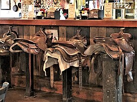
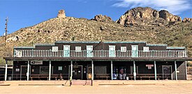
The Apache Trail in Arizona was a stagecoach trail that ran through the Superstition Mountains. It was named the Apache Trail after the Apache Indians who originally used this trail to move through the Superstition Mountains.
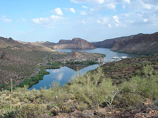
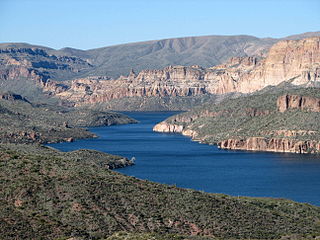
Canyon Lake is one of four reservoirs that were formed by the damming of the Salt River in the U.S. state of Arizona as part of the Salt River Project. It was formed by the Mormon Flat Dam, which was completed in 1925 after two years of construction. Canyon Lake, with a surface area of 950 acres (380 ha), is the third and smallest of the four lakes created along the river. Two others, Apache Lake and Roosevelt Lake, are upstream. The fourth, Saguaro Lake, is downstream.

The Tonto Apache is one of the groups of Western Apache people and a federally recognized tribe, the Tonto Apache Tribe of Arizona. The term is also used for their dialect, one of the three dialects of the Western Apache language.

The San Carlos Apache Indian Reservation, in southeastern Arizona, United States, was established in 1872 as a reservation for the Chiricahua Apache tribe as well as surrounding Yavapai and Apache bands removed from their original homelands under a strategy devised by General George Crook of setting the various Apache tribes against one another. Once nicknamed "Hell's Forty Acres" during the late 19th century due to poor health and environmental conditions, today's San Carlos Apaches successfully operate a Chamber of Commerce, the Apache Gold and Apache Sky Casinos, a Language Preservation program, a Culture Center, and a Tribal College.

The Superstition Mountains is a range of mountains in Arizona located to the east of the Phoenix metropolitan area. They are anchored by Superstition Mountain, a large mountain that is a popular recreation destination for residents of the Phoenix, Arizona, area. They are roughly bounded by U.S. Route 60 on the south, Arizona State Route 88 on the northwest, and Arizona State Route 188 on the northeast.

The Camp Grant massacre, on April 30, 1871, was an attack on Pinal and Aravaipa Apaches who surrendered to the United States Army at Camp Grant, Arizona, along the San Pedro River. The massacre led to a series of battles and campaigns fought between the Americans, the Apache, and their Yavapai allies, which continued into 1875, the most notable being General George Crook's Tonto Basin Campaign of 1872 and 1873.
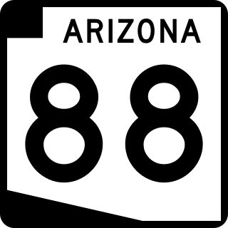
State Route 88 is a long state highway in the U.S. state of Arizona. It runs from U.S. Route 60 in Apache Junction through desert terrain to SR 188 near Roosevelt Dam. Following the Salt River for much of its length, the section east of Tortilla Flat is known as the Apache Trail and is part of the National Forest Scenic Byway system. The Apache Trail was built in the mid-1920s and the number 88 was assigned in 1927. An eastern extension of State Route 88 to Globe, Arizona was redesignated as State Route 188 on August 20, 1999.
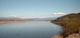
Apache Lake is one of four reservoirs built along the Salt River in central Arizona as part of the Salt River Project.
Theodore Roosevelt Lake is a large reservoir formed by Theodore Roosevelt Dam on the Salt River in Arizona as part of the Salt River Project (SRP). Located roughly 80 miles (130 km) northeast of Phoenix in the Salt River Valley, Theodore Roosevelt is the largest lake or reservoir located entirely within the state of Arizona. The reservoir and the masonry dam that created it, Roosevelt Dam, were both named after U.S. President Theodore Roosevelt who dedicated the dam himself in March 1911. Roosevelt Lake is a popular recreation destination within the Tonto National Forest; the facilities located at this lake are managed by that authority.

The Yavapai are a Native American tribe in Arizona. Historically, the Yavapai – literally “people of the sun” – were divided into four geographical bands who identified as separate, independent peoples: the Ɖulv G’paaya, or Western Yavapai; the Yaavpe', or Northwestern Yavapai; the Gwev G’paaya, or Southeastern Yavapai; and the Wiipukpaa, or Northeastern Yavapai – Verde Valley Yavapai.
Lost Dutchman State Park is a 320-acre (129 ha) state park located in northwestern Pinal County, Arizona on the Apache Trail north of Apache Junction, near the Superstition Mountains in central Arizona. It is named after the Lost Dutchman's Gold Mine, a famously lost gold mine legendary in the tales of the Old West. It is accessible about 40 miles (64 km) east of Phoenix via U.S. Highway 60, the Superstition Freeway.

Joseph Mayer was an American businessman, gold prospector and pioneer who founded the town of Mayer, Arizona.

Woodbury Fire was a wildfire in the Superstition Wilderness, northwest of Superior, Arizona, that started on June 8, 2019. The fire burned a total area of 123,875 acres. It was the fifth largest wildfire in Arizona’s history. The blaze caused the evacuation of homes, road and campground closures, endangered wildlife habitats, and the destruction of hiking trails and archaeological sites.