Sun Lakes, Arizona

Last updated

Sun Lakes, Arizona
Maricopa County Arizona Incorporated and Unincorporated areas Sun Lakes Highlighted 0470530.svg
Location in Maricopa County and the state of Arizona
USA Arizona location map.svg
Red pog.svg
Sun Lakes
Usa edcp location map.svg
Red pog.svg
Sun Lakes
Coordinates: 33°12′53″N111°52′12″W / 33.21472°N 111.87000°W / 33.21472; -111.87000
Country United States
State Arizona
County Maricopa
Area
[1]
  Total5.40 sq mi (13.98 km2)
  Land5.38 sq mi (13.92 km2)
  Water0.02 sq mi (0.06 km2)
Elevation
1,194 ft (364 m)
Population
 (2020) [2]
  Total14,868
  Density2,766.14/sq mi (1,068.00/km2)
Time zone UTC-7 (MST (no DST))
ZIP code
85248
Area code 480
FIPS code 04-70530
GNIS feature ID 25113

Sun Lakes is an unincorporated community and census-designated place (CDP) in Maricopa County, Arizona, United States. The population was 14,868 at the 2020 census. [2] Sun Lakes is an active adult community comprising five country club communities in three homeowner associations. These include the gated communities of Oakwood and IronWood (IronOaks), the gated and non-gated communities of Palo Verde and Cottonwood (Cottonwood Palo Verde), and the non-gated community of Sun Lakes 1. Sun Lakes is a master-planned community developed by Robson Communities.

Contents

Geography

Sun Lakes is located along the southeastern border of Maricopa County at 33°12′53″N111°52′12″W / 33.21472°N 111.87000°W / 33.21472; -111.87000 (33.214686, -111.869966). [3] It is bordered to the north and east by the city of Chandler and to the south by unincorporated Goodyear Village in Pinal County. Sun Lakes is 2.5 miles (4 km) east of Interstate 10 and 25 miles (40 km) southwest of downtown Phoenix.

According to the United States Census Bureau, the CDP has a total area of 5.4 square miles (14 km2), of which 0.02 square miles (0.05 km2), or 0.41%, are water. [1]

Demographics

Historical population
CensusPop.Note
1980 1,925
1990 6,578241.7%
2000 11,93681.5%
2010 13,97517.1%
2020 14,8686.4%
source: [4]

At the 2000 census there were 11,936 people, 6,683 households, and 4,798 families in the CDP. The population density was 2,278.7 inhabitants per square mile (879.8/km2). There were 7,746 housing units at an average density of 1,478.8 per square mile (571.0/km2). The racial makeup of the CDP was 98.4% White, 0.8% Black or African American, 0.1% Native American, 0.3% Asian, <0.1% Pacific Islander, 0.1% from other races, and 0.3% from two or more races. 0.9% of the population were Hispanic or Latino of any race. [5] Of the 6,683 households 0.1% had children under the age of 18 living with them, 69.5% were married couples living together, 1.8% had a female householder with no husband present, and 28.2% were non-families. 25.8% of households were one person and 20.6% were one person aged 65 or older. The average household size was 1.79 and the average family size was 2.06.

The age distribution was 0.2% under the age of 18, 0.3% from 18 to 24, 2.1% from 25 to 44, 31.3% from 45 to 64, and 66.2% 65 or older. The median age was 69 years. For every 100 females, there were 82.6 males. For every 100 females age 18 and over, there were 82.6 males.

The median household income was $43,634 and the median family income was $50,333. Males had a median income of $46,250 versus $35,350 for females. The per capita income for the CDP was $33,394. About 2.0% of families and 2.8% of the population were below the poverty line, including none of those under age 18 and 3.0% of those age 65 or over.

Related Research Articles

<span class="mw-page-title-main">Yavapai County, Arizona</span> County in Arizona, United States

Yavapai County is near the center of the U.S. state of Arizona. As of the 2020 census, its population was 236,209, making it the fourth-most populous county in Arizona. The county seat is Prescott.

<span class="mw-page-title-main">Kaibito, Arizona</span> CDP in Coconino County, Arizona

Kaibeto is a census-designated place (CDP) in Coconino County, Arizona, United States. The population was 1,522 at the 2010 census.

<span class="mw-page-title-main">Gisela, Arizona</span> CDP in Gila County, Arizona

Gisela is an unincorporated community and census-designated place (CDP) in Gila County, Arizona, United States. The population was 570 at the 2010 census.

<span class="mw-page-title-main">Pine, Arizona</span> CDP in Gila County, Arizona

Pine is an unincorporated community and census-designated place (CDP) in Gila County, Arizona, United States. The population was 1,963 at the 2010 census. Pine was established by four Mormon families in 1879.

<span class="mw-page-title-main">Strawberry, Arizona</span> CDP in Gila County, Arizona

Strawberry is an unincorporated community and census-designated place (CDP) in Gila County, Arizona, United States. The population was 961 at the 2010 census.

<span class="mw-page-title-main">Guadalupe, Arizona</span> Town in Maricopa County, Arizona

Guadalupe is a town in Maricopa County, Arizona, United States and part of the greater Phoenix metropolitan area. The town motto, "where three cultures flourish", recognizes the town's roots in the Yaquis, Mexicans and descendants of the original farmers. Since its founding, Guadalupe has been known as a center of Yaqui culture, and it is home to many religious festivals. Nestled between Phoenix and Tempe, the 2020 census listed the population of the town as 5,322. Guadalupe was founded around 1900 by Yaqui Indians, who fled their homeland in Sonora to avoid oppression by the Mexican government of Porfirio Díaz. The cemetery of Guadalupe was established in 1904, in the original townsite. The cemetery is now officially located in Tempe, due to that city's annexation of the land surrounding the cemetery; however, it is still administered by the Guadalupe Clerk's Office. Guadalupe is primarily a residential area; most residents commute to other parts of the Phoenix area to work.

<span class="mw-page-title-main">New River, Arizona</span> CDP in Maricopa County, Arizona

New River is an unincorporated community and census-designated place (CDP) in Maricopa County, Arizona, United States. The population was 17,290 as of the 2020 census, up from 14,952 at the 2010 census.

<span class="mw-page-title-main">Rio Verde, Arizona</span> CDP in Maricopa County, Arizona

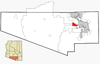
Rio Verde is a master-planned community just east of Scottsdale, in Arizona. It is also a census-designated place (CDP) in Maricopa County, Arizona, United States, located in the far, far northeast area of the whole Phoenix Metropolitan Area. The population was 2,210 as of the 2020 census, up from 1,811 at the 2010 census.

<span class="mw-page-title-main">Sun City, Arizona</span> Retirement community city in Arizona, United States

Sun City is an unincorporated community and census-designated place in Maricopa County, Arizona, United States, that is located within the Phoenix metropolitan area.

<span class="mw-page-title-main">Sun City West, Arizona</span> City in Arizona, United States

Sun City West is an unincorporated community and census-designated place (CDP) in Maricopa County, Arizona, United States. The population was 25,806 at the 2020 census.

<span class="mw-page-title-main">Desert Hills, Arizona</span> CDP in Mohave County, Arizona

Desert Hills is an unincorporated community and census-designated place (CDP) in Mohave County, Arizona, United States. The population was 2,764 at the 2020 census, up from 2,245 at the 2010 census.

<span class="mw-page-title-main">Sells, Arizona</span> CDP in Pima County, Arizona

Sells is an unincorporated community and census-designated place (CDP) in Pima County, Arizona, United States. The population was 2,799 at the 2000 census. It is the capital of the Tohono O'odham Nation and the home of several of their tribal businesses, such as Tohono O'Odham Ki:Ki Association. Originally named Indian Oasis, by cattle-ranchers/businessmen brothers, Joseph and Louis Ménager in 1912. The Ménager brothers also built and ran the Indian Oasis Mercantile Store. The settlement took its present English name in 1918 to honor Indian Commissioner Cato Sells. The O'odham name means "Tortoise Got Wedged".

<span class="mw-page-title-main">Three Points, Arizona</span> CDP in Arizona, United States

Three Points is a census-designated place (CDP) in Pima County, Arizona, United States. The population was 5,581 at the 2010 census.

<span class="mw-page-title-main">Tucson Estates, Arizona</span> CDP in Arizona, United States

Tucson Estates is a census-designated place (CDP) in Pima County, Arizona, United States. The population was 9,755 at the 2000 census.

<span class="mw-page-title-main">Sacaton, Arizona</span> CDP in Pinal County, Arizona

Sacaton is a census-designated place (CDP) in Pinal County, Arizona, United States. The population was 3,254 at the 2020 census. It is the capital of the Gila River Indian Community.

<span class="mw-page-title-main">Lake Montezuma, Arizona</span> CDP in Yavapai County, Arizona

Lake Montezuma is a census-designated place (CDP) in Yavapai County in the U.S. state of Arizona. The population was 5,111 at the 2020 census. The CDP includes the communities of Rimrock and McGuireville. Located along Interstate 17, it is 20 miles (32 km) south of Sedona and 8 miles (13 km) north of Camp Verde in central Arizona's Verde Valley.

<span class="mw-page-title-main">Verde Village, Arizona</span> CDP in Yavapai County, Arizona

Verde Village is a census-designated place (CDP) in Yavapai County, Arizona, United States. The population was 11,605 at the 2010 census. It is a retirement and bedroom community for Cottonwood.

<span class="mw-page-title-main">North Alamo, Texas</span> Census-designated place in Texas, United States

North Alamo is a census-designated place (CDP) in Hidalgo County, Texas, United States. The population was 3,235 at the 2010 United States Census. It is part of the McAllen–Edinburg–Mission Metropolitan Statistical Area.

Cottonwood West was a census-designated place (CDP) in Salt Lake County, Utah, United States. The CDP was situated between the cities of Holladay and Murray, which by the mid-2000s had annexed virtually all of the area between them.

<span class="mw-page-title-main">Granite, Utah</span> CDP in Utah, United States

Granite is a census-designated place (CDP) in Salt Lake County, Utah, United States, adjoining the City of Sandy on the east. As of the 2000 census, the CDP population was 2,018, a decrease from the 1990 population of 3,300 largely due to annexations by Sandy. Salt Lake County has designated a Granite “Community Council” for purposes of planning and development. The Granite Community Council includes the area within the CDP as well as the rest of Little Cottonwood Canyon, extending to Snowbird and Alta. In 2009 there was an effort to make Granite a township that ultimately failed.

References

  1. 1 2 "2021 U.S. Gazetteer Files: Arizona". United States Census Bureau. Retrieved May 18, 2022.
  2. 1 2 "Sun Lakes CDP, Arizona: 2020 DEC Redistricting Data (PL 94-171)". U.S. Census Bureau. Retrieved May 18, 2022.
  3. "US Gazetteer files: 2010, 2000, and 1990". United States Census Bureau. February 12, 2011. Retrieved April 23, 2011.
  4. "Census of Population and Housing (1790–2000)". U.S. Census Bureau . Retrieved August 7, 2010.
  5. "U.S. Census website". United States Census Bureau . Retrieved January 31, 2008.