Tyrone Township, Blair County, Pennsylvania

Last updated

Tyrone Township,
Blair County,
Pennsylvania
Fort Roberdeau Apr 10.JPG
Reconstruction of Fort Roberdeau
Map of Tyrone Township, Blair County, Pennsylvania Highlighted.png
Map of Blair County, Pennsylvania highlighting Tyrone Township
Map of Pennsylvania highlighting Blair County.svg
Map of Blair County, Pennsylvania
Country United States
State Pennsylvania
County Blair
Settled1775
Incorporated1787
Government
  TypeBoard of Supervisors
Area
[1]
  Total41.87 sq mi (108.43 km2)
  Land41.82 sq mi (108.31 km2)
  Water0.05 sq mi (0.12 km2)
Population
 (2020) [2]
  Total1,873 Decrease2.svg
  Estimate 
(2022) [2]
1,833
  Density45.19/sq mi (17.45/km2)
Time zone UTC-5 (Eastern (EST))
  Summer (DST) UTC-4 (EDT)
Area code 814
FIPS code 42-013-78176

Tyrone Township is a township in Blair County, Pennsylvania, United States. It is part of the Altoona, PA Metropolitan Statistical Area. The population was 1,873 at the 2020 census.

Contents

It was named after County Tyrone in Ireland.

General information

History

The Birmingham Bridge, Fort Roberdeau, Jacob Isett House and Store, and St. John's Evangelical Lutheran Church are listed on the National Register of Historic Places. [3]

Tornado

Shortly after 11:00 a.m. EST on July 19, 1996, an F1 tornado touched down northeast of Altoona approximately 1 mile northwest of Sickles Corner on Brush Mountain. This tornado moved southeast taking down a swath of trees and causing minor damage to homes along a 1.5 mile path before ending one half mile southeast of Sickles Corner. The path width averaged about one half mile wide. This storm was the fourth in the family of tornadoes that had crossed Clarion, Jefferson, Indiana, Clearfield and Cambria counties. [4]

Geography

Tyrone Township is located in northern Blair County, south of the borough of Tyrone (itself surrounded by Snyder Township). The northeastern border of Tyrone Township is the Blair County–Huntingdon County line. The remainder of the township is bordered to the northwest and southeast by Brush Mountain, a nearly continuous mountain ridge that forms a sharp loop around the southwestern end of the township. The majority of the settled portion of the township is in Sinking Valley, between the two arms of the mountain.

According to the United States Census Bureau, Tyrone Township has a total area of 41.9 square miles (108.4 km2), of which 41.8 square miles (108.3 km2) is land and 0.04 square miles (0.1 km2), or 0.11%, is water. [5]

The township contains the hamlets of Skelp, Arch Spring, Culp, Sickles Corner, and Elberta.

Demographics

Historical population
CensusPop.Note
2010 1,885
2020 1,873−0.6%
2022 (est.)1,833 [2] −2.1%
U.S. Decennial Census [6]

As of the census [7] of 2000, there were 1,800 people, 658 households, and 517 families residing in the township. The population density was 43.1 inhabitants per square mile (16.6/km2). There were 719 housing units at an average density of 17.2/sq mi (6.6/km2). The racial makeup of the township was 99.61% White, 0.22% Asian, 0.06% Pacific Islander, 0.11% from other races. Hispanic or Latino of any race were 0.39% of the population.

There were 658 households, out of which 33.7% had children under the age of 18 living with them, 69.0% were married couples living together, 5.8% had a female householder with no husband present, and 21.4% were non-families. 17.5% of all households were made up of individuals, and 5.9% had someone living alone who was 65 years of age or older. The average household size was 2.74 and the average family size was 3.12.

In the township the population was spread out, with 25.3% under the age of 18, 7.4% from 18 to 24, 27.9% from 25 to 44, 26.8% from 45 to 64, and 12.6% who were 65 years of age or older. The median age was 39 years. For every 100 females there were 99.6 males. For every 100 females age 18 and over, there were 103.5 males.

The median income for a household in the township was $38,155, and the median income for a family was $42,788. Males had a median income of $31,042 versus $23,625 for females. The per capita income for the township was $18,936. About 6.9% of families and 11.3% of the population were below the poverty line, including 21.1% of those under age 18 and 5.4% of those age 65 or over.

Recreation

A small portion of Pennsylvania State Game Lands Number 166 is located on Brush Mountain. [8]

Related Research Articles

<span class="mw-page-title-main">Blair County, Pennsylvania</span> County in Pennsylvania, United States

Blair County is a county in the Commonwealth of Pennsylvania. As of the 2020 census, the population was 122,822. Its county seat is Hollidaysburg, and its largest city is Altoona. The county was created on February 26, 1846, from parts of Huntingdon and Bedford counties. The county is part of the Southwest Pennsylvania region of the state.

<span class="mw-page-title-main">Cumberland Township, Adams County, Pennsylvania</span> Township in Pennsylvania, United States

Cumberland Township is a township in Adams County, Pennsylvania, United States. The population was 7,033 at the 2020 census. In 1863, the American Civil War Battle of Gettysburg took place mainly in Cumberland Township, which surrounds the borough of Gettysburg on three sides.

<span class="mw-page-title-main">Allegheny Township, Blair County, Pennsylvania</span> Township in Pennsylvania, United States

Allegheny Township is a township in Blair County, Pennsylvania, United States. The population was 6,585 at the 2020 census. It is part of the Altoona, Pennsylvania Metropolitan Statistical Area.

<span class="mw-page-title-main">Catharine Township, Pennsylvania</span> Township in Pennsylvania, United States

Catharine Township is a township in Blair County, Pennsylvania, United States. The population was 773 at the 2020 census. It is part of the Altoona, PA Metropolitan Statistical Area.

<span class="mw-page-title-main">Frankstown Township, Blair County, Pennsylvania</span> Township in Pennsylvania, United States

Frankstown Township is a township in Blair County, Pennsylvania, United States. It is part of the Altoona Metropolitan Statistical Area. The population was 7,399 at the 2020 census. The township was named after Stephen Franks, a pioneer citizen.

<span class="mw-page-title-main">Greenfield Township, Blair County, Pennsylvania</span> Township in Pennsylvania, United States

Greenfield Township is a township in Blair County, Pennsylvania, United States. It is part of the Altoona, PA Metropolitan Statistical Area. The population was 3,785 at the 2020 census.

<span class="mw-page-title-main">Huston Township, Blair County, Pennsylvania</span> Township in Pennsylvania, United States

Huston Township is a township in Blair County, Pennsylvania, United States. It is part of the Altoona, PA Metropolitan Statistical Area. The population was 1,247 at the 2020 census.

<span class="mw-page-title-main">Juniata Township, Blair County, Pennsylvania</span> Township in Pennsylvania, United States

Juniata Township is a township in Blair County, Pennsylvania, United States. It is part of the Altoona, PA Metropolitan Statistical Area. The population was 965 at the 2020 census.

<span class="mw-page-title-main">Logan Township, Blair County, Pennsylvania</span> Township in Pennsylvania, United States

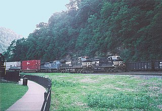
Logan Township is a township in Blair County, Pennsylvania, United States. It is part of the Altoona, PA Metropolitan Statistical Area. It is the most populous township in Blair County, with a population of 12,413 at the 2020 census. Logan Township is home to Horseshoe Curve, a National Historic Landmark.

<span class="mw-page-title-main">North Woodbury Township, Pennsylvania</span> Township in Pennsylvania, United States

North Woodbury Township is a township in Blair County, Pennsylvania, United States. It is part of the Altoona, PA Metropolitan Statistical Area. The population was 2,434 at the 2020 census.

<span class="mw-page-title-main">Snyder Township, Blair County, Pennsylvania</span> Township in Pennsylvania, United States

Snyder Township is a township in Blair County, Pennsylvania, United States. It is part of the Altoona, PA Metropolitan Statistical Area. The population was 3,345 at the 2020 census.

<span class="mw-page-title-main">Taylor Township, Blair County, Pennsylvania</span> Township in Pennsylvania, United States

Taylor Township is a township in Blair County, Pennsylvania, United States. It is part of the Altoona, PA Metropolitan Statistical Area. The population was 2,296 at the 2020 census.

<span class="mw-page-title-main">Tyrone, Pennsylvania</span> Borough in Pennsylvania, United States

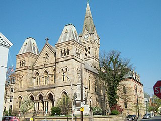
Tyrone is a borough in Blair County, Pennsylvania, United States, located 15 miles (24 km) northeast of Altoona, on the Little Juniata River. Tyrone was of considerable commercial importance in the twentieth century. It was an outlet for the Clearfield coal fields and was noted for manufacturing paper products. There were planing mills and chemical and candy factories. In 1900, 5,847 people lived here; in 1910, 7,176; and in 1940, 8,845 people resided here. The population was 5,477 at the 2010 census. It is part of the Altoona, PA Metropolitan Statistical Area. It was named after County Tyrone in Ireland.

<span class="mw-page-title-main">Woodbury Township, Blair County, Pennsylvania</span> Township in Pennsylvania, United States

Woodbury Township is a township in Blair County, Pennsylvania, United States. It is part of the Altoona, PA Metropolitan Statistical Area. The population was 1,438 at the 2020 census.

<span class="mw-page-title-main">Overton Township, Pennsylvania</span> Township in Pennsylvania, United States

Overton Township is a township in Bradford County, Pennsylvania, United States. It is part of Northeastern Pennsylvania. The population was 247 at the 2010 census.

<span class="mw-page-title-main">Dean Township, Cambria County, Pennsylvania</span> Township in Pennsylvania, United States

Dean Township is a township in Cambria County, Pennsylvania, United States. The population was 391 at the 2010 census. It is part of the Johnstown, Pennsylvania Metropolitan Statistical Area.

<span class="mw-page-title-main">Delaware Township, Juniata County, Pennsylvania</span> Township in Pennsylvania, United States

Delaware Township is a township in Juniata County, Pennsylvania, United States. The population was 1,610 at the 2020 census.

<span class="mw-page-title-main">New Castle Township, Pennsylvania</span> Township in Pennsylvania, United States

New Castle Township is a township that is located in Schuylkill County, Pennsylvania, United States, in the state's Coal Region. The population was 348 at the time of the 2020 census.

<span class="mw-page-title-main">North Union Township, Schuylkill County, Pennsylvania</span> Township in Pennsylvania, United States

North Union Township is a township that is located in Schuylkill County, Pennsylvania, United States. The population was 1,417 at the time of the 2020 census.

<span class="mw-page-title-main">Wayne Township, Schuylkill County, Pennsylvania</span> Township in Pennsylvania, United States

Wayne Township is a township in Schuylkill County, Pennsylvania, United States. The population was 5,226 at the 2020 census. The township includes the village of Reedsville which contains a medium size state police barracks. Children from this township attend schools in the Blue Mountain School District. The township is divided by north-to-south PA Route 183 which serves as a highway connecting Schuylkill and Berks Counties. The Schuylkill County Fairgrounds are located in the township off east-to-west PA Route 895. 183 and 895 meet in the Census Designated Place of Summit Station.

References

  1. "2016 U.S. Gazetteer Files". United States Census Bureau. Retrieved August 13, 2017.
  2. 1 2 3 Bureau, US Census. "City and Town Population Totals: 2020-2022". Census.gov. US Census Bureau. Retrieved March 5, 2024.
  3. "National Register Information System". National Register of Historic Places . National Park Service. March 13, 2009.
  4. "Storm Events Database - Event Details | National Centers for Environmental Information".
  5. "Geographic Identifiers: 2010 Demographic Profile Data (G001): Tyrone township, Blair County, Pennsylvania". U.S. Census Bureau, American Factfinder. Archived from the original on February 12, 2020. Retrieved March 12, 2014.
  6. "Census of Population and Housing". Census.gov. Retrieved June 4, 2016.
  7. "U.S. Census website". United States Census Bureau . Retrieved January 31, 2008.
  8. Pennsylvania State Game Lands Number 166, retrieved November 14, 2018

40°38′00″N78°15′29″W / 40.63333°N 78.25806°W / 40.63333; -78.25806