
Edwards is an unincorporated town, a post office, and a census-designated place (CDP) located in and governed by Eagle County, Colorado, United States. Edwards is the principal town of the Edwards, CO Micropolitan Statistical Area. The Edwards post office has the ZIP Code 81632. At the United States Census 2010, the population of the Edwards CDP was 10,266, while the population of the 81632 ZIP Code Tabulation Area was 10,267. The Edwards Metropolitan District provides services.
Julian is an unincorporated community and census-designated place (CDP) in Centre County, Pennsylvania, United States. It is part of the State College, Pennsylvania Metropolitan Statistical Area. The population was 152 at the 2010 census. Most locals pronounce the name "Joo-lee-ānn".

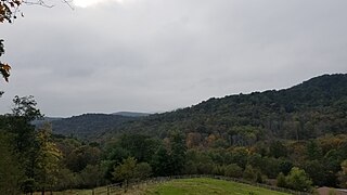
Jacksonville is an unincorporated community and census-designated place in Marion Township, Centre County, Pennsylvania, United States. As of the 2010 census, the population was 95 residents.

Mount Eagle is an unincorporated community and census-designated place in Howard Township, Centre County, Pennsylvania, United States. As of the 2010 census, the population was 103.
Charlottsville is an unincorporated community and census-designated place (CDP) in Blair County, Pennsylvania, United States. It was first listed as a CDP prior to the 2020 census.
Ironville is an unincorporated community and census-designated place (CDP) in Blair County, Pennsylvania, United States. It was first listed as a CDP prior to the 2020 census.
Leamersville is an unincorporated community and census-designated place (CDP) in Blair County, Pennsylvania, United States. It was first listed as a CDP prior to the 2020 census.
Nealmont is an unincorporated community and census-designated place (CDP) in Blair County, Pennsylvania, United States. It was first listed as a CDP prior to the 2020 census.
Olivia is an unincorporated community and census-designated place (CDP) in Blair County, Pennsylvania, United States. It was first listed as a CDP prior to the 2020 census.
Reservoir is an unincorporated community and census-designated place (CDP) in Blair County, Pennsylvania, United States. It was first listed as a CDP prior to the 2020 census.
Shellytown is an unincorporated community and census-designated place (CDP) in Blair County, Pennsylvania, United States. It was first listed as a CDP prior to the 2020 census.
Sickles Corner is an unincorporated community and census-designated place (CDP) in Blair County, Pennsylvania, United States. It was first listed as a CDP prior to the 2020 census.
Sunbrook is an unincorporated community and census-designated place (CDP) in Blair County, Pennsylvania, United States. It was first listed as a CDP prior to the 2020 census.
Tyrone Forge is an unincorporated community and census-designated place (CDP) in Blair County, Pennsylvania, United States. It was first listed as a CDP prior to the 2020 census.
Vicksburg is an unincorporated community and census-designated place (CDP) in Blair County, Pennsylvania, United States. It was first listed as a CDP prior to the 2020 census.
Continental Courts is a mobile home park and census-designated place (CDP) in Centre County, Pennsylvania, United States. It was first listed as a CDP prior to the 2020 census.
Eagle Creek is a census-designated place (CDP) in Centre County, Pennsylvania, United States. It was first listed as a CDP prior to the 2020 census.
Holters Crossing is an unincorporated community and census-designated place (CDP) in Centre County, Pennsylvania, United States. It was first listed as a CDP prior to the 2020 census.
Moose Run is a census-designated place (CDP) in Centre County, Pennsylvania, United States. It was first listed as a CDP prior to the 2020 census.
Runville is an unincorporated community and census-designated place (CDP) in Centre County, Pennsylvania, United States. It was first listed as a CDP prior to the 2020 census.


