Western Sydney Parklands

Last updated

Western Sydney Parklands
Western Sydney parklands.jpg
Near The Dairy, in Abbotsbury
Western Sydney Parklands
Type Urban park system and a nature reserve
Location Greater Western Sydney
Nearest city
Coordinates 33°50′21″S150°51′34″E / 33.8393°S 150.8595°E / -33.8393; 150.8595
Area5,280 hectares (13,047 acres)
Elevation60–100 metres (197–328 ft)
Created1968 (1968)
Owned by Government of New South Wales
Administered by NSW National Parks and Wildlife Service
Visitors430,000–790,000(in 2009–10) [1]
OpenAll year
Website westernsydneyparklands.com.au

The Western Sydney Parklands is an urban park system and a nature reserve located in Sydney, New South Wales, Australia. [2] The NSW government has spent around $400 million for the park. The park is governed by the NSW National Parks and Wildlife Service and is listed under the National Parks and Wildlife Act 1974 . [3] The Parklands begin in the north in the City of Blacktown, cross the City of Fairfield, and end in the City of Liverpool. [4]

Contents

The parklands, being approximately 5,280-hectare (13,000-acre) in size and 27 kilometres (17 mi) in length, are one of the largest in the world, and they would feature picnic areas, sports grounds and walking tracks. The parklands attract 430,000 to 790,000 visitors annually. [1] In addition, the parkland provided lands for the 2000 Olympic Games.

History

The Parkland was an area of specialty for the Darug people and it is still deemed as important by the Aboriginal Land Council. [5] The Parkland has been visited by some early settlers, such as Edward Abbott and George Johnson. The Parklands were planned in 1968, as Western Sydney needed open space and recreational areas. In the late 1970s, the northern parts of the regional park had areas for rural residential lots (near Horsley Park). In the year 2000, the parklands supplied venues for the Sydney Olympic Games. The boundaries of the park were completed in 2006. A year later, the walking and cycling track, which meander through the park, was finally finished and opened to public. [6]

In November 2019, school students planted over 140,000 trees in the parkland to rejuvenate the critically endangered Cumberland Plain Woodland community that once predominated the Sydney region. [7]

Geography

The typical savanna landscape of the parkland in Bungaribee (Blacktown). WesternSydneyParklands.jpg
The typical savanna landscape of the parkland in Bungaribee (Blacktown).

The Parklands are formed by a series of connected green spaces, roughly following the western section of the M7 motorway and the M7 cycleway. They form an elongated shape, narrow in the east-west direction. The Parklands are bounded by the M7 motorway in the north, and begin in the suburb of Dean Park in the north, then largely follow the eastern side of the M7 motorway south to reach the M4 Western Motorway. The Parklands continue to follow the M7 motorway south, and near Cecil Hills crosses the M7 motorway to incorporate parkland on the western side of the motorway, from where it continues south, and ends in the suburb of Horningsea Park. [8]

The park is around 27 kilometres (17 mi) long, starting from the suburb of Quakers Hill in the north, to Leppington (Liverpool) in the south. It features a conspicuous ridge that runs through it from north to south, providing panoramic views of Greater Western Sydney. Every entrance to the parkland contains prominent planting accompanied by a large signage to indicate access. The Parklands contain the headwaters of Eastern Creek, as a tributary of the Hawkesbury-Nepean. The north-south ridgeline in the Parklands is the catchment boundary between the Hawkesbury-Nepean, Georges River and Parramatta River catchments. [9]

Ecology

Flora

A snag Western Sydney parklands 6.jpg
A snag

The park has around 135 hectares of woodland areas, which are remnants of Cumberland Plain Woodland and features 180,000 plants. Most parts of the regional park are made up of 427 hectares of planted re-vegetation and cleared grassland areas. The Parkland's environment has remained very similar to how it was prior European contact. The park consists of 135 hectares of woodland, with the majority comprising 427 hectares of planted vegetation and cleared grassland areas. Until recently, the NSW Government has re-vegetated the area through the Greening Western Sydney Program. The Parkland's revegetation has been going since the early 1990s. [10]

The parkland has three types of soil present, with the primary ones being Luddenham soil, which comes from Wianamatta Shale. Tree in the park include, Eucalyptus moluccana, Forest Red Gum, Eucalyptus tereticornis, Eucalyptus crebra, Corymbia, Corymbia maculata, Stringybark and Eucalyptus eugenioides. Shrubs include, Blackthorn, Bursaria spinosa, Themeda triandra, Themeda australis and Microlaena stipoides. [11]

Fauna

The Park contains threatened and endangered species which are protected under State and Commonwealth legislation. Wildlife in the parks includes many native species of frogs, birds, lizards and bats. Foxes and rabbits are not rare and not unheard of. The parklands from Quakers Hill, Glendenning and all the way to Bungarribee are home to a large population of Eastern Grey Kangaroos. There is also a substantial Fallow Deer population also. [11] Around eighty native vertebrate species exist within the parkland. Migratory birds are also known to visit. [12]

One group of birds that is present all year round are the parrots. Many breed in the Parklands' trees are found, such as rainbow lorikeets, rosellas, red-rumped parrots, galahs and cockatoos. [13] Threatened species in the park include, Meridolum corneovirens, White-faced heron, Grey-headed flying fox, little eagle, Eastern false pipistrelle, Varied sittella, East-coast free-tailed bat, Common bent-wing bat, Rüppell's broad-nosed bat and Turquoise parrot. [14] Other species include Pandion haliaetus, Haliastur sphenurus, Haliaeetus leucogaster, Phascogale tapoatafa, Petaurus australis, Petaurus norfolcensis and Petaurus breviceps.

Recreational features

Walking paths are common in the parklands Sydneywesternregionalpark.jpg
Walking paths are common in the parklands

The parklands have 16 precincts and 50 park areas and has space for 3,000 people/visitors. From north to south, the following parks, reserves, geographical features and sporting facilities are incorporated into the Western Sydney Parklands. Most of the precincts below feature picnic and BBQ areas, pathways (for cycling or walking) and children's playgrounds. [15]

Northern Parklands
Southern Parklands

In addition to above, the Parklands contains market gardens, former military places and infrastructural facilities such as water supply canal, pipelines, electricity, gas and water easements, waste services, water storage tanks and telecommunications towers. Heritage sites include the Upper Canal System, The Rooty Hill, Bungarribee Homestead complex archaeological site.

See also

Related Research Articles

<span class="mw-page-title-main">Brisbane Water National Park</span> Protected area in New South Wales, Australia

Brisbane Water National Park is a national park on the Central Coast of New South Wales, Australia. The national park is situated 70 kilometres (43 mi) north of Sydney and 12 kilometres (7.5 mi) southwest of Gosford. It consists the Brisbane Water and Mooney Mooney Creek waterways.

<span class="mw-page-title-main">Rooty Hill historic site</span> Historic site in New South Wales, Australia

Rooty Hill is a heritage-listed historic site and now parkland at Eastern Road, Rooty Hill, City of Blacktown, New South Wales, Australia. It was built from 1802 to 1828. It is also known as The Rooty Hill and Morreau Reserve. The property is owned by the Presbyterian Church (NSW) Property Trust. It was added to the New South Wales State Heritage Register on 13 June 2007.

<span class="mw-page-title-main">Australian Botanic Garden Mount Annan</span>

The Australian Botanic Garden Mount Annan is a 416-hectare (1,030-acre) botanical garden located in a hilly area of the southwestern Sydney suburb of Mount Annan, between Campbelltown and Camden, New South Wales. It is the largest botanical garden in Australia, specializing in native plants, with a collection of over 4000 species. Officially opened in 1988, it was known as Mount Annan Botanic Garden, until 2011.

<span class="mw-page-title-main">Cumberland Plain</span> Plain in Australia

The Cumberland Plain, also known as Cumberland Basin, is a relatively flat region lying to the west of Sydney CBD in New South Wales, Australia. An IBRA biogeographic region, Cumberland Basin is the preferred physiographic and geological term for the low-lying plain of the Permian-Triassic Sydney Basin found between Sydney and the Blue Mountains, and it is a structural sub-basin of the Sydney Basin.

<span class="mw-page-title-main">Sydney Turpentine-Ironbark Forest</span> Critically endangered forest in Australia

The Sydney Turpentine-Ironbark Forest (STIF) is a wet sclerophyll forest community of Sydney, New South Wales, Australia, that is typically found in the Inner West and Northern region of Sydney. It is also among the three of these plant communities which have been classified as Endangered, under the New South Wales government's Threatened Species Conservation Act 1995, with only around 0.5% of its original pre-settlement range remaining.

<span class="mw-page-title-main">Cumberland State Forest (New South Wales)</span> State forest in West Pennant Hills, Australia.

Cumberland State Forest is a wet sclerophyll forest in Sydney, New South Wales, Australia. Situated on the southern edge of the Hornsby Plateau, the forest is located in the suburb of West Pennant Hills, Sydney and contains 40 hectares of native forest. It is the only metropolitan state forest in Australia and it is considered unique in comparison to the other state forests of NSW. The forest receives about 150,000 visitors annually.

<span class="mw-page-title-main">Yathong Nature Reserve</span> Protected area in New South Wales, Australia

The Yathong Nature Reserve is a protected nature reserve that is also a nationally and internationally recognized biosphere situated in the central-western region of New South Wales, in eastern Australia. The 107,240-hectare (265,000-acre) reserve was listed by UNESCO in 1977 as a Biosphere Reserve under the Man and the Biosphere Programme (MAB). The reserve is significant for its biodiversity in both native plant and animal species. Cultural heritage and historical grazing activities add to the significance of this site as a conservation area.

<span class="mw-page-title-main">Western Sydney Regional Park</span> Park in Sydney

Western Sydney Regional Park is a large urban park and a nature reserve situated in Western Sydney, Australia within the suburbs of Horsley Park and Abbotsbury. A precinct of Western Sydney Parklands, a park system, and situated within the heart of the Cumberland Plain Woodland, the regional park features several picnic areas, recreational facilities, equestrian trails, and walking paths within the Australian bush.

<span class="mw-page-title-main">Central Gardens Nature Reserve</span>

The Central Gardens Nature Reserve, also called Central Gardens, is a protected nature reserve located in the western suburbs of Sydney, New South Wales, Australia. Established in 1976, the 12-hectare (30-acre) reserve, garden and fauna and wildlife park is situated in the suburb of Merrylands and is managed by Cumberland Council. The park is regionally important and it attracts visitors outside the Cumberland local government area. The bushland contains remnants of Cumberland Plain Woodland and is approximately 3.5 hectares.

<span class="mw-page-title-main">Brenan Park</span> Urban park in Sydney, Australia

Brenan Park is a 20-hectare (49-acre) urban park situated in the western suburbs of Sydney, New South Wales, Australia. Primarily categorised as a sports field, the reserve contains an open grassland, bushland and recreational areas within the vicinity of native plants, such as eucalyptus trees. It is named after John Ryan Brenan, who founded the suburb of Smithfield in 1836.

<span class="mw-page-title-main">Rosford Street Reserve</span>

Rosford Street Reserve, or Rosford Reserve, is an urban park and nature reserve situated in the western suburbs of Sydney, New South Wales, Australia. The reserve contains an open grassland, woodlands and recreational areas surrounded by native plants, such as eucalyptus trees. Janice Crosio Oval is a fenced sports ground incorporated within the reserve. The park is one of the largest in the Fairfield LGA area.

<span class="mw-page-title-main">Cumberland Plain Woodland</span> Indigenous woodland community in Sydney, Australia

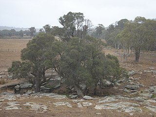
The Cumberland Plain Woodland, also known as Cumberland Plain Bushland and Western Sydney woodland, is a grassy woodland community found predominantly in Western Sydney, New South Wales, Australia, that comprises an open tree canopy, a groundcover with grasses and herbs, usually with layers of shrubs and/or small trees.

<span class="mw-page-title-main">Cattai Estate</span> Historic site in New South Wales, Australia

The Cattai Estate is a heritage-listed former farm and cultural landscape and now national park at Wisemans Ferry Road, Cattai, The Hills Shire, New South Wales, Australia. It was built from 1804 to 1821. It is also known as Caddai Estate, Cattai National Park and Caddie estate. The property is owned by Office of Environment and Heritage, an agency of the Government of New South Wales. It was added to the New South Wales State Heritage Register on 2 April 1999.

<span class="mw-page-title-main">Fairfield Park Precinct</span>

Fairfield Park Precinct, or Fairfield Park, is an urban park situated in the western suburbs of Sydney, New South Wales, Australia. Situated to the south of Fairfield CBD, the park contains an open grassland, bushland, picnic spots, playgrounds, indoor and outdoor sport facilities, and recreational areas within the vicinity of native plants, such as eucalyptus trees.

<span class="mw-page-title-main">Prospect Nature Reserve</span>

Prospect Nature Reserve is a nature reserve and recreational area that is situated in the western suburbs of Sydney, New South Wales, Australia, which incorporates the Prospect Reservoir, and also features picnic spots, lookouts, walking tracks and BBQ areas within the Australian bush. It is located within the Blacktown City local government area, but is also close to the boundaries of Cumberland Council and the City of Fairfield.

<span class="mw-page-title-main">Ecology of Sydney</span> Geographic aspect of Sydney, Australia

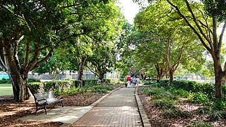
The ecology of Sydney, located in the state of New South Wales, Australia, is diverse for its size, where it would mainly feature biomes such as grassy woodlands or savannas and some sclerophyll forests, with some pockets of mallee shrublands, riparian forests, heathlands, and wetlands, in addition to small temperate rainforest fragments.

<span class="mw-page-title-main">Limeburners Creek National Park</span> Protected area in New South Wales, Australia

Limeburners Creek National Park is a protected national park on the Mid North Coast of New South Wales, Australia. The 91.2 km national park is located 5 km (3.1 mi) to the north of Port Macquarie and exists across both the Kempsey Shire and Port Macquarie-Hastings Council local government areas, but is chiefly managed by National Parks and Wildlife Service. The area was originally erected as a nature reserve but this reservation was revoked when it became formally recognised as a national park in 2010 under the National Parks and Wildlife Act (1974). Many threatened ecological habitats and species of fauna and flora are found within this park, alongside several heritage sites of cultural significance, particularly to the local Birpai and Dunghutti people upon whose land the park exists. The protected status of this national park is largely owing to the ecological and cultural value of the area, in addition to the value of the ecosystems to further scientific research.

<span class="mw-page-title-main">Southern Highlands Shale Forest and Woodland</span> Ecological community in New South Wales

The Southern Highlands Shale Forest and Woodland is a mixed grassy woodland and sclerophyll-temperate forest community situated within the Southern Highlands region of New South Wales, Australia. An ecotone featuring clay soils derived from Wianamatta Group, it is listed as an endangered ecological community by the Environment Protection and Biodiversity Conservation Act 1999 as less than 5% of the original extent remains today. Three varieties of the Shale Woodland exist: ‘typical’, ‘tall wet’ and ‘short dry’.

<span class="mw-page-title-main">Castlereagh Scribbly Gum and Agnes Banks Woodlands</span> Indigenous woodland community in Sydney, Australia

The Castlereagh Scribbly Gum and Agnes Banks Woodlands is an endangered sclerophyll low-woodland and shrubland community found in western Sydney, New South Wales, Australia. Vegetation comprises low woodlands with sclerophyllous shrubs and an uneven ground layer of graminoids and forbs.

<span class="mw-page-title-main">Grey Box Reserve</span> Nature reserves in Australia

The Grey Box Reserve, or Greystanes Grey Box Reserve, is a small nature reserve situated in the suburb of Greystanes, New South Wales in Western Sydney, Australia. A remnant bushland of the Cumberland Plain Woodland, it mainly features native vegetation. The reserve is so-named because of its abundance of Eucalyptus moluccana, reflecting the pre-European cultural landscape of the area.

References

  1. 1 2 WSPT Annual Visitor Monitoring 2009/2010
  2. HASSELL (2010a) Stage One Report, Context and Analysis, Western Sydney Parklands Plan of Management.
  3. "Archived copy". Archived from the original on 21 April 2013. Retrieved 15 November 2013.{{cite web}}: CS1 maint: archived copy as title (link)
  4. "Archived copy". Archived from the original on 21 April 2013. Retrieved 15 September 2013.{{cite web}}: CS1 maint: archived copy as title (link)
  5. RTA (2008) The Western Sydney Regional Aboriginal Heritage Study. NSW Department of Environment and Climate Change
  6. HASSELL (2010b) Draft Western Sydney Parklands Plan of Management 2010–2020.
  7. Students plant over 140,000 trees to grow ‘green legacy’ in Sydney’s Biggest Backyard Claire Thompson from Western Sydney Parklands. 26 November 2019. Retrieved 29 August 2022.
  8. DECCW (2009), Draft Recovery Plan for the Cumberland Plain. DECCW, Sydney.
  9. NSW NPWS (2001) State of the Parks 2001, NSW National Parks and Wildlife Service, Hurstville.
  10. "Archived copy" (PDF). Archived from the original (PDF) on 4 November 2014. Retrieved 15 September 2013.{{cite web}}: CS1 maint: archived copy as title (link)
  11. 1 2 DECC (2006) A Vertebrate Fauna Survey of Western Sydney Regional Park. Unpublished report. NPWS, Parramatta.
  12. NSW NPWS (2002) Native Vegetation of the Cumberland Plain - Final Edition. NPWS, Sydney.
  13. "Parklands Wildlife". Archived from the original on 22 September 2012. Retrieved 15 November 2013.
  14. "DEC | NSW threatened species - Species, populations and ecological communities". Archived from the original on 23 January 2012. Retrieved 15 November 2013.
  15. Ecological (2008) Biodiversity Restoration Strategy Western Sydney Parklands. NSW Department of Planning.
  16. "Sydney Zoo - Bungarribee Super Park, Western Sydney". Sydney Zoo. Retrieved 16 August 2018.