
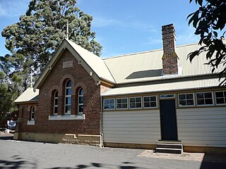
Rhodes is an Inner West suburb of Sydney, in the state of New South Wales, Australia. Rhodes is located 12 kilometres west of the Sydney central business district, in the local government area of the City of Canada Bay. It was formerly part of Concord Municipality until a merger with Drummoyne Council to form Canada Bay in December 2000.

Ryde is a suburb of Sydney, New South Wales, Australia. Ryde is located 13 km north-west of the Sydney central business district and 8 km east of Parramatta. Ryde is the administrative centre of the local government area of the City of Ryde and part of the Northern Sydney region. It lies on the north bank of the Parramatta River. People from Ryde are colloquially known as Ryders, Rydiens or Rydemen.

The Lane Cove River, a northern tributary of the Parramatta River, is a tide-dominated, drowned valley estuary west of Sydney Harbour, located in Sydney, New South Wales, Australia. The river winds through a bushland valley and joins Parramatta River at Greenwich and Woolwich, where together they form an arm of Sydney Harbour, and serves as a border along with Middle Harbour separating Sydney's North Shore.

Epping is a suburb of Sydney, in the Australian state of New South Wales, 18 kilometres north-west of the Sydney central business district in the local government area of the City of Parramatta. Epping is in the Northern Sydney region. The suburb is the most north-eastern area of the City of Parramatta. North Epping is a separate suburb to the north and under a different council, Hornsby Shire.

North Epping is a suburb of Sydney, in the state of New South Wales, Australia 19 kilometres north-west of the Sydney central business district in the local government area of Hornsby Shire. North Epping is in the Northern Sydney region, and is often referred to as part of the "North-West" or North Shore. Epping is a separate suburb to the south and under the Parramatta City Council, which shares the postcode of 2121.

Eastwood is a suburb of Sydney, Australia. Eastwood is located 17 kilometres north-west of the Sydney central business district in the local government areas of the City of Ryde and the City of Parramatta. Eastwood is in the Northern Sydney region and is on the Sydney Trains Northern Line (Sydney). despite it being partially in the City of Parramatta. The area is best known for being an ethnic enclave for immigrant populations in Sydney, mainly of East Asian origin but the suburb also has a significant number of other immigrant populations, such as Italian and Anglo-Saxon people. Eastwood was originally its own town but due to the expansion of Sydney, was eventually absorbed.
North Ryde is a suburb located in the Northern Sydney region of Sydney, New South Wales, Australia. North Ryde is located 15 kilometres north-west of the Sydney central business district, in the local government area of the City of Ryde.
Dundas is a suburb of Sydney, New South Wales, Australia. Dundas is located 21 kilometres north-west of the Sydney central business district, in the local government area of the City of Parramatta, and the electoral division of Bennelong. Dundas is a leafy green suburb, notably due to its centrepiece The Ponds Walk, which follows the Ponds Subiaco Creek. Dundas is part of the Northern Sydney and Greater Western Sydney regions.
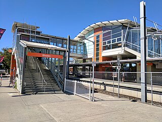
Rhodes railway station is a heritage-listed railway station located on the Main Northern line, serving the Sydney suburbs of Rhodes and Liberty Grove both in City of Canada Bay, Sydney, New South Wales, Australia. It is served by Sydney Trains T9 Northern Line services.

Macquarie Park is a suburb in the Northern Sydney region of Sydney, New South Wales, Australia. Macquarie Park is located 13 kilometres north-west of the Sydney central business district in the local government area of the City of Ryde.

East Ryde is a suburb of Sydney in the state of New South Wales, Australia. East Ryde is in the Northern Sydney region and is located 12 kilometers north-west of the Sydney central business district, in the local government area of the City of Ryde. East Ryde sits on the western bank of the Lane Cove River. East Ryde shares the postcode of 2113 with the adjacent suburb of North Ryde, though it does not have a post office of its own.

TG Millner Field is in the North West Sydney suburb of Marsfield, New South Wales, Australia, and is currently the home ground of Eastwood Rugby Club, a rugby union Club that competes in the Shute Shield competition.

Marsfield is a suburb in the Northern Sydney region of Sydney, in the state of New South Wales, Australia. Marsfield is located 16 kilometres north-west of the Sydney central business district in the local government area of the City of Ryde.

The City of Ryde is a local government area in the Northern Sydney region, in New South Wales, Australia. It was first established as the Municipal District of Ryde in 1870, became a municipality in 1906 and was proclaimed as the City of Ryde in 1992.
Wallumatta was the original name given to the Ryde-Hunters Hill area of Northern Sydney, Australia. Prior to the time that the area was known as Kissing Point, Wallumatta was the formal title and was named in honour of the area's native inhabitants: The Wallumettagal Aboriginal tribe.

The New South Wales Office of Environment and Heritage (OEH), a former division of the Government of New South Wales between April 2011 and July 2019, was responsible for the care and protection of the environment and heritage, which includes the natural environment, Aboriginal country, culture and heritage, and built heritage in New South Wales, Australia. The OEH supported the community, business and government in protecting, strengthening and making the most of a healthy environment and economy within the state. The OEH was part of the Department of Planning and Environment cluster and managed national parks and reserves.

Field of Mars Parish is one of the 57 parishes of Cumberland County, New South Wales, a cadastral unit for use on land titles. While the name is mostly forgotten as a region name today, it has given the name to the modern suburb of Marsfield and the reserve in the area. It is centred on Carlingford and also includes Epping, Telopea and Ermington. Its southern boundary is the Parramatta River.

The Sydney Turpentine-Ironbark Forest (STIF) is a wet sclerophyll forest community of Sydney, New South Wales, Australia, that is typically found in the Inner West and Northern region of Sydney. It is also among the three of these plant communities which have been classified as Endangered, under the New South Wales government's Threatened Species Conservation Act 1995, with only around 0.5% of its original pre-settlement range remaining.

Northern Sydney is a large metropolitan area in Greater Sydney, New South Wales, Australia on the north shore of Sydney Harbour and Parramatta River. The region embraces suburbs in Sydney's north-east, north and inner north west. Northern Sydney is divided into distinctive regions such as the North Shore, Northern Beaches and Forest District.

Wallumatta Nature Reserve, also called the Macquarie Hospital Bushland, is a 6-hectare (15-acre) nature reserve bushland area, surrounded by the residential suburb of East Ryde, in suburban Sydney, Australia. Once part of the Field of Mars of 1804, the reserve is the largest surviving area of Sydney Turpentine-Ironbark Forest, an endangered ecosystem. Soils are based on Ashfield Shale and Hawkesbury Sandstone.
