
The San Francisco Municipal Railway (SF Muni or Muni), is the public transit system for the City and County of San Francisco. It operates a system of bus routes, the Muni Metro light rail system, three historic cable car lines, and two historic streetcar lines. Previously an independent agency, the San Francisco Municipal Railway merged with two other agencies in 1999 to become the San Francisco Municipal Transportation Agency (SFMTA). In 2018, Muni served 46.7 square miles (121 km2) with an operating budget of about $1.2 billion. Muni is the seventh-highest-ridership transit system in the United States, with 114,721,200 rides in 2022, and the second-highest in California after the Los Angeles County Metropolitan Transportation Authority.

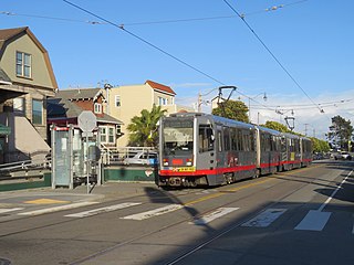
Muni Metro is a light rail system serving San Francisco, California, United States. Operated by the San Francisco Municipal Railway (Muni), a part of the San Francisco Municipal Transportation Agency (SFMTA), Muni Metro served an average of 157,700 passengers per weekday in the fourth quarter of 2019, making it the second-busiest light rail system in the United States.

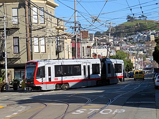
The N Judah is a hybrid light rail/streetcar line of the Muni Metro system in San Francisco, California. The line is named after Judah Street that it runs along for much of its length, named after railroad engineer Theodore Judah. It links downtown San Francisco to the Cole Valley and Sunset neighborhoods. It is the busiest line in the Muni Metro system, serving an average of 41,439 weekday passengers in 2013. It was one of San Francisco's streetcar lines, beginning operation in 1928, and was partially converted to modern light-rail operation with the opening of the Muni Metro system in 1980. While many streetcar lines were converted to bus lines after World War II, the N Judah remained a streetcar line due to its use of the Sunset Tunnel.

The L Taraval is a hybrid light rail/streetcar line of the Muni Metro system in San Francisco, California, mainly serving the Parkside District. Since 2021, the line has been suspended and replaced by buses through the end of 2024 for an improvement project along Taraval Street.

The K Ingleside is a hybrid light rail/streetcar line of the Muni Metro system in San Francisco, California. It mainly serves the West Portal and Ingleside neighborhoods. The line opened on February 3, 1918, and was the first line to use the Twin Peaks Tunnel.

The J Church is a hybrid light rail/streetcar line of the Muni Metro system in San Francisco, California. The line runs between Embarcadero station and Balboa Park station through Noe Valley. Opened on August 11, 1917, it is the oldest and has the lowest ridership of all of the Muni Metro lines.

Embarcadero station is a combined BART and Muni Metro rapid transit subway station in the Market Street subway in downtown San Francisco. Located under Market Street between Drumm Street and Beale Street near The Embarcadero, it serves the Financial District neighborhood and surrounding areas. The three-level station has a large fare mezzanine level, with separate platform levels for Muni Metro and BART below. Embarcadero station opened in May 1976 – almost two years after service began through the Transbay Tube – as an infill station.

38 Geary is a bus line operated by the San Francisco Municipal Railway (Muni). Together with the limited service routes that share the number, the 38R Geary Rapid, 38AX Geary 'A' Express, and 38BX Geary 'B' Express, the Geary Boulevard corridor makes up Muni's busiest thoroughfare.

Duboce and Church is a light rail stop on the Muni Metro J Church and N Judah lines, located in the Duboce Triangle neighborhood of San Francisco, California. Just east of the station, the two lines enter the Market Street subway. The stop originally opened with the 22 Fillmore line in 1895. The station has complex layout with two side platforms in the middle of Duboce Avenue for the N Judah, one side platform in the middle of Church Street for northbound J Church trains entering the Market Street subway, and two mini-high platforms at the subway portal which provides access to both lines for people with disabilities.
Church and 30th Street station is a one-way light rail stop on the Muni Metro J Church line, located in the Noe Valley neighborhood of San Francisco, California. The stop is only served by inbound trains; outbound trains stop further north at Day Street. The stop has no platforms, trains stop at marked poles and passengers cross a vehicle travel lanes to board trains. The stop is not accessible to people with disabilities.

Ocean and Lee is a light rail stop on the Muni Metro K Ingleside line, located between the Westwood Park and Ingleside neighborhoods of San Francisco, California. The stop consists of two side platforms, with the eastbound (outbound) platform located on Ocean Avenue west of the intersection with Lee Street, and vice versa.
Broad and Plymouth station is a light rail stop on the Muni Metro M Ocean View line, located in the Ingleside neighborhood of San Francisco, California. The station has transit bulbs which extend the sidewalk of Broad Street, to meet trains like a side platform, allowing passengers to board or depart from trains. The stops are located just before trains cross Plymouth Avenue and include mini-high platforms which provide access to people with disabilities.
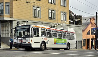
30 Stockton is a trolleybus line operated by the San Francisco Municipal Railway. The line is notable for being the slowest trolleybus route in the city of San Francisco because it travels through the densely populated neighborhood of Chinatown.
41 Union is a trolleybus line operated by the San Francisco Municipal Railway (Muni). It connects South of Market, the Financial District, Chinatown, North Beach, Russian Hill, and Cow Hollow.

31 Balboa is a trolleybus line operated by the San Francisco Municipal Railway. It is one of several routes operating between the Financial District and the Richmond District.

3 Jackson is a suspended trolleybus line operated by the San Francisco Municipal Railway.
45 Union/Stockton is a trolleybus line operated by the San Francisco Municipal Railway. It connects Cow Hollow to South of Market via Russian Hill, Chinatown, and the Financial District.
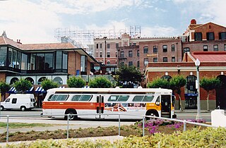
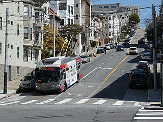
19 Polk is a bus route operated by the San Francisco Municipal Railway (Muni). It runs from Ghirardelli Square in the north to Hunters Point in the south via Russian Hill, Nob Hill, the Tenderloin, South of Market, India Basin, and Potrero Hill.
