Atlantic Plain

Last updated

Atlantic Plain Physiographic Division of the United States. Green highlighted area is the Atlantic Plain, and the other seven physiographic divisions of the contiguous United States are shown in the legend. Atlantic Plain Physiographic Division.jpg
Atlantic Plain Physiographic Division of the United States. Green highlighted area is the Atlantic Plain, and the other seven physiographic divisions of the contiguous United States are shown in the legend.

The Atlantic Plain is one of eight distinct physiographic divisions of the contiguous United States. Using the USGS physiographic classification system, the Atlantic Plain division comprises two provinces and six sections. The Coastal Plain province is differentiated from the Continental Shelf province simply based on the portion of the land mass above and below sea level. [1]

Contents

The lands adjacent to the Atlantic coastline are made up of sandy beaches, marshlands, bays, and barrier islands. It is the flattest of the U.S. physiographic divisions and stretches over 2,200 miles (3,500 km) in length from Cape Cod to the Mexican border and southward an additional 1,000 miles (1,600 km) to the Yucatán Peninsula. The central and southern Atlantic Coast is characterized by barrier and drowned valley coasts. The coastal Atlantic plain features nearly continuous barriers interrupted by inlets, large embayments with drowned river valleys, and extensive wetlands and marshes. [2] The Atlantic plain slopes gently seaward from the inland highlands in a series of terraces. This gentle slope continues far into the Atlantic and Gulf of Mexico, forming the continental shelf. The relief at the land-sea interface is so low that the boundary between them is often blurry and indistinct, especially along stretches of the Louisiana bayous and the Florida Everglades.

Continental Shelf

Extent of the Atlantic Plain Continental Shelf province as indicated by the 1928 work by Fenneman. Atlantic Plain Continental Shelf.jpg
Extent of the Atlantic Plain Continental Shelf province as indicated by the 1928 work by Fenneman.

The Atlantic Ocean has a broad, flat continental shelf that reaches a depth of 100 meters. [3] The continental shelf off the Atlantic Ocean ranges in width from less than 1 km off Florida to more than 420 km off Maine. The average width is about 135 km. [4]

Coastal Plain

The Coastal Plain of the United States includes all or portions of the states of Alabama, Arkansas, Delaware, Florida, Georgia, Kentucky, Maryland, Massachusetts, Mississippi, New Jersey, New York, North Carolina, Oklahoma, South Carolina, Rhode Island, [lower-alpha 1] Tennessee, Texas and Virginia. From the northeast, it begins on Cape Cod, Massachusetts and stretches to the southwest to South Padre Island, Texas. This is approximately 1,900 miles (3,100 km).

This province consists of the following physiographic sections: the Embayed, Sea Island, Floridian, East Gulf Coastal Plain, Mississippi Alluvial Plain, and the West Gulf Coastal Plain.

The rocks in the province consist, for the most part, of layers of sand and clay which are not yet hardened into sandstone and shale. The Coastal Plain features nearly continuous barrier islands interrupted by inlets, large embayments with drowned river valleys, and extensive wetlands and marshes. The Coastal Plain slopes gently seaward from the inland highlands in a series of terraces.

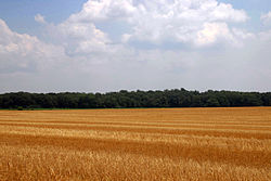
The province's average elevation is less than 900 meters above sea level and extends some 50 to 100 kilometers inland from the ocean.[ citation needed ] The coastal plain is normally wet, including many rivers, marsh, and swampland.[ citation needed ] It is composed primarily of sedimentary rock and unlithified sediments and is primarily used for agriculture. [5] The Atlantic Coastal Plain includes the Carolina Sandhills region [6] as well as the Embayed and Sea Island physiographic provinces. The Atlantic Coastal Plain is sometimes subdivided into northern and southern regions, specifically the Mid-Atlantic and South Atlantic coastal plains.

Geology

The Atlantic Plain is generally gently dipping undeformed Mesozoic and Cenozoic sediments, with the sedimentary wedge thickening toward the sea, reaching a maximum thickness of about 3 kilometers (10,000 ft) in the vicinity of Cape Hatteras, North Carolina. [7]

Ecology

Flora

Longleaf pine woodland savanna, typical of the region. Pinus palustris USDAFS.jpg
Longleaf pine woodland savanna, typical of the region.

Despite being previously overlooked in research, the Atlantic Coastal Plain is now identified as a global biodiversity hotspot, with over 1500 endemic plant species, and ~70% habitat loss. This endemism is particularly high in the longleaf pine savannas and woodlands, along with the other herbaceous and fire dependent ecosystems of the ecoregion. Despite intermittent flooding, certain refugia have remained continuously terrestrial since at least the late Cretaceous (85-80mya), contributing to endemism. Generally speaking, despite the high diversity of soils, the soil is nutrient poor. This is primarily due to an abundance of well-drained soils, creating a primarily xeric character to the floral makeup of the Atlantic Plain. [8] [9] However, waterlogged soils are also notable, with wetlands and hammocks being important ecological features. [10]

The Eastern woodlands are the original, predominant ecosystem of the Atlantic coastal plain. The Atlantic coastal plain upland longleaf pine woodland is an endemic plant community found in most of the Atlantic coastal plain, ranging from Virginia to northern Florida. These woodland savannas are reliant on sandy soils and are fire dependent, lest hardwoods start to dominate. Alongside longleaf pine, typically associated flora includes turkey oak and wiregrass. The Florida longleaf pine sandhill extends the longleaf pine forests into central Florida, with South Florida slash pine flatwoods, Florida sand pine scrub and Florida dry prairie stretching into southern Florida. [11] [12] [13] [14] [15] Longleaf pine woodlands also stretch further west, to eastern Texas. These consist of East Gulf and West Gulf longleaf pine flatwoods, bisected by the Mississippi Alluvial Plain. [12] [13] [16]

Wheat field near Centreville on the Eastern Shore of Maryland, with flat terrain typical of the Atlantic Plain Harvested Wheat 1 (3727629107).jpg
Wheat field near Centreville on the Eastern Shore of Maryland, with flat terrain typical of the Atlantic Plain

To the north, the Atlantic Coastal Plain also broaches into the mesic hardwood forests of the Middle Atlantic coastal forests, followed by the northern Atlantic coastal pine barrens. [17] [18] [19] The southernmost Atlantic Plain contains the only Neotropical ecoregion of the continental USA, being the Everglades and Florida mangroves. [20]

Fauna

The following species are largely endemic to the region. Amphibian diversity is especially notable in the Atlantic Plain. [9]

North

South

The red-cockaded woodpecker was once a widespread, signature species across the Atlantic Plain. Endangered Red-cockaded woodpecker - Photo credit - U.S. Forest Service-Chuck Hess - Copy (33284859802).jpg
The red-cockaded woodpecker was once a widespread, signature species across the Atlantic Plain.

Some of these species' ranges may extend into the longleaf pine woodlands and savannas of the Gulf Plain. [16] [21]

Notes

  1. New Shoreham, Rhode Island is specifically included in the polygonal database created by the USGS

Related Research Articles

<span class="mw-page-title-main">Longleaf pine</span> Species of plant (tree)

The longleaf pine is a pine species native to the Southeastern United States, found along the coastal plain from East Texas to southern Virginia, extending into northern and central Florida. In this area it is also known as "yellow pine" or "long leaf yellow pine", although it is properly just one out of a number of species termed yellow pine. It reaches a height of 30–35 m (98–115 ft) and a diameter of 0.7 m (28 in). In the past, before extensive logging, they reportedly grew to 47 m (154 ft) with a diameter of 1.2 m (47 in). The tree is a cultural symbol of the Southern United States, being the official state tree of Alabama. This particular species is one of the eight pine tree species that falls under the "Pine" designation as the state tree of North Carolina.

<span class="mw-page-title-main">Sandhill</span> Type of ecological community or xeric wildfire-maintained ecosystem

A sandhill is a type of ecological community or xeric wildfire-maintained ecosystem. It is not the same as a sand dune. It features very short fire return intervals, one to five years. Without fire, sandhills undergo ecological succession and become more oak dominated.

<span class="mw-page-title-main">Flatwoods</span> Ecological community in the southeastern coastal plain of North America

Flatwoods, pineywoods, pine savannas and longleaf pine–wiregrass ecosystem are terms that refer to an ecological community in the southeastern coastal plain of North America. Flatwoods are an ecosystem maintained by wildfire or prescribed fire and are dominated by longleaf pine, and slash pine in the tree canopy and saw palmetto, gallberry and other flammable evergreen shrubs in the understory, along with a high diversity of herb species. It was once one of the dominant ecosystem types of southeastern North America. Although grasses and pines are characteristic of this system, the precise composition changes from west to east, that is, from Texas to Florida. In Louisiana, savannas even differ between the east and west side of the Mississippi River. The key factor maintaining this habitat type is recurring fire. Without fire, the habitat is eventually invaded by other species of woody plants.

<span class="mw-page-title-main">Myakka River State Park</span> State park in Florida, United States

Myakka River State Park is a Florida State Park, that is located nine miles (14 km) east of Interstate 75 in Sarasota County and a portion of southeastern Manatee County on the Atlantic coastal plain. This state park consists of 37,000 acres (150 km2), making it one of the state's largest parks. It is also one of the oldest parks in the state. It was delineated in the 1930s by the Civilian Conservation Corps. A small portion of the park was the gift of the family of Bertha Palmer to the state. The park is named after the Myakka River.

<span class="mw-page-title-main">Sandhills (Carolina)</span> Region of the southeast United States

The Sandhills or Carolina Sandhills is a 10-35 mi wide physiographic region within the U.S. Atlantic Coastal Plain province, along the updip (inland) margin of this province in the states of North Carolina, South Carolina, and Georgia. The extent of the Carolina Sandhills is shown in maps of the ecoregions of North Carolina, South Carolina, and Georgia.

<span class="mw-page-title-main">Apalachicola National Forest</span> A national forest located Florida

The Apalachicola National Forest is the largest U.S. National Forest in the state of Florida. It encompasses 632,890 acres and is the only national forest located in the Florida Panhandle. The National Forest provides water and land-based outdoors activities such as off-road biking, hiking, swimming, boating, hunting, fishing, horse-back riding, and off-road ATV usage.

<span class="mw-page-title-main">De Soto National Forest</span> Protected area in Mississippi, United States

De Soto National Forest, named for 16th-century Spanish explorer Hernando de Soto, is 518,587 acres of pine forests in southern Mississippi. It is one of the most important protected areas for the biological diversity of the Gulf Coast ecoregion of North America.

<span class="mw-page-title-main">Hammock (ecology)</span> Type of ecosystem in the southeastern United States

Hammock is a term used in the southeastern United States for stands of trees, usually hardwood, that form an ecological island in a contrasting ecosystem. Hammocks grow on elevated areas, often just a few inches high, surrounded by wetlands that are too wet to support them. The term hammock is also applied to stands of hardwood trees growing on slopes between wetlands and drier uplands supporting a mixed or coniferous forest. Types of hammocks found in the United States include tropical hardwood hammocks, temperate hardwood hammocks, and maritime or coastal hammocks. Hammocks are also often classified as hydric, mesic or xeric. The types are not exclusive, but often grade into each other.

<span class="mw-page-title-main">Pocosin</span> Kind of wetland of the Atlantic plain

Pocosin is a type of palustrine wetland with deep, acidic, sandy, peat soils. Groundwater saturates the soil except during brief seasonal dry spells and during prolonged droughts. Pocosin soils are nutrient-deficient (oligotrophic), especially in phosphorus.

<span class="mw-page-title-main">Wet meadow</span>

A wet meadow is a type of wetland with soils that are saturated for part or all of the growing season which prevents the growth of trees and brush. Debate exists whether a wet meadow is a type of marsh or a completely separate type of wetland. Wet prairies and wet savannas are hydrologically similar.

<span class="mw-page-title-main">Florida scrub</span> Ecoregion of Florida, United States

Florida scrub is a forest ecoregion found throughout Florida in the United States. It is found on coastal and inland sand ridges and is characterized by an evergreen xeromorphic plant community dominated by shrubs and dwarf oaks. Because the low-nutrient sandy soils do not retain moisture, the ecosystem is effectively an arid one. Wildfires infrequently occur in the Florida scrub. Most of the annual rainfall falls in summer. It is endangered by residential, commercial and agricultural development, with the largest remaining block in and around the Ocala National Forest. Lake Wales Ridge National Wildlife Refuge also holds a high proportion of remaining scrub habitat, while the Archbold Biological Station near Lake Placid contains about 20 km2 (7.7 sq mi) of scrub habitat and sponsors biological research on it.

<span class="mw-page-title-main">Gopher frog</span> Species of amphibian

The gopher frog is a species of frog in the family Ranidae, endemic to the south-eastern United States. It primarily inhabits the threatened sandhill communities, flatwoods, and scrub in the Atlantic coastal plain, where it is usually found near ponds.

<span class="mw-page-title-main">North American Atlantic Region</span> Floristic region in the Holarctic kingdom

The North American Atlantic Region is a floristic region within the Holarctic Kingdom identified by Armen Takhtajan and Robert F. Thorne, spanning from the Atlantic and Gulf coasts to the Great Plains and comprising a major part of the United States and southeastern portions of Canada. It is bordered by the Circumboreal floristic region in the north, by the Rocky Mountain and Madrean floristic regions in the west and by the Caribbean floristic region of the Neotropical Kingdom in the south of Florida. The flora of the region comprises two endemic monotypic families, Hydrastidaceae and Leitneriaceae, and is characterized by about a hundred of endemic genera. The degree of species endemism is very high, many species are Tertiary relicts, which survived the Wisconsin glaciation and are now concentrated in the Appalachians and the Ozarks. A number of genera are shared only with the Canadian floristic province of the Circumboreal region. Moreover, as has long been noted, a large number of relict genera are shared with the relatively distant Eastern Asiatic Region and sometimes Southeast Asia. R. F. Thorne counted at least 74 genera restricted to eastern North America and Asia. The fossil record indicates that during the Tertiary period a warm temperate zone extended across much of the Northern Hemisphere, linking America to Asia.

<span class="mw-page-title-main">Eastern woodlands of the United States</span>

The eastern woodlands of the United States covered large portions of the southeast side of the continent until the early 20th century. These were in a fire ecology of open grassland and forests with low ground cover of herbs and grasses.

<span class="mw-page-title-main">Pre-Columbian woodlands of North America</span> Mixed woodland-grassland ecosystem

Pre-Columbian woodlands of North America, consisting of a mixed woodland-grassland ecosystem, were maintained by both natural lightning fires and by Native Americans before the significant arrival of Europeans. Although decimated by widespread epidemic disease, Native Americans in the 16th century continued using fire to clear woodlands until European colonists began colonizing the eastern seaboard. Many colonists continued the practice of burning to clear underbrush, reinforced by their similar experience in Europe, but some land reverted to forest.

<span class="mw-page-title-main">East Central Texas forests</span> Temperate broadleaf and mixed forests ecoregion of Oklahoma and Texas, United States

The East Central Texas forests or East Central Texas Plains (33) is a small temperate broadleaf and mixed forests ecoregion almost entirely within the state of Texas, United States. The northern forests perimeter is partially within the southeast Oklahoma border.

<span class="mw-page-title-main">Middle Atlantic coastal forests</span> Temperate coniferous forests ecoregion of the United States

The Middle Atlantic coastal forests are a temperate coniferous forest mixed with patches of evergreen broadleaved forests along the coast of the southeastern United States.

<span class="mw-page-title-main">Southeastern mixed forests</span> Temperate broadleaf and mixed forests ecoregion of the United States

The Southeastern mixed forests are an ecoregion of the temperate broadleaf and mixed forest biome, in the lower portion of the Eastern United States.

<span class="mw-page-title-main">Southeastern conifer forests</span> Temperate coniferous forests ecoregion of the United States

The Southeastern conifer forests are a temperate coniferous forest ecoregion of the southeastern United States. It is the largest conifer forest ecoregion east of the Mississippi River. It is also the southernmost instance of temperate coniferous forest within the Nearctic realm.

The east Gulf coastal plain near-coast pine flatwoods are forests and woodlands found in the eastern Gulf coastal plain, in the states of Alabama, Florida, Georgia, Louisiana, and Mississippi. They take the form of forests and woodlands on broad, sandy flatlands. Fires are naturally frequent, occurring every one to four years.

References

  1. "Physiographic divisions of the conterminous U. S." U.S. Geological Survey. Archived from the original on December 5, 2007. Retrieved December 6, 2007.
  2. "Programmatic Environmental Assessment for the Emergency Forestry Conservation Reserve Program" (PDF). U.S. Department of Agriculture, Farm Service Agency. Retrieved December 30, 2007.
  3. "NOAA Ocean Explorer: Estuary to the Abyss". oceanexplorer.noaa.gov. Retrieved October 7, 2023.
  4. Emery, K. O. (1966). Atlantic Continental Shelf and Slope of The United States, Geologic Background. USGS.
  5. Water table management in the eastern coastal plain Archived July 21, 2011, at the Wayback Machine
  6. Swezey, C.S., Fitzwater, B.A., Whittecar, G.R., Mahan, S.A., Garrity, C.P., Aleman Gonzalez, W.B., and Dobbs, K.M., 2016, The Carolina Sandhills: Quaternary eolian sand sheets and dunes along the updip margin of the Atlantic Coastal Plain province, southeastern United States: Quaternary Research, v. 86, p. 271-286; www.cambridge.org/core/journals/quaternary-research
  7. Renner, J. L.; Vaught, Tracy L. (1979). "Geothermal Resources of the Eastern United States" (PDF). U.S. Department of Energy, Division of Geothermal Energy. doi:10.2172/6630154 . Retrieved December 27, 2007.{{cite journal}}: Cite journal requires |journal= (help)
  8. Noss, Reed F.; Platt, William J.; Sorrie, Bruce A.; Weakley, Alan S.; Means, D. Bruce; Costanza, Jennifer; Peet, Robert K. (February 2015). Richardson, David (ed.). "How global biodiversity hotspots may go unrecognized: lessons from the North American Coastal Plain". Diversity and Distributions. 21 (2): 236–244. doi: 10.1111/ddi.12278 . S2CID   84685018.
  9. 1 2 Klepzig, Kier; Shelfer, Richard; Choice, Zanethia (2014). "Outlook for coastal plain forests: a subregional report from the Southern Forest Futures Project". Gen. Tech. Rep. SRS-GTR-196. Asheville, NC: USDA-Forest Service, Southern Research Station. 68 P. 196: 1–68. doi:10.2737/SRS-GTR-196.
  10. "Mid-Atlantic Coastal Forests Eco-Region: Endangered Forests and Special Areas" (PDF). Natural Resources Defense Council.
  11. Landers, J. Larry; Boyer, William D. (1999). "An old-growth definition for upland longleaf and south Florida slash pine forests, woodlands, and savannas". Gen. Tech. Rep. SRS-29. Asheville, NC: U.S. Department of Agriculture, Forest Service, Southern Research Station. 20 P. 29. doi:10.2737/SRS-GTR-29. hdl: 2027/uiug.30112048257486 .
  12. 1 2 Palmquist, Kyle A.; Peet, Robert K.; Carr, Susan C. (2013). "Xeric Longleaf Pine Vegetation of the Atlantic and East Gulf Coast Coastal Plain: an Evaluation and Revision of Associations within the U.S. National Vegetation Classification" (PDF). U.S. National Vegetation Classification: 1–70.
  13. 1 2 Peet, Robert K.; Allard, Dorothy J. (1993). Hermann, Shannon M. (ed.). "Longleaf Pine Vegetation of the Southern Atlantic and Eastern Gulf Coast Regions: A Preliminary Classification*" (PDF). Proceedings of the Tall Timbers Fire Ecology Conference (18): 45–81.
  14. Carr, Susan C.; Robertson, Kevin M.; Peet, Robert K. (June 2010). "A Vegetation Classification of Fire-Dependent Pinelands of Florida". Castanea. 75 (2): 153–189. doi: 10.2179/09-016.1 . ISSN   0008-7475. S2CID   56015575.
  15. "Sandhill" (PDF). FNAI - Guide to the Natural Communities of Florida. 2010 edition.
  16. 1 2 "East and West Gulf Coastal Plain: Open Pine/Savanna" (PDF). Gulf Coastal Plains and Ozarks Landscape Conservation Cooperative.
  17. Phillips, Jonathan D. (1994). "Forgotten Hardwood Forests of the Coastal Plain". Geographical Review. 84 (2): 162–171. doi:10.2307/215328. ISSN   0016-7428. JSTOR   215328.
  18. "North Atlantic Habitat Guide" (PDF). The Nature Conservancy.
  19. Myers, Jennifer Moore; Communications, SRS Science. "Bottomland Hardwoods of the Mid-Atlantic". CompassLive. Retrieved February 26, 2023.
  20. "Ecoregions 2017 ©". ecoregions.appspot.com. Retrieved February 26, 2023.
  21. "North American Coastal Plain - Species | CEPF". www.cepf.net. Retrieved February 26, 2023.

32°N83°W / 32°N 83°W / 32; -83