Ballston is named after the Ball family, and one of their family cemeteries lies in the neighborhood at N. Stafford Street and Fairfax Drive, also known as VA State Route 237.[2][3] Ballston began as Birch's Crossroads,[4] and later became Ball's Crossroads at what is now the intersection of N. Glebe Road and Wilson Boulevard.[5]
A historical marker that stands near the southeastern corner of the intersection reads:
This intersection has been a focal point since about 1740, when two roads were developed, one from the future site of Alexandria to the mouth of Pimmit Run, the other from Awbury’s Ferry (at the site of Rosslyn) to The Falls Church. The first came to be known as the Glebe Road because it passed the glebe of Fairfax Parish and in order to distinguish it from other roads to the Falls. The second was eventually named Wilson Boulevard in honor of President Wilson. The intersection became known as Ball’s Crossroads when Ball’s Tavern was established here in the early 1800s.[5]
19th century
In 1896, an interurban electric trolley line, the Fairfax line of the Washington, Arlington and Falls Church Railway (WA&FC), began operating north of the crossroads along the present route of Fairfax Drive, whose name derives from that of the trolleys' final destination, Fairfax City. Construction of the trolley line, which branched at Clarendon to serve both Rosslyn and downtown Washington, D.C., temporarily shifted much of the area's development away from the crossroads.[6]
20th century
A historical marker near the northwestern corner of Fairfax Drive and N. Stafford Street, one block east of the Ballston–MU station, at the former site of the Ballston trolley station, states:
By 1900, a well-defined village called Central Ballston had developed in the area bounded by the present-day Wilson Boulevard, Taylor Street, Washington Boulevard, and Pollard Street. More diffuse settlement extended westward to Lubber Run and southward along Glebe Road to Henderson Road.
The track of the Washington, Arlington, and Falls Church Electric Railroad ran along what is now Fairfax Drive; the Ballston Station was at Ballston Avenue, now North Stuart Street. Here Clements Avenue, now Stafford Street, divided to pass on either side of an old Ball family graveyard.[2]
The Ball family burial ground on Washington Boulevard has a historical marker, which states:
Old Ball Family Burial Ground. This is one of Arlington's oldest family burial grounds. Ensign John Ball (1748–1814), a veteran of the American Revolution (Sixth Virginia Infantry) is buried here. John Ball was the son of Moses Ball, who was one of the pioneer settlers in the Glencarlyn area of Arlington. Also buried here in the cemetery are many of John Ball's direct and collateral descendants including John Wesley Boldin, a Civil War soldier (Company D, Third Pennsylvania Cavalry) and members of the Marcey, Stricker, Donaldson, and Croson families.[7]
In 1912, a competing interurban electric trolley line, the Washington and Old Dominion Railway constructed a branch that crossed the WA&FC near the west end of Ballston, then called Lacey, near a WA&FC car barn and railyard. Interstate 66 and the Bluemont Junction Trail now follow the route of this railroad branch between Rosslyn and the Washington and Old Dominion Railroad Regional Park in Bluemont Park. A historical marker entitled "Lacey Car Barn" located near the northwest corner of N. Glebe Road and Fairfax Drive states:
In 1896, the Washington, Arlington & Falls Church Railway began running electric trolleys from Rosslyn to Falls Church on the present routes of Fairfax Drive and I-66. By 1907, the Fairfax trolley linked Fairfax, Vienna, and Ballston with downtown Washington, D.C. In 1910, at this location, the railway built a car barn, railyard, workshops, electrical substation, and general office. In 1912, the rival Washington and Old Dominion Railroad began crossing the tracks on a bridge 200 yards west of here, following the present route of I-66 from Rosslyn. The Fairfax trolley closed in 1939, but Metrorail’s Orange Line follows its route through Arlington.[8]
In 1951, the Parkington Shopping Center opened at the intersection, formerly known as Balls Crossroads on the site of present-day Ballston Quarter. Parkington was anchored by the headquarters location of the Hecht Company, and was reputed to have the largest parking garage in the nation when it opened.[6]
Ballston Quarter, a shopping, entertainment and residential complex, reopened in 2019 after being closed for two years of renovations.[11]
The MedStar Capitals Iceplex, constructed on top of the Ballston Quarter parking garage, houses the offices, 20,000 square feet (1,900m2) training facility, for the Washington Capitals of the National Hockey League (NHL)y. In addition to the ice hockey team's training center, the Iceplex features two indoor NHL-sized ice rinks, office space, locker rooms, a full-service pro-shop, a Capitals team store, a snack bar, and space for special events. The facility provides public skating, figure skating, and hockey programs for youths and adults.[12]Virginia Square Shopping Center once operated in the now named Virginia Square section of the Ballston neighborhood.[13][14]
Ballston hosts the annual Taste of Arlington food festival,[15] a street fair which has been produced each spring since 1987. The 2009 Taste of Arlington event featured over 40 area restaurants offering portions of their cuisine to ticket-holders, and drew approximately 15,000 people.[16] The regional business development organization, the Ballston Business Improvement District (Ballston BID), (formerly the Ballston-Virginia Square Partnership which is inclusive of the Virginia Square district of Ballston),[10] other area community development organizations, and the National Science Foundation organize the festival.[16] Ticket sales at the event raise funds for area charities.[17]
In January 2014, the Arlington County Board approved MU's site plan application to redevelop the campus with two new buildings, a nine-story office and educational building for Marymount University and a 15-story multifamily building with 272 residential units, by Arlington developer, the Shooshan Company.[19] The new campus opened in August 2017.[18]
↑ "Kann's Virginia Set for Friday Opening," The Washington Post, Nov 14, 1951, p. 15.
↑ (1) "About Ballston". Arlington, Virginia: Ballston BID. 2017. Archived from the original on August 25, 2017. Retrieved November 13, 2018. (2) "Ballston-Virginia Square Village Website". Ballston-Virginia Square Partnership. 2007. Archived from the original on January 21, 2013. Retrieved October 31, 2013.
Arlington County, or simply Arlington, is a county in the U.S. state of Virginia. The county is located in Northern Virginia on the southwestern bank of the Potomac River directly across from Washington, D.C., the national capital.
Interstate 66 (I-66) is a 76.32 mile east–west Interstate Highway in the eastern United States. The highway runs from an interchange with I-81 near Middletown, Virginia, on its western end to an interchange with U.S. Route 29 (US 29) in Washington, D.C., at the eastern terminus. Much of the route parallels US 29 or State Route 55 (SR 55) in Virginia. I-66 has no physical or historical connection to US 66, which was located in a different region of the United States.
The Orange Line is a rapid transit line of the Washington Metro system, consisting of 26 stations in Fairfax County and Arlington in Northern Virginia; Washington, D.C.; and Prince George's County, Maryland, United States. The Orange Line runs from Vienna in Virginia to New Carrollton in Maryland. Half of the line's stations are shared with the Blue Line and over two thirds are shared with the Silver Line. Orange Line service began on November 20, 1978.
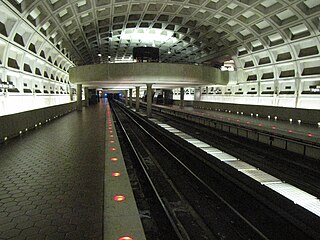
Ballston–MU station is a side platformed Washington Metro station in the Ballston section of Arlington County, Virginia. The station opened on December 1, 1979, and is operated by the Washington Metropolitan Area Transit Authority (WMATA). The station is part of the Orange and Silver Lines and serves the transit-oriented community of Ballston, Ballston Quarter, and Marymount University (MU).
Virginia Square–GMU station is a Washington Metro station in the Virginia Square neighborhood of Arlington, Virginia, United States. The side platformed station opened on December 1, 1979, and is operated by the Washington Metropolitan Area Transit Authority (WMATA). The station serves the Orange and Silver Lines. The station serves the Virginia Square neighborhood as well as the Arlington campus of George Mason University (GMU). The station entrance is located at the intersection of Fairfax Drive and North Monroe Street.
Clarendon is an urbanized, upper-class neighborhood in Arlington County, Virginia, located between the Rosslyn area and the Ballston area. It was named after Edward Hyde, 1st Earl of Clarendon, a leading statesman and historian of the English Civil War. The main thoroughfares are Wilson Boulevard and Clarendon Boulevard.
Court House, also known as Courthouse, is a transit-oriented neighborhood in Arlington County, Virginia. It is centered around the Court House station on the Orange Line and the Silver Line of the Washington Metro.
State Route 120 is a primary state highway in the U.S. state of Virginia. Known as Glebe Road, the state highway runs 9.10 miles (14.65 km) from U.S. Route 1 (US 1) in Crystal City north to SR 123 at the Chain Bridge. SR 120 is a partial circumferential highway in Arlington County that connects the southeastern and northwestern corners of the county with several urban villages along its crescent-shaped path, including Ballston. The state highway also connects all of the major highways in Virginia that radiate from Washington, including Interstate 395, I-66, US 50, and US 29. SR 120 is a part of the National Highway System for its entire length.
The Washington and Old Dominion Railroad was an intrastate short-line railroad located in Northern Virginia, United States. The railroad was a successor to the bankrupt Washington and Old Dominion Railway and to several earlier railroads, the first of which began operating in 1859. The railroad closed in 1968.
The Washington and Old Dominion Railroad Regional Park is a linear regional park in Northern Virginia. The park's primary feature is the Washington and Old Dominion Railroad Trail, an asphalt-surfaced paved rail trail that runs through densely populated urban and suburban communities as well as through rural areas. Most of the trail travels on top of the rail bed of the former Washington and Old Dominion Railroad, which closed in 1968.
The Northern Virginia trolleys were the network of electric streetcars that moved people around the Northern Virginia suburbs of Washington, D.C., from 1892 to 1941. They consisted of six lines operated by as many as three separate companies connecting Rosslyn, Great Falls, Bluemont, Mount Vernon, Fairfax, Camp Humphries, and Nauck across the Potomac River to Washington, D.C.
The Great Falls and Old Dominion Railroad (GF&OD) was an interurban trolley line that ran in Northern Virginia during the early 20th century.
State Route 237 is a primary state highway in the U.S. state of Virginia. The state highway runs 13.07 miles (21.03 km) from SR 236 in Fairfax east to U.S. Route 50 in Arlington. SR 237 connects Fairfax and Arlington with Falls Church. Between Fairfax and Falls Church, the state highway mostly runs concurrently with US 29. East of Falls Church, SR 237 parallels Interstate 66 (I-66) and connects several of Arlington's urban villages.
The Glebe House, built in 1854–1857, is a historic house with an octagon-shaped wing in Arlington County, Virginia. The Northern Virginia Conservation Trust holds a conservation easement to help protect and preserve it. The name of the house comes from the property's history as a glebe, an area of land within an ecclesiastical parish used to support a parish priest. In this case, the glebe was established by the Church of England before the American Revolutionary War.
Ballston Quarter, formerly known as Ballston Common Mall, originally opened as Parkington Shopping Center, is one of the first major suburban shopping centers in the Washington metropolitan area. It opened in 1951 and was the nation's first shopping center built around a multi-story parking garage. It is located at the intersection of Glebe Road and Wilson Boulevard in the Ballston neighborhood of Arlington County, Virginia, two blocks from Ballston–MU station on the Washington Metro's Orange and Silver lines.
The Bluemont Junction Trail is a 1.2-mile (1.9 km) asphalt-paved rail trail in Arlington County, Virginia, United States, that the Arlington County government constructed along a former branch of the defunct Washington and Old Dominion Railroad. The shared use path travels southwest from Ballston through Bluemont Junction Park to Bluemont Junction. The trail connects Ballston to the Washington and Old Dominion Railroad Trail and the Four Mile Run Trail in and near Bluemont Park.
MedStar Capitals Iceplex is the practice arena of the Washington Capitals of the National Hockey League. The highest ice rink above street-level in the United States, it is located on the eighth floor atop the parking garage adjoining the Ballston Quarter in the Ballston neighborhood of Arlington County, Virginia.
Nauck is a neighborhood in the southern part of Arlington County, Virginia, known locally as Green Valley. It is bordered by Four Mile Run and Shirlington to the south, Douglas Park to the west, I-395 to the east, and Columbia Heights and the Army-Navy Country Club to the north. The southeastern corner of the neighborhood borders the City of Alexandria.
The Hunting Point–Ballston Line, designated as Route 10B, is a daily bus route operated by the Washington Metropolitan Area Transit Authority between Hunting Point and Ballston–MU station of the Orange and Silver lines of the Washington Metro. This line provides service within the neighborhoods in Fairfax County, Alexandria, and Arlington County. Alongside the neighborhoods, it also brings service through the marketplace, businesses, and offices within the counties.
Frank Livingston Ball was a member of the Virginia Senate from 1924 to 1932.
This page is based on this Wikipedia article Text is available under the CC BY-SA 4.0 license; additional terms may apply. Images, videos and audio are available under their respective licenses.