Whidbey Island is the largest of the islands composing Island County, Washington, in the United States, and the largest island in Washington state. Whidbey is about 30 miles (48 km) north of Seattle, and lies between the Olympic Peninsula and the I-5 corridor of western Washington. The island forms the northern boundary of Puget Sound. It is home to Naval Air Station Whidbey Island. The state parks and natural forests are home to numerous old growth trees.

The San Juan Islands is an archipelago in the Pacific Northwest of the United States between the U.S. state of Washington and Vancouver Island, British Columbia, Canada. The San Juan Islands are part of Washington state, and form the core of San Juan County.

Vancouver Island is an island in the northeastern Pacific Ocean and part of the Canadian province of British Columbia. The island is 456 km (283 mi) in length, 100 km (62 mi) in width at its widest point, and 32,100 km2 (12,400 sq mi) in total area, while 31,285 km2 (12,079 sq mi) are of land. The island is the largest by area and the most populous along the west coasts of the Americas.

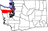
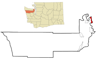
Jefferson County is a county located in the U.S. state of Washington. As of the 2020 census, the population was 32,977. The county seat and only incorporated city is Port Townsend. The county is named for Thomas Jefferson.

Port Jefferson, also known as Port Jeff, is an incorporated village in the town of Brookhaven in Suffolk County, New York, on the North Shore of Long Island. Officially known as the Incorporated Village of Port Jefferson, the population was 7,962 as of the 2020 United States census.
Marrowstone is a census-designated place (CDP) in Jefferson County, Washington, United States. The population was 995 at the 2020 census. All Marrowstone addresses are in Nordland, Washington, and the ZIP code for Marrowstone Island is 98358.

Port Townsend is a city on the Quimper Peninsula in Jefferson County, Washington, United States. The population was 10,148 at the 2020 United States Census. It is the county seat and only incorporated city of Jefferson County.
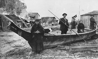
The Klallam are a Coast Salish people Indigenous to the northern Olympic Peninsula. The language of the Klallam is the Klallam language, a language closely related to the North Straits Salish languages. The Klallam are today citizens of four recognized bands: Three federally-recognized tribes in the United States and one band government in Canada. Two Klallam tribes, the Jamestown S'Klallam and Lower Elwha Klallam, live on the Olympic Peninsula, and one, the Port Gamble S'Klallam, on the Kitsap Peninsula in Washington state. In Canada, the Scia'new First Nation is based at Becher Bay on southern Vancouver Island in British Columbia.

The Olympic Peninsula is a large arm of land in western Washington that lies across Puget Sound from Seattle, and contains Olympic National Park. It is bounded on the west by the Pacific Ocean, the north by the Strait of Juan de Fuca, and the east by Hood Canal. Cape Alava, the westernmost point in the contiguous United States, and Cape Flattery, the northwesternmost point, are on the peninsula. Comprising about 3,600 square miles (9,300 km2), the Olympic Peninsula contained many of the last unexplored places in the contiguous United States. It remained largely unmapped until Arthur Dodwell and Theodore Rixon mapped most of its topography and timber resources between 1898 and 1900.
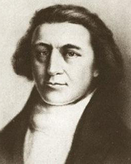
Robert Gray was an American merchant sea captain who is known for his achievements in connection with two trading voyages to the northern Pacific coast of North America, between 1790 and 1793, which pioneered the American maritime fur trade in that region. In the course of those voyages, Gray explored portions of that coast and in the year 1790 he completed the first American circumnavigation of the world. He was also noted for coming upon and naming the Columbia River, in 1792, while on his second voyage.

Discovery Bay is an unincorporated community in Jefferson County, Washington. The community of Discovery Bay is an area near the intersection of U.S. Route 101 and State Route 20, at the foot of Discovery Bay – roughly midway between the larger communities of Port Townsend to the northeast and Sequim to the northwest. It is a mix of residential areas and commercial enterprises, including crabbing, oystering, clamming, timbering, security training and gravel extraction. A few restaurants and stores on US 101 near SR 20 primarily serve drivers and truckers along US 101.
Gardiner is an unincorporated community in Jefferson County, Washington, United States. Additionally, part of Clallam County, located along the Jefferson County line adjacent to Gardiner is often referred to as being part of Gardiner.
Port Discovery, Washington is the name of a historically significant community in Jefferson County, Washington that was located on the bay for roughly a hundred years; it disappeared in the late 20th century, with the collapse of the local timber industry.
The Quimper Peninsula is a narrow peninsula forming the most northeastern extent of the Olympic Peninsula of Washington state in the northwestern United States of America.
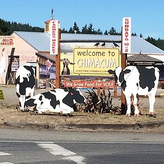
Chimacum is an unincorporated community in Jefferson County, Washington, United States, located in the center of the primary agricultural area of the eastern Olympic Peninsula.

Protection Island is an island located in the Strait of Juan de Fuca just north of Discovery Bay in northeastern Jefferson County, Washington, United States. The island has a land area of 379 acres (153 ha). It is a federally protected National Wildlife Refuge; boats are not permitted within 200 yards (180 m) for the safety and health of wildlife on and near the shores. There is only one individual still living on the island not associated with the government. Marty Bluewater has lifetime use of his inholding cabin on the island's southern bluffs. The island also houses a caretaker, a volunteer hired by the United States Fish and Wildlife Service, to watch over the island and take care of its many inhabitants. Boat trips from nearby Port Townsend, Washington provide ecotourism visits for viewing wildlife from the adjacent waters.

The Vancouver Expedition (1791–1795) was a four-and-a-half-year voyage of exploration and diplomacy, commanded by Captain George Vancouver of the Royal Navy. The British expedition circumnavigated the globe and made contact with five continents. The expedition at various times included between two and four vessels, and up to 153 men, all but 6 of whom returned home safely.

Victoria Harbour is a harbour, seaport, and seaplane airport in the Canadian city of Victoria, British Columbia. It serves as a cruise ship and ferry destination for tourists and visitors to the city and Vancouver Island. It is both a port of entry and an airport of entry for general aviation. Historically it was a shipbuilding and commercial fishing centre. While the Inner Harbour is fully within the City of Victoria, separating the city's downtown on its east side from the Victoria West neighbourhood, the Upper Harbour serves as the boundary between the City of Victoria and the district municipality of Esquimalt. The inner reaches are also bordered by the district of Saanich and the town of View Royal. Victoria is a federal "public harbour" as defined by Transport Canada. Several port facilities in the harbour are overseen and developed by the Greater Victoria Harbour Authority, however the harbour master's position is with Transport Canada.

Vancouver is a city on the north bank of the Columbia River in the U.S. state of Washington, located in Clark County. Founded in 1825 and incorporated in 1857, Vancouver had a population of 190,915 as of the 2020 census, making it the fourth-most populous city in Washington state. Vancouver is the seat of government of Clark County and forms part of the Portland-Vancouver metropolitan area, the 25th-largest metropolitan area in the United States. Originally established in 1825 around Fort Vancouver, a fur-trading outpost, the city is located on the Washington–Oregon border along the Columbia River, directly north of Portland, and is considered a suburb of the city along with its surrounding areas.

Discovery Bay is a small bay connected to the Strait of Juan de Fuca on the coast of the Olympic Peninsula in Washington state; it was also historically called Port Discovery. An unincorporated community also named Discovery Bay lies in Jefferson County at the southern end of the bay.