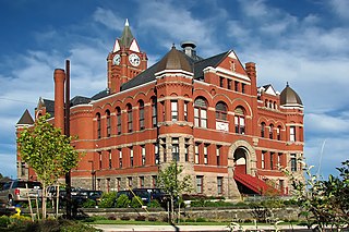
Marrowstone, Washington

Last updated

Marrowstone, Washington
CDP
Jefferson County Washington Incorporated and Unincorporated areas Marrowstone Highlighted.svg
Location of Marrowstone, Washington
Coordinates: 48°3′30″N122°41′17″W / 48.05833°N 122.68806°W / 48.05833; -122.68806 [1]
Country United States
State Washington
County Jefferson
Area
  Total6.3 sq mi (16.4 km2)
  Land6.3 sq mi (16.4 km2)
  Water0.0 sq mi (0.0 km2)
Elevation
16 ft (5 m)
Population
 (2020)
  Total995
  Density160/sq mi (61/km2)
Time zone UTC-8 (Pacific (PST))
  Summer (DST) UTC-7 (PDT)
FIPS code 53-43762 [2]
GNIS feature ID1852949 [3]

Marrowstone is a census-designated place (CDP) in Jefferson County, Washington, United States. The population was 995 at the 2020 census. All Marrowstone addresses are in Nordland, Washington, and the ZIP code for Marrowstone Island is 98358.

Contents

Marrowstone takes its name from Marrowstone Point, the northernmost point on Marrowstone Island. It was given the name "Marrow-Stone Point" in 1792 by the British explorer, George Vancouver, in describing the area's hard, clay-like soil. [4]

History

A post office called Nordland has been in operation since 1898. [5] The community derives its name from Peter Nordby, the original owner of the town site. [6]

Geography

East Beach Park, looking north towards Marrowstone Point East Beach Park, Marrowstone Island.JPG
East Beach Park, looking north towards Marrowstone Point
Northern side of Nodule Point Northern side of Nodule Point.JPG
Northern side of Nodule Point
Marrowstone Point Light Marrowstone pt lt.JPG
Marrowstone Point Light

According to the United States Census Bureau, the CDP has a total area of 6.3 square miles (16.4 km2), all of it land.

Prominent land features include several points, such as Marrowstone Point, at the northern end of Marrowstone Island, Kinney Point, at the southern end of the island, Nodule Point, on the east side, mid island, and Griffiths Point, on the western side of Mystery Bay, which is an inlet on the western side of Marrowstone Island. Other notable features include East Beach, a sandy beach at the northern end of East Marrowstone Road and Scow Bay/Kilisut Harbor, which separates Marrowstone Island from its western neighbor, Indian Island, a Navy ammunition depot.

A narrow causeway connects the southwestern end of Marrowstone Island with the southern end of Indian Island. A short bridge joins the western side of Indian Island to the mainland of Jefferson County.

Flagler Road (SR 116) runs along the western edge of Marrowstone Island, which is primarily low-lying. East Marrowstone Road runs along the eastern edge of the island, which consists largely of sandy bluffs, with the exception of the area near East Beach.

Demographics

Historical population
CensusPop.Note
2010 844
2020 99517.9%
US Decennial Census [2]
2020 Census [7]

As of the census [2] of 2010, there were 844 people, 432 households, and 260 families residing in the CDP. The population density was 133.5 people per square mile (51.5/km2). There were 611 housing units at an average density of 96.6/sq mi (37.4/km2). The racial makeup of the CDP was 96.4% White, 0.4% Native American, 0.8% Asian, 0.1% from other races, and 2.1% from two or more races. Hispanic or Latino of any race were 0.9% of the population.

There were 432 households, out of which 10.4% had children under the age of 18 living with them, 55.1% were married couples living together, 3.7% had a female householder with no husband present, and 39.8% were non-families. 30.3% of all households were made up of individuals, and 16.0% had someone living alone who was 65 years of age or older. The average household size was 1.95 and the average family size was 2.37.

In the CDP, the population skewed older with 90.5% 18 and over, 46.3% over 62, and 36.1% who were 65 years of age or older. The median age was 60.5 years. For every 100 males there were 98.1 females.

The median income for a household in the CDP was $48,533, and the median income for a family was $54,397. Males had a median income of $45,000 versus $26,607 for females. The per capita income for the CDP was $31,146. None of the families and 0.0% of the population were living below the poverty line.

Arts and culture

The Nordland General Store is Marrowstone's only source of groceries. It is arguably the focal point of Marrowstone; on maps the town of Nordland (the address of all Marrowstone residents) is usually located at the site of the Nordland General Store. It is located across Flagler Road from Mystery Bay, near the center of Marrowstone Island. It was severely damaged by fire and forced to close in November 2020. [8]

Festivals and events

For approximately 100 years, Marrowstone has held its annual Strawberry Festival in June. Residents and visitors enjoy strawberry shortcake at the Nordland Garden Club Building. The Marrowstone Island Community Association hosts the Strawberry Festival each year. It meets about 7 times throughout the year at the Nordland Garden Club Building. Strawberries were once grown all over Marrowstone and can be found growing wild on the island.

On Memorial Day weekend, island residents bring their tractors to parade them in front of the Nordland General Store.

The Seattle Youth Symphony's Marrowstone Music Festival - now called Marrowstone Summer Music and held on the campus of Western Washington University, in Bellingham, Washington – was held at Fort Flagler on the northern end of Marrowstone Island from 1958 until 1989. Until 1975, it was called the Pacific Northwest Music Camp.

The neo-pagan Aquarian Tabernacle Church performs a modern Eleusinian Mysteries play at Fort Flagler over Easter weekend each year.

Parks and recreation

Fort Flagler, a Washington state park, is situated on 784 acres (314 hectares) at the northern end of Marrowstone Island. It overlooks Port Townsend Bay and Admiralty Inlet, the entrance to Puget Sound. Fort Flagler was one of three forts, along with Fort Worden (near Port Townsend) and Fort Casey (on Whidbey Island), that guarded the entrance to Puget Sound. Mystery Bay State Park is another state park on Marrowstone Island, located on 10 acres (4 hectares) of Mystery Bay shorefront about a half-mile north of the Nordland General Store. It is primarily for boaters. Kinney Point State Park comprises 76 acres (310,000 m2) at the south end of the island. Accessible only by boat, it is part of the Cascadia Marine Trail.

Related Research Articles

<span class="mw-page-title-main">Jefferson County, Washington</span> County in Washington, United States

Jefferson County is a county located in the U.S. state of Washington. As of the 2020 census, the population was 32,977. The county seat and only incorporated city is Port Townsend. The county is named for Thomas Jefferson.
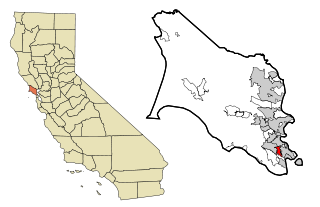
<span class="mw-page-title-main">Strawberry, Marin County, California</span> Census-designated place in California, United States

Strawberry is a census-designated place (CDP) and an unincorporated district of Marin County, California, United States. It shares a ZIP code (94941) with Mill Valley and falls within its school districts; however, it is considered within the sphere of influence of the town of Tiburon. It is largely separated from Mill Valley by U.S. Route 101. Its population was 5,447 at the 2020 census.

<span class="mw-page-title-main">Niantic, Connecticut</span> Census-designated place in Connecticut, United States

Niantic is a census-designated place (CDP) and village in the town of East Lyme, Connecticut in the United States. The population was 3,114 at the 2010 census. It is located on Long Island Sound, the Millstone Nuclear Power Plant in nearby Waterford is visible on the bay's eastern horizon line, Rocky Neck State Park is also located in the area. Niantic was once famous for its Niantic River scallops, but the scallop population has been in decline for a number of years.
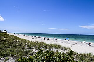
<span class="mw-page-title-main">Manasota Key, Florida</span> Census-designated place in Florida, United States

Manasota Key is a census-designated place (CDP) consisting mainly of the community of Englewood Beach in Charlotte County, Florida, United States. The population of the CDP was 1,326 at the 2020 census, up from 1,229 at the 2010 census. It is part of the Punta Gorda, Florida Metropolitan Statistical Area, included in the North Port-Bradenton, Florida Combined Statistical Area.

<span class="mw-page-title-main">St. James City, Florida</span> Census-designated place in Florida, United States

St. James City is an unincorporated community and census-designated place (CDP) on Pine Island in Lee County, Florida, United States. The population was 3,876 at the 2020 census, up from 3,784 at the 2010 census. It is part of the Cape Coral-Fort Myers, Florida Metropolitan Statistical Area.

<span class="mw-page-title-main">Big Pine Key, Florida</span> Census-designated place in Florida, United States

Big Pine Key is a census-designated place and unincorporated community in Monroe County, Florida, United States, on an island of the same name in the Florida Keys. As of the 2020 census, the town had a total population of 4,521.

Calcium is a census-designated place (CDP) in Jefferson County, New York, United States. The population was 3,573 as of the 2020 census. The CDP is in the town of Le Ray and includes the hamlets of Calcium and Sanfords Four Corners.

<span class="mw-page-title-main">Neah Bay, Washington</span> CDP in Washington, United States

Neah Bay is a census-designated place (CDP) on the Makah Reservation in Clallam County, Washington, United States. The population was 935 at the 2020 census. It is across the Canada–US border from British Columbia. Europeans originally called it "Scarborough Harbour" in honor of Captain James Scarborough of the Hudson's Bay Company. It was changed to Neah in 1847 by Captain Henry Kellett. Kellett spelled it "Neeah Bay". The name "Neah" refers to the Makah Chief Dee-ah, pronounced Neah in the Klallam language. During the summer months, Neah Bay is a popular fishing area for sports fishermen. Another attraction is the Makah Museum, which houses artifacts from a Makah village partly buried by a mudslide around 1750. Many people also visit to hike the Cape Trail or camp at Hobuck Beach. An emergency response tug is stationed at Neah Bay which has saved 41 vessels since its introduction in 1999.

<span class="mw-page-title-main">Clinton, Washington</span> CDP in Washington, United States

Clinton is a community and census-designated place (CDP) located on southern Whidbey Island in Island County, Washington, United States. The town was named after Clinton, Michigan. As of the 2010 census, the population was 928. However, the post office serves at least 2,500 people.

<span class="mw-page-title-main">Coupeville, Washington</span> Town in Washington, United States

Coupeville is a town on Whidbey Island, in Island County, Washington, United States.

<span class="mw-page-title-main">Freeland, Washington</span> Census-designated place in Washington, United States

Freeland is an unincorporated community and census-designated place (CDP) on Whidbey Island in Island County, Washington, United States. At the time of the 2020 census the population was 2,252. The town received its name based on its origins as a socialist commune in the early 1900s: in the eyes of its founders, the land of the town was literally to be free for all people. Some of the first settlers were veterans of a prior experiment in socialism, the nearby Equality Colony.

<span class="mw-page-title-main">Port Hadlock-Irondale, Washington</span> Census-designated place in Washington, United States

Port Hadlock-Irondale is a census-designated place (CDP) in Jefferson County, Washington, United States. The population was 3,983 at the 2020 census.

<span class="mw-page-title-main">Port Ludlow, Washington</span> Census-designated place in Washington, United States

Port Ludlow is an unincorporated community and census-designated place (CDP) in Jefferson County, Washington, United States. It is also the name of the marine inlet on which the community is located. The CDP's population was 2,603 at the 2010 census, up from 1,968 at the 2000 census.

<span class="mw-page-title-main">Quilcene, Washington</span> Census-designated place in Washington, United States

Quilcene is an unincorporated community and census-designated place (CDP) in Jefferson County, Washington, United States. The population was 598 at the 2020 census.

<span class="mw-page-title-main">Manchester, Washington</span> Census-designated place in Washington, United States

Manchester is an unincorporated community and census-designated place (CDP) in Kitsap County, Washington, United States. The population was 5,714 at the 2020 census. Manchester is located on the Puget Sound approximately 10 miles from downtown Seattle, and is adjacent to county seat Port Orchard to its east. Today, Manchester labels itself as a village. It is small in size but is home to a Kitsap Regional Library (KRL) branch, a post office, an elementary school, and a beachfront park to serve its residents.

<span class="mw-page-title-main">Allyn-Grapeview, Washington</span> Former CDP in Washington, United States

Allyn-Grapeview is a former census-designated place (CDP) in Mason County, Washington, United States. At the 2010 census, the CDP was separated into Allyn and Grapeview. The combined 2010 population of the two new CDPs was 2,917. The community-based monthly newspaper called the North Bay Review, services the Allyn-Grapeview area. Allyn's main road and thoroughfare is State Route 3 with Grapeview connected to Route 3 via Grapeview Loop Road.
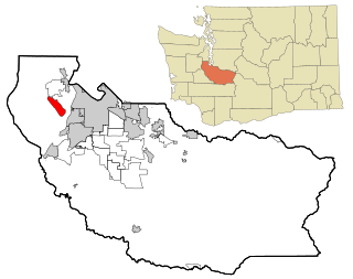
<span class="mw-page-title-main">Fox Island, Washington</span> CDP in Washington, United States

Fox Island is an island and census-designated place (CDP) in Pierce County, Washington, United States, in Puget Sound. It is located approximately 5 miles (8 km) from Gig Harbor. The island was named Fox by Charles Wilkes during the United States Exploring Expedition, to honor J.L. Fox, an assistant surgeon on the expedition. The population was 3,921 at the 2020 census, up from 3,633 at the 2010 census.
<span class="mw-page-title-main">French Island, Wisconsin</span> Census-designated place in Wisconsin, United States

French Island is a census-designated place (CDP) in La Crosse County, Wisconsin, United States. The population was 4,207 at the 2010 census. It lies on an island of the same name, though they are not coextensive; a portion of the island is part of the city of La Crosse. All of the island is part of the La Crosse Metropolitan Statistical Area. French Island is part of the town of Campbell and contains all of its population, because the balance of Campbell is uninhabited.
<span class="mw-page-title-main">Fort Flagler State Park</span> State historic park in Washington state, United States

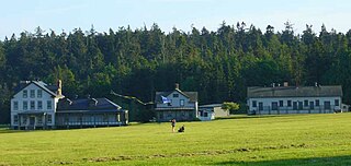
Fort Flagler State Park is a public recreation area that occupies the site of Fort Flagler, a former United States Army fort at the northern end of Marrowstone Island in Washington. The state park occupies 1,451 acres (587 ha) south of the entrance to Admiralty Inlet, and the Marrowstone Point Light stands adjacent. Port Townsend is visible to the northwest, the cranes at the Navy base on Indian Island to the west, and Whidbey Island to the east across Admiralty Inlet. Flagler Road terminates at the park entrance.

Mystery Bay State Park is an eighteen-acre (7.3 ha) Washington marine state park on Mystery Bay, a small inlet off Scow Bay/Kilisut Harbor on the western side of Marrowstone Island. The park is located approximately one-half mile north of the Nordland General Store on Flagler Road. Many older wooden sailboats can be swinging at permanent moorage at the park. Park activities include picnicking, shellfish harvesting, fishing, boating, beachcombing, and scuba diving.

References

  1. "US Gazetteer files: 2010, 2000, and 1990". United States Census Bureau. February 12, 2011. Retrieved April 23, 2011.
  2. 1 2 3 "U.S. Census website". United States Census Bureau . Retrieved January 31, 2008.
  3. "Marrowstone". Geographic Names Information System . United States Geological Survey, United States Department of the Interior.
  4. Roberts, John E. (2005). A Discovery Journal: George Vancouver's First Survey Season – 1792. Trafford Publishing. p. 36. ISBN   978-1-4120-7097-3.
  5. "Post Offices". Jim Forte Postal History. Retrieved August 19, 2016.
  6. Meany, Edmond S. (1923). Origin of Washington geographic names. Seattle: University of Washington Press. p. 191.
  7. "Census Bureau profile: Marrowstone, Washington". United States Census Bureau. May 2023. Retrieved May 12, 2024.
  8. "UPDATE: Nordland General Store facing an uncertain future". November 11, 2020.