Clifton, Maine

Last updated

Clifton, Maine
Clifton ME.JPG
Clifton, Maine, 2012
USA Maine location map.svg
Red pog.svg
Clifton, Maine
Location within the state of Maine
Coordinates: 44°48′20″N68°31′37″W / 44.80556°N 68.52694°W / 44.80556; -68.52694
Country United States
State Maine
County Penobscot
Area
[1]
  Total35.90 sq mi (92.98 km2)
  Land34.53 sq mi (89.43 km2)
  Water1.37 sq mi (3.55 km2)
Elevation
249 ft (76 m)
Population
 (2020)
  Total840
  Density24/sq mi (9.4/km2)
Time zone UTC-5 (Eastern (EST))
  Summer (DST) UTC-4 (EDT)
ZIP code
04428
Area code 207
FIPS code 23-13365
GNIS feature ID0582411

Clifton is a town in Penobscot County, Maine, United States. The population was 840 at the 2020 census. [2] It is part of the Bangor Metropolitan Statistical Area.

Contents

Geography

According to the United States Census Bureau, the town has a total area of 35.90 square miles (92.98 km2), of which 34.53 square miles (89.43 km2) is land and 1.37 square miles (3.55 km2) is water. [1]

Demographics

Historical population
CensusPop.Note
1850 306
1860 3070.3%
1870 34813.4%
1880 3500.6%
1890 284−18.9%
1900 236−16.9%
1910 217−8.1%
1920 185−14.7%
1930 156−15.7%
1940 1687.7%
1950 19314.9%
1960 22717.6%
1970 2332.6%
1980 46298.3%
1990 60731.4%
2000 74322.4%
2010 92124.0%
2020 840−8.8%
U.S. Decennial Census [3]

2010 census

As of the census [4] of 2010, there were 921 people, 346 households, and 256 families living in the town. The population density was 26.7 inhabitants per square mile (10.3/km2). There were 468 housing units at an average density of 13.6 per square mile (5.3/km2). The racial makeup of the town was 95.0% White, 1.1% African American, 1.5% Native American, 0.3% Asian, and 2.1% from two or more races. Hispanic or Latino of any race were 1.0% of the population.

There were 346 households, of which 34.4% had children under the age of 18 living with them, 57.2% were married couples living together, 11.0% had a female householder with no husband present, 5.8% had a male householder with no wife present, and 26.0% were non-families. 18.8% of all households were made up of individuals, and 5.5% had someone living alone who was 65 years of age or older. The average household size was 2.64 and the average family size was 2.93.

The median age in the town was 41.1 years. 23.9% of residents were under the age of 18; 6.9% were between the ages of 18 and 24; 25.5% were from 25 to 44; 33.8% were from 45 to 64; and 10% were 65 years of age or older. The gender makeup of the town was 52.2% male and 47.8% female.

2000 census

As of the census [5] of 2000, there were 743 people, 303 households, and 213 families living in the town. The population density was 21.6 inhabitants per square mile (8.3/km2). There were 416 housing units at an average density of 12.1 per square mile (4.7/km2). The racial makeup of the town was 97.85% White, 0.27% African American, 1.08% Native American, 0.13% Asian, 0.13% Pacific Islander, and 0.54% from two or more races. Hispanic or Latino of any race were 0.27% of the population.

There were 303 households, out of which 34.7% had children under the age of 18 living with them, 57.1% were married couples living together, 9.6% had a female householder with no husband present, and 29.4% were non-families. 21.1% of all households were made up of individuals, and 7.3% had someone living alone who was 65 years of age or older. The average household size was 2.45 and the average family size was 2.83.

In the town, the population was spread out, with 24.5% under the age of 18, 6.2% from 18 to 24, 35.8% from 25 to 44, 24.4% from 45 to 64, and 9.2% who were 65 years of age or older. The median age was 38 years. For every 100 females, there were 100.8 males. For every 100 females age 18 and over, there were 98.2 males.

The median income for a household in the town was $36,333, and the median income for a family was $39,000. Males had a median income of $31,065 versus $22,019 for females. The per capita income for the town was $16,380. About 7.0% of families and 8.9% of the population were below the poverty line, including 13.5% of those under age 18 and 3.0% of those age 65 or over.

Notable person

Related Research Articles

<span class="mw-page-title-main">Steele, Alabama</span> Town in Alabama, United States

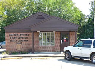
Steele is a town in northeastern St. Clair County, Alabama, United States. It was incorporated in 1952. At the 2010 census the population was 1,043, down from 1,093. The town is a part of the Birmingham–Hoover–Cullman Combined Statistical Area. It was initially known as Steel's Station or Steele's Depot in the late 19th century.

<span class="mw-page-title-main">Eagle Lake, Maine</span> Town in the state of Maine, United States

Eagle Lake is a town in Aroostook County, Maine, United States. The population was 772 at the 2020 census. The town was named by a body of troops heading from Bangor to the Aroostook War for the many eagles that they saw around the lake. A total of 49.0% of the population speaks French, reflecting a trend in Northeastern Maine.

<span class="mw-page-title-main">Mapleton, Maine</span> Town in the state of Maine, United States

Mapleton is a town in Aroostook County, Maine, United States. The population was 1,886 at the 2020 census.

<span class="mw-page-title-main">Merrill, Maine</span> Town in the state of Maine, United States

Merrill is a town in Aroostook County, Maine, United States. The population was 208 at the 2020 census.

<span class="mw-page-title-main">Wallagrass, Maine</span> Town in the state of Maine, United States

Wallagrass is a town in Aroostook County, Maine, United States. The population was 519 at the 2020 census.

<span class="mw-page-title-main">Chesterville, Maine</span> Town in Maine, United States

Chesterville is a town in Franklin County, Maine, United States. The population was 1,328 at the 2020 census.

Osborn is a town in Hancock County, Maine, United States. The population was 65 at the 2020 census.

Waltham is a town in Hancock County, Maine, United States. The population was 332 at the 2020 census.

<span class="mw-page-title-main">Manchester, Maine</span> Town in Maine, United States

Manchester is a town in Kennebec County, Maine, United States, located at 44.33°N 69.87°W. The population was 2,456 at the 2020 census. The southern part of the town bordering Cobbosseecontee Lake is a popular recreation spot in central Maine, and part of the Winthrop Lakes Region. Manchester is included in the Augusta, Maine micropolitan and included in the Lewiston-Auburn, Maine metropolitan New England City and Town Area.

<span class="mw-page-title-main">Vienna, Maine</span> Town in the state of Maine, United States

Vienna is a town in Kennebec County, Maine, United States. The population was 578 at the 2020 census.

Lakeville is a town in Penobscot County, Maine, United States. The population was 104 at the 2020 census.

Detroit is a town in Somerset County, Maine, United States. The population was 885 at the 2020 census.

Beddington is a town in Washington County, Maine, United States. The population was 60 at the 2020 census. It is the third-smallest organized town in Maine after Frye Island and Frenchboro.

<span class="mw-page-title-main">Park Hills, Missouri</span> City in Missouri, United States

Park Hills is a city in St. Francois County, Missouri, United States. The population was 8,587 at the 2020 census.

<span class="mw-page-title-main">Worth Township, Centre County, Pennsylvania</span> Township in Pennsylvania, United States

Worth Township is a township in Centre County, Pennsylvania, United States. It is part of the State College, Pennsylvania Metropolitan Statistical Area. The population was 734 at the 2020 census.

<span class="mw-page-title-main">Sparta Township, Pennsylvania</span> Township in Pennsylvania, United States

Sparta Township is a township in Crawford County, Pennsylvania, United States. The population was 1,910 at the 2020 census, up from 1,832 at the 2010 census. The Township surrounds Spartansburg, a borough of a few hundred people.

<span class="mw-page-title-main">Sophia, West Virginia</span> Town in West Virginia, United States

Sophia is a town in Raleigh County, West Virginia, United States. It was incorporated in 1912. The population was 1,124 at the 2020 census.

<span class="mw-page-title-main">Reedy, West Virginia</span> Town in West Virginia, United States

Reedy is a town in Roane County, West Virginia, United States. The population was 152 at the 2020 census.

<span class="mw-page-title-main">Pine Grove, West Virginia</span> Town in West Virginia, United States

Pine Grove is a town in Wetzel County, West Virginia, United States. The population was 363 at the 2020 census. The community was named for a grove of pine trees near the original town site.

<span class="mw-page-title-main">North Hills, West Virginia</span> Town in West Virginia, United States

North Hills is a town in Wood County, West Virginia, United States. It is a suburb of Parkersburg. The population was 837 at the 2020 census. North Hills was incorporated on February 15, 1979.

References

  1. 1 2 "US Gazetteer files 2010". United States Census Bureau . Retrieved December 16, 2012.
  2. "Census - Geography Profile: Clifton town, Penobscot County, Maine". United States Census Bureau . Retrieved January 22, 2022.
  3. "Census of Population and Housing". Census.gov. Retrieved June 4, 2015.
  4. "U.S. Census website". United States Census Bureau . Retrieved December 16, 2012.
  5. "U.S. Census website". United States Census Bureau . Retrieved January 31, 2008.

44°49′00″N68°30′40″W / 44.81667°N 68.51111°W / 44.81667; -68.51111