Eddington, Maine

Last updated

Eddington, Maine
USA Maine location map.svg
Red pog.svg
Eddington, Maine
Location within the state of Maine
Coordinates: 44°49′34″N68°41′36″W / 44.82611°N 68.69333°W / 44.82611; -68.69333
Country United States
State Maine
County Penobscot
Founded by Jonathan Eddy
Named for Jonathan Eddy
Area
[1]
  Total26.54 sq mi (68.74 km2)
  Land24.99 sq mi (64.72 km2)
  Water1.55 sq mi (4.01 km2)
Elevation
200 ft (61 m)
Population
 (2020)
  Total2,194
  Density88/sq mi (33.9/km2)
Time zone UTC-5 (Eastern (EST))
  Summer (DST) UTC-4 (EDT)
ZIP code
04428
Area code 207
FIPS code 23-22535
GNIS feature ID0582461
Website www.eddingtonmaine.gov

Eddington is a town located on the eastern side of the Penobscot River in Penobscot County, Maine, United States. As of the 2020 census, the town had a population of 2,194. [2]

Contents

History

The town was founded by and named after Jonathan Eddy, a militia captain in the French and Indian War, a colonel in the American Revolutionary War, and the first magistrate in the area. [3] Eddy and most of the town's other original settlers migrated to the town from Nova Scotia, where they had supported the rebel cause against the majority British Loyalist population. Eddy tried to make Nova Scotia—the 14th American colony—join the revolution by leading the Siege of Fort Cumberland. After the siege failed, Eddy and others emigrated to the District of Maine and were given land grants in present-day Eddington.[ citation needed ] Later in the war, Eddy successfully defended Maine from a British attack in the Battle of Machias (1777).

Geography

According to the United States Census Bureau, the town has a total area of 26.54 square miles (68.74 km2), of which 24.99 square miles (64.72 km2) is land and 1.55 square miles (4.01 km2) is water. [1]

Demographics

Historical population
CensusPop.Note
1800 167
1810 20522.8%
1820 27132.2%
1830 40549.4%
1840 59546.9%
1850 69617.0%
1860 85623.0%
1870 776−9.3%
1880 746−3.9%
1890 729−2.3%
1900 663−9.1%
1910 611−7.8%
1920 527−13.7%
1930 487−7.6%
1940 57117.2%
1950 66416.3%
1960 95844.3%
1970 1,35841.8%
1980 1,76930.3%
1990 1,94710.1%
2000 2,0525.4%
2010 2,2258.4%
2020 2,194−1.4%
U.S. Decennial Census [4]

2010 census

As of the census [5] of 2010, there were 2,225 people, 930 households, and 643 families living in the town. The population density was 89.0 inhabitants per square mile (34.4/km2). There were 1,037 housing units at an average density of 41.5 per square mile (16.0/km2). The racial makeup of the town was 97.8% White, 0.6% African American, 0.5% Native American, 0.5% Asian, and 0.7% from two or more races. Hispanic or Latino of any race were 0.3% of the population.

There were 930 households, of which 28.2% had children under the age of 18 living with them, 54.2% were married couples living together, 10.4% had a female householder with no husband present, 4.5% had a male householder with no wife present, and 30.9% were non-families. 23.5% of all households were made up of individuals, and 8% had someone living alone who was 65 years of age or older. The average household size was 2.37 and the average family size was 2.76.

The median age in the town was 44.1 years. 20% of residents were under the age of 18; 6.1% were between the ages of 18 and 24; 25.7% were from 25 to 44; 33.2% were from 45 to 64; and 15.1% were 65 years of age or older. The gender makeup of the town was 49.7% male and 50.3% female.

2000 census

As of the census [6] of 2000, there were 2,052 people, 825 households, and 595 families living in the town. The population density was 81.7 inhabitants per square mile (31.5/km2). There were 920 housing units at an average density of 36.6 per square mile (14.1/km2). The racial makeup of the town was 97.95% White, 0.15% African American, 0.49% Native American, 0.29% Asian, 0.00% Pacific Islander, 0.29% from other races, and 0.83% from two or more races. 0.39% of the population were Hispanic or Latino of any race.

There were 825 households, out of which 30.2% had children under the age of 18 living with them, 58.5% were married couples living together, 8.7% had a female householder with no husband present, and 27.8% were non-families. 21.1% of all households were made up of individuals, and 6.7% had someone living alone who was 65 years of age or older. The average household size was 2.46 and the average family size was 2.84.

In the town, the population was spread out, with 22.1% under the age of 18, 6.4% from 18 to 24, 30.9% from 25 to 44, 27.5% from 45 to 64, and 13.0% who were 65 years of age or older. The median age was 40 years. For every 100 females, there were 98.6 males. For every 100 females age 18 and over, there were 96.3 males.

The median income for a household in the town was $40,250, and the median income for a family was $45,966. Males had a median income of $31,105 versus $22,445 for females. The per capita income for the town was $19,113. 6.7% of the population and 3.2% of families were below the poverty line. Out of the total population, 5.5% of those under the age of 18 and 4.6% of those 65 and older were living below the poverty line.

Notable people

Related Research Articles

<span class="mw-page-title-main">Penobscot County, Maine</span> County in Maine, United States

Penobscot County is a county in the U.S. state of Maine, named for the Penobscot people in Wabanakik. As of the 2020 census, the population was 152,199, making it the third-most-populous county in Maine. Its county seat is Bangor. The county was established on February 15, 1816, from part of Hancock County when the area was still part of Massachusetts. Penobscot County is home to the University of Maine.

<span class="mw-page-title-main">Haynesville, Maine</span> Town in the state of Maine, United States

Haynesville is a town in Aroostook County, Maine, United States. The population was 97 at the 2020 census.

<span class="mw-page-title-main">Penobscot, Maine</span> Town in the state of Maine, United States

Penobscot is a town in Hancock County, Maine, United States. The Bagaduce River flows through the town. The population was 1,136 at the 2020 census.

Bradley is a town in Penobscot County, Maine, United States. It is part of the Bangor Metropolitan Statistical Area. The population was 1,532 at the 2020 census. The village of Bradley is in the northwestern corner of the town.

Burlington is a town in Penobscot County, Maine, United States. It is part of the Bangor Metropolitan Statistical Area. The population was 373 at the 2020 census.

<span class="mw-page-title-main">Carmel, Maine</span> Town in the state of Maine, United States

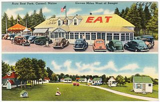
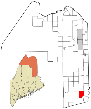
Carmel is a town in Penobscot County, Maine, United States. It is part of the Bangor Metropolitan Statistical Area. The population was 2,867 at the 2020 census.

Carroll Plantation is a plantation in Penobscot County, Maine, United States. The plantation was named for Daniel Carroll, a signatory of the United States Constitution. It is located along Maine State Route 6 near its intersection with State Route 170. The population was 138 at the 2020 census. It is part of the Bangor Metropolitan Statistical Area.

Exeter is a town in Penobscot County, Maine, United States. The population was 963 at the 2020 census.

Holden is a town in Penobscot County, Maine, United States. The population was 3,277 at the 2020 census.

Lee is a town in Penobscot County, Maine, United States. It was incorporated in 1832. The town was originally called Mattekeunk, but changed it to Lee to give it an English name. Stephen Lee suggested the town be named Lee after Revolutionary general Henry "High Horse" Lee. To further convince the townsfolk, he brought a barrel of rum to the meeting. The population was 916 at the 2020 census. Lee has been home to Lee Academy since 1845.

<span class="mw-page-title-main">Mattawamkeag, Maine</span> Town in the state of Maine, United States

Mattawamkeag is a town in Penobscot County, Maine, United States, located where the Mattawamkeag River joins the Penobscot River. The population was 596 at the 2020 census. The village of Mattawamkeag is in the southwestern part of the town.

Passadumkeag is a town on the east bank of the Penobscot River at the confluence with the Passadumkeag River in Penobscot County, Maine, United States. The population was 356 at the 2020 census. Passadumkeag is a word of the Penobscot people meaning "quick water".

<span class="mw-page-title-main">Veazie, Maine</span> Town in the state of Maine, United States

Veazie is a town in Penobscot County, Maine, United States. The population was 1,814 at the 2020 census. The town is named after General Samuel Veazie, an early lumber baron and railroad operator. Veazie was originally part of Bangor, using Penobscot River water power to operate sawmills. It became a separate town in 1853 because Gen. Veazie, its wealthiest citizen, thought Bangor's property taxes were too high.

Winn is a town in Penobscot County, Maine, United States, on the east bank of the Penobscot River. The town was named for John M. Winn, an early landholder. The population was 399 at the 2020 census.

<span class="mw-page-title-main">Frankfort, Maine</span> Town in the state of Maine, United States

Frankfort is a town on the Penobscot River estuary in Waldo County, Maine, United States. The population was 1,231 at the 2020 census.

<span class="mw-page-title-main">Prospect, Maine</span> Town in the state of Maine, United States

Prospect is a town in Waldo County, Maine, United States. The population was 698 at the 2020 census.

East Central Penobscot is an unorganized territory in Penobscot County, Maine, United States. The population was 308 at the 2020 census.

<span class="mw-page-title-main">East Millinocket, Maine</span> Town in the state of Maine, United States

East Millinocket is a town in Penobscot County, Maine, United States. The population was 1,572 at the 2020 census.

Lincoln is a town in Penobscot County, Maine, United States. The town's population was 4,853 at the 2020 United States Census. A statue honoring Medal of Honor recipient Gary Gordon was installed in Lincoln, in 2021. The 10-foot (3.0 m) bronze sculpture faces Gordon's grave at Park Street Cemetery.

Milford is a town in Penobscot County, Maine, United States. It is located across the Penobscot River from the city of Old Town. The population of Milford was 3,069 at the 2020 census. The town's slogan is the "Best little town by a dam site," referring to the Milford Dam abutting Milford on the Penobscot River, south of the Penobscot Indian Island Reservation.

References

  1. 1 2 "US Gazetteer files 2010". United States Census Bureau . Retrieved December 16, 2012.
  2. "Census - Geography Profile: Eddington town, Penobscot County, Maine". United States Census Bureau . Retrieved January 17, 2022.
  3. Maine League of Historical Societies and Museums (1970). Doris A. Isaacson (ed.). Maine: A Guide 'Down East'. Rockland, Me: Courier-Gazette, Inc. p. 393.
  4. "Census of Population and Housing". Census.gov. Retrieved June 4, 2015.
  5. "U.S. Census website". United States Census Bureau . Retrieved December 16, 2012.
  6. "U.S. Census website". United States Census Bureau . Retrieved January 31, 2008.

44°49′34″N68°41′36″W / 44.82611°N 68.69333°W / 44.82611; -68.69333