Mattawamkeag, Maine

Last updated

Mattawamkeag, Maine
Pan Am Railways, Mattawamkeag, Maine.jpg
USA Maine location map.svg
Red pog.svg
Mattawamkeag, Maine
Location within the state of Maine
Coordinates: 45°31′0″N68°19′0″W / 45.51667°N 68.31667°W / 45.51667; -68.31667
Country United States
State Maine
County Penobscot
Area
[1]
  Total38.04 sq mi (98.52 km2)
  Land37.73 sq mi (97.72 km2)
  Water0.31 sq mi (0.80 km2)
Elevation
413 ft (126 m)
Population
 (2020)
  Total596
  Density16/sq mi (6.1/km2)
Time zone UTC-5 (Eastern (EST))
  Summer (DST) UTC-4 (EDT)
ZIP code
04459
Area code 207
FIPS code 23-44270
GNIS feature ID0582585

Mattawamkeag is a town in Penobscot County, Maine, United States, located where the Mattawamkeag River joins the Penobscot River. [2] The population was 596 at the 2020 census. [3] The village of Mattawamkeag is in the southwestern part of the town.

Contents

Railroad history

Railroad Street c. 1910 Railroad St., Mattawamkeag, ME.jpg
Railroad Street c.1910

Mattawamkeag's history is inextricably linked to the railroad.

The European & North American Railway built a track up the Penobscot River valley from Bangor and reached Mattawamkeag in 1869. By October 1871, the line was completed from Mattawamkeag to Vanceboro, where it connected through to Saint John, New Brunswick, Canada. The Maine Central Railroad leased the Bangor-Vanceboro E&NA in 1882 and purchased it in 1955.

In 1889, the International Railway of Maine was completed between Megantic, Quebec, and Mattawamkeag, where it interchanged with the Maine Central. The parent company of the International Railway, Canadian Pacific, obtained running rights from Maine Central for Mattawamkeag to Vanceboro, where it regained CPR trackage in New Brunswick. This placed Mattawamkeag on the transcontinental mainline of the Canadian Pacific, running from Saint John to Vancouver, British Columbia. In 1974, CPR purchased the Mattawamkeag-Vanceboro railway tracks from Maine Central. In 1988, CPR transferred trackage east of Megantic to its subsidiary Canadian Atlantic Railway. In 1994, Canadian Atlantic was sold, with the line running through Mattawamkeag being purchased by J. D. Irving, and is now operated as the Eastern Maine Railway.

Maine Central was purchased by Guilford Transportation Industries in 1981 and became part of Guilford Rail System, since renamed Pan Am Railways. Pan Am now operates as a subsidiary of the larger CSX Transportation network, and is both the northernmost and easternmost point on the CSX Transportation network.

Historic building

The George W. Smith Homestead (1874) in Mattawamkeag is listed on the National Register of Historic Places. [4]

Geography

According to the United States Census Bureau, the town has a total area of 38.04 square miles (98.52 km2), of which 37.73 square miles (97.72 km2) is land and 0.31 square miles (0.80 km2) is water. [1]

Demographics

Historical population
CensusPop.Note
1820 7
1830 16128.6%
1860 280
1870 35627.1%
1880 45628.1%
1890 63338.8%
1900 527−16.7%
1910 517−1.9%
1920 5537.0%
1930 461−16.6%
1940 84382.9%
1950 803−4.7%
1960 94517.7%
1970 9884.6%
1980 1,0001.2%
1990 830−17.0%
2000 825−0.6%
2010 687−16.7%
2020 596−13.2%
U.S. Decennial Census [5]

2010 census

As of the census [6] of 2010, there were 687 people, 317 households, and 197 families living in the town. The population density was 18.2 inhabitants per square mile (7.0/km2). There were 407 housing units at an average density of 10.8 per square mile (4.2/km2). The racial makeup of the town was 98.0% White, 0.1% African American, 0.9% Native American, 0.1% Asian, 0.1% from other races, and 0.7% from two or more races. Hispanic or Latino of any race were 0.6% of the population.

There were 317 households, of which 20.2% had children under the age of 18 living with them, 47.6% were married couples living together, 8.8% had a female householder with no husband present, 5.7% had a male householder with no wife present, and 37.9% were non-families. 31.5% of all households were made up of individuals, and 12.9% had someone living alone who was 65 years of age or older. The average household size was 2.17 and the average family size was 2.66.

The median age in the town was 50.4 years. 15.1% of residents were under the age of 18; 5.9% were between the ages of 18 and 24; 18% were from 25 to 44; 41.5% were from 45 to 64; and 19.5% were 65 years of age or older. The gender makeup of the town was 50.9% male and 49.1% female.

2000 census

As of the census [7] of 2000, there were 825 people, 338 households, and 234 families living in the town. The population density was 22.0 inhabitants per square mile (8.5/km2). There were 393 housing units at an average density of 10.5 per square mile (4.1/km2). The racial makeup of the town was 98.06% White, 0.36% Native American, and 1.58% from two or more races. Hispanic or Latino of any race were 0.12% of the population.

There were 338 households, out of which 31.1% had children under the age of 18 living with them, 58.0% were married couples living together, 7.4% had a female householder with no husband present, and 30.5% were non-families. 26.9% of all households were made up of individuals, and 13.9% had someone living alone who was 65 years of age or older. The average household size was 2.44 and the average family size was 2.96.

In the town, the population was spread out, with 25.2% under the age of 18, 5.1% from 18 to 24, 28.0% from 25 to 44, 24.6% from 45 to 64, and 17.1% who were 65 years of age or older. The median age was 40 years. For every 100 females, there were 95.5 males. For every 100 females age 18 and over, there were 95.3 males.

The median income for a household in the town was $23,403, and the median income for a family was $32,000. Males had a median income of $27,857 versus $19,063 for females. The per capita income for the town was $12,573. About 7.8% of families and 12.9% of the population were below the poverty line, including 12.3% of those under age 18 and 12.0% of those age 65 or over.

Notable people

Related Research Articles

<span class="mw-page-title-main">Penobscot County, Maine</span> County in Maine, United States

Penobscot County is a county in the U.S. state of Maine, named for the Penobscot people in Wabanakik. As of the 2020 census, the population was 152,199, making it the third-most-populous county in Maine. Its county seat is Bangor. The county was established on February 15, 1816, from part of Hancock County when the area was still part of Massachusetts. Penobscot County is home to the University of Maine.

<span class="mw-page-title-main">Island Falls, Maine</span> Town in the state of Maine, United States

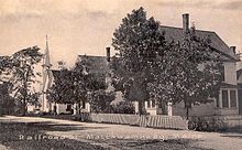
Island Falls is a town in Aroostook County, Maine, United States. The population was 758 at the 2020 census. The primary village of Island Falls in the town is situated at a falls in the West Branch Mattawamkeag River.

<span class="mw-page-title-main">Penobscot, Maine</span> Town in the state of Maine, United States

Penobscot is a town in Hancock County, Maine, United States. The Bagaduce River flows through the town. The population was 1,136 at the 2020 census.

Bradley is a town in Penobscot County, Maine, United States. It is part of the Bangor Metropolitan Statistical Area. The population was 1,532 at the 2020 census. The village of Bradley is in the northwestern corner of the town.

Burlington is a town in Penobscot County, Maine, United States. It is part of the Bangor Metropolitan Statistical Area. The population was 373 at the 2020 census.

Drew is a township in Penobscot County, Maine, United States. The population was 26 at the 2020 census. It is part of the Bangor Metropolitan Statistical Area. The Surety of Sinners Orthodox Mission, a Russian Orthodox church, is located in Drew. A former plantation, Drew completed the de-organization process in 2023 to become part of Maine's unorganized territory.

Eddington is a town located on the eastern side of the Penobscot River in Penobscot County, Maine, United States. As of the 2020 census, the town had a population of 2,194.

Edinburg is a town in Penobscot County, Maine, United States. The population was 134 at the 2020 census. It is part of the Bangor Metropolitan Statistical Area. It is located between the towns of Argyle and Howland along Maine State Route 116 on the west bank of the Penobscot River.

Kenduskeag is a town in Penobscot County, Maine, United States. The population was 1,346 at the 2020 census.

LaGrange is a town in Penobscot County, Maine, United States. The population was 635 at the 2020 census.

Lakeville is a town in Penobscot County, Maine, United States. The population was 104 at the 2020 census.

<span class="mw-page-title-main">Mount Chase, Maine</span> Town in the state of Maine, United States

Mount Chase is a town in Penobscot County, Maine, United States. The population was 187 at the 2020 census.

Patten is a small town in Penobscot County, Maine, United States. At the 2020 census, the population was 881. The village of Patten is in the northeastern part of the town.

Winn is a town in Penobscot County, Maine, United States, on the east bank of the Penobscot River. The town was named for John M. Winn, an early landholder. The population was 399 at the 2020 census.

<span class="mw-page-title-main">Brownville, Maine</span> Town in the state of Maine, United States

Brownville is a town in Piscataquis County, Maine, United States. The population was 1,139 at the 2020 census. The town includes the villages of Brownville, Knight's Landing and Brownville Junction, near which passes the 100-Mile Wilderness of the Appalachian Trail.

<span class="mw-page-title-main">Frankfort, Maine</span> Town in the state of Maine, United States

Frankfort is a town on the Penobscot River estuary in Waldo County, Maine, United States. The population was 1,231 at the 2020 census.

<span class="mw-page-title-main">Prospect, Maine</span> Town in the state of Maine, United States

Prospect is a town in Waldo County, Maine, United States. The population was 698 at the 2020 census.

Vanceboro is a town in Washington County, Maine, United States. The town was named after landowner William Vance. The main village in town is located at the eastern terminus of Maine State Route 6. Vanceboro is across the St. Croix River from St. Croix, New Brunswick, Canada, to which it is connected by the Saint Croix–Vanceboro Bridge. Vanceboro is also connected to St. Croix by the Saint Croix–Vanceboro Railway Bridge, which is used by the New Brunswick Southern Railway.

<span class="mw-page-title-main">East Millinocket, Maine</span> Town in the state of Maine, United States

East Millinocket is a town in Penobscot County, Maine, United States. The population was 1,572 at the 2020 census.

Milford is a town in Penobscot County, Maine, United States. It is located across the Penobscot River from the city of Old Town. The population of Milford was 3,069 at the 2020 census. The town's slogan is the "Best little town by a dam site," referring to the Milford Dam abutting Milford on the Penobscot River, south of the Penobscot Indian Island Reservation.

References

  1. 1 2 "US Gazetteer files 2010". United States Census Bureau . Retrieved December 16, 2012.
  2. Maine League of Historical Societies and Museums (1970). Doris A. Isaacson (ed.). Maine: A Guide 'Down East'. Rockland, Me: Courier-Gazette, Inc. p. 352.
  3. "Census - Geography Profile: Mattawamkeag town, Penobscot County, Maine". United States Census Bureau . Retrieved January 23, 2022.
  4. "US Post Office--Old Town Main - Archiplanet". Archived from the original on November 30, 2009. Retrieved February 21, 2008.
  5. "Census of Population and Housing". Census.gov. Retrieved June 4, 2015.
  6. "U.S. Census website". United States Census Bureau . Retrieved December 16, 2012.
  7. "U.S. Census website". United States Census Bureau . Retrieved January 31, 2008.

45°30′49″N68°21′16″W / 45.51361°N 68.35444°W / 45.51361; -68.35444