Griswold is a town in New London County, Connecticut, United States. The population was 11,402 at the 2020 census. Griswold contains the borough of Jewett City and the villages of Doaneville, Kaalmanville, Rixtown, Glasgo, Hopeville, Nathanieltown, and Pachaug.

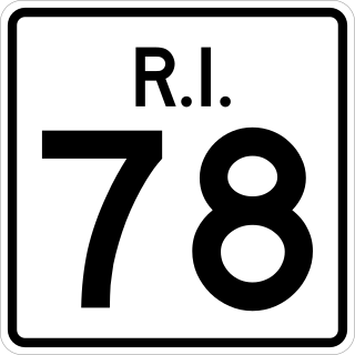
Route 78, also known as the Westerly Bypass, is a two-lane arterial boulevard and expressway between Pawcatuck, Connecticut to Westerly, Rhode Island. The route is about 4.6 miles (7.4 km) long and begins at Connecticut Route 2 in Stonington, crossing into Rhode Island at the Pawcatuck River, where it continues as an expressway to U.S. Route 1 in Westerly. The route was constructed in 1979, after a sixteen-year delay. The designation was to become part of the Orient Point–Watch Hill Bridge, but this plan was later dropped. The route was given the memorial name of Veterans Way in 2004.

Route 2 is a 58.03-mile (93.39 km) state highway in Hartford and New London counties in Connecticut. It is a primary state route, with a limited-access freeway section connecting Hartford to Norwich and following surface roads to Stonington. The entire freeway section of Route 2 is also known as the Veterans of Foreign Wars Memorial Highway.

Route 138 is the portion of the 118-mile-long (190 km) multi-state Route 138 within the state of Connecticut. It is one of several New England state highways that travel through three states while keeping their number designation. The route begins in Sprague at Route 97. From its western terminus up to the junction with Interstate 395 in Griswold, the road functions as a collector road. From the Interstate 395 junction, it then enters Voluntown, and continues into the state of Rhode Island as Route 138.

Route 169 is a 47.36-mile-long (76.22 km) state highway in the U.S. states of Connecticut and Massachusetts. It begins in the city of Norwich, Connecticut, and runs 38 miles (61 km) through Northeastern Connecticut, continuing across the state line into Southbridge, Massachusetts. The route ends in Charlton after another nine miles (14 km). A portion of the route in the town center of Pomfret is on the National Register of Historic Places as Pomfret Street Historic District, and 32.10 miles (51.66 km) of the road is designated as the Connecticut State Route 169 National Scenic Byway.

Route 27 is a north–south state highway in southeastern Connecticut running for 3.21 miles (5.17 km) from U.S. Route 1 in Mystic to Route 184 in Old Mystic.

Route 49 is a Connecticut state highway from Route 2 in Stonington to Route 14A in Sterling, in the southeast part of the state. It is a scenic route that runs 21.74 miles (34.99 km) through the Pachaug State Forest.

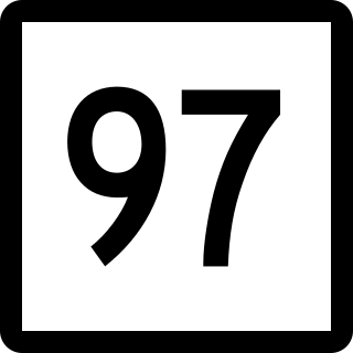
Route 97 is a north–south state highway in eastern Connecticut running for 29.14 miles (46.90 km) from Route 12 in Norwich to US 44 in Pomfret.

State Route 15 (SR 15) is a numbered state highway in Maine, United States. SR 15 runs over 180 miles (290 km) from Stonington in the south to Jackman in the north.

Route 216 is a state highway in southeastern Connecticut, running entirely within the town of North Stonington. It connects Route 49 to the Rhode Island state line and serves the village of Clarks Falls.

Route 234 is a state highway in southeastern Connecticut, running entirely within the town of Stonington. It connects the Old Mystic section of town with the village of Pawcatuck.

Route 164 is a minor state highway in southeastern Connecticut, United States, running from Route 2 in Preston through the village of Preston City to Route 138 in Griswold just south of the borough of Jewett City.

Route 117 is a state highway in southeastern Connecticut, running from Groton to Preston. Route 117 is designated the Colonel Ledyard Highway from its intersection with Route 184 in Groton to the Ledyard-Preston town line.

Route 145 is a state highway in the western part of the Connecticut River Estuary region of Connecticut. It connects Clinton center, through the village of Winthrop, to the town of Chester.

Route 165 is a state highway in southeastern Connecticut running from Norwich to the Rhode Island state line in Voluntown, and continuing as RI Route 165.

Route 177 is a state highway in central Connecticut, running from Plainville to Canton.

Route 184 is a state highway in southeastern Connecticut, running from Groton to North Stonington.

The Pachaug River is a 16.0-mile-long (25.7 km) river arising from the Pachaug State Forest at the Connecticut - Rhode Island border and draining into the Quinebaug River. It is crossed by the Ashland Mill Bridge in Griswold, Connecticut, a bridge which is listed on the U.S. National Register of Historic Places.

The Nehantic Trail is a 13-mile (21 km) Connecticut hiking trail and is one of the Blue-Blazed hiking trails maintained by the Connecticut Forest and Park Association.

Hopeville Pond State Park is a public recreation area located on Hopeville Pond, an impoundment of the Pachaug River, in the town of Griswold, Connecticut. A portion of the 554-acre (224 ha) state park occupies the site of the lost village of Hopeville. The park manager's house occupies Avery House, which is listed on the National Register of Historic Places. The park offers fishing, swimming, camping, and trails for hiking and biking. It is managed by the Connecticut Department of Energy and Environmental Protection.


