Thomaston is a town in Litchfield County, Connecticut, United States. The town is part of the Naugatuck Valley Planning Region. The population was 7,442 at the 2020 census. The urban center of the town is the Thomaston census-designated place, with a population of 1,928 at the 2020 census.

Watertown is a town in Litchfield County, Connecticut, United States. The town is part of the Naugatuck Valley Planning Region. The population was 22,105 at the 2020 census. The ZIP Codes for Watertown are 06795 and 06779. It is a suburb of Waterbury. The urban center of the town is the Watertown census-designated place, with a population of 3,938 at the 2020 census.
The Naugatuck River Valley is the watershed area of the Naugatuck River in the western part of Connecticut. The Naugatuck Valley straddles parts of Litchfield County, New Haven, and Fairfield counties. The Route 8 corridor and Waterbury Branch of the Metro-North railroad line run along the river valley. Geographically, it comprises the municipalities located within the Naugatuck River basin. During the 19th and 20th centuries, the area was one of the main manufacturing centers in New England, and most of the communities around the river were emblematic New England mill towns.

The Naugatuck Railroad is a common carrier railroad owned by the Railroad Museum of New England and operated on tracks leased from the Connecticut Department of Transportation. The original Naugatuck Railroad was a railroad chartered to operate through south central Connecticut in 1845, with the first section opening for service in 1849. In 1887 the line was leased by the New York, New Haven and Hartford Railroad, and became wholly owned by 1906. At its greatest extent the Naugatuck ran from Bridgeport north to Winsted. Today's Naugatuck Railroad, formed in 1996, runs from Waterbury to the end of track in Torrington, Connecticut. From Waterbury south to the New Haven Line, Metro-North Railroad operates commuter service on the Waterbury Branch.

Route 8 is a 67.36-mile (108.41 km) state highway in Connecticut that runs north–south from Bridgeport, through Waterbury, all the way to the Massachusetts state line where it continues as Massachusetts Route 8. Most of the highway is a four-lane freeway but the northernmost 8.8 miles (14.2 km) is a two-lane surface road.

Route 63 is a secondary state highway in the U.S. state of Connecticut, from New Haven up to Canaan, running for 52.57 miles (84.60 km). It connects the Greater New Haven area to Northwestern Connecticut via the western suburbs of Waterbury.

U.S. Route 6 (US 6) within the state of Connecticut runs for 116.33 miles (187.21 km) from the New York state line near Danbury to the Rhode Island state line in Killingly. West of Hartford, the route either closely parallels or runs along Interstate 84 (I-84), which has largely supplanted US 6 as a through route in western Connecticut. East of Hartford, US 6 serves as a primary route for travel between Hartford and Providence.

Route 64 is a Connecticut state highway connecting the towns of Woodbury and Waterbury via Middlebury.

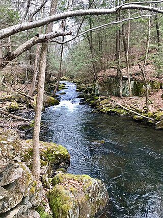
The Naugatuck River is a 40.2-mile-long (64.7 km) river in the U.S. state of Connecticut. Its waters carve out the Naugatuck River Valley in the western reaches of the state, flowing generally due south and eventually emptying into the Housatonic River at Derby, Connecticut and thence 11 miles (18 km) to Long Island Sound. The Plume and Atwood Dam in Thomaston, completed in 1960 following the Great Flood of 1955, creates a reservoir on the river and is the last barrier to salmon and trout migrating up from the sea.

Route 73 is an east–west state highway in Connecticut connecting the town center of Watertown to the Route 8 expressway in Waterbury via the village of Oakville. The road is classified as an urban principal arterial road and carries traffic volumes of about 16,400 vehicles per day.

Mattatuck State Forest is a Connecticut state forest spread over twenty parcels in the towns of Waterbury, Plymouth, Thomaston, Watertown, Litchfield, and Harwinton. The Naugatuck River runs through a portion of the forest. The largest section of the forest is located about 1 mile (1.6 km) north of Waterbury. The Leatherman's Cave, named after the vagabond Leatherman of the late 19th century, is located in Thomaston near the Mattatuck Trail, 1/4 mile west of the junction with the Jericho Trail.

Route 115 is a Connecticut state highway in the Lower Naugatuck River Valley area, running from Route 34 in Derby to Route 67 in Seymour. The road runs along the east bank of the lower Naugatuck River.

Route 222 is a state highway in west central Connecticut, running in a meandering pattern from Thomaston to Harwinton.

Route 254 is a state highway in northwestern Connecticut running from Thomaston to Litchfield.

Route 313 is a Connecticut state highway in the outer northwestern New Haven suburbs, running from Seymour to Woodbridge.

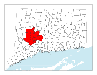
The Central Naugatuck Valley is a region of Connecticut in New Haven and Litchfield counties located approximately 70 miles (110 km) northeast of New York City and 110 miles (180 km) southwest of Boston, United States. The region comprises 13 towns: Beacon Falls, Bethlehem, Cheshire, Middlebury, Naugatuck, Oxford, Prospect, Southbury, Thomaston, Waterbury, Watertown, Wolcott, and Woodbury.

State Route 73 is part of Maine's system of numbered state highways, a coastal route located in southern Knox County. It runs for 10.7 miles (17.2 km) from an intersection with SR 131 in St. George to an intersection with U.S. Route 1 (US 1) in Rockland.

The Whitestone Cliffs Trail is a 1.7-mile (2.7 km) Blue-Blazed hiking trail in the Waterbury area in Thomaston and Plymouth, Litchfield County, Connecticut. It is contained almost entirely in a section of the Mattatuck State Forest. The mainline trail is a loop trail with one connector trail to the Jericho Blue-Blazed Trail.

The 'Hancock Brook Trail' is a 2.8-mile (4.5 km) Blue-Blazed hiking trail Waterville Section of the City of Waterbury in New Haven County close to the borders of Thomaston and Plymouth, Litchfield County, Connecticut. It is contained overwhelmingly in a section of the Mattatuck State Forest bounded by Hancock Brook on the east, Thomaston Avenue on the west and Spruce Brook Road / Route 262 to the north.

The Jericho trail is a 3.4-mile (5.5 km) Blue-Blazed hiking trail in the Oakville section of Watertown, near the border with Thomaston and Plymouth, Litchfield County, Connecticut. The trail is contained almost entirely in a section of the Mattatuck State Forest. The mainline trail is a linear north–south "hike-through" trail with one east–west connector trail to the Whitestone Cliffs Blue-Blazed Trail.


