Habitats of the Indiana Dunes

Last updated
Ecosystems of the Indiana Coastal Region Habitats of the Dunes (2).jpg
Ecosystems of the Indiana Coastal Region

The Indiana Dunes comprise ten different habitats. Each provides for a unique combination of plants and animals. The range of the Indiana Dunes varies depending your source. The Indiana Lake Michigan Coastal Program uses the river drainage systems along the shoreline. This expands the area from the areas of lakeshore southward to the edges of the Valparaiso Moraine. This entire region has been dune landscapes since over 114,000 years before present (YBP). [1] Traditionally, the Indiana Dunes area thought of as a narrow area along the shores of Lake Michigan, including the areas of Marquette Park in Gary, Indiana (1920), Indiana Dunes State Park (1926) and Indiana Dunes National Park, (1966, designated as a national park in 2019). [2] The identified ten habitats can be found in these parks, where they have been preserved, but are also visible throughout the three counties of Northwest Indiana.

Contents

Prairie

The prairie community is dominated by grasses with few to no trees. In the dunes, there are several different prairie types. Each is dependent on moisture levels and soil types. They ranger from wet, Hoosier Prairie to dry, Mnoke Prairie. [1] Soils varies from sand to silt loams. Some key identifiers of a prairie community include the eastern bluebird, blazing starr, and lead plant.

Dunes

Looking northeast from the top of Mt. Baldy, Indiana Dunes National Park. NIPSCO Michigan City P6220059.jpg
Looking northeast from the top of Mt. Baldy, Indiana Dunes National Park.

The dominant feature of the Indiana Dunes is the dunes. The hills and ridges throughout the southern border of Lake Michigan are predominantly sand ridges, created by the movements of the winds and their deposition of the sands. The dunes cover a complex of plant communities. [1] The central dunes, which were a large area of high and diverse dunes was removed to make way for the Bethlehem Burns Harbor Steel Plant [3] The most accessible dunes are at the West Beach facility of the national park (Dunes Succession Trail); the Tremont’s Trail in Indiana Dunes State Park, and at Mt. Baldy, located in the east end of the national park. [2] Some key identifiers of the dune communities include the spotted sandpiper, pitcher's thistle, and olympia marblewing.

Dune and swale

At the west end of the Indiana Dunes, in Gary there is a dune and swale province of the system. The area is characterized by low, linear sand ridges, parallel to the shoreline. Between these ridges are low areas of marsh or ponds. The ridges are characterized by prairie and savanna life forms and the marsh areas and ponds by the plants and wildlife of those characteristic areas of the dune lands. The dune and swale topography is easiest to see in the Miller Woods area of the park. Much of the dune and swales was eliminated by the construction of the industrial plants of Gary, East Chicago, Whiting and Hammond. [1] Some key identifiers of a dune and swale community include the common yellowthroat, Blanding's turtle, and bluehearts.

River

Little Calumet River in the Heron Rookery Little Calumet Heron Rookery Indiana Dunes Natl Lakeshore.JPG
Little Calumet River in the Heron Rookery

The primary river of the dunes is the Calumet River. Its three segments were once a single waterway, parallel to the Lake Michigan Shoreline. [4] On the east is Trail Creek in Michigan City, Indiana. The Calumet River is accessible at several locations. The upper reaches are viewable in the Heron Rookery. [2] The midsection is parallel to the Calumet Trail from the Bailly/Chellberg Parking lot of the national park and the historic mouth exist in the lakes of Marquette Park in Gary. The construction of the Burns Waterway altered the historic flow, creating three ‘Calumet’ Rivers from the original one. This can be observed from the Portage Lakefront and Riverwalk in the national park adjacent to the steel mills in Burns Harbor. Some key identifiers of a river community include the red-shouldered hawk, Baltimore oriole, and bluntnose minnow. [1]

Swamp

Swamps are wetlands dominated by woody plants. Swamps extend nearly the entire length of the dunes. The wider swamps are in the west in Lake County, Indiana. They parallel the Calumet River and its tributaries. Narrower swamps are found between the various dune ridges, which are also where the rivers are located. Swamp access is available at Inland Marsh in the west end of the national park and in Beverly Shores to the east, the restoration of the Great Marsh is now accessible from a trail off Broadway Ave. In the State Park, trail #10, circles a large wetland, offering [1] Some key identifiers of a swamp community include the gray tree frog, wood duck, and barred owl.

Lake Michigan

The second largest of the North American Great Lakes, the Indiana Dunes are located on its most southern shoreline. This southerly position supports fish and birds that cannot withstand the extreme winters of the northern end of the lake or the deep snows of the eastern shore of the lake. [1] The shoreline currents move and, debris, and other pollutants from the north on both shores to the toe of the lake off the Indiana Coast. [4] The prevailing winds are out of the northwest and west all year. This leads to the creation of a ‘snow belt’ along the eastern half of the Indiana Shoreline and all of the State of Michigan’s Shoreline. [1] The dunes had been dotted with lakes. From the west, they start with the Wolf Lake complex in Hammond. In east Lake County are the Miller Woods ponds (nearly a dozen). North, closer to Lake Michigan, in the old Calumet River bed, are the Marquette Lakes in Marquette Park. Passing into Porter County, there is Long Lake at the West Beach facility of the national park. The state park has a lake in the middle of its nature preserve along trail #10. Several other lakes, including ‘Mud Lake’ in the Pines have disappeared over time. [2] Some key identifiers of lake include the lake trout, smallmouth bass, and common tern.

Bog and fen

These two types of wetlands are easily confused. A bog is usually the result of a glacial depression, which creates and enclosed drainage system. There will usually be a floating mat of peat moss. On this mat, there will be low heath shrubs. If the bog is old, larger trees will be supported. Pinhook Bog in LaPorte is open to ranger guided tours by the national park. [1] A fen is another wetland form, which is created by a seep from below. The fen is affected by the calcium included in the seepage. It is usually associated with glacial moraines. Vegetation can be either herbaceous plants or heavily forested. The best known fen in the dunes is mistakenly called Cowles Bog, rather than more appropriately, Cowles Fen. [1] Some key identifiers of a bog or fen community include the pitcher plant, swamp sparrow, and Ohio goldenrod.

Forest

Winter along the Little Calumet River, passing through a floodplain forest at the Bailly Homestead Little Calumet River at Bailly Homestead Indiana Dunes NL PC160148.JPG
Winter along the Little Calumet River, passing through a floodplain forest at the Bailly Homestead

The dunes include three distinct types of forests. Forests are dominated by mature trees that have nearly a closed canopy during the summer season. In the dunes, there are upland forest, floodplain forest, and flatwoods forests. [1] Upland forests would be visible at Pinhook Bog, in the Hobart Prairie Grove in Hobart along U.S. 20 in Porter County. The best example of a floodplain forest would be along the Calumet Trail, accessible from the Bailly/Chellberg Historic area parking lot. [2] Some key identifiers of a forest community include the red-eyed vireo, ovenbird, and large-flowered trillium.

Savanna

A savanna is a naturally occurring area that is open like a prairie with grasses and herbaceous shrubs dominating, but having a substantial canopy from trees. The canopy is less than 80% of the area, but more than 10%. Where the soils are sandy, the dominant trees are black oak and white oak. When the soil is predominantly a silty loam, burr oak and other oaks are common. [1] Savannas begin along the Tinley Moraine and southward onto the Valparaiso Moraine. [2] Some key identifiers of a savanna community include the red-headed woodpecker, Karner blue, and lupine.

Marsh

Restored Great Marsh in Beverly Shores, Indiana. (Indiana Dunes National Park) Reat Marsh Indiana Dunes National Lakeshore P6060051.JPG
Restored Great Marsh in Beverly Shores, Indiana. (Indiana Dunes National Park)

Another wetland that is predominantly sedges and grasses. It is characterized as having water at the surface or above the surface during most of the year. [1] The great marsh in Beverly Shores is visible the entire length of Beverly Drive from U.S. 12 at Mt. Baldy to its end at East State Park Road. [2] Some key identifiers of a marsh community include the sora, marsh fern, and calico pennant.

Related Research Articles

<span class="mw-page-title-main">Swamp</span> A forested wetland

A swamp is a forested wetland. Swamps are considered to be transition zones because both land and water play a role in creating this environment. Swamps vary in size and are located all around the world. The water of a swamp may be fresh water, brackish water, or seawater. Freshwater swamps form along large rivers or lakes where they are critically dependent upon rainwater and seasonal flooding to maintain natural water level fluctuations. Saltwater swamps are found along tropical and subtropical coastlines. Some swamps have hammocks, or dry-land protrusions, covered by aquatic vegetation, or vegetation that tolerates periodic inundation or soil saturation. The two main types of swamp are "true" or swamp forests and "transitional" or shrub swamps. In the boreal regions of Canada, the word swamp is colloquially used for what is more formally termed a bog, fen, or muskeg. Some of the world's largest swamps are found along major rivers such as the Amazon, the Mississippi, and the Congo.

<span class="mw-page-title-main">Indiana Dunes National Park</span> United States National Park in Indiana

Indiana Dunes National Park is a United States national park located in northwestern Indiana managed by the National Park Service. It was authorized by Congress in 1966 as the Indiana Dunes National Lakeshore and was redesignated as the nation's 61st national park on February 15, 2019. The park runs for about 20 miles (32 km) along the southern shore of Lake Michigan and covers 15,349 acres (6,212 ha). Along the lakefront, the eastern area is roughly the lake shore south to U.S. 12 or U.S. 20 between Michigan City, Indiana, on the east and the Cleveland-Cliffs steel plant on the west. This area's conservation scheme is enhanced by the older Indiana Dunes State Park. To the west of the steel plant lies West Beach and a small extension south of the steel mill continues west along Salt Creek to Indiana 249. The western area is roughly the shoreline south to U.S. 12 between the Burns Ditch west to Broadway in downtown Gary, Indiana. In addition, there are several outlying areas, including Pinhook Bog, in LaPorte County to the east; the Heron Rookery in Porter County, the center of the park; and the Calumet Prairie State Nature Preserve and the Hobart Prairie Grove, both in Lake County, the western end of the park.

<span class="mw-page-title-main">Kankakee River</span> River in Indiana and Illinois, United States

The Kankakee River is a tributary of the Illinois River, approximately 133 miles (214 km) long, in the Central Corn Belt Plains of northwestern Indiana and northeastern Illinois in the United States. At one time, the river drained one of the largest wetlands in North America and furnished a significant portage between the Great Lakes and the Mississippi River. Significantly altered from its original channel, it flows through a primarily rural farming region of reclaimed cropland, south of Lake Michigan.

Pottageville is an unincorporated community located in northeastern King Township, in Ontario, Canada. It is near Schomberg. It is named for one of its early settlers, Edward Pottage.

<span class="mw-page-title-main">Indiana Dunes State Park</span> State park in Indiana, United States

Indiana Dunes State Park is an Indiana State Park located in Porter County, Indiana, United States, 47 miles (75.6 km) east of Chicago. The park is bounded by Lake Michigan to the northwest and is surrounded by as well as within the authorized boundaries of Indiana Dunes National Park, a unit of the National Park Service; the NPS owns the water from the ordinary high water mark to 300 feet (91 m) offshore. The 1,530-acre (619.2 ha) Dunes Nature Preserve makes up the bulk of eastern part of the park, and includes most of the park's hiking trails and dune landscape. This was one of the first places Richard Lieber considered when establishing the Indiana State Park system. Like all Indiana state parks, there is a fee for entrance. Indiana Dunes State Park was established in 1925 and designated a National Natural Landmark in 1974.

Northwest Indiana, nicknamed The Region after the Calumet Region, comprises Lake, Porter, LaPorte, and Newton counties in Indiana. This region neighbors Lake Michigan and is part of the Chicago metropolitan area. According to the 2020 Census, Northwest Indiana has a population of 831,080 and is the state's second largest urban area after the Indianapolis Metropolitan Area. It is also the home of the Indiana Dunes, parts of which have been preserved through conservation efforts. The town of Ogden Dunes houses the Hour Glass, a museum showcasing the ecological and conservation efforts of O. D. Frank.

<span class="mw-page-title-main">Illinois Beach State Park</span> Park on Lake Michigan in Illinois

Adeline Jay Geo-Karis Illinois Beach State Park, part of the Illinois state park system, is located along Lake Michigan in northern Lake County in northeast Illinois. Together with lands to the north, including Chiwaukee Prairie, it forms the Chiwaukee Prairie Illinois Beach Lake Plain, an internationally recognized wet-land of importance under the Ramsar Convention. The park is broken into two units that encompass an area of 4,160 acres (1,683 ha) and contains over six miles of Lake Michigan shoreline. In 2010, it was renamed for former state senator Adeline Geo-Karis.

<span class="mw-page-title-main">Cowles Bog</span> Wetland complex in Indiana, US

Cowles Bog is a 4,000-year-old wetland complex in Indiana Dunes National Park, near Chesterton, Indiana. It is named for Henry Chandler Cowles who did his pioneering work in ecology and ecological succession here. His work brought international attention to the area which led to efforts to preserve the Indiana Dunes. It was designated a National Natural Landmark in 1965. It contains bog, fen, marsh, wet meadow, swamp, and pond habitats.

<span class="mw-page-title-main">Geography of Indiana</span> Overview of the geography of Indiana

The geography of Indiana comprises the physical features of the land and relative location of U.S. State of Indiana. Indiana is in the north-central United States and borders on Lake Michigan. Surrounding states are Michigan to the north and northeast, Illinois to the west, Kentucky to the south, and Ohio to the east. The entire southern boundary is the Ohio River.

There are numerous natural areas in King, a township in Ontario, Canada. These areas are zones officially designated by the Government of Ontario that are within the township and exhibit provincially or regionally significant features representative of the region. The list of zones is defined and maintained by the provincial Ministry of Natural Resources Natural Heritage Information Centre.

<span class="mw-page-title-main">Westchester Township, Porter County, Indiana</span> Township in Indiana, United States

Westchester Township is one of twelve townships in Porter County, Indiana. It is included in the Calumet, Northwest Indiana, and Great Lakes regions. It is located on the southern shore of Lake Michigan, about 50 miles (80 km) southeast of Chicago. It stretches from the famous Indiana Dunes on its northern border, south to the Valparaiso Moraine, a ridge of rolling hills left by the last glacier to pass through the area. As of the 2010 census, its population was 19,396.

<span class="mw-page-title-main">Mammals of the Indiana Dunes</span>

Thirty-seven species of mammals have been identified at Indiana Dunes National Park. Four other species are thought to inhabit the park, but have not been documented: the northern long-eared myotis, the Indiana bat, the hoary bat, and the southern bog lemming

<span class="mw-page-title-main">Trail Creek (Lake Michigan)</span> River in Indiana, United States

Trail Creek is a 7.3-mile-long (11.7 km) north- by northwest-flowing stream whose main stem begins at the confluence of the West Branch Trail Creek and the East Branch Trail Creek in LaPorte County, Indiana, United States. Its mouth is a Lake Michigan harbor and marina adjacent to Washington Park in Michigan City, Indiana.

<span class="mw-page-title-main">Salt Creek (Little Calumet River tributary)</span> River in Indiana, United States

Salt Creek is a 24.0-mile-long (38.6 km) tributary of the East Arm Little Calumet River that begins south of Valparaiso in Porter County, Indiana and flows north until it joins the East Arm Little Calumet River just before it exits to Lake Michigan via the Port of Indiana-Burns Waterway.

The Shirley Heinze Land Trust, originally known as the Shirley Heinze Environmental Fund, is a 501(c)(3) nonprofit land trust dedicated to the preservation of natural areas in Northwest Indiana. The Heinze Trust manages more than 2,800 acres of protected land in Lake, Porter, LaPorte, St. Joseph, Starke, and Marshall Counties in Indiana. Its preserves include a wide range of dune, wetland, prairie, and forest ecosystems.

Ridge and swale, or in dunal areas dune and swale, is a landform consisting of regular, parallel ridges alternating with marshy depressions. Ridge-and-swale landscapes are most commonly formed by the gradual movement of a beach, for example as a result of gradually fluctuating water levels, or the shifting meanders of a river. In the river context, ridge-and-swale landscapes are commonly formed by scroll bars. They are also found along ocean coasts, for example on the Outer Banks of North Carolina.

<span class="mw-page-title-main">Kiser Lake Wetlands State Nature Preserve</span>

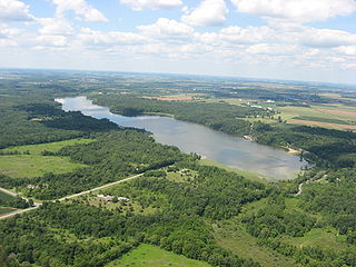
Kiser Lake Wetlands State Nature Preserve, or simply Kiser Lake Wetlands, is a 51 acres (21 ha) nature reserve located in Johnson Township, Champaign County, Ohio, United States. It is located wholly within the Kiser Lake State Park, and operated by the Ohio Department of Natural Resources.

<span class="mw-page-title-main">Hobart Nature District</span>

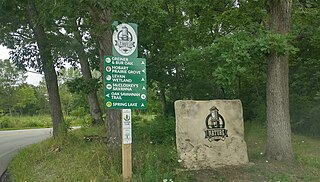
The Hobart Nature District is located in the City of Hobart, Indiana and includes over 1,000 acres (400 ha) of scenic parks, wetlands and floodplains, winding rivers, peaceful lakes, open prairies, oak savannas, old-growth forests, and undulating ravines.

References

  1. 1 2 3 4 5 6 7 8 9 10 11 12 13 Ecosystems of the Indiana Coastal Region; Indiana Lake Michigan Coastal Program, Indiana Department of Natural Resources and the National Oceanic and Atmospheric Administration; 2007
  2. 1 2 3 4 5 6 7 Indiana Dunes, Map and Guide; National Park Service, Indiana Dunes National Lakeshore; Harpers Ferry Design Center; 2002
  3. The Calumet Region, Indiana’s Last Frontier; Indiana Historical Collections; Volume 34; Powell A. Moore; Historical Bureau, 1959
  4. 1 2 Calumet Beginnings; Kenneth J. Schoon, Indiana University Press; Bloomington, Indiana; 2003