Humboldt, Wisconsin

Last updated

Humboldt, Wisconsin
Brown County Wisconsin incorporated and unincorporated areas Humboldt highlighted.svg
Location in Brown County and the state of Wisconsin.
Coordinates: 44°30′33″N87°50′10″W / 44.50917°N 87.83611°W / 44.50917; -87.83611
Country Flag of the United States.svg  United States
State Flag of Wisconsin.svg  Wisconsin
County Brown
Area
  Total24.0 sq mi (62.2 km2)
  Land24.0 sq mi (62.2 km2)
  Water0.0 sq mi (0.0 km2)
Elevation
[1]
801 ft (244 m)
Population
 (2010)
  Total1,311
  Density55/sq mi (21.1/km2)
Time zone UTC-6 (Central (CST))
  Summer (DST) UTC-5 (CDT)
Area code 920
FIPS code 55-36425 [2]
GNIS feature ID1583422 [1]
Website townofhumboldt.com

Humboldt is a town in Brown County in the U.S. state of Wisconsin. The population was 1,311 at the 2010 census. [3] The community name was chosen by Henry Fontaine. [4]

Contents

Communities

Geography

Humboldt is in eastern Brown County and is bordered by Kewaunee County to the east and the city of Green Bay to the west and north.

According to the United States Census Bureau, the town has a total area of 24.0 square miles (62.2 km2), all of it land. [3]

Demographics

As of the census [2] of 2000, there were 1,338 people, 453 households, and 370 families residing in the town. The population density was 55.9 people per square mile (21.6/km2). There were 460 housing units at an average density of 19.2 per square mile (7.4/km2). The racial makeup of the town was 99.25% White, 0.45% Native American, 0.15% from other races, and 0.15% from two or more races. Hispanic or Latino of any race were 0.22% of the population.

There were 453 households, out of which 39.7% had children under the age of 18 living with them, 73.3% were married couples living together, 4.9% had a female householder with no husband present, and 18.3% were non-families. 15.7% of all households were made up of individuals, and 6.6% had someone living alone who was 65 years of age or older. The average household size was 2.95 and the average family size was 3.31.

In the town, the population was spread out, with 28.3% under the age of 18, 9.0% from 18 to 24, 29.4% from 25 to 44, 23.8% from 45 to 64, and 9.6% who were 65 years of age or older. The median age was 36 years. For every 100 females, there were 110.7 males. For every 100 females age 18 and over, there were 108.7 males.

The median income for a household in the town was $54,821, and the median income for a family was $60,063. Males had a median income of $38,889 versus $24,489 for females. The per capita income for the town was $19,813. About 2.3% of families and 2.2% of the population were below the poverty line, including 2.5% of those under age 18 and 4.4% of those age 65 or over.

Related Research Articles

<span class="mw-page-title-main">Huron Township, Michigan</span> Civil township in Michigan, United States

Huron Township is a civil township of Huron County in the U.S. state of Michigan. The population was 352 at the 2020 census.

<span class="mw-page-title-main">Madison Charter Township, Michigan</span> Charter township in Michigan, United States

Madison Charter Township is a charter township of Lenawee County in the U.S. state of Michigan. The population was 8,439 at the 2020 census.

<span class="mw-page-title-main">Pike Township, St. Louis County, Minnesota</span> Township in Minnesota, United States

Pike Township is a township in Saint Louis County, Minnesota, United States. The population was 417 at the 2010 census.

<span class="mw-page-title-main">Clover, Wisconsin</span> Town in Wisconsin, United States

Clover is a town in Bayfield County, Wisconsin, United States. The population was 223 at the 2010 census. The unincorporated communities of Bark Point and Herbster are located in the town.

<span class="mw-page-title-main">Glenmore, Wisconsin</span> Town in Wisconsin, United States

Glenmore is a town in Brown County in the U.S. state of Wisconsin. The population was 1,045 at the 2020 census.

<span class="mw-page-title-main">Morrison, Wisconsin</span> Town in Wisconsin, United States

Morrison is a town in Brown County in the U.S. state of Wisconsin. The population was 1,599 at the 2010 census.

<span class="mw-page-title-main">Scott, Brown County, Wisconsin</span> Town in Wisconsin, United States

Scott is a town in Brown County in the U.S. state of Wisconsin. As of the 2020 census, the population was 3,636.

<span class="mw-page-title-main">Dairyland, Wisconsin</span> Town in Wisconsin, United States

Dairyland is a town in Douglas County, Wisconsin, United States. The population was 186 at the 2000 census. The unincorporated communities of Cozy Corner, Dairyland, and Moose Junction are located in the town.

<span class="mw-page-title-main">Parkland, Wisconsin</span> Town in Wisconsin, United States

Parkland is a town in Douglas County, Wisconsin, United States. The population was 1,240 at the 2000 census. The unincorporated communities of Cutter, Parkland, Peyton, South Itasca, Sunnyside and South Range are in the town.

<span class="mw-page-title-main">Cato, Wisconsin</span> Town in Wisconsin, United States

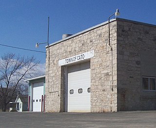
Cato is a town in Manitowoc County, Wisconsin, United States. The population was 1,616 at the 2000 census. A Manitowoc County park is located in the town which is called "Cato Falls" for a waterfall on the Manitowoc River.

<span class="mw-page-title-main">Cooperstown, Wisconsin</span> Town in Wisconsin, United States

Cooperstown is a town in Manitowoc County, Wisconsin, in the United States. As of the 2000 census, the town population was 1,403.

<span class="mw-page-title-main">Gibson, Wisconsin</span> Town in Wisconsin, United States

Gibson is a town in Manitowoc County, Wisconsin, United States. The population was 1,352 at the 2000 census.

<span class="mw-page-title-main">Meeme, Wisconsin</span> Town in Wisconsin, United States

Meeme is a town in Manitowoc County, Wisconsin, United States. The population was 1,538 at the 2000 census. Its Menominee name is Omīnīw which means "pigeon". The Menominee sold this land to the United States in the 1831 Treaty of Washington.

<span class="mw-page-title-main">Schleswig, Wisconsin</span> Town in Wisconsin, United States

Schleswig is a town in Manitowoc County, Wisconsin, United States. The population was 1,900 at the 2000 census.

<span class="mw-page-title-main">Day, Wisconsin</span> Town in Wisconsin, United States

Day is a town in southwest Marathon County, Wisconsin, United States. It is part of the Wausau, Wisconsin Metropolitan Statistical Area. The population was 1,085 at the 2010 census. The unincorporated community of Rozellville is located in the town. The unincorporated community of Rangeline is also located partially in the town.

<span class="mw-page-title-main">Middle Inlet, Wisconsin</span> Town in Wisconsin, United States

Middle Inlet is a town in Marinette County, Wisconsin, United States. The population was 831 at the 2000 census.

<span class="mw-page-title-main">Pensaukee, Wisconsin</span> Town in Wisconsin, United States

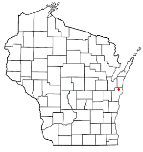
Pensaukee is a town in Oconto County, Wisconsin, United States, on the coast of Green Bay. The population was 1,214 at the 2000 census.

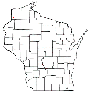
Gilman is a town in Pierce County, Wisconsin, United States. The population was 772 as of the 2000 census. The unincorporated communities of Olivet and Viking are partially located in the town.

<span class="mw-page-title-main">Holland, Sheboygan County, Wisconsin</span> Town in Wisconsin, United States

Holland is a town in Sheboygan County, Wisconsin, United States. The population was 2,360 at the 2000 census. It is included in the Sheboygan, Wisconsin Metropolitan Statistical Area. The unincorporated community of Idlewood Beach is located in the town. The unincorporated community of Dacada is also located partially in the town.

<span class="mw-page-title-main">Eau Galle, St. Croix County, Wisconsin</span> Town in Wisconsin, United States

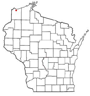
Eau Galle is a town in St. Croix County, Wisconsin, United States. The population was 882 at the 2000 census. The unincorporated community of Wildwood is located in the town. The unincorporated community of Viking is also partially located in the town.

References

  1. 1 2 "US Board on Geographic Names". United States Geological Survey. October 25, 2007. Retrieved January 31, 2008.
  2. 1 2 "U.S. Census website". United States Census Bureau . Retrieved January 31, 2008.
  3. 1 2 "Geographic Identifiers: 2010 Demographic Profile Data (G001): Humboldt town, Brown County, Wisconsin". U.S. Census Bureau, American Factfinder. Archived from the original on February 12, 2020. Retrieved May 12, 2014.
  4. Town Of Humboldt Sesquicentennial 1860-2010, pg 9

44°30′07″N87°49′33″W / 44.50194°N 87.82583°W / 44.50194; -87.82583