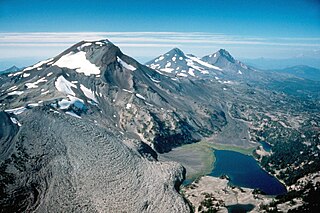
Mount Jefferson is a stratovolcano in the Cascade Volcanic Arc, part of the Cascade Range in the U.S. state of Oregon. The second highest mountain in Oregon, it is situated within Linn County, Jefferson County, and Marion County and forms part of the Mount Jefferson Wilderness. Due to the ruggedness of its surroundings, the mountain is one of the hardest volcanoes to reach in the Cascades. It is also a popular tourist destination despite its remoteness, with recreational activities including hiking, backpacking, mountaineering, and photography. Vegetation at Mount Jefferson is dominated by Douglas fir, silver fir, mountain hemlock, ponderosa pine, lodgepole pine, and several cedar species. Carnivores, insectivores, bats, rodents, deer, birds, and various other species inhabit the area.

Mount Thielsen, or Big Cowhorn, is an extinct shield volcano in the Oregon High Cascades, near Mount Bailey. Because eruptive activity ceased 250,000 years ago, glaciers have heavily eroded the volcano's structure, creating precipitous slopes and a horn-like peak. The spire-like shape of Thielsen attracts lightning strikes and creates fulgurite, an unusual mineral. The prominent horn forms a centerpiece for the Mount Thielsen Wilderness, a reserve for recreational activities such as skiing and hiking. Thielson is one of Oregon's Matterhorns.

Sunset Crater is a cinder cone located north of Flagstaff in the U.S. state of Arizona. The crater is within the Sunset Crater Volcano National Monument.

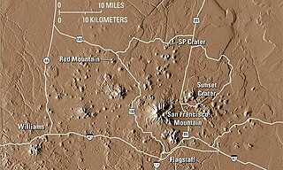
The San Francisco volcanic field is an area of volcanoes in northern Arizona, north of Flagstaff, US. The field covers 1,800 square miles (4,700 km2) of the southern boundary of the Colorado Plateau. The field contains 600 volcanoes ranging in age from nearly 6 million years old to less than 1,000 years, of which Sunset Crater is the youngest. The highest peak in the field is Humphreys Peak, at Flagstaff's northern perimeter: the peak is Arizona's highest at 12,633 feet and is a part of the San Francisco Peaks, an active stratovolcano complex.

Mount Tehama is an eroded andesitic stratovolcano in the Cascade Volcanic Arc and the Cascade Range in Northern California. Part of the Lassen volcanic area, its tallest remnant, Brokeoff Mountain, is itself the second highest peak in Lassen Volcanic National Park and connects to the park's highest point, Lassen Peak. Located on the border of Tehama County and Shasta County, Brokeoff's peak is the highest point in the former. The hikers that summit this mountain each year are treated to "exceptional" views of Lassen Peak, the Central Valley of California, and many of the park's other features. On clear days, Mount Shasta can also be seen in the distance.

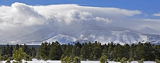
Humphreys Peak is the highest natural point and the second most prominent peak after Mount Graham in the U.S. state of Arizona, with an elevation of 12,637 feet (3,852 m) and is located within the Kachina Peaks Wilderness in the Coconino National Forest, about 11 miles (17.7 km) north of Flagstaff, Arizona. Humphreys Peak is the highest of a group of dormant volcanic peaks known as the San Francisco Peaks.

Goat Rocks is an extinct stratovolcano in the Cascade Range, located between Mount Rainier and Mount Adams in southern Washington, in the United States. Part of the Cascade Volcanoes, it was formed by the subduction of the Juan de Fuca Plate under the western edge of the North American Plate. The volcano was active from 3.2 million years ago until eruptions ceased between 1 and 0.5 million years ago. Throughout its complex eruptive history, volcanism shifted from silicic explosive eruptions to voluminous, mafic activity.

The Coconino National Forest is a 1.856-million acre United States National Forest located in northern Arizona in the vicinity of Flagstaff, with elevations ranging from 2,600 feet to the highest point in Arizona at 12,633 feet. Originally established in 1898 as the "San Francisco Mountains National Forest Reserve", the area was designated a U.S. National Forest by Pres. Theodore Roosevelt on July 2, 1908, when the San Francisco Mountains National Forest Reserve was merged with lands from other surrounding forest reserves to create the Coconino National Forest. Today, the Coconino National Forest contains diverse landscapes, including deserts, ponderosa pine forests, flatlands, mesas, alpine tundra, and ancient volcanic peaks. The forest surrounds the towns of Sedona and Flagstaff and borders four other national forests; the Kaibab National Forest to the west and northwest, the Prescott National Forest to the southwest, the Tonto National Forest to the south, and the Apache-Sitgreaves National Forest to the southeast. The forest contains all or parts of nine designated wilderness areas, including the Kachina Peaks Wilderness, which includes the summit of the San Francisco Peaks. The headquarters are in Flagstaff. The Coconino National Forest consists of three districts: Flagstaff Ranger District, Mogollon Rim Ranger District, and Red Rock Ranger District, which have local ranger district offices in Flagstaff, Happy Jack, and Sedona.

Broken Top is a glacially eroded complex stratovolcano. It lies in the Cascade Volcanic Arc, part of the extensive Cascade Range in the U.S. state of Oregon. Located southeast of the Three Sisters peaks, the volcano, residing within the Three Sisters Wilderness, is 20 miles (32 km) west of Bend, Oregon in Deschutes County. Eruptive activity stopped roughly 100,000 years ago, and erosion by glaciers has since reduced the volcano's cone to where its contents are exposed. There are two named glaciers on the peak, Bend and Crook Glacier.

The Three Sisters are closely spaced volcanic peaks in the U.S. state of Oregon. They are part of the Cascade Volcanic Arc, a segment of the Cascade Range in western North America extending from southern British Columbia through Washington and Oregon to Northern California. Each over 10,000 feet in elevation, they are the third-, fourth- and fifth-highest peaks in Oregon. Located in the Three Sisters Wilderness at the boundary of Lane and Deschutes counties and the Willamette and Deschutes national forests, they are about 10 miles south of the nearest town, Sisters. Diverse species of flora and fauna inhabit the area, which is subject to frequent snowfall, occasional rain, and extreme temperature variation between seasons. The mountains, particularly South Sister, are popular destinations for climbing and scrambling.

Four Peaks is a prominent landmark on the eastern skyline of Phoenix. Part of the Mazatzal Mountains, it is located in the Four Peaks Wilderness in the Tonto National Forest, 40 miles (64 km) east-northeast of Phoenix. In winter, Four Peaks offers much of the Phoenix metro area a view of snow-covered peaks. Four Peaks is the site of an amethyst mine that produces top-grade amethyst.

Kendrick Mountain Wilderness is a 6,510-acre (26.3 km2) wilderness area in the U.S. State of Arizona. It lies north of the city of Flagstaff on the Coconino Plateau in Coconino County. Kendrick Mountain Wilderness was designated a protected Wilderness area by Congress in 1984. About two thirds of the wilderness is contained within the Kaibab National Forest. Kendrick Mountain Wilderness contains 10,418-foot (3,175 m) Kendrick Peak, upon which a fire lookout has been located since the early 1900s.

Oak Creek Canyon is a river gorge located in northern Arizona between the cities of Flagstaff and Sedona. The canyon is often described as a smaller cousin of the Grand Canyon because of its scenic beauty. State Route 89A enters the canyon on its north end via a series of hairpin turns before traversing the bottom of the canyon for about 13 miles (21 km) until the highway enters the town of Sedona.

Mount Elden or Elden Mountain is located in central Coconino County northeast of Flagstaff, Arizona. It takes its name from one of the region's earliest Anglo settlers, John Elden, who, along with his family, established a homestead on the mountain's lower slopes and grazed sheep on the open grasslands below during the late 19th century.

Agassiz Peak is the second-highest mountain in the U.S. state of Arizona at 12,360 feet (3,767 m). It is located north of Flagstaff, Arizona in the San Francisco Peaks. It is in the Kachina Peaks Wilderness on the Coconino National Forest. The peak was named in honor of Louis Agassiz, a Swiss-born American biologist and geologist.

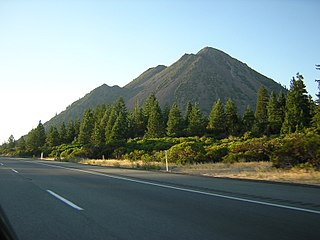
Black Butte is a cluster of overlapping dacite lava domes in a butte, a satellite cone of Mount Shasta. It is located directly adjacent to the northbound lanes of Interstate 5 at milepost 742 between the cities of Mount Shasta and Weed, California. The I-5 freeway crosses a 3,912 ft (1,192 m) pass, Black Butte Summit, at the western base of the lava domes. The lava domes were extruded at the foot of the cone of Shastina following the period of its major eruptions about 9,000–10,000 years ago.

O'Leary Peak is an extinct Pleistocene lava dome volcano within the San Francisco volcanic field, north of Flagstaff, Arizona, and to the northwest of Sunset Crater National Monument. A fire lookout tower was built on a subsidiary eastern peak. It has an elevation of 8,919 feet (2,719 m).

Carr Peak is the third-highest mountain in Cochise County, Arizona and is the second-highest mountain in the Huachuca Mountains. It rises about 10 miles (16 km) south of Sierra Vista, Arizona. The summit is in the Miller Peak Wilderness on the Coronado National Forest and about 4 miles (6 km) south of the Nature Conservancy's Ramsey Canyon Preserve. The area is well known among birders because of the variety of hummingbird species seen in the area as well as the dozens of southwestern specialties such as Apache pine, Chihuahua pine, ridge-nosed rattlesnake, lesser long-nosed bat and elegant trogon.

Sitgreaves Mountain is a mountain peak located within Kaibab National Forest in Coconino County, Arizona. It is located between Flagstaff and Williams, Arizona and can be easily seen by drivers along Interstate 40.

East Pocket Knob is a 7,196-foot-elevation (2,193-meter) summit in Coconino County, Arizona, United States.


