
Crawley is a large town and borough in West Sussex, England. It is 28 miles (45 km) south of London, 18 miles (29 km) north of Brighton and Hove, and 32 miles (51 km) north-east of the county town of Chichester. Crawley covers an area of 17.36 square miles (44.96 km2) and had a population of 106,597 at the time of the 2011 Census.

Kings Langley is a village, former manor and civil parish in Hertfordshire, England, 21 miles north-west of Westminster in the historic centre of London and to the south of the Chiltern Hills. It now forms part of the London commuter belt. The village is divided between two local government districts by the River Gade with the larger western portion in the Borough of Dacorum and smaller part, to the east of the river, in Three Rivers District. It was the location of Kings Langley Palace and the associated King's Langley Priory, of which few traces survive.

Southgate is one of the 14 residential neighbourhoods in Crawley, a town and borough in West Sussex, England. Crawley was planned and laid out as a New Town after the Second World War, based on the principle of self-contained neighbourhoods surrounding a town centre of civic and commercial buildings. Southgate was one of the four in the "inner ring" closest to the town centre, and was intended to be the largest of the nine designed in the original master plan. It was built in two stages between the 1950s and the 1970s, but retains some older buildings from before the New Town era and has "significant areas of pre-New Town character".

West Green is one of the 14 residential neighbourhoods in Crawley, a town and borough in West Sussex, England. Crawley was planned and laid out as a New Town after the Second World War, based on the principle of self-contained neighbourhoods surrounding a town centre of civic and commercial buildings. West Green was the first neighbourhood to be developed, and is one of the smallest and closest to the town centre.

Spennymoor is a town and civil parish in County Durham, England. It is south of the River Wear and is 7 mi (11 km) south of Durham. The civil parish includes the villages of Kirk Merrington, Middlestone Moor, Byers Green and Tudhoe.

Broadfield is one of 14 neighbourhoods within the town of Crawley in West Sussex, England. Broadfield is located in the south west of the town. It is bordered by Bewbush to the north, Southgate to the north east and Tilgate to the east.

Tilgate is one of 14 neighbourhoods within the town of Crawley in West Sussex, England. The area contains a mixture of privately developed housing, self-build groups and ex-council housing. It is bordered by the districts of Furnace Green to the north east, Southgate to the north west and Broadfield to the south west.

Bewbush is one of 14 neighbourhoods in Crawley in West Sussex, England. Bewbush is located in south west Crawley and is bordered by Broadfield to the south, Ifield to the north, Kilnwood Vale to the west and Gossops Green to the north east. The neighbourhood has a population of approximately 9,000.
Ifield is a former village and now one of 14 neighbourhoods within the town of Crawley in West Sussex, England. Ifield is in the west of the town and is bordered by Ifield West, Horsham, Langley Green to the north east, West Green to the east across the ring road and Gossops Green and Bewbush to the south across the Arun Valley railway line.
Gossops Green is one of 14 neighbourhoods within the town of Crawley in West Sussex, England. Gossops Green is located in the west of the town and is bordered by Bewbush to the south west, Ifield to the north and Southgate to the east across the ring road. Gossops Green is also a local government ward.

Northgate is one of the 14 residential neighbourhoods in Crawley, a town and borough in West Sussex, England. Crawley was planned and laid out as a New Town after the Second World War, based on the principle of self-contained neighbourhoods surrounding a town centre of civic and commercial buildings. Northgate was one of the four in the "inner ring" closest to the town centre, and was the second to be completed: almost all building work on the 168-acre (68 ha) site took place in the first half of the 1950s.

As of 2011 there were 102 listed buildings and structures in the English borough of Crawley, West Sussex. Two others have subsequently gained listed status. The Borough of Crawley is based on the town of the same name, located approximately halfway between London and Brighton. Although Crawley expanded substantially after World War II when it was designated a New Town by an Act of Parliament, many older buildings remain.

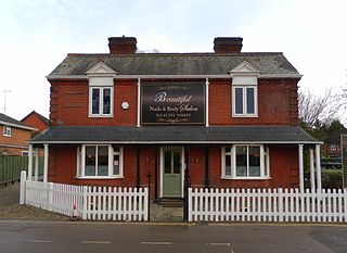
The Ifield Friends Meeting House is a Friends meeting house in the Ifield neighbourhood of Crawley, a town and borough in West Sussex, England. Built in 1676 and used continuously since then by the Quaker community for worship, it is one of the oldest purpose-built Friends meeting houses in the world. It is classified by English Heritage as a Grade I listed building, a status given to buildings of "exceptional interest" and national importance. An adjoining 15th-century cottage is listed separately at Grade II*, and a mounting block in front of the buildings also has a separate listing at Grade II. Together, these structures represent three of the 100 listed buildings and structures in Crawley.

Langley Green & West Green is an electoral division of West Sussex in the United Kingdom, and returns one member to sit on West Sussex County Council.
Crawley Development Corporation was set up in February 1947 by the Government of the United Kingdom to establish, administer and control the development of the New Town of Crawley in accordance with the New Towns Act 1946. The Corporation had the task of growing the ancient Sussex market town of Crawley from a population of 9,000 to 40,000 by the early 1960s, expanding its commercial and industrial base and developing a balanced, socially cohesive community. A master plan supplied by planning consultant Anthony Minoprio would guide the Corporation's work. The "energy and enthusiasm" of its chairman Thomas Bennett helped it meet many of its targets early, and it was formally dissolved in 1962. Its assets passed to the Commission for New Towns in that year; they are now owned privately or by the local authority, Crawley Borough Council.
As of November 2010, there were 59 locally listed buildings in Crawley, a town and borough in the county of West Sussex in southeast England. One of these has subsequently been demolished. A locally listed building is defined as "a building, structure or feature that, whilst not statutorily listed by the Secretary of State, the Council considers to be an important part of Crawley's heritage due to its architectural, historic or archaeological significance". Crawley Borough Council administers the selection and deselection process, defines the criteria for inclusion, and produces and updates the local list.

Crawley, a postwar New Town and borough in the English county of West Sussex, has a wide range of public services funded by national government, West Sussex County Council, Crawley Borough Council and other public-sector bodies. Revenue to fund these services comes principally from Council Tax. Some of Crawley's utilities and infrastructure are provided by outside parties, such as utility companies and West Sussex County Council, rather than by the borough council. To help pay for improved infrastructure and service provision in proposed major residential developments such as Kilnwood Vale and the North East Sector, the borough council has stated that as part of the Crawley Local Plan it would require developers to pay a Community Infrastructure Levy.

Forge Wood is the 14th residential neighbourhood in Crawley, a town and borough in West Sussex. The 1,900 houses and other facilities will be built on open land in the northeast of the borough, adjoining the ancient village of Tinsley Green and to the north of the Pound Hill neighbourhood.

