A ZIP Code is a postal code used by the United States Postal Service (USPS) in a system it introduced in 1963. The term ZIP is an acronym for Zone Improvement Plan; it was chosen to suggest that the mail travels more efficiently and quickly when senders use the code in the postal address. The basic format consists of five digits. An extended ZIP+4 code was introduced in 1983 which includes the five digits of the ZIP Code, followed by a hyphen and four additional digits that reference a more specific location.
Whipple is an unincorporated community in southern Salem Township, Washington County, Ohio, United States. Although it is unincorporated, it once had a post office, with the ZIP code of 45788. It lies on State Route 821 south of the village of Lower Salem, at the junction of Whipple Run with Duck Creek. The community took its name from nearby Whipple Run.

Waterford is a census-designated place in central Waterford Township, Washington County, Ohio, United States. Although it is unincorporated, it has a post office, with the ZIP code of 45786. It is located on State Route 339 across the Muskingum River from the village of Beverly, slightly below where Wolf Creek meets the Muskingum. The community is home to both schools of the Wolf Creek School System. Waterford Elementary serves grades K through Eighth. Waterford High School serves 9–12th grades.

Vincent is a census-designated place in southern Barlow Township, Washington County, Ohio, United States. Although it is unincorporated, it has a post office, with the ZIP code of 45784. It lies along State Route 339 near Tupper Creek, a subsidiary of the Little Hocking River, which in turn meets the Ohio River at Little Hocking to the south.

Reno is a census-designated place in southern Marietta Township, Washington County, Ohio, United States. Although it is unincorporated, it has a post office, with the ZIP code of 45773. It is located on the Ohio River a short distance above the county seat of Marietta. State Route 7 forms its main street.

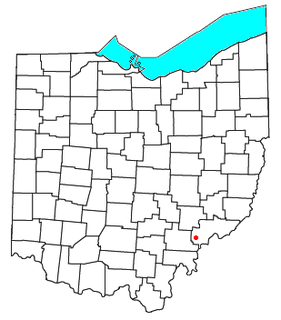
Little Hocking is a census-designated place in southern Belpre Township, Washington County, Ohio, United States. Although it is unincorporated, it has a post office, with the ZIP code of 45742.
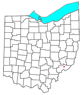
Cutler is an unincorporated community in southwestern Fairfield Township, Washington County, Ohio, United States. Although it is unincorporated, it has a post office, with the ZIP code of 45724. It lies at the intersection of State Route 555 and County Road 59 near Gilbert Run, a subsidiary of the Little Hocking River, which meets the Ohio River at Little Hocking to the southeast.
Thurston is a neighborhood in the eastern part of Springfield, Oregon, United States on Oregon Route 126. Before being annexed by Springfield, it was formerly an unincorporated community with its own post office. The earliest land claims in the Thurston area by white settlers were in 1851. A small crossroads community, including a general store and a blacksmith shop, formed at the corner of Thurston Road and 66th Street. The settlement was named for pioneer George H. Thurston, and Thurston post office was established in 1877. The ZIP code for Thurston post office boxes is 97482. The ZIP code for delivered mail is 97478.

Hansford is an unincorporated community in Kanawha County, West Virginia, United States. Hansford is located along the Kanawha River and West Virginia Route 61 1 mile (1.6 km) southwest of Pratt. Hansford has a post office with ZIP code 25103.

Valleyford is an unincorporated community in Spokane County, Washington, United States. Valleyford is 12.5 miles (20.1 km) southeast of downtown Spokane. Valleyford has a post office with ZIP code 99036.
Palisades is an unincorporated community in Douglas County, Washington, United States. Palisades is 17.5 miles (28.2 km) east of East Wenatchee. Palisades has a post office with ZIP code 98845.
Silver Creek is an unincorporated community in Lewis County, Washington, United States. Silver Creek is located along U.S. Route 12 near its junction with Washington State Route 122, 5 miles (8.0 km) west of Mossyrock. Silver Creek has a post office with ZIP code 98585.
East Olympia is an unincorporated community in Thurston County, Washington, United States. East Olympia is 6 miles (9.7 km) south-southeast of downtown Olympia. East Olympia has a post office with ZIP code 98540. The Olympia area's station on Amtrak's Coast Starlight line was located in East Olympia before it moved to Lacey in 1994.

Lakebay is an unincorporated community in Pierce County, Washington, United States. Lakebay is located at the head of Mayo Cove on the east side of the Key Peninsula, 1 mile (1.6 km) south of Home. Lakebay has a post office with ZIP code 98349.

Morrow is an unincorporated community in Washington County, Arkansas, United States. Morrow is 6.5 miles (10.5 km) south of Lincoln. Morrow has a post office with ZIP code 72749.

Venetia is an unincorporated community in Peters Township, Washington County, Pennsylvania, United States. Although it is unincorporated, it has a post office, with the ZIP code of 15367. This ZIP covers most of the area between McMurray and Gastonville. The population was 8,731 at the 2010 census.
Strabane is an unincorporated community in Washington County, Pennsylvania, United States. The community is located along the southern border of Canonsburg and the eastern border of Houston. Strabane has a post office with ZIP code 15363.
Vestaburg is an unincorporated community in Washington County, Pennsylvania, United States. The community is located along Pennsylvania Route 88 and the Monongahela River 2 miles (3.2 km) south of Centerville. Vestaburg has a post office with ZIP code 15368, which opened on March 4, 1916.
North Washington is an unincorporated community in Butler County, Pennsylvania, United States. The community is located at the intersection of Pennsylvania Route 38 and Pennsylvania Route 138 13.5 miles (21.7 km) north-northeast of Butler. North Washington has a post office with ZIP code 16048.

Cossayuna is a hamlet in Washington County, New York, United States. The community is 7.4 miles (11.9 km) north-northeast of Greenwich. Cossayuna has a post office with ZIP code 12823.


