The Great Plains, sometimes simply "the Plains", is a broad expanse of flatland in North America. It is located just to the east of the Rocky Mountains, much of it covered in prairie, steppe, and grassland. It is the western part of the Interior Plains, which also include the mixed grass prairie, the tallgrass prairie between the Great Lakes and Appalachian Plateau, and the Taiga Plains and Boreal Plains ecozones in Northern Canada. Great Plains or Western Plains is also used to describe the ecoregion of the Great Plains, or alternatively the western portion of the Great Plains.

The Dust Bowl was the result of a period of severe dust storms that greatly damaged the ecology and agriculture of the American and Canadian prairies during the 1930s. The phenomenon was caused by a combination of natural factors and human-made factors: a failure to apply dryland farming methods to prevent wind erosion, most notably the destruction of the natural topsoil by settlers in the region. The drought came in three waves: 1934, 1936, and 1939–1940, but some regions of the High Plains experienced drought conditions for as long as eight years.

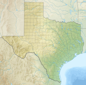
Dallam County is the north-westernmost county in the U.S. state of Texas. As of the 2020 Census, its population was 7,115. Its county seat is Dalhart. The county was founded in 1876 and later organized in 1891. It is named for James Wilmer Dallam, a lawyer and newspaper publisher.

Texas County is a county located in the panhandle of the U.S. state of Oklahoma. Its county seat is Guymon. As of the 2020 census, the population was 21,384. It is the second largest county in Oklahoma, based on land area, and is named for Texas, the state that adjoins the county to its south. Texas County comprises the Guymon, OK Micropolitan Statistical Area. The county economy is largely based on farming and cattle production. It is one of the top-producing counties in the U.S. for wheat, cattle, and hogs. It also lies within the noted Hugoton-Panhandle natural gas field.

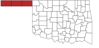
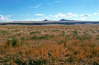
Cimarron County is the westernmost county in the U.S. state of Oklahoma. Its county seat is Boise City. As of the 2020 census, its population was 2,296, making it the least-populous county in Oklahoma; and indeed, throughout most of its history, it has had both the smallest population and the lowest population density of any county in Oklahoma. Located in the Oklahoma Panhandle, Cimarron County contains the only community in the state (Kenton) that observes the Mountain Time Zone. Black Mesa, the highest point in the state, is in the northwest corner of the county. The Cimarron County community of Regnier has the distinction of being the driest spot in Oklahoma ranked by lowest annual average precipitation, at just 15.62 inches; at the same time, Boise City is the snowiest location in Oklahoma ranked by highest annual average snowfall, at 31.6 inches.

Morton County is a county in the southwestern corner of the U.S. state of Kansas. Its county seat and largest city is Elkhart. As of the 2020 census, the county population was 2,701. The county was named after Oliver Morton, the 14th governor of the state of Indiana.

Dalhart is a city in Dallam and Hartley counties in the U.S. state of Texas, and the county seat of Dallam County. The population was 8,447 at the 2020 census.

The Texas panhandle is a region of the U.S. state of Texas consisting of the northernmost 26 counties in the state. The panhandle is a square-shaped area bordered by New Mexico to the west and Oklahoma to the north and east. It is adjacent to the Oklahoma Panhandle, land which Texas previously claimed. The 1820 Missouri Compromise declared no slavery would be allowed in states admitted from the Louisiana Purchase above 36°30′ north latitude. Texas was annexed in 1845 from still more westerly land. The Compromise of 1850 removed territory north of this line from Texas, and set the border between the Texas Panhandle and the New Mexico Territory at the 103rd meridian west. The eastern border at the 100th meridian west was inherited from the Adams–Onís Treaty of 1819, which defined the border between the United States and New Spain. The Handbook of Texas defines the southern border of Swisher County as the southern boundary of the Texas Panhandle region.

The XIT Ranch was a cattle ranch in the Texas Panhandle which operated from 1885 to 1912. Comprising over 3,000,000 acres (12,000 km2) of land, it ran for 200 miles (300 km) along the border with New Mexico, varying in width from 20 to 30 miles. The massive ranch stretched through ten counties in Texas and at its peak regularly handled 150,000 head of cattle. The brand "XIT" was chosen for its difficulty to alter thus thwarting rustlers.

U.S. Route 56 is an east–west United States highway that runs for approximately 640 miles (1,030 km) in the Midwestern United States. US 56's western terminus is at Interstate 25 Business, US 412 and New Mexico State Road 21 in Springer, New Mexico and the highway's eastern terminus is at US 71 in Kansas City, Missouri. Much of it follows the Santa Fe Trail.
The Oklahoma Panhandle is a salient in the extreme northwestern region of the U.S. state of Oklahoma, consisting of Cimarron County, Texas County and Beaver County, from west to east. As with other salients in the United States, its name comes from the similarity of its shape to the handle of a pan. Its largest city is Guymon in Texas County. Black Mesa State Park, located in Cimarron County, is the highest point in the state. Other points of interest include Beaver Dunes Park, Optima Lake, and the Optima National Wildlife Refuge. Oklahoma Panhandle State University is ten miles away from Guymon.

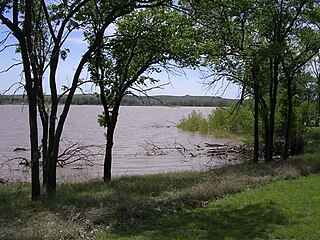
The Cimarron River extends 698 miles (1,123 km) across New Mexico, Oklahoma, Colorado, and Kansas. The headwaters flow from Johnson Mesa west of Folsom in northeastern New Mexico. Much of the river's length lies in Oklahoma, where it either borders or passes through eleven counties. There are no major cities along its route. The river enters the Oklahoma Panhandle near Kenton, Oklahoma, crosses the corner of southeastern Colorado into Kansas, reenters the Oklahoma Panhandle, reenters Kansas, and finally returns to Oklahoma where it joins the Arkansas River at Keystone Reservoir west of Tulsa, Oklahoma, its only impoundment. The Cimarron drains a basin that encompasses about 18,927 square miles (49,020 km2).

The Cibola National Forest is a 1,633,783 acre United States National Forest in New Mexico, US. The name Cibola is thought to be the original Zuni Indian name for their pueblos or tribal lands. The name was later interpreted by the Spanish to mean "buffalo." The forest is disjointed with lands spread across central and northern New Mexico, west Texas and Oklahoma. The Cibola National Forest is divided into four Ranger Districts: the Sandia, Mountainair, Mt. Taylor, and Magdalena. The Forest includes the San Mateo, Magdalena, Datil, Bear, Gallina, Manzano, Sandia, Mt. Taylor, and Zuni Mountains of west-central New Mexico. The Forest also manages four National Grasslands that stretch from northeastern New Mexico eastward into the Texas Panhandle and western Oklahoma. The Cibola National Forest and Grassland is administered by Region 3 of the United States Forest Service from offices in Albuquerque, New Mexico. Elevation ranges from 5,000 ft to 11,301 ft. The descending order of Cibola National Forest acres by county are: Socorro, Cibola, McKinley, Catron, Torrance, Bernalillo, Sandoval County, New Mexico, Lincoln, Sierra, and Valencia counties in New Mexico. The Cibola National Forest currently has 137,701 acres designated as Wilderness. In addition to these acres, it has 246,000 acres classified as Inventoried Roadless Areas pursuant to the Roadless Area Conservation Rule.
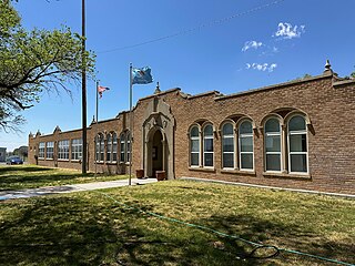
Felt is a small unincorporated community and census-designated place (CDP) in Cimarron County, Oklahoma, United States. As of the 2020 census, the town’s population was 77. It was named for C.F.W. Felt of the Santa Fe Railroad. Nearby is the Cedar Breaks Archeological District, included on the National Register of Historic Places listings in Cimarron County, Oklahoma. The community is served by a post office and a school. During the Great Depression in 1936 a farm in Felt was the site of the iconic Dust Bowl photograph known as Dust Bowl Cimarron County, Oklahoma.
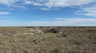
Kiowa National Grassland is a National Grassland, located in northeastern New Mexico. The southwestern Great Plains grassland includes prairie and part of the Canadian River Canyon.
McClellan Creek National Grassland is a National Grassland located in southern Gray County, Texas, United States. It was purchased with the goal of restoring badly eroded land to its natural state. The grassland is administered by the U.S. Forest Service together with Cibola National Forest and Black Kettle, Kiowa, and Rita Blanca National Grasslands, from common headquarters located in Albuquerque, New Mexico. The grassland is part of the combined Black Kettle and McClellan Creek Ranger District with offices in Cheyenne, Oklahoma.

Northwestern Oklahoma is the geographical region of the state of Oklahoma which includes the Oklahoma Panhandle and a majority of the Cherokee Outlet, stretching to an eastern extent along Interstate 35, and its southern extent along the Canadian River to Noble County. Northwest Oklahoma is also known by its Oklahoma Department of Tourism designation, Red Carpet Country, which is named after the region's red soil and alludes to the metaphor that the panhandle is a "red carpet" into Oklahoma. The region consists of Cimarron, Texas, Beaver, Harper, Woods, Alfalfa, Grant, Kay, Ellis, Woodward, Major, Garfield, Noble, Dewey, Blaine, and Kingfisher counties.

The Geography of Oklahoma encompasses terrain and ecosystems ranging from arid plains to subtropical forests and mountains. Oklahoma contains 10 distinct ecological regions, more per square mile than in any other state by a wide margin. It is situated in the Great Plains and U.S. Interior Highlands region near the geographical center of the 48 contiguous states. Usually considered part of the South Central United States, Oklahoma is bounded on the east by Arkansas and Missouri, on the north by Kansas, on the northwest by Colorado, on the far west by New Mexico, and on the south and near-west by Texas.
The Western short grasslands is a temperate grassland ecoregion of the United States.

The Black Kettle National Grassland, in Roger Mills County, Oklahoma, and Hemphill County, Texas, contains 31,286 acres (12,661 ha) of which 30,710 acres (12,430 ha) are in Oklahoma.