This is a list of current and former state parks in Oklahoma.
Contents

Oklahoma State Parks (Hover mouse over pog to popup clickable link)
This is a list of current and former state parks in Oklahoma.
| Park Name | County or Counties | Area in acres | Date founded | Stream(s) and / or Lake(s) | Notes |
|---|---|---|---|---|---|
| Adair Park (Stilwell, Oklahoma) | Adair | 25 | Small park within the city limits of Stilwell. Now owned by the City of Stilwell. [5] | ||
| Beaver Dunes Park | Beaver | 520 | Owned by City of Beaver. [5] | ||
| Boggy Depot Park | Atoka | 630 | Owned and managed by the Chickasaw Nation since 2011. [5] | ||
| Brushy Lake Park (Sallisaw, Oklahoma) | Sequoyah | 90 | 1971 | Brushy Lake | Since 2011, owned and managed by the City of Sallisaw, Oklahoma |
| Crowder Lake University Park | Washita | 22 | Crowder Lake | Owned and operated since 2003 by Southwestern Oklahoma State University. Lake surface is 158 acres. | |
| Dripping Springs Park | Okmulgee | 1,075 | Dripping Springs Lake | The former Dripping Springs State Park; operated by the City of Okmulgee since 2015. | |
| Heavener Runestone Park | Le Flore | 50 | 1970 | Owned and managed by city of Heavener since 2011. [5] | |
| Hochatown State Park | McCurtain | 1,713 | 1966 | Broken Bow Lake | Combined into Beavers Bend, no longer a separate park |
| Hugo Lake State Park | Choctaw | 289 | 1974 | Hugo Lake | Originally built in 1974 as Kiamichi Park, renamed Hugo Lake State Park in 2002. |
| Lake Eucha Park | Delaware | 55 | 1967 | Lake Eucha | The former Lake Eucha State Park; owned and managed by the city of Tulsa since 2011; [5] Park is not actually on Lake Eucha |
| Okmulgee Park | Okmulgee | 1,075 | 1963 | Okmulgee Lake | The former Okmulgee State Park; owned and managed by the City of Okmulgee since 2015 |
| Red Rock Canyon Park | Caddo | 310 | 1956 | Leased to the City of Hinton, Oklahoma in 2018. | |
| Snowdale State Park | Mayes | 15 | 1959 | Lake Hudson (Oklahoma) | Snowdale became the Snowdale Area at Grand Lake State Park. [6] [7] The Oklahoma Department of Tourism and Recreation chose not to renew its lease from the Grand River Dam Authority in 2019, shutting down the park. [8] |
| Walnut Creek State Park | Osage | 1,429 | 1966 | Keystone Lake | Park was permanently closed October 1, 2014 [9] |
| Wah-Sha-She Park | Osage | 266 | 1973 | Lake Hulah | Formerly Wah-Sha-She State Park. Leased to the Osage Nation since 2011 by the US Corps of Engineers; [5] subleased since 2015 to the non-profit Hulah Lake Osage Association which maintains the park through volunteer efforts and campground fees. [10] [11] |

Rogers County is located in the northeastern part of the U.S. state of Oklahoma. As of the 2020 census, the population was 95,240, making it the sixth-most populous county in Oklahoma. The county seat is Claremore. Rogers County is included in the Tulsa, OK metropolitan statistical area.

Osage County is the largest county by area in the U.S. state of Oklahoma. Created in 1907 when Oklahoma was admitted as a state, the county is named for and is home to the federally recognized Osage Nation. The county is coextensive with the Osage Nation Reservation, established by treaty in the 19th century when the Osage relocated there from Kansas. The county seat is in Pawhuska, one of the first three towns established in the county. The total population of the county as of 2020 was 45,818.

Okmulgee County is a county in the U.S. state of Oklahoma. As of the 2020 census, the population was 36,706. The county seat is Okmulgee. Located within the Muscogee Nation Reservation, the county was created at statehood in 1907. The name Okmulgee is derived from the Hitchita word okimulgi, meaning "boiling waters".
Creek County is a county located in the U.S. state of Oklahoma. As of the 2020 census, the population was 71,754. Its county seat is Sapulpa.
Pryor Creek or Pryor is a city in and county seat of Mayes County, Oklahoma, United States. The population was 8,659 at the 2000 census and 9,539 in the 2010 census.
Eufaula is a city and county seat of McIntosh County, Oklahoma, United States. The population was 2,813 at the 2010 census, an increase of 6.6 percent from 2,639 in 2000. Eufaula is in the southern part of the county, 30 miles (48 km) north of McAlester and 32 miles (51 km) south of Muskogee.

Okmulgee is a city in, and the county seat of, Okmulgee County, Oklahoma. The name is from the Mvskoke word okimulgee, which means "boiling waters". The site was chosen because of the nearby rivers and springs. Okmulgee is 38 miles south of Tulsa and 13 miles north of Henryetta via US-75.

Skiatook is a city in Osage and Tulsa counties in the U.S. state of Oklahoma located in the northeastern part of the state, approximately 20 miles north and west of Tulsa. Due to its location on the border between Osage County and Tulsa County, Skiatook has been referred to as "the Gateway to the Osage." The town includes the state highway junction of Oklahoma State Highway 11 and Oklahoma State Highway 20. The population was 8,450 at the 2020 census, an increase of 14.24 percent over the figure of 7,397 recorded in 2010.

Robbers Cave State Park is a state park in Latimer County, Oklahoma. It is located 5 miles (8.0 km) north of Wilburton, Oklahoma, on Oklahoma State Highway 2. Originally named Latimer State Park, it received its current name in 1936. It is located in the scenic, hilly woodlands of the Sans Bois Mountains of southeast Oklahoma. This park is a favorite of rappellers, equestrians, hikers and outdoor lovers. The park and adjoining wildlife management area covers more than 8,000 acres (3,200 ha) and includes three lakes. It offers visitors acres of discovery and enjoyment including trout fishing in season, boating, hunting, mountain biking, trails for hikers and horses, sandstone cliffs for climbing and rappelling, and fall foliage viewing. In addition, Robbers Cave is historically notable as a former hideout for infamous outlaws Belle Starr and Jesse James.

Keystone Lake is a reservoir in northeastern Oklahoma on the Arkansas and Cimarron rivers. It is located upstream about 23 miles (37 km) from Tulsa. It was created in 1968 when the Keystone Dam was completed. The primary purposes are: flood control, hydroelectric power generation, wildlife management and recreation.

Lake Eufaula, sometimes referred to as Eufaula Lake, is a reservoir in Oklahoma. It is located on the Canadian River, 27 mi (43 km) upstream from its confluence with the Arkansas River and near the town of Eufaula. The lake covers parts of McIntosh County, Pittsburg, Haskell and Okmulgee counties and drains 47,522 square miles (123,080 km2). Water sources include the Canadian, North Fork Canadian and Deep Fork rivers. It is the largest-capacity lake in the state of Oklahoma with a volume of 2,099,000 acre-feet (2.589×10⁹ m3), a surface area of 102,000 acres (410 km2) and 600 miles (970 km) of shoreline.

Lake of the Ozarks is a reservoir created by impounding the Osage River in the northern part of the Ozarks in central Missouri. Parts of three smaller tributaries to the Osage are included in the impoundment: the Niangua River, Grandglaize Creek, and Gravois Creek. The lake has a surface area of 54,000 acres (220 km2) and 1,150 miles (1,850 km) of shoreline. The main channel of the Osage Arm stretches 92 miles (148 km) from one end to the other. The total drainage area is over 14,000 square miles (36,000 km2). The lake's serpentine shape has earned it the nickname "the Missouri Dragon", which has, in turn, inspired the names of local institutions such as the Magic Dragon Street Meet.

Lake Murray is a 5,700-acre (23 km2) lake in south central Oklahoma, near Ardmore named for Oklahoma Governor William H. Murray. It was created by damming Anadarche and Fourche Maline Creeks. The lake is wholly within Lake Murray State Park, Oklahoma's largest state park, containing over 12,500 acres (51 km²) of relative wilderness. A state-operated lodge and resort is located on the west shore that serves many visitors to the lake, and serves as a base for numerous cabin and campground facilities near the lake.
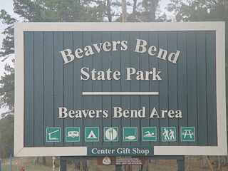
Beavers Bend State Park is a 3,482 acres (14.09 km2) Oklahoma state park located in McCurtain County. It is approximately 10.5 miles (16.9 km) north of Broken Bow on SH-259A. It was established in 1937 and contains Broken Bow Lake.

The Tulsa metropolitan area, officially defined as the Tulsa metropolitan statistical area is a metropolis in northeastern Oklahoma centered around the city of Tulsa and encompassing Tulsa, Rogers, Wagoner, Osage, Creek, Okmulgee and Pawnee counties. It had a population of 1,034,123 according to the 2022 U.S. census estimates.

The former Arrowhead State Park, now known as the Arrowhead Area at Lake Eufaula State Park is a 2,200-acre (8.9 km2) Oklahoma state park area located in northern Pittsburg County, Oklahoma on a peninsula of Eufaula Lake. It is located near the city of Canadian, Oklahoma. Eufaula is one of the largest man-made lakes in the southwest. Arrowhead State Park features 100 tent sites and 91 total RV sites. The park also offers picnic shelters, a marina, playgrounds, trails, miniature golf course, swimming area, mountain biking, equestrian campground, stables, and 25 miles (40 km) of equestrian trails. Group camps with a kitchen and bunkhouses are available and can sleep up to 144 people. Area 51 Marina, which also offers a restaurant, is also located at the park in the Echo Ridge area.

Lake Eufaula State Park is a 2,853-acre (11.55 km2) Oklahoma state park located in McIntosh County, Oklahoma on Lake Eufaula. It is 14 miles (23 km) southwest of Checotah. The park was formerly known as Fountainhead State Park. Fountainhead, together with the neighboring Arrowhead State Park, were created in 1965. Fountainhead's name was changed to Lake Eufaula State Park effective November 1, 2002. Arrowhead is now known as the Arrowhead Area at Lake Eufaula State Park.

Osage Hills State Park is a 1,100-acre (4.5 km2) Oklahoma state park It is located in eastern Osage County, Oklahoma. The nearest cities are Pawhuska and Bartlesville. The park offers outdoor recreation opportunities including camping, hiking, fishing and wildlife watching. Park facilities include picnic tables and shelters, 20 semi-modern RV campsites, 16 tent sites and 8 cabins. Several of the park's structures are historic parkitecture built by the Civilian Conservation Corps during the 1930s and 1940s.
Wah-Sha-She Park, formerly named Wah-Sha-She State Park, is on the shore of Hulah Lake in Osage County, Oklahoma. The 266-acre (108 ha) park offers recreational activities including boating, fishing, swimming and camping. Hunting is allowed in the adjacent 8,900-acre (3,600 ha) Wildlife Management Area. There is also a 2,000-acre (810 ha) Waterfowl Refuge where birdwatching is allowed.
Walnut Creek State Park was a former Oklahoma State Park on the north shore of Lake Keystone, 4 miles (6.4 km) west of Prue in Osage County, Oklahoma. The park was created in 1966, and contains 1,400 acres. Facilities include sandy beaches, a softball field, picnic shelter with tables, RV hookups, and tent sites and restrooms. The 15 miles (24 km) long Sand Plum Trail is open to hikers, horseback riders, and mountain bikers. The park has an equestrian campground, but visitors must bring their own horses because horses are not available for rent in the park. The park was open all year.