Réaume's Trading Post

Last updated
Reaume's Trading Post
Location Address restricted [1] , Wing River Township, Minnesota
Built 1792
NRHP reference # 74001042 [2]
Designated  December 24, 1974

Réaume's Trading Post (Smithsonian trinomial 21WD15) was a trading post established on the Leaf River in 1792 in what is now Wing River Township, Minnesota, United States. No visible traces remain at the site, which is on private property, but archaeological investigations have identified several features. It was listed on the National Register of Historic Places in 1974 for having state-level significance in the themes of commerce and historical archaeology. [3] It was nominated for its role in and research potential on the opening of the fur trade in north-central Minnesota. [4]

Smithsonian trinomials are unique identifiers assigned to archaeological sites in many states in the United States. They are composed of one or two digits coding for the state, typically two letters coding for the county or county-equivalent within the state, and one or more sequential digits representing the order in which the site was listed in that county. The Smithsonian Institution developed the site number system in the 1930s and 1940s. The 48 states then in the union were assigned numbers in alphabetical order. Alaska was assigned number 49 and Hawaii was assigned number 50 after those states were admitted to the union. There are no Smithsonian trinomial numbers assigned for the District of Columbia or any United States territories.

Trading post place or establishment where the trading of goods took place

A trading post, trading station, or trading house was a place or establishment where the trading of goods took place; the term is generally used, in modern parlance, in reference to such establishments in historic Northern America, although the practice long predates that continent's colonization by Europeans. The preferred travel route to a trading post or between trading posts, was known as a trade route.

Leaf River (Minnesota) tributary of the Crow Wing River in Minnesota, United States of America

The Leaf River is a 43.6-mile-long (70.2 km) tributary of the Crow Wing River in west-central Minnesota in the United States. Via the Crow Wing, it is part of the Mississippi River watershed.

Contents

Establishment

Joseph Réaume was trading among the Ojibwe on Red Lake as early as 1785. Around 1789 he joined with John Sayer, Jean Baptiste Cadotte, Jr., and Gabriel Attina dit Laviolette to trade in the Mississippi headwaters region. [5] In 1792 he accompanied Cadotte on an expedition down the Mississippi River into central Minnesota, which was then a hunting territory of the Dakota people. When Cadotte stopped to build a trading post on the Crow Wing River, Réaume continued upstream to the Leaf River where he established his own post. Both posts were on an established water route between Lake Superior and the Red River of the North. [4] Réaume's post was abandoned at an unknown date and later burned to the ground. [6]

Ojibwe group of indigenous peoples in North America

The Ojibwe, Ojibwa, Chippewa, or Saulteaux are an Anishinaabe people of Canada and the United States. They are one of the most numerous indigenous peoples north of the Rio Grande. In Canada, they are the second-largest First Nations population, surpassed only by the Cree. In the United States, they have the fifth-largest population among Native American peoples, surpassed in number only by the Navajo, Cherokee, Choctaw and Sioux.

Red Lake (Minnesota) lake in Beltrami County, Minnesota, United States

Red Lake is a lake in Beltrami County in northern Minnesota.

John Sayer was an early Canadian fur trader. He was one of the earliest traders working out of Fort Michilimackinac to winter in the Leech Lake, Minnesota area. During the winter of 1804–1805, he wintered along the Snake River near present-day Pine City, Minnesota, where he helped establish the North West Company at the site of present-day Snake River Fur Post.

Réaume himself must not have spent long at the post, because he is recorded working on the Assiniboine River after 1794. In 1797 he joined the North West Company, serving as a clerk and interpreter. In the 1802–1804 diary of fur trader George Nelson, Réaume is referred to as "a respectable old gentleman" in charge of the Folle Avoine region and trading on the Snake River. [5]

Assiniboine River river in Saskatchewan and Manitoba, Canada

The Assiniboine River is a 1,070-kilometre (660 mi) river that runs through the prairies of Western Canada in Saskatchewan and Manitoba. It is a tributary of the Red River. The Assiniboine is a typical meandering river with a single main channel embanked within a flat, shallow valley in some places and a steep valley in others. Its main tributaries are the Qu'Appelle, Souris and Whitesand Rivers. For early history and exploration see Assiniboine River fur trade.

North West Company

The North West Company was a fur trading business headquartered in Montreal from 1779 to 1821. It competed with increasing success against the Hudson's Bay Company in what is present-day Western Canada. With great wealth at stake, tensions between the companies increased to the point where several minor armed skirmishes broke out, and the two companies were forced by the British government to merge.

Excavation

Surveys in 1869 and 1901 first noted ditches, two diamond-shaped depressions, and piles of rock at the site, but these were presumed to be traces of a Native American fortification. It wasn't until 1972 that further surveys, correlated with historical narratives, suggested the site was that of Réaume's trading post. Those efforts identified a stockade comprising two angled palisades, a ditch, and possibly a blockhouse. Within the stockade were depressions indicating the presence of buildings, and piles of rock suggesting collapsed chimneys. On the riverbank were two canoe landing sites. The few artifacts recovered at the time included some bone fragments and a nail. [4]

Stockade enclosure of palisades and tall walls made of logs placed side by side vertically

A stockade is an enclosure of palisades and tall walls made of logs placed side by side vertically with the tops sharpened as a defensive wall.

Blockhouse small, isolated fort in the form of a single building

In military science, a blockhouse is a small fortification, usually consisting of one or more rooms with loopholes, allowing its defenders to fire in various directions. It usually refers to an isolated fort in the form of a single building, serving as a defensive strong point against any enemy that does not possess siege equipment or, in modern times, artillery, air force and cruise missiles. A fortification intended to resist these weapons is more likely to qualify as a fortress or a redoubt, or in modern times, be an underground bunker. However, a blockhouse may also refer to a room within a larger fortification, usually a battery or redoubt.

Nail (fastener) sharp object of hard metal used as a fastener

In woodworking and construction, a nail is a pin-shaped object of metal which is used as a fastener, as a peg to hang something, or sometimes as a decoration. Generally, nails have a sharp point on one end and a flattened head on the other, but headless nails are available. Nails are made in a great variety of forms for specialized purposes. The most common is a wire nail. Other types of nails include pins, tacks, brads, spikes, and cleats.

Archaeologist Amelie Allard of the University of Minnesota began conducting new studies of the site in 2011. Its exact location remains undisclosed as part of the agreement with the property owner. [6]

University of Minnesota public research university in Minneapolis and Saint Paul, Minnesota, United States

The University of Minnesota, Twin Cities is a public research university in Minneapolis and Saint Paul, Minnesota. The Minneapolis and St. Paul campuses are approximately 3 miles (4.8 km) apart, and the Saint Paul campus is actually in neighboring Falcon Heights. It is the oldest and largest campus within the University of Minnesota system and has the sixth-largest main campus student body in the United States, with 50,943 students in 2018-19. The university is the flagship institution of the University of Minnesota system, and is organized into 19 colleges and schools, with sister campuses in Crookston, Duluth, Morris, and Rochester.

See also

Related Research Articles

Wadena County, Minnesota county in Minnesota, United States

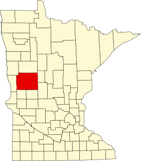
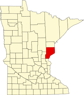
Wadena County is a county in the U.S. state of Minnesota. As of the 2010 census, the population was 13,843. Its county seat is Wadena. The county was formed in 1858 and organized in 1873.

Wing River Township, Wadena County, Minnesota Township in Minnesota, United States

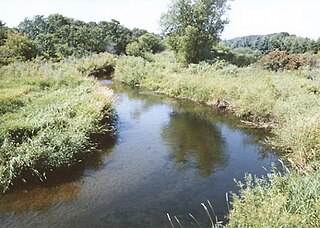
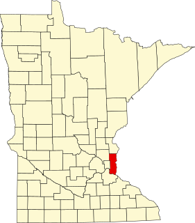
Wing River Township is a township in Wadena County, Minnesota, United States. The population was 430 at the 2000 census. It is named for the Wing River, which joins the Leaf River in the township.

The Minnesota Historical Society (MNHS) is a nonprofit educational and cultural institution dedicated to preserving the history of the U.S. state of Minnesota. It was founded by the territorial legislature in 1849, almost a decade before statehood. The Society is named in the Minnesota Constitution. It is headquartered in the Minnesota History Center in downtown St. Paul.

Grand Portage National Monument national monument in the United States

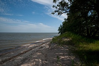
Grand Portage National Monument is a United States National Monument located on the north shore of Lake Superior in northeastern Minnesota that preserves a vital center of fur trade activity and Anishinaabeg Ojibwe heritage. The area became one of the British Empire's four main fur trading centers in North America, along with Fort Niagara, Fort Detroit, and Michilimackinac.

Crow Wing State Park

Crow Wing State Park is a state park of Minnesota, United States, at the confluence of the Mississippi and Crow Wing Rivers. The park interprets the site of Old Crow Wing, one of the most populous towns in Minnesota in the 1850s and 1860s. The entire park was added to the National Register of Historic Places in 1970. A section of the Red River Trails that passed through Old Crow Wing is also separately listed on the National Register.

National Register of Historic Places listings in Minnesota Wikimedia list article

This is a list of sites in Minnesota which are included in the National Register of Historic Places. There are more than 1,600 properties and historic districts listed on the NRHP; each of Minnesota's 87 counties has at least 2 listings. Twenty-two sites are also National Historic Landmarks.

Saint Croix State Park

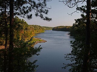
St. Croix State Park is a state park in Pine County, Minnesota, USA. The park follows the shore of the St. Croix River for 21 miles (34 km) and contains the last 7 miles (11 km) of the Kettle River. At 33,895 acres (13,717 ha) it is the largest Minnesota state park. It was developed as a Recreational Demonstration Area in the 1930s, and is one of the finest surviving properties of this type in the nation. 164 structures built by the Civilian Conservation Corps and the Works Progress Administration survive, the largest collection of New Deal projects in Minnesota. As a historic district they were listed on the National Register of Historic Places and proclaimed a National Historic Landmark in 1997.

National Register of Historic Places listings in Dakota County, Minnesota Wikimedia list article

This is a list of the National Register of Historic Places listings in Dakota County, Minnesota. It is intended to be a complete list of the properties and districts on the National Register of Historic Places in Dakota County, Minnesota, United States. Dakota County is located in the southeastern part of the U.S. state of Minnesota, bounded on the northeast side by the Upper Mississippi River and on the northwest by the Minnesota River. The locations of National Register properties and districts for which the latitude and longitude coordinates are included below, may be seen in an online map.

Inyan Ceyaka Otonwe, also called Little Rapids or simply Inyan Ceyaka, was a summer planting village of the Wahpeton Dakota on the Minnesota River in what is now Louisville Township, Minnesota, United States. Located near present-day city of Jordan, the village was occupied by the Wahpeton during the early nineteenth century, and likely before. Burial mounds indicate that Paleo-Indians—possible ancestors of the Dakota—lived at the site as early as 100 CE. The site was listed on the National Register of Historic Places in 1999 for having local significance in the theme of archaeology. The unmarked site is preserved within the Carver Rapids unit of the Minnesota Valley State Recreation Area.

Snake River Fur Post historical site in Minnesota

The Snake River Fur Post is a reconstructed fur trade post on the Snake River west of Pine City, Minnesota, United States of America. The post was established in the fall of 1804 by John Sayer, a partner in the North West Company, and built by his crew of voyageurs. The site operated for several years, although its exact period of operation is unknown. It was later destroyed by fire.

National Register of Historic Places listings in Blue Earth County, Minnesota Wikimedia list article

This is a list of the National Register of Historic Places listings in Blue Earth County, Minnesota. It is intended to be a complete list of the properties and districts on the National Register of Historic Places in Blue Earth County, Minnesota, United States. The locations of National Register properties and districts for which the latitude and longitude coordinates are included below, may be seen in an online map.

National Register of Historic Places listings in Nicollet County, Minnesota Wikimedia list article

This is a list of the National Register of Historic Places listings in Nicollet County, Minnesota. It is intended to be a complete list of the properties and districts on the National Register of Historic Places in Nicollet County, Minnesota, United States. The locations of National Register properties and districts for which the latitude and longitude coordinates are included below, may be seen in an online map.

National Register of Historic Places listings in Otter Tail County, Minnesota Wikimedia list article

This is a list of the National Register of Historic Places listings in Otter Tail County, Minnesota. It is intended to be a complete list of the properties and districts on the National Register of Historic Places in Otter Tail County, Minnesota, United States. The locations of National Register properties and districts for which the latitude and longitude coordinates are included below, may be seen in an online map.

National Register of Historic Places listings in Pine County, Minnesota Wikimedia list article

This is a list of the National Register of Historic Places listings in Pine County, Minnesota. It is intended to be a complete list of the properties and districts on the National Register of Historic Places in Pine County, Minnesota, United States. The locations of National Register properties and districts for which the latitude and longitude coordinates are included below, may be seen in an online map.

National Register of Historic Places listings in Washington County, Minnesota Wikimedia list article

This is a list of the National Register of Historic Places listings in Washington County, Minnesota. It is intended to be a complete list of the properties and districts on the National Register of Historic Places in Washington County, Minnesota, United States. The locations of National Register properties and districts for which the latitude and longitude coordinates are included below, may be seen in an online map.

National Register of Historic Places listings in Big Stone County, Minnesota Wikimedia list article

This is a list of the National Register of Historic Places listings in Big Stone County, Minnesota. It is intended to be a complete list of the properties and districts on the National Register of Historic Places in Big Stone County, Minnesota, United States. Latitude and longitude coordinates are provided for many National Register properties and districts; these locations may be seen together in an online map.

Lac qui Parle Mission

Lac qui Parle Mission is a pre-territorial mission in Chippewa County, Minnesota, United States, which was founded in June 1835 by Dr. Thomas Smith Williamson and Alexander Huggins after fur trader Joseph Renville invited missionaries to the area. Lac qui Parle is a French translation of the native Dakota name, meaning "lake which speaks". In the 19th century, the first dictionary of the Dakota language was written, and part of the Bible was translated into that language for the first time at a mission on the site of the park. It was a site for Christian missionary work to the Sioux for nearly 20 years. Renville was related to and had many friends in the native community, and after his death in 1846, the business was taken over by the "irreligious" Martin McLeod. The Indians became more hostile to the mission, and in 1854 the missionaries abandoned the site and relocated to the Upper Sioux Agency.

Old Wadena Historic District

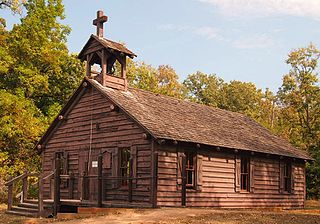
The Old Wadena Historic District is a concentration of historical archaeology sites now largely contained within Old Wadena County Park in Thomastown Township, Minnesota, United States. Features include the sites of four successive trading posts established in 1782, 1792, 1825, and 1856; the original townsite of Wadena on the Red River Trails; and the county's first farm. The town was later moved 3.5 miles (5.6 km) south to its present location. The historic district was listed on the National Register of Historic Places in 1973 for having state-level significance in the themes of agriculture, non-aboriginal archaeology, and transportation. It was nominated for its archaeological potential at the seminal site of Euro-American activity in Wadena County, Minnesota.

The Blueberry Lake Village Site is a prehistoric Native American archaeological site in Blueberry Township, Minnesota, United States. It consists of a habitation site, possibly seasonal, whose period and duration of occupation is uncertain. It was listed on the National Register of Historic Places in 1973 for having state-level significance in the theme of archaeology. It was nominated as one of the few surviving archaeological sites in the Shell River basin of northwestern Wadena County, the region's most conducive zone for prehistoric human habitation.

References

  1. Federal and state laws and practices restrict general public access to information regarding the specific location of sensitive archeological sites in many instances. The main reasons for such restrictions include the potential for looting, vandalism, or trampling. See: Knoerl, John; Miller, Diane; Shrimpton, Rebecca H. (1990), Guidelines for Restricting Information about Historic and Prehistoric Resources, National Register Bulletin (29), National Park Service, U.S. Department of the Interior, OCLC   20706997 .
  2. National Park Service (2010-07-09). "National Register Information System". National Register of Historic Places . National Park Service.
  3. "Reaume's Trading Post". Minnesota National Register Properties Database. Minnesota Historical Society. 2009. Retrieved 2015-06-19.
  4. 1 2 3 Zeik, Susan; Douglas George (1973-04-13). "National Register of Historic Places Inventory – Nomination Form: Reaume's Trading Post". National Park Service.
  5. 1 2 Nelson, George; Laura Lynn Peers; Theresa M. Schenck (2002). My First Years in the Fur Trade: The Journals of 1802–1804. St. Paul, Minn.: Minnesota Historical Society Press. ISBN   9780873514125.
  6. 1 2 "Hunting for clues along Wadena County's Leaf River". Park Rapids Enterprise. Park Rapids, Minn. 2013-01-12. Retrieved 2016-01-23.