National Register of Historic Places listings in Olmsted County, Minnesota

Last updated

Location of Olmsted County in Minnesota Map of Minnesota highlighting Olmsted County.svg
Location of Olmsted County in Minnesota

This is a list of the National Register of Historic Places listings in Olmsted County, Minnesota. It is intended to be a complete list of the properties and districts on the National Register of Historic Places in Olmsted County, Minnesota, United States. The locations of National Register properties and districts for which the latitude and longitude coordinates are included below, may be seen in an online map.

Contents

There are 25 properties and districts listed on the National Register in the county, including one National Historic Landmark. A supplementary list includes five additional sites that were formerly on the National Register. Many of the county's listings are associated with the Mayo Clinic, an influential hospital and medical research facility founded in 1889.


    This National Park Service list is complete through NPS recent listings posted July 15, 2022. [1]

Current listings

Map all coordinates using: OpenStreetMap  
Download coordinates as: KML
[2] Name on the RegisterImageDate listed [3] Location City or townDescription
1 Avalon Hotel
Avalon Hotel AvalonRochesterMN.JPG
Avalon Hotel
March 19, 1982
(#82002992)
301 North Broadway
44°01′35″N92°27′48″W / 44.026453°N 92.463291°W / 44.026453; -92.463291 (Avalon Hotel)
Rochester 1919 hotel dating to a guest accommodation boom fueled by Mayo Clinic patients. Later Rochester's only hotel open to Black patients and travelers, reflecting the diverse but segregated clientele the clinic brought to an otherwise homogeneous Midwestern town. [4]
2 Dr. Donald C. Balfour House
Dr. Donald C. Balfour House BalfourHouse.JPG
Dr. Donald C. Balfour House
July 21, 2004
(#04000723)
427 6th Avenue SW
44°01′06″N92°28′19″W / 44.018416°N 92.471858°W / 44.018416; -92.471858 (Dr. Donald C. Balfour House)
Rochester 1910 home of Dr. Donald Balfour (1882–1963), nationally recognized surgeon, Mayo Clinic partner, and founder of the Mayo Foundation for Medical Education and Research. [5]
3 Benike Family Barn
Benike Family Barn Benike Family Barn.jpg
Benike Family Barn
October 7, 2011
(#09000407)
5209 County Road 21 NE
44°08′15″N92°22′30″W / 44.137379°N 92.374927°W / 44.137379; -92.374927 (Benike Family Barn)
Farmington Township Circa-1875 example of the timber-framed, three-bay barns built during a decade of increased agriculture in Olmsted County and a shift from wheat to diversified farming across southeast Minnesota. [6]
4 John G. Bush House
John G. Bush House BushHouseDoverMN.jpg
John G. Bush House
July 2, 1980
(#80004531)
223 East Center Street
43°58′29″N92°08′11″W / 43.974676°N 92.136428°W / 43.974676; -92.136428 (John G. Bush House)
Dover Well-preserved example of Olmsted County's small-town Italianate houses, built c. 1877 for a prosperous farmer turned merchant. [7]
5 Chateau Dodge Theatre
Chateau Dodge Theatre Barnes&NobleRochesterMN.JPG
Chateau Dodge Theatre
July 17, 1980
(#80002098)
15 1st Street SW
44°01′22″N92°27′50″W / 44.022803°N 92.463962°W / 44.022803; -92.463962 (Chateau Dodge Theatre)
Rochester 1927 atmospheric theatre noted for its Châteauesque façade, fanciful Medieval Revival interior, and long use as a cinema. [8]
6 Coan House
Coan House CoanHouse.JPG
Coan House
July 2, 1980
(#80004532)
118 West 5th Street
43°59′04″N92°14′00″W / 43.984368°N 92.23343°W / 43.984368; -92.23343 (Coan House)
Eyota Elaborately ornamented house built circa 1888; one of the best preserved examples of Olmsted County's relatively small stock of Victorian residences. [9]
7 Eyota Farmers Cooperative Creamery Association
Eyota Farmers Cooperative Creamery Association EyotaCream.JPG
Eyota Farmers Cooperative Creamery Association
July 2, 1980
(#80004533)
222 Washington Avenue S.
43°59′10″N92°13′36″W / 43.986075°N 92.226798°W / 43.986075; -92.226798 (Eyota Farmers Cooperative Creamery Association)
Eyota 1924 Period Revival creamery, a distinctive emblem of Olmsted County's cooperative dairy industry. [10]
8 Frank's Ford Bridge
Frank's Ford Bridge 2010-1014-FranksFordBridge.jpg
Frank's Ford Bridge
July 8, 1980
(#80004534)
County Road 121 over the South Branch of the Zumbro River
44°07′47″N92°27′45″W / 44.129628°N 92.462584°W / 44.129628; -92.462584 (Frank's Ford Bridge)
Oronoco Township 1895 through truss bridge significant for its association with Horace E. Horton (1843–1912), a bridge builder who began his career in Olmsted County and founded the regional Chicago Bridge & Iron Company in 1889. [11]
9 Christoph Krause Farmstead
Christoph Krause Farmstead KrauseFarmhouse.jpg
Christoph Krause Farmstead
October 10, 1980
(#80002097)
County Highway 30
43°57′31″N92°08′17″W / 43.958611°N 92.138056°W / 43.958611; -92.138056 (Christoph Krause Farmstead)
Dover Township Well-preserved farmstead with an Italianate house and large barn dating to the 1870s, exemplifying rural Olmsted County's prosperous 19th-century farms. [12]
10 Maass and McAndrew Company Building
Maass and McAndrew Company Building 1909ConleyCamera.jpg
Maass and McAndrew Company Building
May 24, 2016
(#16000278)
12-14 4th Street SW
44°01′09″N92°27′50″W / 44.019298°N 92.463763°W / 44.019298; -92.463763 (Maass and McAndrew Company Building)
Rochester Home of a mechanical contracting firm in operation 1909–1929, significant for designing and constructing much of the specialized equipment and facilities that helped boost the Mayo Clinic to national prominence. [13]
11 Mayo Clinic Building
Mayo Clinic Building PlummerBuilding.JPG
Mayo Clinic Building
August 4, 1969
(#69000075)
110 and 115 2nd Avenue SW
44°01′19″N92°27′56″W / 44.02189°N 92.465548°W / 44.02189; -92.465548 (Mayo Clinic Building)
Rochester Also known as the Plummer Building, the 1928 headquarters of the influential Mayo Clinic. [14]
12 Dr. William J. Mayo House
Dr. William J. Mayo House MayoFoundationHouseWinter.JPG
Dr. William J. Mayo House
March 26, 1975
(#75001001)
701 4th Street SW
44°01′11″N92°28′25″W / 44.019735°N 92.473748°W / 44.019735; -92.473748 (Dr. William J. Mayo House)
Rochester Tudor Revival mansion built 1916–17 for Mayo Clinic co-founder Dr. William James Mayo (1861–1939). Became the Mayo Foundation House in 1938. [15]
13 Mayowood Historic District
Mayowood Historic District MayowoodMansion.jpg
Mayowood Historic District
September 22, 1970
(#70000306)
3720 Mayowood Road SW
43°59′40″N92°31′09″W / 43.994536°N 92.519163°W / 43.994536; -92.519163 (Mayowood Historic District)
Rochester 10-acre (4 ha) estate dating to 1911 of Charles Horace Mayo (1865–1939) and his son Charles William Mayo (1898–1968), significant for its architecture and association with the Mayo Clinic. [16] Now a museum. [17]
14 Oronoco School
Oronoco School 1875OronocoSchool.JPG
Oronoco School
July 2, 1980
(#80004536)
County Highway 18
44°09′43″N92°32′02″W / 44.161972°N 92.533963°W / 44.161972; -92.533963 (Oronoco School)
Oronoco School in use 1875–1926, a well-preserved example of institutional Italianate architecture and education in Minnesota's rural communities. [18]
15 Pill Hill Residential Historic District
Pill Hill Residential Historic District 2010-1014-PillHillRHD.jpg
Pill Hill Residential Historic District
November 29, 1990
(#85003768)
Roughly bounded by 3rd and 9th Streets and 7th and 10th Avenues SW
44°01′02″N92°28′32″W / 44.0171°N 92.475545°W / 44.0171; -92.475545 (Pill Hill Residential Historic District)
Rochester 15-block neighborhood long fashionable among Rochester's numerous medical professionals, with 133 contributing properties exhibiting the architectural styles popular in the first three decades of the 20th century. [19]
16 Pleasant Grove Masonic Lodge
Pleasant Grove Masonic Lodge PleasantGroveMasonicLodge.JPG
Pleasant Grove Masonic Lodge
October 10, 1980
(#80002102)
Off County Highway 1
43°52′12″N92°23′04″W / 43.870078°N 92.384482°W / 43.870078; -92.384482 (Pleasant Grove Masonic Lodge)
Pleasant Grove Both the oldest purpose-built and continuously used Masonic Temple in Minnesota, built in 1868; with a first floor community hall long serving as the area's social center. [20]
17 Henry S. Plummer House
Henry S. Plummer House PlummerHouse.JPG
Henry S. Plummer House
May 21, 1975
(#75001002)
1091 Plummer Lane
44°00′38″N92°28′47″W / 44.010657°N 92.479789°W / 44.010657; -92.479789 (Henry S. Plummer House)
Rochester Tudor Revival estate built 1917–1924 for pivotal Mayo Clinic doctor and architect Henry Stanley Plummer (1874–1936). [21] Also a contributing property to the Pill Hill Residential Historic District. [19] Now a city park and event center. [22]
18 Rochester Armory
Rochester Armory CastleRochesterMN.JPG
Rochester Armory
December 2, 1980
(#80004268)
121 North Broadway
44°01′31″N92°27′49″W / 44.025139°N 92.463491°W / 44.025139; -92.463491 (Rochester Armory)
Rochester Prominent 1915 example of the medieval fortress design popular for early-20th-century armories, and the local focus of Minnesota National Guard activity into the 1970s. [23]
19 Rochester Public Library
Rochester Public Library MayoMedicalSchool.JPG
Rochester Public Library
July 2, 1980
(#80004537)
226 2nd Street SW
44°01′17″N92°28′01″W / 44.02134°N 92.466991°W / 44.02134; -92.466991 (Rochester Public Library)
Rochester Well-crafted and preserved example of an urban Public Works Administration project, built 1936–37. Now the Mayo Clinic Alix School of Medicine's Mitchell Student Center. [24]
20 St. Mary's Hospital Dairy Farmstead
St. Mary's Hospital Dairy Farmstead TileBarn.JPG
St. Mary's Hospital Dairy Farmstead
July 2, 1980
(#80004538)
County Highway 104
44°01′29″N92°33′22″W / 44.024704°N 92.556085°W / 44.024704; -92.556085 (St. Mary's Hospital Dairy Farmstead)
Rochester vicinityMassive 1923 barn built to supply pasteurized milk to the expanding patient population of St. Mary's Hospital. [25]
21 George Stoppel Farmstead
George Stoppel Farmstead StoppelFarm.JPG
George Stoppel Farmstead
May 12, 1975
(#75001000)
1195 W. Circle Drive
44°00′29″N92°30′36″W / 44.008045°N 92.509962°W / 44.008045; -92.509962 (George Stoppel Farmstead)
Rochester Locally rare surviving mid-19th-century farmstead complex with three architecturally distinctive buildings. [26] Preserved on the grounds of the History Center of Olmsted County. [27]
22 Toogood Barns
Toogood Barns 2010-1014-TwogoodBarns01.jpg
Toogood Barns
June 26, 1975
(#75001003)
615 16th Street SW
44°00′01″N92°28′21″W / 44.000194°N 92.472553°W / 44.000194; -92.472553 (Toogood Barns)
Rochester Interconnected stone barns built circa 1870; one of Minnesota's finest surviving masonry farm complexes and a symbol of its New Englander pioneers. [28]
23 Viola Cooperative Creamery
Viola Cooperative Creamery ViolaCreamery.jpg
Viola Cooperative Creamery
November 12, 1999
(#99001310)
10500 Viola Road NE
44°03′52″N92°16′11″W / 44.064534°N 92.269599°W / 44.064534; -92.269599 (Viola Cooperative Creamery)
Viola Creamery in operation 1924–1948, representing the cooperative dairy movement of the first half of the 20th century and the heyday of small, specialty creameries. [29]
24 Milo White House
Milo White House MiloWhiteHouse.JPG
Milo White House
March 19, 1982
(#82002991)
122 Burr Oak Street
43°51′02″N92°11′18″W / 43.850521°N 92.18836°W / 43.850521; -92.18836 (Milo White House)
Chatfield Elaborate Queen Anne house built 1883–84 for settler and politician Milo White (1830–1913). [30]
25 Timothy A. Whiting House
Timothy A. Whiting House HeritageHouse.jpg
Timothy A. Whiting House
December 4, 1980
(#80004269)
225 1st Avenue NW
44°01′34″N92°27′54″W / 44.026035°N 92.464898°W / 44.026035; -92.464898 (Timothy A. Whiting House)
Rochester Well-preserved example of an Italianate house, built in 1875 during Rochester's initial development as a center of agricultural commerce. [31] Now the Heritage House Victorian Museum. [32]

Former listings

[2] Name on the RegisterImageDate listedDate removedLocationCity or townDescription
1 Chicago Great Western Railroad Company Depot
Chicago Great Western Railroad Company Depot OldDepotRochesterMN.jpg
Chicago Great Western Railroad Company Depot
December 4, 1980
(#80004267)
November 13, 198788 South Park Avenue and 130 South Park Avenue (original address)
Current coordinates are

44°01′08″N92°27′41″W / 44.018984°N 92.461361°W / 44.018984; -92.461361 (Chicago Great Western Railroad Company Depot)
Rochester 1900 Chicago Great Western Railway depot. [33] Moved in 1987. [34] [35]
2 Cutting Barn October 22, 1980
(#80002099)
May 4, 19843210 19th Street, N.W.
Rochester 1868 limestone barn of a prosperous early farm. Destroyed by an accidental fire on January 24, 1982. [36]
3 Hotel Zumbro
Hotel Zumbro 1915postcardHotelZumbroRochesterMN.jpg
Hotel Zumbro
October 10, 1980
(#80002100)
March 28, 1988101 First Avenue, S.W.
Rochester 1912 hotel catering to Mayo Clinic patients and their families. Demolished by owners in 1987 to make way for a modern replacement. [37] [36]
4 Charles H. Mayo House July 2, 1980
(#80004535)
September 25, 1987419 Fourth Street, S.W.
Rochester 1903 house of Dr. Charles Horace Mayo. Demolished as a condition of land sale back to the Mayo Clinic in 1987. [36] [38]
5 Pierce House
Pierce House MaxwellGuestHouseDemolition.jpg
Pierce House
July 21, 1980
(#80002101)
November 7, 2016426 Second Avenue, S.W.
44°01′06″N92°27′56″W / 44.018363°N 92.465634°W / 44.018363; -92.465634 (Pierce House)
Rochester 1877 brick Italianate hotel which became a nursing school and later apartments. [34] Demolished June 5, 2007. [39]

See also

Related Research Articles

National Register of Historic Places listings in Dakota County, Minnesota

This is a list of the National Register of Historic Places listings in Dakota County, Minnesota. It is intended to be a complete list of the properties and districts on the National Register of Historic Places in Dakota County, Minnesota, United States. Dakota County is located in the southeastern part of the U.S. state of Minnesota, bounded on the northeast side by the Upper Mississippi River and on the northwest by the Minnesota River. The locations of National Register properties and districts for which the latitude and longitude coordinates are included below, may be seen in an online map.

National Register of Historic Places listings in Hennepin County, Minnesota

This list is of the properties and historic districts which are designated on the National Register of Historic Places or that were formerly so designated, in Hennepin County, Minnesota; there are 186 entries as of October 2021. A significant number of these properties are a result of the establishment of Fort Snelling, the development of water power at Saint Anthony Falls, and the thriving city of Minneapolis that developed around the falls. Many historic sites outside the Minneapolis city limits are associated with pioneers who established missions, farms, and schools in areas that are now suburbs in that metropolitan area.

National Register of Historic Places listings in Ramsey County, Minnesota

This is a complete list of National Register of Historic Places listings in Ramsey County, Minnesota. It is intended to be a complete list of the properties and districts on the National Register of Historic Places in Ramsey County, Minnesota, United States. The locations of National Register properties and districts for which the latitude and longitude coordinates are included below, may be seen in an online map.

National Register of Historic Places listings in Carver County, Minnesota

This is a list of the National Register of Historic Places listings in Carver County, Minnesota. It is intended to be a complete list of the properties and districts on the National Register of Historic Places in Carver County, Minnesota, United States. The locations of National Register properties and districts for which the latitude and longitude coordinates are included below, may be seen in an online map.

National Register of Historic Places listings in Anoka County, Minnesota

This is a list of the National Register of Historic Places listings in Anoka County, Minnesota. It is intended to be a complete list of the properties and districts on the National Register of Historic Places in Anoka County, Minnesota, United States. The locations of National Register properties and districts for which the latitude and longitude coordinates are included below, may be seen in an online map.

National Register of Historic Places listings in Crow Wing County, Minnesota

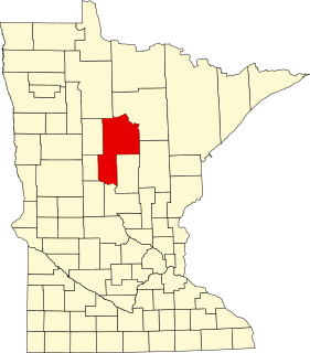
This is a list of the National Register of Historic Places listings in Crow Wing County, Minnesota. It is intended to be a complete list of the properties and districts on the National Register of Historic Places in Crow Wing County, Minnesota, United States. The locations of National Register properties and districts for which the latitude and longitude coordinates are included below, may be seen in an online map.

National Register of Historic Places listings in Morrison County, Minnesota

This is a list of the National Register of Historic Places listings in Morrison County, Minnesota. It is intended to be a complete list of the properties and districts on the National Register of Historic Places in Morrison County, Minnesota, United States. The locations of National Register properties and districts for which the latitude and longitude coordinates are included below, may be seen in an online map.

George Stoppel Farmstead United States historic place

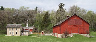
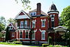
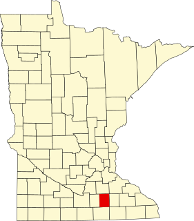
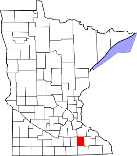
The George Stoppel Farmstead is a pioneer farm located just outside the western city limits of Rochester, Minnesota, United States. The farmstead is owned and operated by the History Center of Olmsted County. It was listed on the National Register of Historic Places in 1975. It was nominated for being one of the few surviving mid-19th-century farmsteads in the urbanizing Rochester in the Rochester metropolitan area, with an architecturally distinctive farmhouse and shed.

National Register of Historic Places listings in Winona County, Minnesota

This is a list of the National Register of Historic Places listings in Winona County, Minnesota. It is intended to be a complete list of the properties and districts on the National Register of Historic Places in Winona County, Minnesota, United States. The locations of National Register properties and districts for which the latitude and longitude coordinates are included below, may be seen in an online map.

National Register of Historic Places listings in Fillmore County, Minnesota

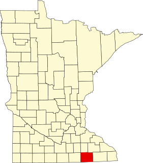
This is a list of the National Register of Historic Places listings in Fillmore County, Minnesota. It is intended to be a complete list of the properties and districts on the National Register of Historic Places in Fillmore County, Minnesota, United States. The locations of National Register properties and districts for which the latitude and longitude coordinates are included below, may be seen in an online map.

National Register of Historic Places listings in Le Sueur County, Minnesota

This is a list of the National Register of Historic Places listings in Le Sueur County, Minnesota. It is intended to be a complete list of the properties and districts on the National Register of Historic Places in Le Sueur County, Minnesota, United States. The locations of National Register properties and districts for which the latitude and longitude coordinates are included below, may be seen in an online map.

National Register of Historic Places listings in Washington County, Minnesota

This is a list of the National Register of Historic Places listings in Washington County, Minnesota. It is intended to be a complete list of the properties and districts on the National Register of Historic Places in Washington County, Minnesota, United States. The locations of National Register properties and districts for which the latitude and longitude coordinates are included below, may be seen in an online map.

National Register of Historic Places listings in Rock County, Minnesota

This is a list of the National Register of Historic Places listings in Rock County, Minnesota. It is intended to be a complete list of the properties and districts on the National Register of Historic Places in Rock County, Minnesota, United States. The locations of National Register properties and districts for which the latitude and longitude coordinates are included below, may be seen in an online map.

National Register of Historic Places listings in Cass County, Minnesota

This is a list of the National Register of Historic Places listings in Cass County, Minnesota. It is intended to be a complete list of the properties and districts on the National Register of Historic Places in Cass County, Minnesota, United States. The locations of National Register properties and districts for which the latitude and longitude coordinates are included below, may be seen in an online map.

National Register of Historic Places listings in Houston County, Minnesota

This is a list of the National Register of Historic Places listings in Houston County, Minnesota. It is intended to be a complete list of the properties and districts on the National Register of Historic Places in Houston County, Minnesota, United States. The locations of National Register properties and districts for which the latitude and longitude coordinates are included below, may be seen in an online map.

National Register of Historic Places listings in Steele County, Minnesota

This is a list of the National Register of Historic Places listings in Steele County, Minnesota. It is intended to be a complete list of the properties and districts on the National Register of Historic Places in Steele County, Minnesota, United States. The locations of National Register properties and districts for which the latitude and longitude coordinates are included below, may be seen in an online map.

National Register of Historic Places listings in Swift County, Minnesota

This is a list of the National Register of Historic Places listings in Swift County, Minnesota. It is intended to be a complete list of the properties and districts on the National Register of Historic Places in Swift County, Minnesota, United States. The locations of National Register properties and districts for which the latitude and longitude coordinates are included below, may be seen in an online map.

National Register of Historic Places listings in Beltrami County, Minnesota

This is a list of the National Register of Historic Places listings in Beltrami County, Minnesota. This is intended to be a complete list of the properties and districts on the National Register of Historic Places in Beltrami County, Minnesota, United States. The locations of National Register properties and districts for which the latitude and longitude coordinates are included below, may be seen in an online map.

National Register of Historic Places listings in Dodge County, Minnesota

This is a list of the National Register of Historic Places listings in Dodge County, Minnesota. It is intended to be a complete list of the properties and districts on the National Register of Historic Places in Dodge County, Minnesota, United States. The locations of National Register properties and districts for which the latitude and longitude coordinates are included below, may be seen in an online map.

National Register of Historic Places listings in Mower County, Minnesota

This is a list of the National Register of Historic Places listings in Mower County, Minnesota. It is intended to be a complete list of the properties and districts on the National Register of Historic Places in Mower County, Minnesota, United States. The locations of National Register properties and districts for which the latitude and longitude coordinates are included below, may be seen in an online map.

References

  1. National Park Service, United States Department of the Interior, "National Register of Historic Places: Weekly List Actions", retrieved July 15, 2022.
  2. 1 2 Numbers represent an alphabetical ordering by significant words. Various colorings, defined here, differentiate National Historic Landmarks and historic districts from other NRHP buildings, structures, sites or objects.
  3. The eight-digit number below each date is the number assigned to each location in the National Register Information System database, which can be viewed by clicking the number.
  4. Frame III, Robert (April 1980). National Register of Historic Places Inventory—Nomination Form: Avalon Hotel. National Park Service. Retrieved 2022-07-10.
  5. Gales, Elizabeth A. (February 2004). National Register of Historic Places Registration Form: Balfour, Dr. Donald C., House. National Park Service. Retrieved 2022-07-07.
  6. Granger, Susan; Scott Kelly (March 2011). "National Register of Historic Places Registration Form: Benike Family Barn". National Park Service.{{cite journal}}: Cite journal requires |journal= (help)
  7. Frame III, Robert M. (April 1980). National Register of Historic Places Inventory—Nomination Form: Bush, John G., House. National Park Service. Retrieved 2022-07-02.
  8. Frame III, Robert M. (April 1980). National Register of Historic Places Inventory—Nomination Form: Chateau Dodge Theatre. National Park Service. Retrieved 2022-07-03.
  9. Frame III, Robert M. (April 1980). National Register of Historic Places Inventory—Nomination Form: Coan House. National Park Service. Retrieved 2022-07-02.
  10. Frame III, Robert M. (April 1980). National Register of Historic Places Inventory—Nomination Form: Eyota Farmers Cooperative Creamery Association. National Park Service. Retrieved 2022-07-01.
  11. Frame III, Robert M. (April 1980). National Register of Historic Places Inventory—Nomination Form: Frank's Ford Bridge. National Park Service. Retrieved 2022-06-30.
  12. Frame III, Robert M. (April 1980). National Register of Historic Places Inventory—Nomination Form: Krause, Christoph, Farmstead. National Park Service. Retrieved 2022-06-29.
  13. Bisel, Jane; Steve Williams (2016-01-07). National Register of Historic Places Registration Form: Maas and McAndrew Company Building (PDF). National Park Service. Retrieved 2016-07-16.
  14. "Mayo Clinic Building". National Historic Landmarks Program. National Park Service. Archived from the original on 2011-09-26. Retrieved 2013-03-04.
  15. VanBrocklin, Lynne (1974-11-04). National Register of Historic Places Inventory – Nomination Form: Mayo, William J., House. National Park Service. Retrieved 2022-06-26.
  16. Grossman, John (1970-03-20). National Register of Historic Places Inventory – Nomination Form: Mayowood or "Big House". National Park Service. Retrieved 2020-06-15.
  17. "Mayowood". History Center of Olmsted County. 2017. Retrieved 2020-06-15.
  18. Frame III, Robert M. (April 1980). National Register of Historic Places Inventory—Nomination Form: Oronoco School. National Park Service. Retrieved 2020-06-13.
  19. 1 2 Koop, Michael (1990-01-01). National Register of Historic Places Registration Form: Pill Hill Residential Historic District. National Park Service. Retrieved 2020-06-13.
  20. Frame III, Robert M. (April 1980). National Register of Historic Places Inventory—Nomination Form: Pleasant Grove Masonic Lodge No. 22 A.F. and A.M. National Park Service. Retrieved 2020-06-10.
  21. VanBrocklin, Lynne (1974-11-05). National Register of Historic Places Inventory – Nomination Form: Plummer Gardens. National Park Service. Retrieved 2020-06-06.
  22. "Plummer House". City of Rochester Parks & Recreation. Retrieved 2020-06-06.
  23. Frame III, Robert M. (April 1980). National Register of Historic Places Inventory—Nomination Form: Rochester Armory. National Park Service. Retrieved 2020-02-20.
  24. Frame, Robert (1980-04-03). National Register of Historic Places Inventory—Nomination Form: Rochester Public Library. National Park Service. Retrieved 2020-02-20.
  25. Frame III, Robert M. (April 1980). National Register of Historic Places Inventory—Nomination Form: St. Mary's Hospital Dairy Farm. National Park Service. Retrieved 2020-02-13.
  26. Tyrrell, Jr., George; Lynne VanBrocklin (November 1974). National Register of Historic Places Inventory – Nomination Form: Dodge Farm. National Park Service. Retrieved 2020-02-09.
  27. "Grounds and Buildings". History Center of Olmsted County. 2017. Retrieved 2020-02-09.
  28. Lutz, Thomas (1975-03-26). National Register of Historic Places Inventory -- Nomination Form: Toogood Barns. National Park Service. Retrieved 2020-02-03.
  29. Peterson, Garneth O. (1999-06-14). National Register of Historic Places Registration Form: Viola Cooperative Creamery. National Park Service. Retrieved 2020-02-03.
  30. Frame III, Robert M. (April 1980). National Register of Historic Places Inventory—Nomination Form: White, Milo, House (Hazelwood). National Park Service. Retrieved 2020-02-03.
  31. Frame III, Robert M. (April 1980). National Register of Historic Places Inventory—Nomination Form: Whiting, Timothy A., House. National Park Service. Retrieved 2020-01-20.
  32. "Heritage House Victorian Museum". Heritage House Victorian Museum. Retrieved 2020-01-20.
  33. "Chicago Great Western Depot (removed)". Minnesota National Register Properties Database. Minnesota Historical Society. 2009. Retrieved 2013-03-05.
  34. 1 2 Nord, Mary Ann (2003). The National Register of Historic Places in Minnesota . Minnesota Historical Society. ISBN   0-87351-448-3.
  35. "About Us". Dos Amigos Mexican Restaurant. Retrieved 2013-09-05.
  36. 1 2 3 El-Hai, Jack (2000). Lost Minnesota: Stories of Vanished Places. Minneapolis: University of Minnesota Press. ISBN   0816635153.
  37. "3rd historic building razed in Rochester". Winona Daily News . October 3, 1987. p. 2. Retrieved July 28, 2022 via Newspapers.com.
  38. "Demolition started on historic Mayo mansion". Winona Daily News . March 8, 1987. p. 2. Retrieved July 28, 2022 via Newspapers.com.
  39. Hansel, Jeff (2007-07-07). "130-year-old Maxwell House is no more". Post-Bulletin. Rochester, Minnesota.