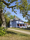
National Register of Historic Places listings in Clay County, Minnesota

Last updated

Location of Clay County in Minnesota Map of Minnesota highlighting Clay County.svg
Location of Clay County in Minnesota

This is a list of the National Register of Historic Places listings in Clay County, Minnesota. It is intended to be a complete list of the properties and districts on the National Register of Historic Places in Clay County, Minnesota, United States. The locations of National Register properties and districts for which the latitude and longitude coordinates are included below, may be seen in an online map.

Contents

There are 20 properties and districts listed on the National Register in the county.


    This National Park Service list is complete through NPS recent listings posted August 18, 2023. [1]

History

Clay County's National Register properties reflect its significance as a transportation corridor and major agricultural region. The Red River of the North and the Red River Trails were important early routes, but Euro-American settlement was light. The Randolph M. Probstfield House, John Bergquist House, and Bernard Bernhardson House are the preserved homes of some of Clay County's earliest settlers. The construction of two major rail lines in the early 1870s fuelled a great increase in population and agriculture, and cemented the importance of Moorhead as a commercial hub. From the 1870s to the 1920s, large bonanza farms carved from railroad land grants gave way to diversified family outfits like the Wulf C. Krabbenhoft Farmstead. The John Olness House, Solomon Gilman Comstock House, and Burnham Building are associated with individuals who prospered in land speculation and other commercial activities. [2]

Current listings

Map all coordinates using: OpenStreetMap
[3] Name on the RegisterImageDate listed [4] Location City or townDescription
1 Barnesville City Hall and Jail
Barnesville City Hall and Jail Barnesville City Hall, Fire Station and Jail.jpg
Barnesville City Hall and Jail
May 7, 1980
(#80002009)
Front and Main Sts.
46°39′12″N96°25′14″W / 46.653196°N 96.420441°W / 46.653196; -96.420441 (Barnesville City Hall and Jail)
Barnesville Well preserved example of a small-town municipal complex, an 1899 city hall/fire station/opera house with a circa-1910 jail. [5]
2 John Bergquist House
John Bergquist House John Bergquist Cabin.jpg
John Bergquist House
May 7, 1980
(#80002014)
719 10th Ave. N.
46°53′09″N96°46′08″W / 46.885851°N 96.768769°W / 46.885851; -96.768769 (John Bergquist House)
Moorhead 1870 log cabin of John G. Bergquist, an early settler arriving in 1869 and notable figure in Moorhead's development. [6]
3 Bernard Bernhardson House
Bernard Bernhardson House Bernard Bernhardson House.jpg
Bernard Bernhardson House
May 7, 1980
(#80002011)
County Road 59
46°41′35″N96°47′07″W / 46.692991°N 96.785273°W / 46.692991; -96.785273 (Bernard Bernhardson House)
Comstock vicinity1870 log cabin built by an early homesteader as a temporary dwelling; Clay County's best preserved example of subsistence log architecture. [7]
4 Buffalo River State Park WPA/Rustic Style Historic Resources
Buffalo River State Park WPA/Rustic Style Historic Resources Buffalo River SP storm shelter.jpg
Buffalo River State Park WPA/Rustic Style Historic Resources
October 25, 1989
(#89001671)
Off U.S. Route 10 east of Glyndon
46°51′53″N96°28′04″W / 46.864825°N 96.46773°W / 46.864825; -96.46773 (Buffalo River State Park WPA/Rustic Style Historic Resources)
Glyndon vicinitySix park facilities built 1937–1940, significant as examples of New Deal federal work relief, the early development of Minnesota's state parks, and split stone architecture. [8]
5 Burnham Building
Burnham Building Burnham Building.jpg
Burnham Building
May 7, 1980
(#80002013)
420 Main Ave.
46°52′26″N96°46′23″W / 46.873981°N 96.772924°W / 46.873981; -96.772924 (Burnham Building)
Moorhead Only remaining example of the false-front buildings once common to downtown Moorhead; a commercial/residential property built circa 1880 for early businessman and land speculator Frank Burnham. [9]
6 Comstock Public School
Comstock Public School Comstock Public School sunny.jpg
Comstock Public School
May 7, 1980
(#80002012)
Main St.
46°39′38″N96°45′03″W / 46.660552°N 96.750855°W / 46.660552; -96.750855 (Comstock Public School)
Comstock School building constructed 1909–1911, noted for its architecture. [10]
7 Solomon Gilman Comstock House
Solomon Gilman Comstock House Comstock House.jpg
Solomon Gilman Comstock House
December 30, 1974
(#74001011)
5th Ave. and 8th St. S.
46°52′08″N96°46′03″W / 46.869027°N 96.767504°W / 46.869027; -96.767504 (Solomon Gilman Comstock House)
Moorhead 1883 house of Solomon Comstock, a founder and leading citizen of Moorhead from his arrival in 1871 to his death in 1933. Also noted as the city's top example of late Victorian architecture. [11] Now a Minnesota Historical Society museum. [12]
8 District No. 3 School January 11, 2023
(#100008545)
10389 280th St. S.
46°44′28″N96°13′04″W / 46.741193°N 96.217698°W / 46.741193; -96.217698 (District No. 3 School)
Parke Township One-room school in use 1892–1961; Clay County's first rural school district and last to consolidate into a larger district, attesting to residents' values on providing a basic, locally controlled education. [13]
9 Fairmont Creamery Company
Fairmont Creamery Company Fairmount Creamery Company.jpg
Fairmont Creamery Company
February 10, 1983
(#83000901)
801 2nd Ave. N.
46°52′35″N96°46′02″W / 46.876358°N 96.76735°W / 46.876358; -96.76735 (Fairmont Creamery Company)
Moorhead 1923 creamery instrumental in moving the Red River Valley away from monocultural cash crop farming into diversified agriculture. Also noted as an example of 1920s industrial architecture. [14]
10 Federal Courthouse and Post Office
Federal Courthouse and Post Office Rourke Art Museum.jpg
Federal Courthouse and Post Office
May 7, 1980
(#80002015)
521 Main Ave.
46°52′25″N96°46′16″W / 46.873599°N 96.771239°W / 46.873599; -96.771239 (Federal Courthouse and Post Office)
Moorhead 1915 Neoclassical landmark in downtown Moorhead, also noted as a local example of a federal government building and for its adaptive reuse. [15] Now the Rourke Art Museum.
11 Lew A. Huntoon House
Lew A. Huntoon House Lew A. Huntoon House.jpg
Lew A. Huntoon House
May 7, 1980
(#80002016)
709 8th St. S.
46°52′01″N96°46′06″W / 46.86692°N 96.76843°W / 46.86692; -96.76843 (Lew A. Huntoon House)
Moorhead Moorhead's only English cottage-style house, built in 1910 for the director of the Moorhead State Normal School and now the official residence of the Concordia College president. [16]
12 Wulf C. Krabbenhoft Farmstead May 7, 1980
(#80002021)
County Road 69
46°47′26″N96°37′34″W / 46.7905°N 96.626113°W / 46.7905; -96.626113 (Wulf C. Krabbenhoft Farmstead)
Sabin vicinityLeading example of a Red River Valley family farm, with five contributing properties built 1890–1905. [17]
13 Main Building, Concordia College
Main Building, Concordia College 2009-0522-Concordia-OldMain.jpg
Main Building, Concordia College
May 7, 1980
(#80002017)
S. 8th St.
46°51′56″N96°46′08″W / 46.865511°N 96.76879°W / 46.865511; -96.76879 (Main Building, Concordia College)
Moorhead Most notable building at Concordia College and Moorhead's leading example of Neoclassical architecture, built in 1906. [18]
14 Moorhead Storage and Transfer Company Warehouse
Moorhead Storage and Transfer Company Warehouse Moorhead Storage and Transfer Company Warehouse Moorhead MN.jpg
Moorhead Storage and Transfer Company Warehouse
January 10, 2020
(#100004863)
1010 Center Ave.
46°52′31″N96°45′51″W / 46.8754°N 96.7642°W / 46.8754; -96.7642 (Moorhead Storage and Transfer Company Warehouse)
Moorhead 1922 trackside potato warehouse, a reminder of an important regional crop and its industrialization, and a rare vestige of Moorhead's former warehousing and manufacturing district. [19]
15 John Olness House
John Olness House Olness-House.jpg
John Olness House
May 7, 1980
(#80002018)
U.S. Route 75
46°59′31″N96°45′10″W / 46.992006°N 96.752715°W / 46.992006; -96.752715 (John Olness House)
Georgetown vicinity1902 house of a prosperous local merchant and land speculator; also noted for its Neoclassical façade and Queen Anne details. [20] Now an event venue called A Friend's House. [21]
16 Park Elementary School
Park Elementary School Park Elementary School.jpg
Park Elementary School
December 22, 1988
(#88003013)
121 6th Ave. S.
46°52′05″N96°46′37″W / 46.86798°N 96.7769°W / 46.86798; -96.7769 (Park Elementary School)
Moorhead Moorhead's oldest school building—constructed in 1900—and only surviving example of its small neighborhood schools in use before the Post–World War II baby boom. [22]
17 Patterson-Hernandez House
Patterson-Hernandez House Patterson Hernandez House - Queen Anne.jpg
Patterson-Hernandez House
May 7, 1980
(#80002010)
404 Main Ave. W
46°39′11″N96°25′33″W / 46.653025°N 96.425765°W / 46.653025; -96.425765 (Patterson-Hernandez House)
Barnesville Unusual and architecturally sophisticated Queen Anne house built 1898–1900 of fieldstone with some frame sections. [23]
18 Randolph M. Probstfield House
Randolph M. Probstfield House ProbstfieldFarmHouse.jpg
Randolph M. Probstfield House
May 7, 1980
(#80002019)
4555 Oakport St. N
46°55′20″N96°45′09″W / 46.922148°N 96.752371°W / 46.922148; -96.752371 (Randolph M. Probstfield House)
Moorhead vicinity1869 house of one of Clay County's first settlers and a local leader in politics, education, and agricultural development from his arrival in 1859 to his death in 1911. [24]
19 St. John the Divine Episcopal Church
St. John the Divine Episcopal Church St. John the Divine Episcopal Church.jpg
St. John the Divine Episcopal Church
May 7, 1980
(#80002020)
120 S. 8th St.
46°52′23″N96°46′02″W / 46.872987°N 96.767302°W / 46.872987; -96.767302 (St. John the Divine Episcopal Church)
Moorhead Shingle Style church built 1898–99, considered Moorhead's leading architectural landmark and one of Cass Gilbert's most interesting churches. [25]
20 Hannah C. and Peter E. Thompson House
Hannah C. and Peter E. Thompson House Hannah C & Peter E Thompson House.jpg
Hannah C. and Peter E. Thompson House
February 23, 1996
(#96000173)
361 2nd St. N.E.
46°39′23″N96°25′05″W / 46.65632°N 96.418051°W / 46.65632; -96.418051 (Hannah C. and Peter E. Thompson House)
Barnesville 1903 Neoclassical house designed by the Hancock Brothers for Barnesville founders and leading citizens Peter (1852–1905) and Hannah Thompson (1857–1920). [26]

See also

Related Research Articles

<span class="mw-page-title-main">National Register of Historic Places listings in Minnesota</span>

This is a list of sites in Minnesota which are included in the National Register of Historic Places. There are more than 1,700 properties and historic districts listed on the NRHP; each of Minnesota's 87 counties has at least 2 listings. Twenty-two sites are also National Historic Landmarks.
<span class="mw-page-title-main">National Register of Historic Places listings in Dakota County, Minnesota</span>

This is a list of the National Register of Historic Places listings in Dakota County, Minnesota. It is intended to be a complete list of the properties and districts on the National Register of Historic Places in Dakota County, Minnesota, United States. Dakota County is located in the southeastern part of the U.S. state of Minnesota, bounded on the northeast side by the Upper Mississippi River and on the northwest by the Minnesota River. The locations of National Register properties and districts for which the latitude and longitude coordinates are included below, may be seen in an online map.

<span class="mw-page-title-main">National Register of Historic Places listings in Hennepin County, Minnesota</span>

This list is of the properties and historic districts which are designated on the National Register of Historic Places or that were formerly so designated, in Hennepin County, Minnesota; there are 190 entries as of April 2023. A significant number of these properties are a result of the establishment of Fort Snelling, the development of water power at Saint Anthony Falls, and the thriving city of Minneapolis that developed around the falls. Many historic sites outside the Minneapolis city limits are associated with pioneers who established missions, farms, and schools in areas that are now suburbs in that metropolitan area.

<span class="mw-page-title-main">National Register of Historic Places listings in Carver County, Minnesota</span>

This is a list of the National Register of Historic Places listings in Carver County, Minnesota. It is intended to be a complete list of the properties and districts on the National Register of Historic Places in Carver County, Minnesota, United States. The locations of National Register properties and districts for which the latitude and longitude coordinates are included below, may be seen in an online map.

<span class="mw-page-title-main">National Register of Historic Places listings in Goodhue County, Minnesota</span>

This is a list of the National Register of Historic Places listings in Goodhue County, Minnesota. It is intended to be a complete list of the properties and districts on the National Register of Historic Places in Goodhue County, Minnesota, United States. The locations of National Register properties and districts for which the latitude and longitude coordinates are included below, may be seen in an online map.

<span class="mw-page-title-main">National Register of Historic Places listings in St. Louis County, Minnesota</span>

This is a list of the National Register of Historic Places listings in Saint Louis County, Minnesota. It is intended to be a complete list of the properties and districts on the National Register of Historic Places in Saint Louis County, Minnesota, United States. The locations of National Register properties and districts for which the latitude and longitude coordinates are included below, may be seen in an online map.

<span class="mw-page-title-main">National Register of Historic Places listings in Stearns County, Minnesota</span>

This is a list of the National Register of Historic Places listings in Stearns County, Minnesota. It is intended to be a complete list of the properties and districts on the National Register of Historic Places in Stearns County, Minnesota, United States. The locations of National Register properties and districts for which the latitude and longitude coordinates are included below, may be seen in an online map.
<span class="mw-page-title-main">National Register of Historic Places listings in Brown County, Minnesota</span>

This is a list of the National Register of Historic Places listings in Brown County, Minnesota. It is intended to be a complete list of the properties and districts on the National Register of Historic Places in Brown County, Minnesota, United States. The locations of National Register properties and districts for which the latitude and longitude coordinates are included below, may be seen in an online map.

<span class="mw-page-title-main">National Register of Historic Places listings in Morrison County, Minnesota</span>

This is a list of the National Register of Historic Places listings in Morrison County, Minnesota. It is intended to be a complete list of the properties and districts on the National Register of Historic Places in Morrison County, Minnesota, United States. The locations of National Register properties and districts for which the latitude and longitude coordinates are included below, may be seen in an online map.

<span class="mw-page-title-main">National Register of Historic Places listings in Otter Tail County, Minnesota</span>

This is a list of the National Register of Historic Places listings in Otter Tail County, Minnesota. It is intended to be a complete list of the properties and districts on the National Register of Historic Places in Otter Tail County, Minnesota, United States. The locations of National Register properties and districts for which the latitude and longitude coordinates are included below, may be seen in an online map.

<span class="mw-page-title-main">National Register of Historic Places listings in Fillmore County, Minnesota</span>

This is a list of the National Register of Historic Places listings in Fillmore County, Minnesota. It is intended to be a complete list of the properties and districts on the National Register of Historic Places in Fillmore County, Minnesota, United States. The locations of National Register properties and districts for which the latitude and longitude coordinates are included below, may be seen in an online map.

<span class="mw-page-title-main">National Register of Historic Places listings in Washington County, Minnesota</span>

This is a list of the National Register of Historic Places listings in Washington County, Minnesota. It is intended to be a complete list of the properties and districts on the National Register of Historic Places in Washington County, Minnesota, United States. The locations of National Register properties and districts for which the latitude and longitude coordinates are included below, may be seen in an online map.

<span class="mw-page-title-main">National Register of Historic Places listings in Rock County, Minnesota</span>

This is a list of the National Register of Historic Places listings in Rock County, Minnesota. It is intended to be a complete list of the properties and districts on the National Register of Historic Places in Rock County, Minnesota, United States. The locations of National Register properties and districts for which the latitude and longitude coordinates are included below, may be seen in an online map.

<span class="mw-page-title-main">National Register of Historic Places listings in Douglas County, Minnesota</span>

This is a list of the National Register of Historic Places listings in Douglas County, Minnesota. It is intended to be a complete list of the properties and districts on the National Register of Historic Places in Douglas County, Minnesota, United States. The locations of National Register properties and districts for which the latitude and longitude coordinates are included below, may be seen in an online map.

<span class="mw-page-title-main">National Register of Historic Places listings in Pipestone County, Minnesota</span>

This is a list of the National Register of Historic Places listings in Pipestone County, Minnesota. It is intended to be a complete list of the properties and districts on the National Register of Historic Places in Pipestone County, Minnesota, United States. The locations of National Register properties and districts for which the latitude and longitude coordinates are included below, may be seen in an online map.

<span class="mw-page-title-main">National Register of Historic Places listings in Kandiyohi County, Minnesota</span>

This is a list of the National Register of Historic Places listings in Kandiyohi County, Minnesota. It is intended to be a complete list of the properties and districts on the National Register of Historic Places in Kandiyohi County, Minnesota, United States. The locations of National Register properties and districts for which the latitude and longitude coordinates are included below, may be seen in an online map.

<span class="mw-page-title-main">National Register of Historic Places listings in Aitkin County, Minnesota</span>

This is a list of the National Register of Historic Places listings in Aitkin County, Minnesota.

<span class="mw-page-title-main">National Register of Historic Places listings in Becker County, Minnesota</span>

This is a list of the National Register of Historic Places listings in Becker County, Minnesota. It is intended to be a complete list of the properties and districts on the National Register of Historic Places in Becker County, Minnesota, United States. The locations of National Register properties and districts for which the latitude and longitude coordinates are included below may be seen in an online map.

<span class="mw-page-title-main">National Register of Historic Places listings in Nobles County, Minnesota</span>

This is a list of the National Register of Historic Places listings in Nobles County, Minnesota. It is intended to be a complete list of the properties and districts on the National Register of Historic Places in Nobles County, Minnesota, United States. The locations of National Register properties and districts for which the latitude and longitude coordinates are included below, may be seen in an online map.
<span class="mw-page-title-main">National Register of Historic Places listings in Beltrami County, Minnesota</span>

This is a list of the National Register of Historic Places listings in Beltrami County, Minnesota. This is intended to be a complete list of the properties and districts on the National Register of Historic Places in Beltrami County, Minnesota, United States. The locations of National Register properties and districts for which the latitude and longitude coordinates are included below, may be seen in an online map.

References

  1. National Park Service, United States Department of the Interior, "National Register of Historic Places: Weekly List Actions", retrieved August 18, 2023.
  2. Harvey, Thomas (December 1979). "National Register of Historic Places Inventory—Nomination Form: Clay County Multiple Resource Area (Partial Inventory)". National Park Service. Retrieved 2014-01-30.
  3. Numbers represent an alphabetical ordering by significant words. Various colorings, defined here, differentiate National Historic Landmarks and historic districts from other NRHP buildings, structures, sites or objects.
  4. The eight-digit number below each date is the number assigned to each location in the National Register Information System database, which can be viewed by clicking the number.
  5. Harvey, Tom (October 1979). "Minnesota Historic Properties Inventory Form: Barnesville City Hall and Jail" (PDF). Minnesota Historical Society. Retrieved 2014-01-30.
  6. Harvey, Tom (September 1979). "Minnesota Historic Properties Inventory Form: John Bergquist Cabin" (PDF). Minnesota Historical Society. Retrieved 2014-01-30.
  7. Harvey, Tom (September 1979). "Minnesota Historic Properties Inventory Form: Bernhardson Cabin" (PDF). Minnesota Historical Society. Retrieved 2014-01-30.
  8. Anderson, Rolf T. (1988-08-25). "National Register of Historic Places Registration Form: Buffalo River State Park WPA/Rustic Style Historic Resources" (PDF). National Park Service. Retrieved 2014-01-30.
  9. Harvey, Tom (October 1979). "Minnesota Historic Properties Inventory Form: 420 Main Avenue Commercial Building" (PDF). Minnesota Historical Society. Retrieved 2014-01-30.
  10. Harvey, Tom (October 1979). "Minnesota Historic Properties Inventory Form: Comstock Public School" (PDF). Minnesota Historical Society. Retrieved 2014-01-29.
  11. Van Brocklin, Lynne; Charles W. Nelson (1974-07-30). "National Register of Historic Places Registration Form: Comstock, Solomon Gilman, House" (PDF). National Park Service. Retrieved 2014-01-29.
  12. "Comstock House". Minnesota Historical Society. Retrieved 2012-11-20.
  13. Gaut, Greg; Steve Martens (2022-07-11). National Register of Historic Places Registration Form: District No. 3 School (PDF). National Park Service. Retrieved 2023-05-18.
  14. Eggleston, Rod (1982-03-04). "National Register of Historic Places Registration Form: Fairmount Creamery Company" (PDF). National Park Service. Retrieved 2014-01-28.
  15. Harvey, Tom (October 1979). "Minnesota Historic Properties Inventory Form: Federal Post Office Building" (PDF). Minnesota Historical Society. Retrieved 2014-01-28.
  16. Harvey, Tom (October 1979). "Minnesota Historic Properties Inventory Form: Huntoon House" (PDF). Minnesota Historical Society. Retrieved 2014-01-28.
  17. Harvey, Tom (October 1979). "Minnesota Historic Properties Inventory Form: Wulf C. Krabbenhoft Farmstead" (PDF). Minnesota Historical Society. Retrieved 2014-01-28.
  18. Harvey, Tom (October 1979). "Minnesota Historic Properties Inventory Form: Main Building, Concordia College" (PDF). Minnesota Historical Society. Retrieved 2014-01-28.
  19. Mack, Doouglas; Rita Goodrich; Rolf Anderson (2019-08-26). National Register of Historic Places Registration Form: Moorhead Storage and Transfer Company Warehouse (PDF). Minnesota State Historic Preservation Office. Retrieved 2021-06-28.
  20. Harvey, Tom (October 1979). "Minnesota Historic Properties Inventory Form: John Olness House" (PDF). Minnesota Historical Society. Retrieved 2014-01-28.
  21. Kuipers, Jeremy; Kuipers, Bobbi. "A Friend's House" . Retrieved 2013-10-06.
  22. Yeater, Royce (1988-05-13). "National Register of Historic Places Registration Form: Park Elementary School" (PDF). National Park Service. Retrieved 2014-01-28.
  23. Harvey, Tom (October 1979). "Minnesota Historic Properties Inventory Form: Patterson-Hernandez House" (PDF). Minnesota Historical Society. Retrieved 2014-01-27.
  24. Harvey, Tom (September 1979). "Minnesota Historic Properties Inventory Form: R.M. Probstfield House" (PDF). Minnesota Historical Society. Retrieved 2014-01-27.
  25. Harvey, Tom (October 1979). "Minnesota Historic Properties Inventory Form: St. John The Divine Episcopal Church" (PDF). Minnesota Historical Society. Retrieved 2014-01-27.
  26. Kooiman, Barbara; Elizabeth Butterfield; Susan Granger; Kay Grossman (1995-07-31). "National Register of Historic Places Registration Form: Hannah C. and Peter E. Thompson House" (PDF). National Park Service. Retrieved 2014-01-27.