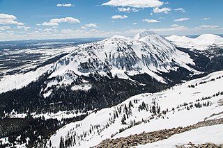
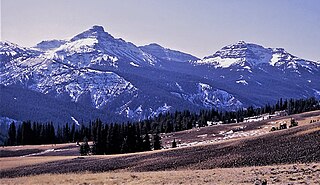
Dome Mountain, elevation 9,903 feet (3,018 m), is a mountain peak in the southern section of the Gallatin Range in Yellowstone National Park, in the U.S. state of Wyoming.

Three Rivers Peak is a 9,958-foot (3,035 m) mountain summit in the southern section of the Gallatin Range in Yellowstone National Park, in the U.S. state of Wyoming.

Hoyt Peak is a 10,506 feet (3,202 m) summit located on the shared border of Yellowstone National Park and North Absaroka Wilderness, in Park County, Wyoming.
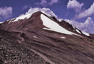
Avalanche Peak is a 10,568-foot (3,221 m) summit located on the shared border of Yellowstone National Park and North Absaroka Wilderness, in Park County, Wyoming. It is part of the Absaroka Range. It features a large bowl covered in scree and is popular with hikers for its view of Yellowstone Lake and the surrounding area. The mountain's name was officially adopted in 1930 by the United States Board on Geographic Names.

Marion Peak is a remote 12,719-foot-elevation (3,877-meter) mountain summit located in Kings Canyon National Park, in Fresno County of northern California, United States. It is situated on Cirque Crest which is west of the crest of the Sierra Nevada mountain range, 2.13 miles (3.43 km) northeast of State Peak, and 2.6 miles (4.2 km) northwest of Arrow Peak, the nearest higher neighbor. Topographic relief is significant as the north aspect rises 2,400 feet above Marion Lake in one mile, and the southeast aspect rises 3,500 feet above South Fork Kings River in less than two miles.
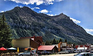
Potosi Peak is a 13,786-foot-elevation (4,202-meter) mountain summit located in Ouray County of Colorado, United States. It is situated five miles southwest of the community of Ouray, on land managed by Uncompahgre National Forest. It is part of the Sneffels Range which is a subset of the San Juan Mountains, which in turn is part of the Rocky Mountains. It is situated west of the Continental Divide, 2.2 miles south of Whitehouse Mountain, and 2.5 miles southeast of Mount Sneffels. Potosi ranks as the 113th-highest peak in Colorado, and the fourth-highest in the Sneffels Range. Recreation enthusiasts heading for Yankee Boy Basin traverse below the southern base of the mountain. Topographic relief is significant as the southeast aspect rises 4,000 feet above the Camp Bird Mine in approximately 1.5 mile. The mining activity in the immediate area produced significant amounts of gold and silver. "Potosi" in Quechuan language translates to "great wealth.". The mountain's name, which has been officially adopted by the United States Board on Geographic Names, was in use before 1899 when Henry Gannett published it in A Dictionary of Altitudes in the United States.

Stony Mountain is a 12,698-foot-elevation (3,870-meter) mountain summit located in Ouray County of southwest Colorado, United States. It is situated five miles southwest of the community of Ouray, on land managed by Uncompahgre National Forest. It is part of the Sneffels Range which is a subset of the San Juan Mountains, which in turn is part of the Rocky Mountains. It is situated west of the Continental Divide, 1.3 miles southwest of Potosi Peak, and 1.15 miles northeast of parent Mount Emma. Yankee Boy Basin is surrounded by Stony Mountain, Gilpin Peak, Mount Sneffels, Cirque Mountain, and Teakettle Mountain. Topographic relief is significant as the east aspect rises 2,000 feet above Sneffels Creek in less than one mile. The mountain's name, which has been officially adopted by the United States Board on Geographic Names, was in use before 1899 when Henry Gannett published it in A Dictionary of Altitudes in the United States.

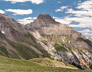
Lookout Peak is a 13,661-foot-elevation (4,164-meter) mountain summit located on the shared boundary of San Juan County with San Miguel County, in southwest Colorado, United States. It is situated three miles east of the community of Ophir, and one mile immediately north of Ophir Pass, on land managed by San Juan National Forest and Uncompahgre National Forest. Lookout Peak is part of the San Juan Mountains which are a subset of the Rocky Mountains, and is west of the Continental Divide. It ranks as the 166th-highest peak in Colorado, and topographic relief is significant as the west aspect rises 3,000 feet in approximately one mile. Neighbors include Silver Mountain three miles to the west-northwest, Wasatch Mountain two miles north-northwest, and Golden Horn five miles south-southwest. The mountain's name, which has been officially adopted by the United States Board on Geographic Names, was in use in 1899 when Henry Gannett published it in A Dictionary of Altitudes in the United States, and in 1906 when he published it in A Gazetteer of Colorado.

Amphitheater Mountain is a prominent 11,042-foot-elevation (3,366-meter) mountain summit located in Park County, Wyoming, United States.
Republic Mountain is a 10,162-foot-elevation (3,097-meter) mountain summit located in Park County, Wyoming, United States.

Citadel Peaks is a mountain ridge located in the Goat Haunt area of Glacier National Park, in Glacier County of the U.S. state of Montana. This arête with a row of sharp points is part of the Livingston Range, and is approximately four miles east of the Continental Divide. Neighbors include Olson Mountain, two miles (3.2 km) to the north, Mount Cleveland four miles (6.4 km) to the east, and Kootenai Peak 2.7 miles (4.3 km) to the south. Topographic relief is significant as Citadel Peaks rises over 3,800 feet above Waterton Lake in less than two miles, and 3,000 feet above Lake Janet in one mile. Precipitation runoff from the mountain drains to the south end of Waterton Lake. The first ascent of Citadel Spire, a major pinnacle on the ridge, was made in 1967 by Jerry Kanzler, Jim Kanzler, Ray Martin, and Clare Pogreba. This geographical feature's name was officially adopted in 1929 by the United States Board on Geographic Names. To the Pikuni people, Citadel Peaks is known as "Ataniawxis", meaning "The Needles".

Cutoff Mountain is a 10,695-foot (3,260-metre) mountain summit located in Park County, Montana.
Pollux Peak is an 11,063-foot-elevation (3,372-meter) mountain summit located in Yellowstone National Park, in Park County, Wyoming, United States.

Top Notch Peak is a 10,245-foot-elevation (3,123 meter) mountain summit located in Yellowstone National Park, in Park County, Wyoming, United States.
Silvertip Peak is a 10,645-foot-elevation (3,245-meter) mountain summit located in Park County, Wyoming, United States.

Hoodoo Peak is a 10,571-foot-elevation (3,222-meter) mountain summit located in Park County, Wyoming, United States.

Dead Horse Peak is a 12,642-foot elevation (3,853 m) mountain summit located on the common border that Duchesne County shares with Summit County in the U.S. state of Utah.

Yard Peak is a 12,706-foot elevation (3,873 m) mountain summit located on the common border that Duchesne County shares with Summit County in the U.S. state of Utah.

The Cathedral is a 12,224-foot elevation (3,726 m) mountain summit located in Summit County, Utah, United States.
Sentinel Mountain is an 8,245-foot-elevation (2,513 meter) summit in Glacier County, Montana, United States.


