Springdale is an unincorporated area and census-designated place (CDP) in Prince George's County, Maryland, United States. Per the 2020 census, the population was 5,301.

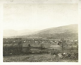
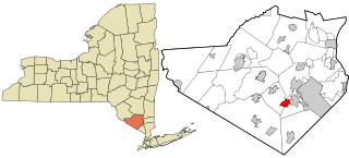
Firthcliffe is a hamlet in Orange County, New York United States. The population was 5,022 at the 2020 Census. It is part of the Poughkeepsie–Newburgh–Middletown, NY Metropolitan Statistical Area as well as the larger New York–Newark–Bridgeport, NY-NJ-CT-PA Combined Statistical Area.

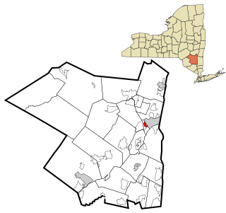
Pine Bush is a hamlet located in the town of Crawford and adjacent to Shawangunk, New York, within Orange and adjacent to Ulster counties in the U.S. It is roughly coterminous with the 12566 ZIP code and 744 telephone exchange in the 845 area code. These both extend into adjacent regions of the town of Shawangunk in Ulster County.. The population was 1,751 at the 2020 census.
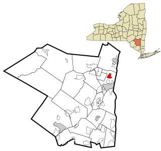
Walton Park is a census-designated place (CDP) in Orange County, New York, United States. As of the 2020 census, the CDP had a total population of 3,907. Walton Park is on the town line separating the towns of Chester and Monroe. Street addresses within Walton Park are usually assigned to Monroe, not Chester.

Accord is a hamlet and census-designated place (CDP) in Ulster County, New York, United States. Accord is located in the eastern part of the Town of Rochester along US 209. Accord is the seat of town government. As of the 2020 census the population is 573.

Clintondale is a hamlet in Ulster County, New York, United States. The population was 1,938 at the 2020 census.

East Kingston is a hamlet in Ulster County, New York, United States. The population was 277 at the 2020 census.
Hillside is a census-designated place (CDP) in Ulster County, New York, United States. The population was 860 at the 2020 census. It is located just south of the city of Kingston, and the Town of Ulster.
Lake Katrine is a hamlet in Ulster County, New York, United States. The population was 2,522 at the 2020 census.

Marlboro is a hamlet in Ulster County, New York, United States. The population was 3,669 at the 2020 census. Marlboro is in the southeastern part of the town of Marlborough, located in the southeastern corner of the county.

Napanoch is a hamlet in Town of Wawarsing, in Ulster County, New York, United States. It is at the junction of routes 209 and 55. The population was 1,131 at the 2020 census. Napanoch is on the Shawangunk Ridge National Scenic Byway, and is part of the Hudson River Valley National Heritage Area.

Rifton is a hamlet in Ulster County, New York, United States. The population was 481 at the 2020 census.
Stone Ridge is a hamlet in Ulster County, New York, United States. The population was 1,234 at the 2020 census.

Tillson is a hamlet in Ulster County, New York, United States. The population was 1,516 at the 2020 census.

Walker Valley is a hamlet located in the western part of the Town of Shawangunk in Ulster County, New York, United States, generally thought of as coterminous with the 12588 ZIP code. The population was 1,269 at the 2020 census.

West Hurley is a hamlet in Ulster County, New York, United States. The population was 1,917 at the 2020 census.
Zena is a hamlet in Ulster County, New York, United States. As of the 2020 census the population was 1,038.

MacArthur is a census-designated place (CDP) in Raleigh County, West Virginia, United States. Originally, it was named Hollywood and renamed MacArthur after General of the Army Douglas MacArthur in 1942. The population was 1,500 at the 2010 census.

Gardiner is a hamlet in Ulster County, New York, United States. The population was 952 at the 2020 census.

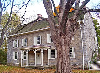
Woodstock is a hamlet in Ulster County, New York, United States. The population was 2,521 according to the 2020 census. The community of Woodstock is in the eastern part of the Town of Woodstock and is northwest of Kingston. It is located along NY 212 near its junction with NY 375. Although the name of the community and the town lent its name to the Woodstock Festival, that event did not take place in Woodstock.