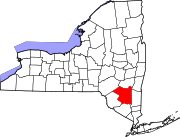
Jefferson Heights is a hamlet and census-designated place (CDP) in Greene County, New York, United States. The population was 1,122 at the 2020 census.

Jewett is a town centrally located in Greene County, New York, United States. The population was 953 at the 2010 census. The town is named for Freeborn G. Jewett, justice of the New York Supreme Court.

Lexington is a town in Greene County, New York, United States. The population was 770 at the 2020 census. The town is in the southwestern part of Greene County.
Tannersville is a village in Greene County, New York, United States. The village is in the north-central part of the town of Hunter on Route 23A. The population was 539 at the 2010 census, up from 448 in 2000.

Stamford is a village in Delaware County, New York, United States. The population was 1,119 at the 2010 census. The village is located partly in the town of Stamford and partly in the town of Harpersfield. The village is on routes 23 and 10. The village has termed itself the "Queen of the Catskills".
Cairo is a hamlet and census-designated place (CDP) in the town of Cairo in Greene County, New York, United States. The population of the CDP was 1,402 at the 2010 census, out of 6,610 people in the entire town.

Hunter is a village in Greene County, New York, United States. The population was 429 at the 2020 census, down from 502 at the 2010 census. The village is in the northwestern part of the town of Hunter on Route 23A.
Pine Hill station, MP 39.7 on the Ulster and Delaware Railroad (U&D), served the village of Pine Hill, New York. It was constructed on the slope of Belle Ayr Mountain 100 feet above the village along the steep grade running from Big Indian to the summit at Grand Hotel station. The famous double horseshoe curves on the U&D were located just west of the station.
Old Clump Mountain is a summit in the Catskills in the towns of Stamford and Roxbury in Delaware County, New York.

The Blackhead Mountains range is located near the northern end of the Catskill Mountains, in Greene County, New York, United States, where it divides the towns of Windham and Jewett. The three named peaks in the range — Thomas Cole Mountain, Black Dome, and Blackhead Mountain — are the fourth-, third-, and fifth-highest peaks in the Catskills, respectively. The gap between Thomas Cole and Black Dome is, at 3,700 feet, the highest in the Catskills.
The Gilboa-Conesville Central School District is a small, rural school located in the Northern Catskill Mountains. There are about 375 students in grades K–12 housed in one building in Gilboa, Schoharie County New York.

The Ulster & Delaware Railroad Historical Society is a chapter of the National Railway Historical Society (NRHS). It focuses on the history of the railroads and related social, economic, and cultural institutions of the Catskill and Hudson Valley regions. That history, which began with the charter of the Catskill & Ithaca Railroad in 1828, encompasses numerous proposed and built railroads and trolley lines within Ulster, Delaware, Greene, Schoharie, Albany and Otsego counties.
Bearpen Mountain is a mountain located in the Catskill Mountains of New York. The mountain's highest peak is in Greene County, but its northwest subpeak at 42°16.42′N74°29.05′W is the highest point in Delaware County at 3,520 ft. Bearpen Mountain is flanked to the north by Roundtop, and to the southeast by Vly Mountain.
Mount Tremper is a hamlet in the Town of Shandaken in Ulster County, New York, United States. Mount Tremper is situated to the east of New York State Route 28 and to the north of New York State Route 212, within the Catskill Park. The community is located at 42°02′41″N74°16′32″W. It is named for nearby Mount Tremper.
Oliverea is a populated place in Ulster County, New York, United States. It is situated on Esopus Creek along Ulster Country Route 47 within Catskill State Park. The community is located at 42°03′55″N74°27′37″W in the Town of Shandaken.

Haines Falls is a hamlet located east of Tannersville in the Town of Hunter, in Greene County, New York, United States. Haines Falls is located at 42°11′45″N74°5′49″W. The hamlet of Haines Falls was always a mountain resort town, unlike Hunter and Palenville which had tanneries. Haines Falls is at the head of Kaaterskill Clove and is the former site of the Catskill Mountain House, Kaaterskill Hotel, and Laurel House which sat atop the famous Kaaterskill Falls. In 1825, Thomas Cole, founder of the Hudson River School of landscape painters, did his first Catskill mountain paintings in Haines Falls: Lake with Dead Trees at South Lake and the Kaaterskill Falls.
Franklinton Vlaie or "The Vlaie" is a tributary of Catskill Creek in Broome, Schoharie County, New York in the United States.
Potic Creek is a 10.1-mile-long (16.3 km) tributary to Catskill Creek in the Catskill Mountains of New York. The name comes from the Mahican for a waterfall, originally referring to the falls in the Catskill near Wolcott Mills. Potic also originally referred to the name of the American Indian village below the falls and also of the commanding hill north of the falls.

The Battle of Krasnobrod was one of the many battles of the January Uprising against the Russian control over Poland. It took place on March 24, 1863, near Krasnobrod in southeastern corner of Tsarist Congress Poland in the territory of the Russian Partition. The Polish forces under Marcin Borelowski clashed with troops of the Imperial Russian Army, commanded by Mayor Yakov Ogalin. The battle ended in Russian victory due to overwhelming numerical superiority.


