Special routes of U.S. Route 74

Last updated

US 74.svg


Special routes of U.S. Route 74
Highway system

Several special routes of U.S. Route 74 exist. In order from west to east they are as follows.

Contents

Existing

Asheville–Forest City alternate route

US 74A.svg

U.S. Highway 74A

Location AshevilleForest City, NC
Length60 mi [1]  (97 km)
Existed1994–present

U.S. Route 74 Alternate (US 74A) was established in 1994, replaced the old mainline US 74 route when US 74 was moved onto the Solon David Smart Memorial Highway and I-26. The alignment of US 74A varies greatly from the current parent route. US 74A traverses through downtown Asheville, goes through the mountain resort communities of Chimney Rock and Lake Lure, continues to Ruth, passes between the towns of Rutherfordton and Spindale, and bypasses Forest City to the south. US 74, joins I-40 eastbound west of Asheville, and switches onto I-26 eastbound through Fletcher, bypassing most of urban Asheville. Continuing along a southeasterly course, the parent US 74 passes by Hendersonville and splits from I-26 at Columbus; after passing south of Rutherfordton, US 74 meets the eastern terminus of US 74A. [2]

US 74A is concurrent with US 64 from Ruth in the east through Lake Lure, where NC 9 joins, and Chimney Rock; the three routes separate in Bat Cave. NC 9 splits to the north, US 64 to the south; US 74A alone continues west from that point. In Asheville, US 74A has many concurrencies; US 70 is concurrent with US 74A in east and downtown Asheville and Interstate 26, I-240, US 19/US 23 are concurrent with US 74A west of downtown. Near US 74A's western terminus, US 19/US 23 are concurrent with US 74A. NC 81 overlaps with US 74A for a short 1-mile (1.6 km) segment in southeast Asheville. Between Asheville and Gerton, US 74A bears the street name Charlotte Highway. East of Gerton, the road is named the Gerton Highway until arriving at Bat Cave. Through towns and cities, the road takes various names including Main Street and Railroad Avenue.

US 74A is overlapped by two North Carolina scenic byways: Drovers Road (Asheville to Bat Cave) and Black Mountain Rag (Bat Cave to Lake Lure). [3]

Major junctions
CountyLocationmi [1] kmExitDestinationsNotes
Buncombe Asheville 0.000.00US 19.svgSouth plate.svg
US 23.svg
I-40.svgUS 74.svg US 19  / US 23 south (Smokey Park Highway south) / I-40  / US 74  Canton
Western end of US 19/US 23 concurrency; western terminus; I-40 exit 44; highway continues south as US 19/US 23.
3.25.1North plate.svg
NC 63.svg
NC 63 north (Leicester Highway) Leicester
4.06.4West plate blue.svg
I-240.svg
To plate blue.svg
Future plate blue.svg
I-26.svg
To plate blue.svg
I-40.svg
I-240 west to Future I-26  / I-40
Southern end of I-240/I-26 concurrency
4.47.13BWestgate Parkway / Resort DriveExit numbers follow I-240.
4.87.74AFuture plate blue.svg
I-26.svg
West plate.svg
US 70.svg
US 19.svgNorth plate.svg
US 23.svg
Future I-26  / US 70 west / US 19  / US 23 north UNC Asheville, Weaverville, Woodfin
Northern end of I-26 and US 19/US 23 concurrencies; western end of US 70 concurrency
5.08.04BPatton Avenue Downtown No westbound exit
5.58.94CMontford Avenue / Haywood Street
6.09.75AUS 25.svg US 25 (Merrimon Avenue)Eastbound entrance includes direct entrance ramp from Woodfin Street.
6.210.0East plate blue.svg
I-240.svg
I-240 east Oteen
Eastern end of I-240 concurrency; I-240 exit 5B
6.510.5North plate.svg
NC 694.svg
NC 694 north (Town Mountain Road)
Southern terminus of NC 694
Beaucatcher Tunnel
7.512.1I-240.svg I-240 I-240 exit 6; access to I-240 east via Chunns Cove Road
8.012.9 US 70 east (Tunnel Road east)Eastern end of US 70 concurrency
8.714.0West plate.svg
NC 81.svg
NC 81 west (Swannanoa River Road west) Biltmore Forest
Western end of NC 81 concurrency
10.016.1East plate.svg
NC 81.svg
NC 81 east (Swannanoa River Road east) Swannanoa
Eastern end of NC 81 concurrency
10.516.9West plate blue.svg
I-240.svg
I-240 west
Western end of I-240 concurrency; I-240 exit 8
11.017.7End plate blue.svg
I-240.svg
I-40.svg I-240 ends / I-40  Statesville, Knoxville
Eastern end of I-240 concurrency; I-240 exit 9; I-40 exit 53
11.819.0Blue Ridge Parkway shield.png Blue Ridge Parkway Right-in/right-out interchange in both directions
Henderson Bat Cave 28.746.2North plate.svg
NC 9.svg
NC 9 north Black Mountain
Western end of NC 9 concurrency
28.846.3West plate.svg
US 64.svg
US 64 west Hendersonville
Western end of US 64 concurrency
Rutherford Lake Lure 36.057.9South plate.svg
NC 9.svg
NC 9 south Mill Spring
Eastern end of NC 9 concurrency
Rutherfordton 52.083.7US 221.svg US 221  Marion Interchange
Ruth 52.584.5East plate.svg
US 64.svg
US 64 east Morganton
Eastern end of US 64 concurrency
Rutherfordton 54.086.9Business plate.svg
US 74.svg
US 221A.svg US 74 Bus.  / US 221A  Spindale, Forest City
Spindale Oakland Road
Spindale
Interchange; eastbound signage
Interchange; westbound signage
Forest City 60.096.6US 74.svg US 74  Columbus, Asheville, Shelby Interchange; eastern terminus
1.000 mi = 1.609 km; 1.000 km = 0.621 mi

Rutherfordton–Forest City business loop

Business plate.svg

US 74.svg

U.S. Highway 74 Business

Location Rutherfordton  Forest City, NC
Length21.5 mi [4]  (34.6 km)
Existed1960–present
US 74 Business at the Cleveland/Rutherford County line US74Bus near Mooresboro.jpg
US 74 Business at the Cleveland/Rutherford County line

U.S. Route 74 Business (US 74 Bus) was established in 1960 as a renumbering of US 74A, it traversed along Washington Street and Charlotte Road in Rutherfordton. In December 1970, US 74 was extended east through Spindale, Forest City, and Ellenboro when US 74 was placed on new freeway bypass. [5] In 1994, US 74 was moved south onto a new alignment towards Columbus, converting the old mainline into US 74A; as a result, US 74 Business was rerouted in Rutherfordton to go south in concurrency with US 221 to the US 74 freeway. [6]

CountyLocationmi [4] kmDestinationsNotes
Rutherford 0.00.0US 74.svgSouth plate.svg
US 221.svg
US 74  / US 221 south Columbus, Shelby, Chesnee
South end of US 221 overlap
Rutherfordton 5.38.5North plate.svg
US 221.svg
US 221A.svgWest plate.svg
NC 108.svg
US 221 north / US 221A  / NC 108 west Marion, Columbus
North end of US 221/US 221A overlap
6.210.0US 74A.svg US 74A  Ruth, Forest City
Forest City 11.418.3South plate.svg
US 221A.svg
US 221A south (Broadway Street)
South end of US 221A overlap
12.820.6Bostic Sunshine Highway Bostic
Cleveland 20.132.3South plate.svg
NC 120.svg
NC 120 south Cliffside
Mooresboro 21.534.6US 74.svg US 74  Columbus, Shelby
1.000 mi = 1.609 km; 1.000 km = 0.621 mi

Shelby business loop

Business plate.svg

US 74.svg

U.S. Highway 74 Business

Location Shelby, North Carolina
Length6.2 mi [7]  (10.0 km)
Existed1960–present

U.S. Route 74 Business (US 74 Bus) was established in 1960 as a renumbering of US 74A, following Marion Street and Warren Street. In December 1971, the eastern portion of Warren Street was changed, forcing eastbound US 74 Business to be rerouted north on DeKalb Street then onto Marion Street. [8]

The entire route is in Shelby, Cleveland County.

mi [7] kmDestinationsNotes
0.00.0US 74.svgNC 226.svg US 74  / NC 226  Forest City, Columbus, Polkville
1.52.4NC 18.svgWest plate.svg
NC 150.svg
NC 18  / NC 150 west (Lafayette Street) Fallston
West end of NC 150 overlap
3.25.1East plate.svg
NC 150.svg
NC 150 east (Cherryville Road) Cherryville
East end of NC 150 overlap
4.87.7NC 180.svg NC 180 (Post Road)
6.210.0US 74.svg US 74  Kings Mountain, Gastonia, Charlotte
1.000 mi = 1.609 km; 1.000 km = 0.621 mi

Kings Mountain business loop

Business plate.svg

US 74.svg

U.S. Highway 74 Business

Location Kings Mountain, North Carolina
Length5.4 mi [9]  (8.7 km)
Existed1984–present

U.S. Route 74 Business (US 74 Bus) was established in 1984, it was a renumbering of the old mainline US 74 through Kings Mountain. US 74 Business begins at US 74 west of Kings Mountain. The route is routed along Shelby Road into the town. US 74 Business runs through the downtown of area Kings Mountain before reaching US 74 again on the eastern side of Kings Mountain.

CountyLocationmi [9] kmDestinationsNotes
Cleveland Kings Mountain 0.00.0US 74.svg US 74  Shelby, Gastonia
2.03.2Kings Mountain Boulevard
4.06.4NC 216.svg NC 216 (Battleground Avenue) Grover, Cherryville
4.67.4NC 161.svg NC 161 (Cleveland Avenue) Bessemer City, York
Gaston 5.48.7East plate.svg
US 74.svg
US 74 east Gastonia, Charlotte
Eastbound exit and westbound entrance
1.000 mi = 1.609 km; 1.000 km = 0.621 mi

Monroe Expressway

By-pass plate white and toll plate yellow.svg

US 74.svg

U.S. Highway 74 Bypass

Location StallingsWingate, NC
Length18.72 mi [10]  (30.13 km)
Existed2018–present

U.S. Route 74 Bypass (US 74 Byp.), also known as the Monroe Expressway, is a 18.72-mile (30.13 km) toll road that bypass north of Monroe, between Stallings and east of Wingate. [11] [12] The highway's purpose is to improve mobility and capacity along the US 74 corridor. At a cost of approximately $840 million and right-of-way acquisition already completed, construction was originally to begin in October 2012; however, because of several environmental issues and litigation, the project was delayed until May 2015. [13] [14] On November 27, 2018, the Monroe Expressway opened to traffic. [15]

The Monroe Expressway uses all-electronic tolling, with tolls payable with valid transponder (NC Quick Pass, E-ZPass, Peach Pass or SunPass) or Bill by mail, which uses automatic license plate recognition. Tolls are collected per gantry, seven in total, which are located between each exit along the bypass. As of July 24, 2018, the total trip rate is $2.54 with valid transponder and $3.92 via bill by mail. [16] [17]

The entire route is in Union County.

LocationmikmExitDestinationsNotes
Stallings West plate.svg
US 74.svg
US 74 west Charlotte
Continuation as US 74
Hemby Bridge 257Indian Trail–Fairview Road Hemby Bridge, Indian Trail
Indian Trail 259Unionville–Indian Trail Road Lake Park
Monroe 260Rocky River Road
264US 601.svg US 601 (Concord Highway) Monroe, Concord
266NC 200.svg NC 200 (Morgan Mill Road)
Wingate 270Austin Chaney Road Wingate
18.7230.13East plate.svg
US 74.svg
US 74 east Rockingham
Continuation as US 74
1.000 mi = 1.609 km; 1.000 km = 0.621 mi

Rockingham–Hamlet business loop

Business plate.svg

US 74.svg

U.S. Highway 74 Business

Location Rockingham  Hamlet, NC
Length15.0 mi [18]  (24.1 km)
Existed2003–present

U.S. Route 74 Business (US 74 Bus) was established in 2003 as a renumbering of the mainline US 74 through Rockingham and Hamlet. [19]

The entire route is in Richmond County.

Locationmi [18] kmDestinationsNotes
0.00.0US 74.svgFuture plate blue.svg
I-73.svg
Future plate blue.svg
I-74.svg
US 74  / Future I-73  / Future I-74  Laurinburg, Wadesboro
Rockingham 2.03.2Cartledge Creek Road
5.58.9US 220.svg US 220  Asheboro, Cheraw
5.89.3South plate.svg
US 1.svg
US 1 south (Hancock Street) Cheraw
Hamlet 11.017.7NC 177.svg NC 177 (King Street) Cheraw
12.019.3South plate.svg
NC 38.svg
NC 38 south (Louis Breeden Boulevard) Bennettsville
13.020.9South plate.svg
NC 381.svg
NC 381 south Gibson
15.024.1US 74.svgEast plate blue.svg
Future plate blue.svg
I-74.svg
US 74  / Future I-74 east Laurinburg
Eastbound exit and Westbound entrance
1.000 mi = 1.609 km; 1.000 km = 0.621 mi

Laurinburg–Maxton business loop

Business plate.svg

US 74.svg

U.S. Highway 74 Business

Location Laurinburg  Maxton, NC
Length12.4 mi [20]  (20.0 km)
Existed1967–present

U.S. Route 74 Business (US 74 Bus) was established in 1967 as a renumbering of mainline US 74 through Laurinburg. In 1984, it was extended east replacing mainline US 74 through Maxton. [21]

CountyLocationmi [20] kmDestinationsNotes
Scotland 0.00.0West plate blue.svg
I-74.svg
West plate.svg
US 74.svg
I-74 west / US 74 west Hamlet, Rockingham
Westbound exit and eastbound entrance
Laurinburg 1.32.1South plate.svg
NC 79.svg
NC 79 south (Gibson Road) Gibson
2.03.2US 15.svgUS 401.svgUS 501.svg US 15  / US 401  / US 501  Aberdeen, Raeford, McColl
2.84.5Business plate.svg
US 15.svg
Business plate.svg
US 401.svg
Business plate.svg
US 501.svg
US 15 Bus.  / US 401 Bus.  / US 501 Bus. (Main Street)
5.89.3I-74.svgUS 74.svg I-74  / US 74  Hamlet, Rockingham, Whiteville
Robeson Maxton 9.815.8North plate.svg
NC 71.svg
South plate.svg
NC 130.svg
NC 71 north / NC 130 south (Patterson Street) Red Springs, Raemon
12.420.0I-74.svgUS 74.svgEast plate.svg
Alternate plate.svg
US 74.svg
I-74  / US 74  / US 74 Alt. east Laurinburg, Whiteville
1.000 mi = 1.609 km; 1.000 km = 0.621 mi

Maxton–Lumberton alternate route

Alternate plate.svg

US 74.svg

U.S. Highway 74 Alternate

Location Maxton  Lumberton, NC
Length15.5 mi [22]  (24.9 km)
Existed2007–present

U.S. Route 74 Alternate (US 74 Alt) was established in 2007 when mainline US 74 and I-74 were realigned to a new freeway south of the old route, between Maxton to near Lumberton. [23] [24] The route, just south of the banks of the Lumber River, goes through mostly farmland. In between, NC 710 connect travelers to Pembroke, where the University of North Carolina at Pembroke is located. Highway signs along the route are signed as "Alternate" or "ALT" above US 74; as opposed to US 74A, which is used in Western North Carolina.

The entire route is in Robeson County.

Locationmi [22] kmDestinationsNotes
0.00.0I-74.svgUS 74.svgWest plate.svg
Business plate.svg
US 74.svg
I-74  / US 74  / US 74 Bus. west Maxton, Laurinburg
5.08.0NC 710.svg NC 710  Pembroke, Rowland To University of North Carolina at Pembroke
Lumberton 15.524.9I-74.svgUS 74.svg I-74  / US 74  Whiteville, Wilmington
1.000 mi = 1.609 km; 1.000 km = 0.621 mi

Chadbourn–Whiteville business loop

Business plate.svg

US 74.svg

U.S. Highway 74 Business

Location Chadbourn  Whiteville, NC
Length12.3 mi [25]  (19.8 km)
Existed1975–present

U.S. Route 74 Business (US 74 Bus) was established in 1975 to replace the old mainline US 74 through Chadbourn and Whiteville. The route is mostly in concurrency with US 76 Business. [26]

The entire route is in Columbus County.

Locationmi [25] kmDestinationsNotes
0.00.0Future plate blue.svg
I-74.svg
West plate.svg
US 74.svg
North plate.svg
NC 130.svg
NC 410.svg Future I-74  / US 74 west / NC 130 north / NC 410  Laurinburg, Bladenboro, Whiteville
West end of NC 130 and north end of NC 410 overlap
Chadbourn 1.93.1US 76.svgBusiness plate.svg
US 76.svg
US 76  / US 76 Bus.  Fair Bluff, Whiteville
West end of US 76 Bus. overlap
2.13.4South plate.svg
NC 410.svg
NC 410 south (Brown Street) Chadbourn, Tabor City
South end of NC 410 overlap
Whiteville 9.214.8US 701.svgEast plate.svg
NC 130.svg
US 701  / NC 130 east (Powell Boulevard) Tabor City, Clarkton, Elizabethtown
East end of NC 130 overlap
9.515.3Business plate.svg
US 701.svg
US 701 Bus. (Pinckney Street/Madison Street)
Roundabout
12.119.5East plate.svg
NC 214.svg
NC 214 east (Sam Potts Highway) Hallsboro
12.319.8Future plate blue.svg
I-74.svg
US 74.svgUS 76.svg Future I-74  / US 74  / US 76  Wilmington, Laurinburg
1.000 mi = 1.609 km; 1.000 km = 0.621 mi

Future

Shelby Bypass

By-pass plate.svg

US 74.svg

U.S. Highway 74 Bypass

Location Shelby, North Carolina

U.S. Route 74 Bypass (US 74 Byp.) is the future designation of the Shelby Bypass; currently being constructed in phases. The designation, listed on NCDOT documents, has not been submitted/approved by AASHTO. [27]

As of July 2020, the segment from the exit with U.S. Route 74 to the current interchange of NC 226 (Polkville Road) has been open and further extensions of the route will be coming soon. The segment from NC 226 (Polkville Road) to NC 150 (Cherryville Road) is already on construction and will be subject to open to traffic in 2022. The last segment of the bypass will extend west of Stony Point Road to U.S. Route 74 Business in Kings Mountain which is subject to open in 2024. [28]

The entire route is in Cleveland County.

LocationmikmExitDestinationsNotes
194312194East plate.svg
US 74.svg
US 74 east
Eastbound entrance and westbound exit; opened to traffic on April 13, 2020
197317197Washburn Switch RoadOpened to traffic on April 13, 2020
199320199NC 226.svg NC 226 (Polkville Road)Opened to traffic on April 13, 2020
202325202NC 18.svg NC 18 (Fallston Road)
Shelby 203327203NC 150.svg NC 150 (Cherryville Road)
208335208West plate.svg
US 74.svg
US 74 west
Eastbound exit and westbound entrance
1.000 mi = 1.609 km; 1.000 km = 0.621 mi
  •       Unopened

Former

Rutherfordton alternate route

US 74A North Carolina 1950.svg

U.S. Highway 74A

Location Rutherfordton, North Carolina
Length2.2 mi [29]  (3.5 km)
Existed1949–1960

U.S. Route 74 Alternate (US 74A) was established in 1948 or 1949, it followed the original US 74 route through Rutherfordton, as the mainline US 74 was placed on a new bypass route through Ruth. Traversing along Washington Street and Charlotte Road, it was renumbered US 74 Business in 1960. [2]

Shelby alternate route

US 74A North Carolina 1950.svg

U.S. Highway 74A

Location Shelby, North Carolina
Length6.2 mi [7]  (10.0 km)
Existed1936–1960

U.S. Route 74 Alternate (US 74A) was established in 1936 as a new primary routing using Marion Street through Shelby; paralleling mainline US 74, which was on Warren Street. Around 1949, US 74 was moved onto new bypass south of Shelby; US 74A was thus extended on both directions. As part of this development, US 74A was split west on Marion Street and east on Warren Street. In 1960 it was renumbered to US 74 Business. [2]

Bessemer City alternate route

US 74A North Carolina 1926.svg

U.S. Highway 74A

Location Bessemer City, North Carolina
Length10.0 mi [30]  (16.1 km)
Existed1937–1938

U.S. Route 74 Alternate (US 74A) was established in 1937, this alternate route, along with US 29A, followed the old routing from Kings Mountain to Gastonia, via Bessemer City. A year later, it was renumbered as NC 161 and NC 274. [2]

Monroe alternate route 1

US 74A North Carolina 1950.svg

U.S. Highway 74A

Location Monroe, North Carolina
Length0.4 mi [31]  (640 m)
Existed1949–1952

U.S. Route 74 Alternate (US 74A) was established between 1945 and 1949, it was set up as an inner bypass of downtown Monroe, via Jefferson Street. It was decommissioned in 1952 when US 74 moved out of the downtown area, converting the old route, along Charlotte Avenue and Franklin Street, into the second alternate route. [2]

Monroe alternate route 2

US 74A North Carolina 1950.svg

U.S. Highway 74A

Location Monroe, North Carolina
Existed1952–1954

U.S. Route 74 Alternate (US 74A) was established in 1952, it replaced the old mainline US 74 through downtown Monroe, via Franklin Street and Charlotte Avenue. In 1953, it was rerouted along Skyway Drive when US 74 was completely realigned onto new bypass routing between Matthews and Monroe. In 1954, it was decommissioned. [2]

Rockingham alternate route

US 74A North Carolina 1950.svg

U.S. Highway 74A

Location Rockingham, North Carolina
Existed1953–1957

U.S. Route 74 Alternate (US 74A) was established between 1951 and 1953, after US 74 was rerouted south of downtown Rockingham. The alternate route followed the old alignment along Washington Street and Rockingham Road. In 1957 it was decommissioned. [2]

Leland alternate route

US 74A.svg

U.S. Highway 74A

Location Leland, North Carolina
Length0.14 mi [32]  (230 m)
Existed1936–1975

U.S. Route 74 Alternate (US 74A) was established in 1936, it replaced mainline US 74 through an intersection in Leland, while the mainline was moved just off to the right on Village Road. At 0.14 miles (0.23 km), it was the shortest alternate route. It was unsigned throughout its existence,[ citation needed ] but was marked on state and county maps up until 1975, when NCDOT downgraded it to secondary road status. [33]

Wrightsville Beach alternate route

US 74A North Carolina 1926.svg

U.S. Highway 74A

Location Wrightsville Beach, North Carolina
Existed1938–1940

U.S. Route 74 Alternate (US 74A) was established by 1938 as new primary routing, it went from Causeway Drive south along Waynick Boulevard, ending on the south-end of Wrightsville Beach; making it a spur route of US 74. By 1940, it was replaced by an extension of US 76. [2]

Related Research Articles

<span class="mw-page-title-main">U.S. Route 74</span> Highway in the United States

U.S. Route 74 (US 74) is an east–west United States highway that runs for 515 miles (829 km) from Chattanooga, Tennessee to Wrightsville Beach, North Carolina. Primarily in North Carolina, it serves as an important highway from the mountains to the sea, connecting the cities of Asheville, Charlotte and Wilmington. It is known as Andrew Jackson Highway throughout most of North Carolina.

<span class="mw-page-title-main">U.S. Route 321</span> Highway in the United States

U.S. Route 321 (US 321) is a spur of U.S. Route 21. It runs for 516.9 miles (831.9 km) from Hardeeville, South Carolina to Lenoir City, Tennessee; with both serving as southern termini. It reaches its northernmost point at Elizabethton, Tennessee, just northeast of Johnson City. Because of its unusual "north–south–north" routing, U.S. Route 321 intersects both Interstate 40 and U.S. Route 70 three separate times. The highway serves different roles in each state: An alternate route to interstates in South Carolina, a major highway in North Carolina, and a scenic route in Tennessee.

<span class="mw-page-title-main">U.S. Route 158</span> Highway in the United States

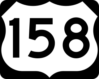
U.S. Route 158 (US 158) is an east–west United States highway that runs for 350 miles (560 km) from Mocksville to Whalebone Junction in Nags Head, entirely in the state of North Carolina. It is also a critical route that connects the cities of Winston-Salem, Summerfield, and Reidsville with one another.

<span class="mw-page-title-main">U.S. Route 264</span>

U.S. Route 264 (US 264) is an east–west United States Highway located completely within the U.S. state of North Carolina, running for 215.7 miles (347.1 km). Its western terminus is located at Interstate 87 (I-87), I-440, and US 64 in Raleigh. US 264 is a freeway between Raleigh and Wilson, with segments running concurrently with I-87, I-587, I-795, and US 64. The highway is largely parallel to I-587 between Wilson and Greenville and primarily serves smaller communities such as Saratoga and Farmville. East of Greenville, US 264 is an important highway connecting communities such as Washington, Belhaven, Swan Quarter, and Engelhard. The eastern terminus of US 264 is located at US 64 in Manns Harbor.

<span class="mw-page-title-main">North Carolina Highway 75</span> State highway in Union County, North Carolina, US

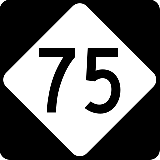
North Carolina Highway 75 (NC 75) is a primary state highway in the U.S. state of North Carolina. Its entire length runs through Union County and serves as the primary connector between the towns of Waxhaw, Mineral Springs, and Monroe. The route roughly parallels a CSX railroad line for its entire span.

<span class="mw-page-title-main">U.S. Route 64 in North Carolina</span> Highway in North Carolina, US

U.S. Route 64 (US 64) is the longest numbered route in the U.S. state of North Carolina, running 604 miles (972 km) from the Tennessee state line to the Outer Banks. The route passes through the westernmost municipality in the state, Murphy, and one of the most easternmost municipalities, Manteo, making US 64 a symbolic representation of the phrase "from Murphy to Manteo" which is used to refer to the expanse of the state. The highway is a major east–west route through the central and eastern portion of the state.

<span class="mw-page-title-main">North Carolina Highway 16</span> State highway in North Carolina, US

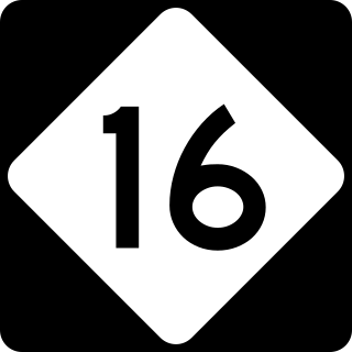
North Carolina Highway 16 (NC 16) is a 143.8-mile primary state highway in the U.S. state of North Carolina. Traveling in a north–south direction, it connects the cities and towns of Charlotte, Newton, Conover, Taylorsville, Wilkesboro and Jefferson, linking the Charlotte metropolitan area with the mountainous High Country. NC 16 is part of a three-state route 16 that connects the Charlotte region with northwestern West Virginia.

<span class="mw-page-title-main">North Carolina Highway 11</span> State highway in North Carolina, US

North Carolina Highway 11 is a primary state highway in the U.S. state of North Carolina. Traveling 193.2 miles (310.9 km) in a north–south alignment through Eastern North Carolina, it connects the towns and cities of Wallace, Kenansville, Kinston, Greenville and Murfreesboro.

<span class="mw-page-title-main">North Carolina Highway 18</span> State highway in North Carolina, US

North Carolina Highway 18 (NC 18) is a primary state highway in the U.S. state of North Carolina. Traveling north–south through the Foothills region, it connects the cities of Shelby, Morganton, Lenoir, Wilkesboro and North Wilkesboro.

<span class="mw-page-title-main">North Carolina Highway 87</span> State highway in North Carolina, US

North Carolina Highway 87 (NC 87) is a primary state highway in the U.S. state of North Carolina. NC 87 begins in the Atlantic coastal town of Southport and crosses into Virginia at the Virginia state line five miles (8 km) north of Eden in Rockingham County. At 240 miles (390 km) in length, NC 87 is the second longest state highway in the U.S. state of North Carolina with only North Carolina Highway 24 being longer. Labeled as a north–south route, NC 87 travels along a relatively straight southeast–northwest path, connecting Cape Fear region with the Piedmont. It is also the main north-south route connecting the cities of Fayetteville, Sanford, Burlington and Reidsville.

<span class="mw-page-title-main">North Carolina Highway 109</span> State highway in North Carolina, US

North Carolina Highway 109 (NC 109) is a north–south state highway in North Carolina. It primarily connects small towns in the central Piedmont region of the state. The 117-mile (188 km) route is a two-lane road for most of its length, but the segment between Winston-Salem and Thomasville is being upgraded to a divided 4-lane highway, as it is a major route between the two cities. The central segment of NC 109 passes through the Uwharrie Mountains and the Uwharrie National Forest.

<span class="mw-page-title-main">North Carolina Highway 268</span> State highway in North Carolina, US

North Carolina Highway 268 (NC 268) is a primary state highway in the U.S. state of North Carolina. It connects many communities as it traverses through the northwestern North Carolina mountains and foothills.

<span class="mw-page-title-main">Special routes of U.S. Route 17</span> United States Numbered Highway System

A total of at least 31 special routes of U.S. Route 17 (US 17) exist: 3 in Florida, 5 in South Carolina, 17 in North Carolina, and 6 in Virginia.

<span class="mw-page-title-main">U.S. Route 25 in North Carolina</span>

U.S. Highway 25 (US 25) is a north–south United States Numbered Highway that runs for 75.4 miles (121.3 km) from the South Carolina state line, near Tuxedo, to the Tennessee state line, near Hot Springs. It is part of the longer US 25, which runs from Brunswick, Georgia, to Covington, Ohio. It is a major north–south route through Western North Carolina.

<span class="mw-page-title-main">U.S. Route 221 in North Carolina</span>

In the U.S. state of North Carolina U.S. Route 221 (US 221) is a north–south highway that travels through Western North Carolina. From Chesnee, South Carolina to Independence, Virginia, it connects the cities of Rutherfordton, Marion, Boone and Jefferson between the two out-of-state destinations. Its most memorable section, known as the Little Parkway Scenic Byway between Linville and Blowing Rock, offers area visitors a curvier alternative to the Blue Ridge Parkway and access to Grandfather Mountain.

<span class="mw-page-title-main">Special routes of U.S. Route 70</span>

Several special routes of U.S. Route 70 exist. In order from west to east, these special routes are as follows.

<span class="mw-page-title-main">North Carolina Highway 81</span> State highway in Buncombe County, North Carolina, US

North Carolina Highway 81 (NC 81) is a primary state highway in the U.S. state of North Carolina. That runs entirely in Asheville and Buncombe County from US 25 to US 70.

<span class="mw-page-title-main">Special routes of U.S. Route 64</span>

Several special routes of U.S. Route 64 exist. In order from west to east they are as follows.

<span class="mw-page-title-main">Special routes of U.S. Route 29</span>

Several special routes of U.S. Route 29 (US 29) exist. In order from south to north, they are as follows.

<span class="mw-page-title-main">Special routes of U.S. Route 421</span>

Several special routes of U.S. Route 421 exist. In order from south to north they are as follows.

References

  1. 1 2 Google (March 1, 2011). "US 74A — Asheville-Forest City" (Map). Google Maps . Google. Retrieved March 1, 2011.
  2. 1 2 3 4 5 6 7 8 "NCRoads.com: U.S. 74-A" . Retrieved August 16, 2012.
  3. "NCDOT: Scenic Byways". Archived from the original on January 25, 2011. Retrieved March 1, 2011.
  4. 1 2 Google (March 1, 2011). "US 74 Bus — Rutherfordton-Forest City" (Map). Google Maps . Google. Retrieved March 1, 2011.
  5. "US Route Changes (1970-12-03)" (PDF). North Carolina Department of Transportation. December 3, 1970. Retrieved July 10, 2014.
  6. "Route Changes (1994-09-15)" (PDF). North Carolina Department of Transportation. September 15, 1994. Retrieved July 10, 2014.
  7. 1 2 3 Google (March 1, 2011). "US 74 Bus — Shelby" (Map). Google Maps . Google. Retrieved March 1, 2011.
  8. "US Route Changes (1971-12-01)" (PDF). North Carolina Department of Transportation. December 1, 1971. Retrieved July 10, 2014.
  9. 1 2 Google (March 1, 2011). "US 74 Bus — Kings Mountain" (Map). Google Maps . Google. Retrieved March 1, 2011.
  10. Special Committee on U.S. Route Numbering (September 20, 2018). "2018 Annual Meeting Report to the Council on Highways and Streets" (PDF) (Report). Washington, DC: American Association of State Highway and Transportation Officials. p. 3. Archived from the original (PDF) on October 5, 2018. Retrieved October 7, 2018.
  11. Selected Alternative, Monroe Connector/Bypass (PDF) (Map). North Carolina Turnpike Authority. Retrieved April 21, 2014.
  12. Henson, Christian (November 27, 2018). "The Charlotte Area's First Toll Road, the Monroe Expressway, Opens Tuesday". Charlotte, NC: Spectrum News . Retrieved November 27, 2018.
  13. Staff. "Monroe Bypass". North Carolina Department of Transportation. Retrieved June 11, 2015.
  14. "NCDOT Begins Construction on Monroe Expressway" (Press release). North Carolina Department of Transportation. May 28, 2015. Retrieved May 28, 2015.
  15. Henson, Christian (November 27, 2018). "The Charlotte Area's First Toll Road, the Monroe Expressway, Opens". Charter Communications. Spectrum News Charlotte. Retrieved November 29, 2018.
  16. "Monroe Expressway". North Carolina Turnpike Authority. Retrieved October 1, 2018.
  17. Monroe Expressway Toll Rates 2018 (PDF) (Map). North Carolina Turnpike Authority. July 24, 2018. Retrieved October 1, 2018.
  18. 1 2 Google (March 1, 2011). "US 74 Bus — Rockingham-Hamlet" (Map). Google Maps . Google. Retrieved March 1, 2011.
  19. "Route Changes (2003-02-17)" (PDF). North Carolina Department of Transportation. February 17, 2003. Retrieved July 10, 2014.
  20. 1 2 Google (March 1, 2011). "US 74 Bus — Laurinburg-Maxton" (Map). Google Maps . Google. Retrieved March 1, 2011.
  21. "Route Changes (1984-11-01)" (PDF). North Carolina Department of Transportation. November 1, 1984. Retrieved July 10, 2014.
  22. 1 2 Google (March 1, 2011). "US 74 Alt — Maxton-Lumberton" (Map). Google Maps . Google. Retrieved March 1, 2011.
  23. "I-74 Segment 16". Archived from the original on January 2, 2011. Retrieved October 30, 2010.
  24. "Route Changes (2007-10-05)" (PDF). North Carolina Department of Transportation. October 5, 2007. Retrieved July 10, 2014.
  25. 1 2 Google (March 1, 2011). "US 74 Bus — Chadbourn-Whiteville" (Map). Google Maps . Google. Retrieved March 1, 2011.
  26. "Route Changes (1976-02-01)" (PDF). North Carolina Department of Transportation. February 1, 1976. Retrieved July 10, 2014.
  27. "R-2702 Cleveland County, US 74 Shelby Bypass" (PDF). NCDOT. Retrieved March 6, 2016.
  28. Sitzes, Rebecca (April 15, 2020). "New Segment of Bypass Open for Business". Shelby Star. Archived from the original on December 2, 2020.
  29. Google (August 16, 2012). "US 74A — Rutherfordton" (Map). Google Maps . Google. Retrieved August 16, 2012.
  30. Google (August 16, 2012). "US 74A — Bessemer City" (Map). Google Maps . Google. Retrieved August 16, 2012.
  31. Google (August 16, 2012). "US 74A — Monroe 1" (Map). Google Maps . Google. Retrieved August 16, 2012.
  32. Google (August 16, 2012). "US 74A — Leland" (Map). Google Maps . Google. Retrieved August 16, 2012.
  33. "US Route Changes (09-01-75)" (PDF). Retrieved August 16, 2012.