Tuluksak, Alaska

Last updated

Tuluksak
Tuulkessaaq
CDP
AKMap-doton-Tuntutliak.PNG
Location of Tuluksak, Alaska
Coordinates: 61°6′9″N160°57′38″W / 61.10250°N 160.96056°W / 61.10250; -160.96056
CountryUnited States
State Alaska
Census Area Bethel
Incorporated October 28, 1970 [1]
Disincorporated1997 [2]
Government
   State senator Lyman Hoffman (D)
   State rep. Conrad McCormick (D)
Area
[3]
  Total3.02 sq mi (7.82 km2)
  Land2.93 sq mi (7.58 km2)
  Water0.10 sq mi (0.25 km2)
Population
 (2020)
  Total444
  Density151.74/sq mi (58.59/km2)
Time zone UTC-9 (Alaska (AKST))
  Summer (DST) UTC-8 (AKDT)
ZIP code
99679
Area code 907
FIPS code 02-78790

Tuluksak (Central Yupik : Tuulkessaaq) is a census-designated place (CDP) in Bethel Census Area, Alaska, United States. At the 2010 census the population was 373, down from 428 in 2000.

Contents

The view spans across the tundra from the banks of the Tuluksak river The view spans across the tundra from the banks of the Tuluksak river.jpg
The view spans across the tundra from the banks of the Tuluksak river

Geography

Tuluksak is located at 61°06′09″N160°57′38″W / 61.102492°N 160.960651°W / 61.102492; -160.960651 . [4]

According to the United States Census Bureau, the CDP has a total area of 3.1 square miles (8.0 km2), of which, 3.0 square miles (7.8 km2) of it is land and 0.1 square miles (0.26 km2) of it (2.24%) is water.

Demographics

Historical population
CensusPop.Note
1880 150
1890 62−58.7%
1920 73
1930 9631.5%
1940 88−8.3%
1950 11631.8%
1960 13718.1%
1970 19542.3%
1980 23621.0%
1990 35851.7%
2000 42819.6%
2010 373−12.9%
2020 44419.0%
U.S. Decennial Census [5]

Tuluksak first appeared on the 1880 U.S. Census as an unincorporated Inuit village. [6] All 150 residents were Inuit. [7] In 1890, it returned as "Tuluksagmiut." All residents were listed as Native. [8] It did not report again until 1920, when it returned under its original 1880 spelling of Tuluksak. It has returned in every successive census to date. In 1970, it formally incorporated. In 1997, it disincorporated as a city and was reclassified as a census-designated place (CDP).

As of the census [9] of 2000, there were 428 people, 86 households, and 76 families residing in the CDP. The population density was 140.1 inhabitants per square mile (54.1/km2). There were 93 housing units at an average density of 30.4 per square mile (11.7/km2). The racial makeup of the CDP was 5.14% White, 94.16% Native American and 0.70% Asian.

There were 86 households, out of which 53.5% had children under the age of 18 living with them, 59.3% were married couples living together, 9.3% had a female householder with no husband present, and 11.6% were non-families. 11.6% of all households were made up of individuals, and 3.5% had someone living alone who was 65 years of age or older. The average household size was 4.98 and the average family size was 5.37.

In the CDP, the population was spread out, with 39.7% under the age of 18, 12.4% from 18 to 24, 28.7% from 25 to 44, 11.4% from 45 to 64, and 7.7% who were 65 years of age or older. The median age was 24 years. For every 100 females, there were 117.3 males. For every 100 females age 18 and over, there were 106.4 males.

The median income for a household in the CDP was $31,563, and the median income for a family was $33,125. Males had a median income of $21,250 versus $31,250 for females. The per capita income for the CDP was $7,132. About 21.3% of families and 27.9% of the population were below the poverty line, including 33.6% of those under age 18 and 11.1% of those age 65 or over.

Related Research Articles

<span class="mw-page-title-main">Goodnews Bay, Alaska</span> City in Alaska, United States

Goodnews Bay is a city in Bethel Census Area, Alaska, United States. As of the 2010 census, the population of the city was 243, up from 230 in 2000.

<span class="mw-page-title-main">Kongiganak, Alaska</span> CDP in Alaska, United States

Kongiganak is a census-designated place (CDP) in Bethel Census Area, Alaska, United States, and primarily sits on the eastern shore of the Kongiganak River. As of the 2010 census, the population was 439, up from 359 in 2000.

<span class="mw-page-title-main">Tununak, Alaska</span> CDP in Alaska, United States

Tununak(Too-new-nak) is a census-designated place (CDP) in Bethel Census Area, Alaska, United States. At the 2020 census, the population was 411.

<span class="mw-page-title-main">Naknek, Alaska</span> Place in Alaska

Naknek is a census-designated place located in and the borough seat of Bristol Bay Borough in the U.S. state of Alaska. As of the 2020 census, the population of the CDP was 470, down from 544 in 2010.

<span class="mw-page-title-main">Koliganek, Alaska</span> Census-designated place in Alaska, United States

Koliganek is a census-designated place (CDP) in Dillingham Census Area, Alaska, United States. It is located along the Nushagak River At the 2010 census, the population was 209, up from 182 in 2000.

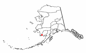
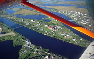
Togiak is a city in Dillingham Census Area, Alaska, United States. At the 2010 census the population was 817, up from 809 in 2000.

<span class="mw-page-title-main">Twin Hills, Alaska</span> Census-designated place in Alaska, United States

Twin Hills is a census-designated place (CDP) in Dillingham Census Area, Alaska, United States. The population was 74 at the 2010 census, up from 69 in 2000.

<span class="mw-page-title-main">Nikiski, Alaska</span> Census-designated place in Alaska, United States

Nikiski is a census-designated place (CDP) in Kenai Peninsula Borough, Alaska, United States. The population was 4,456 at the 2020 census, down from 4,493 in 2010.

<span class="mw-page-title-main">Tyonek, Alaska</span> Census-designated place in Alaska, United States

Tyonek or Present / New Tyonek is a census-designated place (CDP) in Kenai Peninsula Borough in the U.S. state of Alaska. As of the 2020 census the population was 152, down from 171 in 2010. In 1973, the community formed the Tyonek Native Corporation (TNC) under the Alaska Native Claims Settlement Act and is federally recognized.

Chiniak is a census-designated place (CDP) in Kodiak Island Borough, Alaska, United States. The population was 47 at the 2010 census, down from 50 in 2000.

<span class="mw-page-title-main">Karluk, Alaska</span> Census-designated place in Alaska, United States

Karluk is a census-designated place (CDP) in Kodiak Borough, Kodiak Island, Alaska, United States. The population was 37 at the 2010 census, up from 27 in 2000.

<span class="mw-page-title-main">Gateway, Alaska</span> CDP in Alaska, United States

Gateway is a census-designated place (CDP) in Matanuska-Susitna Borough, Alaska, United States. It is part of the Anchorage, Alaska Metropolitan Statistical Area. The population was 5,748 at the 2020 census, up from 5,552 in 2010. Gateway is the fifth-most populated CDP in the borough.

<span class="mw-page-title-main">Lakes, Alaska</span> CDP in Alaska, United States

Lakes was a census-designated place (CDP) in Matanuska-Susitna Borough, Alaska, United States. It was split in two CDPs for 2020 Census purposes: North Lakes and South Lakes. The area is part of the Anchorage, Alaska Metropolitan Statistical Area. At the 2010 census the population was 8,364, up from 6,706 in 2000.

<span class="mw-page-title-main">Susitna, Alaska</span> Census-designated place in Alaska, United States

Susitna is a census-designated place (CDP) in Matanuska-Susitna Borough, Alaska, United States. It is part of the Anchorage Metropolitan Area. As of the 2020 census, the population of the CDP was 11.

<span class="mw-page-title-main">Point Lay, Alaska</span> CDP in Alaska, United States

Point Lay is a census-designated place (CDP) in North Slope Borough, Alaska, United States. At the 2020 census the population was 330, up from 189 in 2010.

<span class="mw-page-title-main">Noatak, Alaska</span> Place in Alaska, United States

Noatak is a census-designated place (CDP) in the Northwest Arctic Borough in the U.S. state of Alaska. The population was 570 at the 2020 census, up from 514 in 2010. It is served by Noatak Airport.

<span class="mw-page-title-main">Selawik, Alaska</span> City in Alaska, United States

Selawik is a city in Northwest Arctic Borough, Alaska, United States. At the 2010 census the population was 829, up from 772 in 2000.

<span class="mw-page-title-main">Klukwan, Alaska</span> Census-designated place in Alaska, United States

Klukwan is a census-designated place (CDP) in Alaska, United States. It is technically in Hoonah-Angoon Census Area, though it is an enclave of Haines Borough. At the 2010 census the population was 95, down from 139 at the 2000 census.

<span class="mw-page-title-main">Tatitlek, Alaska</span> CDP in Alaska, United States

Tatitlek is a census-designated place (CDP) in Chugach Census Area, United States. The population was 88 at the 2010 census, down from 107 in 2000. Tatitlek is in the Chugach School District and has one school, Tatitlek Community School, serving about 15 students from preschool through high school. Tatitlek is served by the Tatitlek Airport.

<span class="mw-page-title-main">Beaver, Alaska</span> CDP in Alaska, United States

Beaver is a census-designated place (CDP) in Yukon-Koyukuk Census Area, Alaska, United States. At the time of the 2010 census the population was 84, unchanged from 2000, however the 2020 census reported a total population of 48.

References

  1. "Directory of Borough and City Officials 1974". Alaska Local Government. XIII (2). Juneau: Alaska Department of Community and Regional Affairs: 81. January 1974.
  2. Gates, Nancy, ed. (2006). The Alaska Almanac (Thirtieth ed.). Portland: Alaska Northwest Books. ISBN   0-88240-652-3 . Retrieved November 19, 2013.
  3. "2020 U.S. Gazetteer Files". United States Census Bureau. Retrieved October 29, 2021.
  4. "US Gazetteer files: 2010, 2000, and 1990". United States Census Bureau. February 12, 2011. Retrieved April 23, 2011.
  5. "U.S. Decennial Census". Census.gov. Retrieved June 6, 2013.
  6. "Geological Survey Professional Paper". 1949.
  7. "Statistics of the Population of Alaska" (PDF). United States Census Bureau. 1880.
  8. "Report on Population and Resources of Alaska at the Eleventh Census: 1890" (PDF). United States Census Bureau. Government Printing Office.
  9. "U.S. Census website". United States Census Bureau . Retrieved January 31, 2008.